Black Canyon Campground - Lower
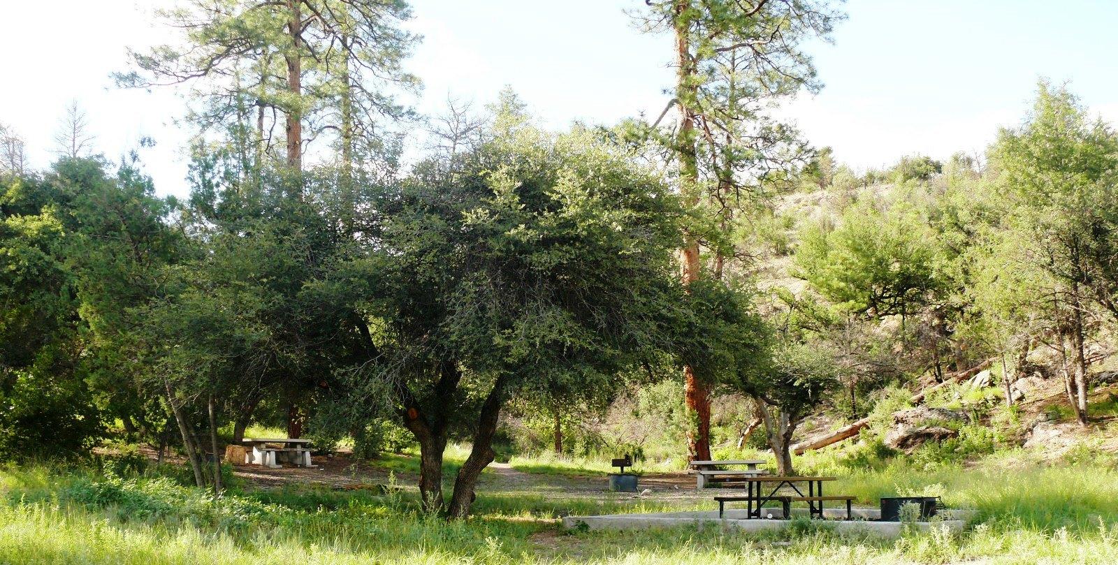
This is a beautiful remote camping area. Trail #94 begins at the rear of the campground. Located in a remote area of forest approximately 30 miles from the Wilderness Ranger District office. This campground is accessible from FR 150, and driving approximately.5 miles from the road, across the stream. You will enter an area with a newer vault toilet and a beautiful meadow next to the stream. Please be advised - the district recommends high-clearance 4x4 vehicles on FR 150.
More like this: first-come in New Mexico

Weather by month
Getting there
The campground is located 30 miles from Wilderness Ranger District office. Take Hwy 35 to MM15 to FR150.Turn right & travel 26 miles over a improved dirt & rock road to Black Canyon Campground. Turn left and travel.5 miles, over a steep stream crossing to the Lower Campground.
| Coordinates | 33.1842° N, 108.0340° W · Directions ↗ |
Fire nearby
- PrescribedRx Wagon Wheel North Piles Fy27
25 mi from the campground
- PrescribedRx Wagon Wheel West Piles Fy27
26 mi from the campground · 33 acres
Distance is to the reported incident point, not the fire edge. Call the managing office before you drive.
Supplies & services
| Outdoor gear | Outdoor gear ↗ | 30.4 mi |
Locations © OpenStreetMap contributors. Call ahead; hours change seasonally.
Explore
Video
Black Canyon Lake and Campground
Worth a stop
- 0.2 miLower Black Canyon #94 Trailhead ↗Trailhead
- 0.7 miMiddle Mesa #716 Trailhead ↗Trailhead
- 12.7 miLake Roberts Picnic Area ↗Day use
- 12.8 miLake Roberts Boat Launch ↗Boat launch
Trails nearby
- 0.2 miLower Black Canyon2.5 mi trail · hiking, horse, bike
- 0.7 miMiddle Mesa ↗7.8 mi trail · hiking, horse, bike
- 1.2 miBlack Canyon ↗12.2 mi trail · hiking, horse, bike
- 1.3 miTom Moore ↗13.4 mi trail · hiking, horse, bike
- 2.1 miMe Own4 mi trail · hiking, horse
- 4.4 miAspen Canyon ↗5.2 mi trail · hiking, horse
Trailheads within three miles
- 0.2 miLower Black Canyon #94 Trailhead ↗Gila National Forest
- 0.7 miMiddle Mesa #716 Trailhead ↗Gila National Forest
- 1.4 miTom Moore #708 Trailhead ↗Gila National Forest
- 2.1 miMeOwn #707 Trailhead ↗Gila National Forest
Trail and trailhead records are the Forest Service's. Distances are straight-line to the nearer trail end. Trail conditions are not tracked here.
Public land it sits in
This campground sits inside Aldo Leopold Wilderness, which overlaps Gila National Forest.
- inAldo Leopold Wilderness ↗Wilderness · Forest Service · 203,548 acres
- inGila National Forest ↗National Forest · Forest Service · 3,389,394 acres
- 4.1 miGila Wilderness ↗Wilderness · Forest Service · 559,310 acres
Each unit is published as a centre point and an acreage rather than a boundary, so this section stands it in for a circle of the same area. Whether a campground is inside, and how far it is from one it is outside, are both approximate.
Other campgrounds nearby


On the National Register nearby
- Reeds Peak Lookout TowerStructure · Reeds Peak · 10.8 mi
Guidebooks for New Mexico
We earn a small commission if you buy through these links. It does not change what we list.
Titles come from Open Library's catalog, matched by subject heading or by title.
Reference
Questions people ask
Do I need a reservation at Black Canyon Campground - Lower?
No. Black Canyon Campground - Lower is first-come, first-served. Sites are taken on arrival and paid at the fee station.
What if Black Canyon Campground - Lower is full?
The nearest public campgrounds are Black Canyon Campground - Upper (0.2 mi, first-come), Forks Campground (10 mi, first-come), and Mesa Campground (12.7 mi, first-come).
Source: Campgrounds nearby