Cumberland Island National Seashore Camping Permits
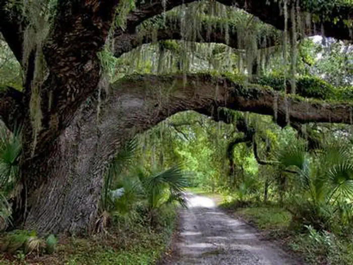
Whether you are looking to spend a night with family and friends around a campfire under the moss covered branches of the live oak trees, or looking for the rugged challenges and solitude of the wilderness, you will find it on Cumberland Island National Seashore. The park includes a designated Wilderness area, undeveloped beaches, historic sites, cultural ruins, critical habitat and nesting areas, Watch the "Camping on Cumberland Island" video for information to help you plan an d prepare for your trip.
More like this: reservable in Georgia · tent only in Georgia · group sites in Georgia
Check availability on Recreation.gov ↗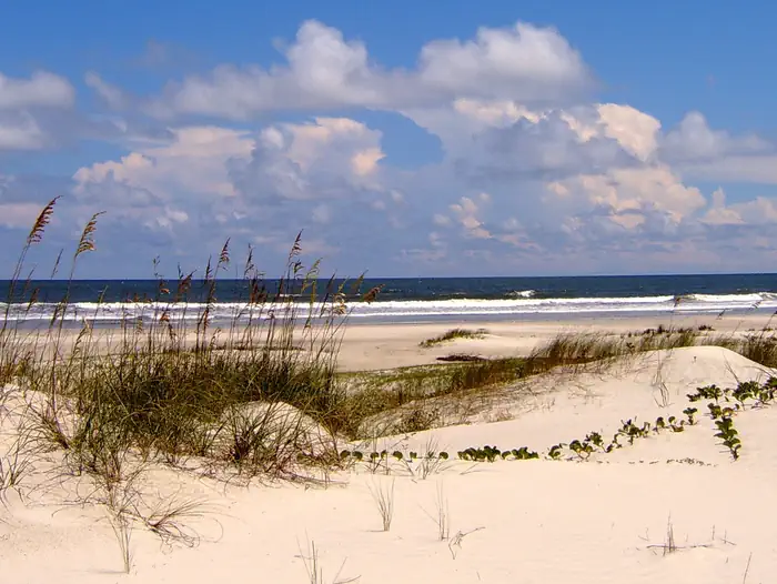

Site mix
| Hike-in | 25 |
| Walk-in | 16 |
| group walk to | 2 |
| designated campsite | 1 |
| Host/management | 3 |
Site guide
43 sites in 5 loops. Tap a filter to narrow the list; the map follows.
| Site | Loop | Type | Shade | Waterfront | People / vehicles | Fires | Pets |
|---|---|---|---|---|---|---|---|
| 1 | Brickhill Bluff | Hike-in | 6 / – | No | No | ||
| 2 | Brickhill Bluff | Hike-in | Partial | 6 / – | No | No | |
| 3 | Brickhill Bluff | Hike-in | Partial | 6 / – | No | ||
| 4 | Brickhill Bluff | Hike-in | Partial | 6 / – | No | ||
| Brickhill Bluff - Wilderness | Brickhill Bluff | Hike-in | 6 / – | No | No | ||
| 1 | Hickory Hill | Hike-in | Partial | 6 / – | No | No | |
| 2 | Hickory Hill | Hike-in | Partial | 6 / – | No | No | |
| 3 | Hickory Hill | Hike-in | Partial | 6 / – | No | No | |
| 4 | Hickory Hill | Hike-in | Partial | 6 / – | No | No | |
| Hickory Hill - Wilderness | Hickory Hill | Hike-in | Partial | 6 / – | No | No |
Per-site records as published by the managing agency on Recreation.gov. Blank cells mean the agency listed nothing for that site. Check-in 10:00 AM, checkout 10:00 AM.
Amenities & rules
| Equipment | Tents |
| Campfires | Allowed, subject to restrictions |
| Fees | Nightly Camping Use Fees apply (see Facility Rates below) |
There are no amenities on the island beyond the restrooms and water fountains. You should bring lunch and water bottles to refill. Be Ready!
Individual sites vary. Confirm on Recreation.gov or with the managing office.
Weather by month
Getting there
NPS VISITOR CENTER/FERRY CHECK-IN. Take Exit 3 from Interstate 95. At the exit stop light turn east on to Highway 40. Follow the signs traveling east into Historic St. Marys. Highway 40 East will become Osborne St. Once you reach the waterfront, turn right at the stop sign onto St Marys Street.
| Nearest town | St. Marys, Georgia |
| Coordinates | 30.7204° N, 81.5497° W · Directions ↗ |
Charges and cancellations
- Refund and Cancellation Policy
- Cancellations 10 days or more before the start date of the reservation will result in a refund of the permit cost minus a 25% cancellation fee.
- Cancellations less than 10 days from the start date of the reservation will result in a refund of the permit cost minus a 50% cancellation fee.
- No refunds will be granted for cancellations one day prior to the start date of the reservation.
- When a reservation is cancelled, those dates will be made available for other campers at a random time within 24 hours.
- Changes Before Permit is Printed:
- The Refund and Cancellation Policy will be applied to all changes to the reservation.
- The start date of the reservation cannot be changed without cancelling the reservation. A new reservation must be made. Cancellation fees apply and fees associated with making a new reservation apply.
- Changes may be made to the number of people (maximum 6 per site) with the same dates and trip itinerary.
- Reservations are non-transferable.
- After Permit is Printed:
- Changes cannot be made to permit once it is printed.
- Changes will require a cancellation of the permit and reserving a new permit, if space is available. All cancellation fees and new reservation fees apply.
- Permits can only be printed within 10 days of the arrival date.
- You cannot change your site assignment. All permits must be honored as they are.
- Ensure every person on the camping permit has reserved a round-trip ferry ticket or has transportation via private boat.
- No-Show Policy
- If you do not cancel and decide not to use your reservation, no fees will be refunded. Please cancel your reservation if you are unable to use it as this opens space for others.
- Park Closures
- The Park reserves the right to cancel reservations during periods of inclement weather, based on forecasts of inclement weather or due to other hazardous conditions that will impact the safety of our visitors. In the event of an emergency closure, the Recreation.gov team or facility manager will refund all fees for the nights of the closure and will attempt to notify you using the contact informat
Supplies & services
| RV sales & service | Thompson RV Sales ↗ | 3 mi |
| Outdoor gear | Amelia Angler Outfitters ↗ | 6.1 mi |
| Dump station | Dump station ↗ | 6.6 mi |
Locations © OpenStreetMap contributors. Call ahead; hours change seasonally.
Explore
Video
Guide to Cumberland Island National Seashore | Beach/Hiking/Horse/Biking/Camping/Historica
Public land it sits in
Cumberland Island Wilderness begins about 9.8 miles away, and it is the closest of these.
- 9.8 miCumberland Island Wilderness ↗Wilderness · National Park Service · 9,907 acres
Each unit is published as a centre point and an acreage rather than a boundary, so this section stands it in for a circle of the same area. Whether a campground is inside, and how far it is from one it is outside, are both approximate.
Other campgrounds nearby

On the National Register nearby
- Orange HallBuilding · St. Marys · 0.3 mi
- St. Marys Historic DistrictHistoric district · St. Marys · 1.7 mi
- John Houstoun McIntosh SugarhouseSite · St. Marys · 5.3 mi
Natural features
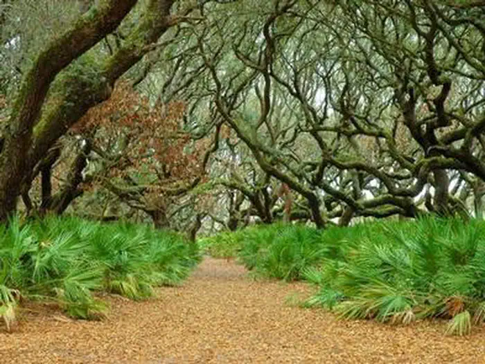
The island is home to more than 17 miles of undeveloped beach, a maritime forest of oak hammock and long leaf pine, tidal creeks, and marshland. Visitors can see an abundance of wildlife from deer, turkey, alligators, and bobcats, to snakes, tortoises, lizards, and hundreds of migratory birds.
Recreation
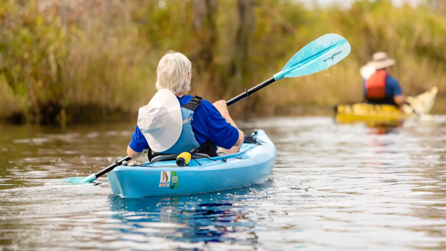
There are over 50 miles of trails and roads as well as 18 miles of beach. Hiking, biking, camping, birdwatching, and beachcombing are popular activities on the island.
Nearby
City of St. Marys, GA - St. Marys, Georgia, the gateway to Cumberland Island National Seashore, a small coastal village located in southeast Georgia remains one of Georgia's best kept secrets, a place rich in history, natural beauty and Southern hospitality. St. Marys and Cumberland Island National Seashore provide a perfect escape from the hustle and bustle of everyday life. Okefenokee National Wildlife Refuge - In southern Georgia and northern Florida there is a very special place, one of the oldest and best preserved freshwater systems in America. Native Americans called it Okefenoka, meaning “Land of the Trembling Earth”. Now this place, where earth, air, fire and water continuously reform the landscape, is preserved within the Okefenokee National Wildlife Refuge, created in 1937 to protect wildlife and for you to explore. St. Marys Submarine Museum - This museum is a great place to learn about the "Silent Service". A wide variety of Submarine artifacts, memorabilia and information are available for viewing, and you can view the beautiful St Marys waterfront through a real periscope.
Guidebooks for Cumberland Island National Seashore and Georgia
We earn a small commission if you buy through these links. It does not change what we list.
Titles come from Open Library's catalog, matched by subject heading or by title.
Reference
Questions people ask
Do I need a reservation at Cumberland Island National Seashore Camping Permits?
Sites at Cumberland Island National Seashore Camping Permits are reservable on Recreation.gov. Any walk-up sites are listed on the booking page.
Source: Recreation.gov
How much does it cost to camp at Cumberland Island National Seashore Camping Permits?
Nightly Camping Use Fees apply (see Facility Rates below)
Source: Recreation.gov
What time is check-in at Cumberland Island National Seashore Camping Permits?
Check-in 10:00 AM, checkout 10:00 AM.
Source: Recreation.gov
How many sites does Cumberland Island National Seashore Camping Permits have?
47 sites, including 25 hike-in sites, 16 walk-in sites, 2 group walk to, and 1 designated campsite.
Source: Recreation.gov
Can I bring an RV to Cumberland Island National Seashore Camping Permits?
Cumberland Island National Seashore Camping Permits is listed for tents only.
Source: Recreation.gov
Can I have a campfire at Cumberland Island National Seashore Camping Permits?
Fires are allowed in the provided rings under normal conditions.
Source: Recreation.gov
Is there cell service at Cumberland Island National Seashore Camping Permits?
FCC coverage maps show Verizon 5G, AT&T 5G, and T-Mobile 5G at the campground point. Terrain changes that from one site to the next.
Source: FCC Broadband Map
What is there to do at Cumberland Island National Seashore Camping Permits?
There are over 50 miles of trails and roads as well as 18 miles of beach. The Recreation section on this page has the rest.
Source: Recreation
What is the nearest town to Cumberland Island National Seashore Camping Permits?
St. Marys, Georgia. City of St.
Source: Getting there
What if Cumberland Island National Seashore Camping Permits is full?
The nearest public campgrounds are Okefenokee National Wildlife Refuge Overnight Camping Permit (45.3 mi), Cobb Hunt Camp (60.8 mi, first-come), and Ocean Pond Campground (62.4 mi).
Source: Campgrounds nearby
Which national park is Cumberland Island National Seashore Camping Permits in?
Cumberland Island National Seashore Camping Permits is a Cumberland Island National Seashore campground. Entrance fees, alerts, and hours are on Park Atlas.