Miller Cabin
The Miller Creek Cabin is located in the Townsend Ranger District and rests at the intersection of the Confederate Gulch Road (FS Road 287) and the Blacktail Road (FS Road 4171), surrounded by scattered forest in the Big Belt Mountains in west-central Montana. The cabin is accessible by high-clearance vehicle, but requires over-the-snow vehicle travel during winter months. Please use caution when accessing Miller cabin in the winter months, winter access will vary based on snow conditions. Do not count on wheeled vehicle access from November through April. You can get to Miller cabin in the winter months with snowmobile or cross country skiing.
Check availability on Recreation.gov ↗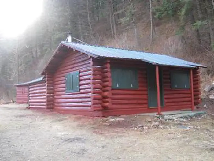
Site mix
| Cabins | 1 |
Site guide
1 site. Tap a filter to narrow the list; the map follows.
| Site | Surface | Shade | People / vehicles | Fires | Accessible |
|---|---|---|---|---|---|
| Miller Cabin | Gravel | Partial | 4 / – | Yes | Yes |
Per-site records as published by the managing agency on Recreation.gov. Blank cells mean the agency listed nothing for that site. Check-in 2:00 PM, checkout 11:00 AM.
Amenities & rules
| Pets | Allowed |
| Campfires | Allowed, subject to restrictions |
| Accessibility | Site Miller Cabin is listed accessible |
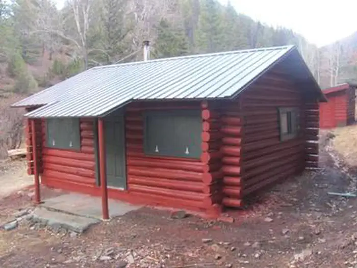
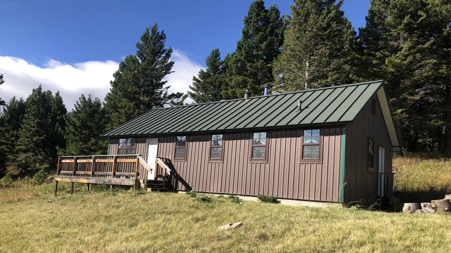
This is a two room log cabin that has been completely remodeled. In addition to the cabin there is a wood shed and new outhouse facility. Miller is a rustic log cabin furnished with two sets of bunk beds, kitchen hutch and table with four chairs. Pots and pans as well as dishes and some cleaning supplies are available for use. A two-burner propane camp cook stove and two lanterns are provided. Guests will need to provide their own fuel for the cook stove and lanterns. The stove and lantern require pre-filled propane cylinders which screw on (one pound cylinders work well). There is no water available. Guests must bring their own bedding and pillows, flashlights, towels, food, garbage bags, dish soap, dish towels, extra cooking utensils and dishes, toilet paper and paper towels. Bedding and linens are not provided. Guests must clean the cabin completely and pack out all food and trash before leaving.
Individual sites vary. Confirm on Recreation.gov or with the managing office.
Weather by month
Getting there
From Townsend, Montana: Turn east from US Highway 287 onto US Highway 12 for approximately 3 miles. Turn north on State Highway 284 for approximately 15 miles. Turn northeast onto Forest Road 287, Confederate Gulch, travel on Forest Rd 287 for approximately 8 miles. Arrived at location. Junction of Forest Rd 287 and Blacktail Rd 4171.
| Nearest town | Townsend, Montana |
| Coordinates | 46.6084° N, 111.3889° W · Directions ↗ |
Fire nearby
- PrescribedBear Gulch Rx
33 mi from the campground · 300 acres
- PrescribedWakina Sky Rx
33 mi from the campground · 300 acres
- PrescribedKings Hill Cabin Piles Rx
36 mi from the campground · 1 acres
- PrescribedCoyote Divide Piles Rx
38 mi from the campground
Distance is to the reported incident point, not the fire edge. Call the managing office before you drive.
Supplies & services
| Dump station | Dump station ↗ | 9.6 mi |
| RV sales & service | D & D RV Center ↗ | 29 mi |
| Outdoor gear | Sierra ↗ | 29.3 mi |
Locations © OpenStreetMap contributors. Call ahead; hours change seasonally.
Explore
Worth a stop
Confederate Gulch is a steeply incised valley on the west facing slopes of the Big Belt Mountains. Its small stream drains westward into Canyon Ferry Lake on the upper Missouri River Valley near present day Townsend, Montana. In 1864 Confederate soldiers on parole from the American Civil War made a minor gold discovery in the gulch, but in 1865 the discovery of the sensationally rich Montana Bar - one of the richest placer strikes per acre ever made - led to other rich gold strikes up and down the gulch, and touched off a frantic boom period of placer gold mining that extended through 1869. From 1866 to 1869 the gulch equaled or outstripped all other Montana Territory mining camps in gold production, producing an estimated $19 to $30 million in gold - late 1860s money. For a time, the gulch became the largest community in Montana. In 1866 Montana had a total population of 28,000, and of these, about 10,000 (35%) were working in Confederate Gulch. The main community was Diamond City while gold production was at its height; Diamond City roared along both night and day.
- 11.1 miGipsy Lake Day Picnic Area ↗Day use
- 12.7 miNever Sweat Trailhead ↗Trailhead
Trails nearby
- 0.8 miBoulder Lakes ↗6.9 mi trail · hiking, horse, bike
- 2.1 miSpruce Creek2.8 mi trail · hiking, horse, bike
- 2.6 miBelt Mountain Divide ↗11.1 mi trail · hiking, horse, bike, motorcycle and 1 more
- 2.7 miKentucky Gulch3 mi trail · hiking, horse, bike
- 4.4 miCamas2.4 mi trail · hiking, horse, bike
Trail and trailhead records are the Forest Service's. Distances are straight-line to the nearer trail end. Trail conditions are not tracked here.
Public land it sits in
This campground sits inside Helena-Lewis and Clark National Forest.
- inHelena-Lewis and Clark National Forest ↗National Forest · Forest Service · 3,177,729 acres
Each unit is published as a centre point and an acreage rather than a boundary, so this section stands it in for a circle of the same area. Whether a campground is inside, and how far it is from one it is outside, are both approximate.
Other campgrounds nearby

Cabin and lookout rentals nearby
On the National Register nearby
- Fort Logan and BlockhouseSite · White Sulphur Springs · 11.6 mi
- St. Joseph's Catholic Mission ChurchBuilding · Townsend · 14.1 mi
Natural features
The cabin sits at the confluence of two drainages, Confederate and Blacktail Creeks. The site is shaded for most of the day with mature trees and shrubs.
Recreation
During the summer months, enjoy a hike on local trails that will take you to high mountain lakes. During the fall, the cabin offers a wide array of recreation opportunities including hiking, hunting and off-highway vehicle access. The winter months provide for cross-country skiing and snowmobile opportunities.
Guidebooks for Montana
We earn a small commission if you buy through these links. It does not change what we list.

Titles come from Open Library's catalog, matched by subject heading or by title.
Reference
Questions people ask
Do I need a reservation at Miller Cabin?
Sites at Miller Cabin are reservable on Recreation.gov. Any walk-up sites are listed on the booking page.
Source: Recreation.gov
What time is check-in at Miller Cabin?
Check-in 2:00 PM, checkout 11:00 AM.
Source: Recreation.gov
How many sites does Miller Cabin have?
1 site, including 1 cabin.
Source: Recreation.gov
Are pets allowed at Miller Cabin?
Yes, pets are allowed at Miller Cabin. Leash rules apply.
Source: Recreation.gov
Can I have a campfire at Miller Cabin?
Fires are allowed in the provided rings under normal conditions. As of 2026-10-16, there are 4 active fires within 50 miles, so check current restrictions before you light one.
Source: Fire nearby
Are there accessible sites at Miller Cabin?
Site Miller Cabin is listed accessible on Recreation.gov. What that covers (a paved pad, an accessible table, a nearby accessible restroom) is on each site's booking page.
Source: Recreation.gov
What is there to do at Miller Cabin?
During the summer months, enjoy a hike on local trails that will take you to high mountain lakes. The Recreation section on this page has the rest.
Source: Recreation
What is the nearest town to Miller Cabin?
Townsend, Montana. Confederate Gulch is a steeply incised valley on the west facing slopes of the Big Belt Mountains.
Source: Getting there
What if Miller Cabin is full?
The nearest public campgrounds are Coulter Campground (9.8 mi, first-come), White Earth Campground (11.2 mi), and Hellgate Campground (11.9 mi).
Source: Campgrounds nearby