North Arm Campground
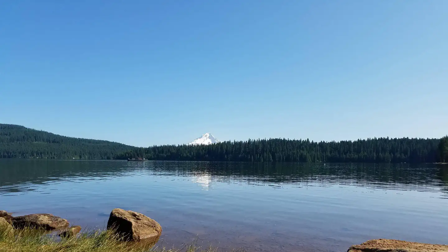
The North Arm Campground sits on the shores of Timothy Lake, in the shadow of Oregon's Mt. Hood. The surrounding forest setting offers spectacular views, wetlands, trails for exploration, and abundant fishing. This campground is smaller and more secluded than the others on the south side of the lake. Recommended Route: From Sandy, Oregon, travel east on Highway 26 for approximately 40 miles to Skyline Road / FS Road 42. Turn right on Skyline Road, and continue south for about 9 miles. Turn right on FS Road 57, and travel west for approximately 3 ½ miles, crossing the dam at Timothy Lake. Take the 2nd right onto FS Road 5810. North Arm is approximately 5 ½ miles from here.
Some sites take reservations on Recreation.gov. Others are first-come, first-served.
More like this: first-come in Oregon · reservable in Oregon · big rigs in Oregon · pets allowed in Oregon
Check availability on Recreation.gov ↗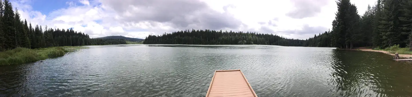

Site mix
| Standard, no hookups | 19 |
| Host/management | 1 |
Site guide
Will my RV fit
The longest site here provides 30 feet of vehicle capacity. Most sites are shorter.
19 sites in 2 loops. Tap a filter to narrow the list; the map follows.
| Site | Loop | Entry | Fits, ft | Surface | Shade | People / vehicles | Fires | Accessible | Rating |
|---|---|---|---|---|---|---|---|---|---|
| 005 | HIKE TO | Back-in | 15 | Gravel | Partial | 4 / 1 | Yes | Standard | |
| 006 | HIKE TO | Back-in | 15 | Gravel | Partial | 4 / 1 | Yes | Standard | |
| 007 | HIKE TO | Back-in | 15 | Gravel | Partial | 4 / 1 | Yes | Standard | |
| 008 | HIKE TO | Back-in | 15 | Gravel | Partial | 4 / 1 | Yes | Standard | |
| 020 | HIKE TO | Back-in | 15 | Gravel | Partial | 4 / 1 | Yes | Standard | |
| 001 | NORTH ARM (TIMOTHY LAKE) CAMPGROUND | Back-in | 35 | Gravel | Partial | 6 / 1 | Yes | Standard | |
| 002 | NORTH ARM (TIMOTHY LAKE) CAMPGROUND | Pull-through | 30 | Gravel | Partial | 6 / 1 | Yes | Standard | |
| 003 | NORTH ARM (TIMOTHY LAKE) CAMPGROUND | Back-in | 35 | Gravel | Partial | 6 / 1 | Yes | Standard | |
| 004 | NORTH ARM (TIMOTHY LAKE) CAMPGROUND | Back-in | 35 | Gravel | Partial | 6 / 1 | Yes | Standard | |
| 009 | NORTH ARM (TIMOTHY LAKE) CAMPGROUND | Back-in | 30 | Gravel | Partial | 6 / 1 | Yes | Yes | Standard |
Per-site records as published by the managing agency on Recreation.gov. Blank cells mean the agency listed nothing for that site. Check-in 4:00 PM, checkout 12:00 PM.
Amenities & rules
| Hookups | None |
| Max vehicle length | 45 ft |
| Equipment | RVs & trailers, Tents |
| Pets | Allowed |
| Campfires | Allowed, subject to restrictions |
| Fees | Payment in-full will be charged to your credit card upon completion of the reservation. A non-refundable online reservation fee may be charged for some facilities. |
| Accessibility | Sites 009, 015 are listed accessible |
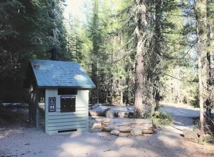
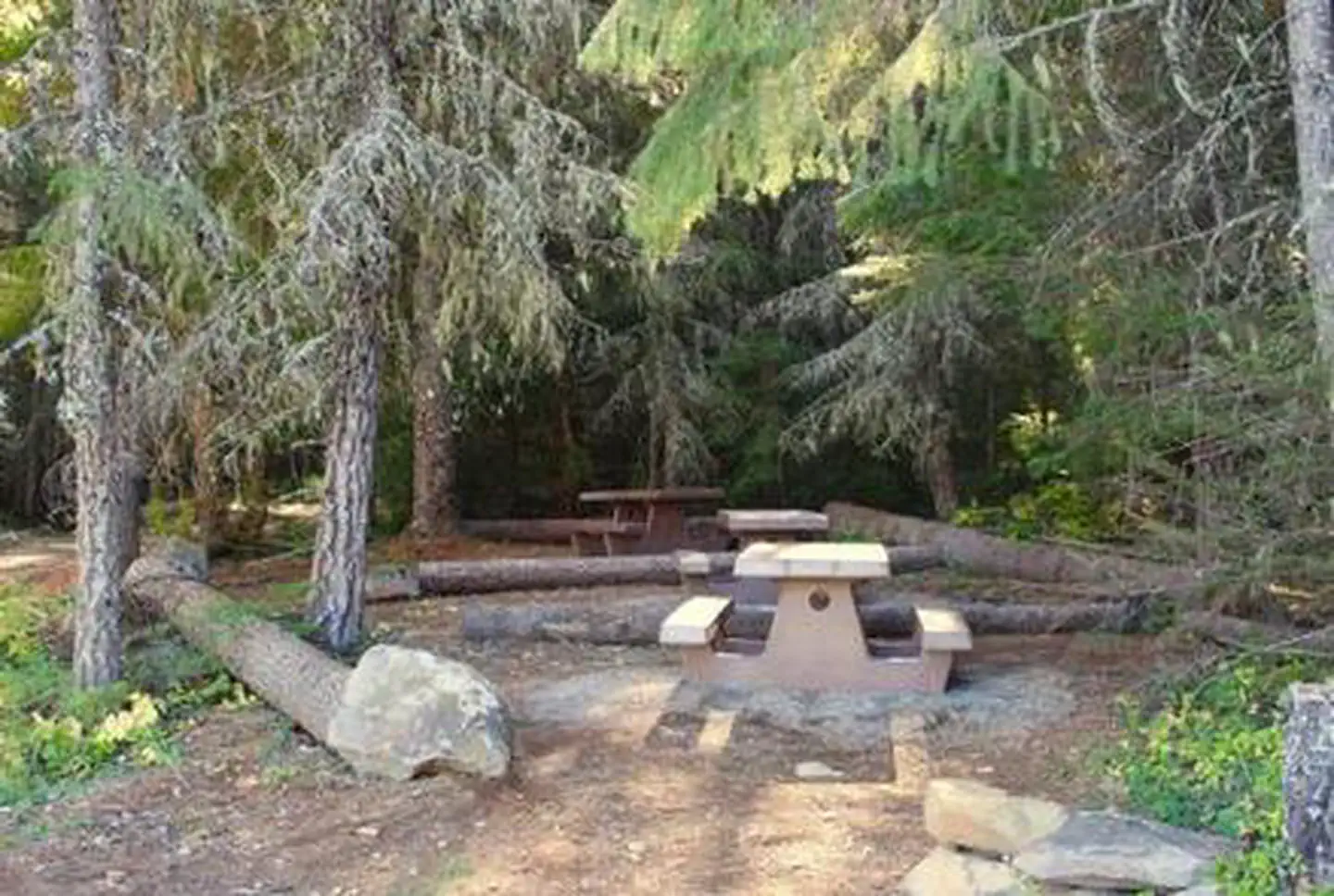
The campground offers 14 campsites for tent and RV camping. There are four hike-to campsites available as well. Each site is equipped with a table and a fire ring. Accessible vault toilets and drinking water are provided. A campground host is also available onsite. The nearest gas station/convenience store is about 14 miles away, west on Hwy. 26. The nearest grocery store is in Government Camp, about 19 miles away, west on Hwy. 26.
Individual sites vary. Confirm on Recreation.gov or with the managing office.
Season & status
| Status | Closed for the season. Forest Service sites close for the season; check the official page for the reopening date. |
| Forest | Mt. Hood National Forest |
| Booking | North Arm Campground is available by reservation only. Reservations can be made online at Recreation.gov or by calling 1-877-444-6777. |
| Fees | Camping: $26/night for standard non-electric single site. $22/night for hike-in non-electric single site. $10/night for extra vehicle. Holiday weekend camping rates are an additional $2 per night. Day use: $10/day/vehicle |
| Rules | 10 mph speed limit for motorized boats on the lake. |
Weather by month
Getting there
Recommended Route: From Government Camp, travel east on Highway 26 for approximately 11 miles to Skyline Road / FS Road 42. Turn right on Skyline Road, and continue south for just over 8 miles. Turn right on FS Road 57, and travel west for approximately 3 ½ miles, crossing the dam at Timothy Lake. Take the 2nd right onto FS Road 5810.
| Coordinates | 45.1425° N, 121.7717° W · Directions ↗ |
Good to know
- Driving note: There are two routes to North Arm Campground—one is rugged and one is suitable for RVs and trailers.
Charges and cancellations
A service fee will apply if you change or cancel your reservation. Late cancellations are subject to additional fees.
Fire nearby
- PrescribedStone Ck/Clackamas Guard Station Rx - West
3 mi from the campground
- PrescribedGoat Stew Rx - West
11 mi from the campground
- WildfireAustin
12 mi from the campground · 12,888 acres · 98% contained
- PrescribedAustin Repair Pile Rx - West
13 mi from the campground
Distance is to the reported incident point, not the fire edge. Call the managing office before you drive.
Supplies & services
| Outdoor gear | Valians Sports ↗ | 11.2 mi |
| Dump station | Dump station ↗ | 29.8 mi |
| RV sales & service | Adventure Trading RV ↗ | 41.3 mi |
Locations © OpenStreetMap contributors. Call ahead; hours change seasonally.
Explore
Video
North Arm (Timothy Lake) 2
Worth a stop
The Clackamas Lake Ranger Station Historic District is less than 10 miles from the campground. It was built to house Forest Service workers in the early 1900s. The rustic architecture and historic nature of the buildings and the surrounding area draws thousands of tourists each year.
- 11.1 miMirror Lake Trailhead ↗Trailhead
- 12.1 miParadise Park Trailhead ↗Trailhead
Trails nearby
- 0.8 miTimothy Bike4.2 mi trail
- 0.8 miTimothy Lake ↗7.4 mi trail
- 1 miLittle Crater Lake ↗0.3 mi trail
- 1.3 mi5800-230 Spur Snow0.5 mi trail
- 1.5 miMeditation Point0.3 mi trail
- 2.1 mi5860 Road Snow3.5 mi trail
Trailheads within three miles
- 2.5 miTimothy Lake - West Shore Day Use ↗Mt. Hood National Forest
Trail and trailhead records are the Forest Service's. Distances are straight-line to the nearer trail end. Trail conditions are not tracked here.
Public land it sits in
This campground sits inside Mt. Hood National Forest.
- inMt. Hood National Forest ↗National Forest · Forest Service · 1,060,160 acres
- 6.4 miSalmon-Huckleberry Wilderness ↗Wilderness · Forest Service · 62,139 acres
- 7.2 miRoaring River Wilderness ↗Wilderness · Forest Service · 36,548 acres
Each unit is published as a centre point and an acreage rather than a boundary, so this section stands it in for a circle of the same area. Whether a campground is inside, and how far it is from one it is outside, are both approximate.
Other campgrounds nearby


Cabin and lookout rentals nearby

On the National Register nearby
- Silcox HutBuilding · Timberline Lodge · 14.3 mi
- Wilbur and Evelyn Reid's Alderbrook LodgeBuilding · Boring · 14.7 mi
Natural features
The campground is situated on the northeastern shore of the roughly 1,400-acre lake, at an elevation of 3,400 feet. Timothy Lake was created in 1956 as a storage reservoir for the Oak Grove Hydroelectric Project. It is one of the larger lakes in the Mt. Hood National Forest. The campground is nestled in a dense mix conifer forest close to the shoreline. Most sites have a thick understory to provide privacy between sites. The wetlands nearby provide an opportunity to observe many species of wildlife.
Recreation
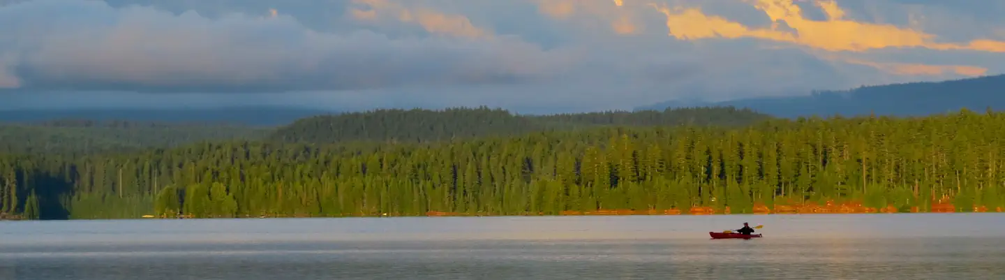
Proximity to Timothy Lake allows campers to enjoy a variety of water-related recreation, including boating and sailing, as well as swimming, windsurfing and fishing. Anglers can expect a catch of kokanee salmon and a variety of trout, as well as crayfish. This area has wonderful canoeing and kayaking opportunities. A variety of trails are located in the area. The Timothy Lake Trail is popular for hiking, mountain biking and horseback riding. The 12 miles of relatively level terrain loops trekkers around the lake, providing scenic views of the area. It connects to the Pacific Crest National Scenic Trail, a lengthy hike that extends across three states, from the borders of Canada and Mexico. Portions of that trail also lead southwest to Clackamas Lake Campground and a historic site. The Little Crater Lake is only a short hike away. Little Crater Lake is a geologic oddity, possibly formed by artesian water forcing its way through soft, volcanic rock. The beautiful, turquoise water is a wonder to see. The surrounding meadow is a great place for observing birds and other wildlife. The region is ripe for huckleberry picking as well.
Guidebooks for Oregon
We earn a small commission if you buy through these links. It does not change what we list.

Titles come from Open Library's catalog, matched by subject heading or by title.
Reference
Questions people ask
Do I need a reservation at North Arm Campground?
For some sites. Some sites take reservations on Recreation.gov. Others are first-come, first-served.
Source: Recreation.gov
How much does it cost to camp at North Arm Campground?
Payment in-full will be charged to your credit card upon completion of the reservation. A non-refundable online reservation fee may be charged for some facilities.
Source: Recreation.gov
What time is check-in at North Arm Campground?
Check-in 4:00 PM, checkout 12:00 PM.
Source: Recreation.gov
Is North Arm Campground open right now?
Closed for the season as of Oct 16, 2026.
Source: Forest Service status
How many sites does North Arm Campground have?
20 sites, including 19 standard sites without power.
Source: Recreation.gov
Will my RV fit at North Arm Campground?
The longest site here provides 45 feet of vehicle capacity. Most sites are shorter. The sidebar tool checks a trailer or motorhome length against every site.
Source: Will my RV fit
Are pets allowed at North Arm Campground?
Yes, pets are allowed at North Arm Campground. Leash rules apply.
Source: Recreation.gov
Can I have a campfire at North Arm Campground?
Fires are allowed in the provided rings under normal conditions. As of 2026-10-16, there are 4 active fires within 50 miles, so check current restrictions before you light one. 10 mph speed limit for motorized boats on the lake.
Source: Fire nearby
Are there accessible sites at North Arm Campground?
Sites 009 and 015 are listed accessible on Recreation.gov. What that covers (a paved pad, an accessible table, a nearby accessible restroom) is on each site's booking page.
Source: Recreation.gov
What is there to do at North Arm Campground?
Proximity to Timothy Lake allows campers to enjoy a variety of water-related recreation, including boating and sailing, as well as swimming, windsurfing and fishing. The Recreation section on this page has the rest.
Source: Recreation
What if North Arm Campground is full?
The nearest public campgrounds are Little Crater Lake (1.3 mi), Timothy Lake - Meditation Point Campground (1.5 mi, first-come), and Oak Fork Campground (1.9 mi, partly first-come).
Source: Campgrounds nearby