Burnt Corral Campground
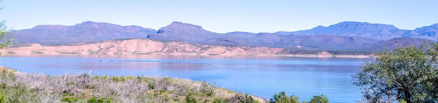
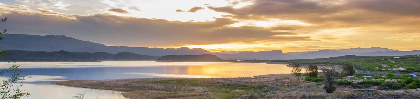
Burnt Corral Campground and Recreation Area (elevation 1914') is about 5.8 miles south of Roosevelt Dam along the Apache Trail (AZ Hwy 88) along the shoreline of Apache Lake. It is nestled amongst the saguaros, mesquites, and palo verdes, and offers opportunities to boat, swim, fish, relax, hike, and sightsee.
Some sites take reservations on Recreation.gov. Others are first-come, first-served.
More like this: first-come in Arizona · reservable in Arizona · pets allowed in Arizona
Check availability on Recreation.gov ↗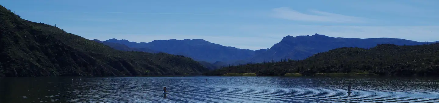
Site mix
| Standard, no hookups | 79 |
Site guide
Will my RV fit
The longest site here provides 22 feet of vehicle capacity. Most sites are shorter.
79 sites. Tap a filter to narrow the list; the map follows.
| Site | Entry | Fits, ft | Surface | Shade | Waterfront | People / vehicles | Fires | Rating |
|---|---|---|---|---|---|---|---|---|
| 1 | Pull-through | 32 | Gravel | Partial | Lakefront | 10 / 3 | Yes | Standard |
| 2 | Back-in | 32 | Gravel | Partial | Lakefront | 10 / 3 | Yes | Standard |
| 3 | Back-in | 32 | Gravel | Partial | Lakefront | 10 / 3 | Yes | Standard |
| 4 | Back-in | 32 | Gravel | Partial | Lakefront | 10 / 3 | Yes | Standard |
| 5 | Back-in | 32 | Gravel | Partial | Lakefront | 10 / 3 | Yes | Standard |
| 6 | Back-in | 32 | Gravel | Partial | Lakefront | 10 / 3 | Yes | Standard |
| 7 | Back-in | 32 | Gravel | Partial | Lakefront | 10 / 3 | Yes | Standard |
| 8 | Back-in | 32 | Gravel | Partial | Lakefront | 10 / 3 | Yes | Standard |
| 9 | Back-in | 32 | Gravel | Partial | Lakefront | 10 / 3 | Yes | Standard |
| 10 | Back-in | 32 | Gravel | Partial | Lakefront | 10 / 3 | Yes | Standard |
Per-site records as published by the managing agency on Recreation.gov. Blank cells mean the agency listed nothing for that site. Check-in 12:00 PM, checkout 10:00 AM.
Amenities & rules
| Hookups | None |
| Max vehicle length | 32 ft |
| Equipment | RVs & trailers, Tents |
| Pets | Allowed |
| Campfires | Allowed, subject to restrictions |
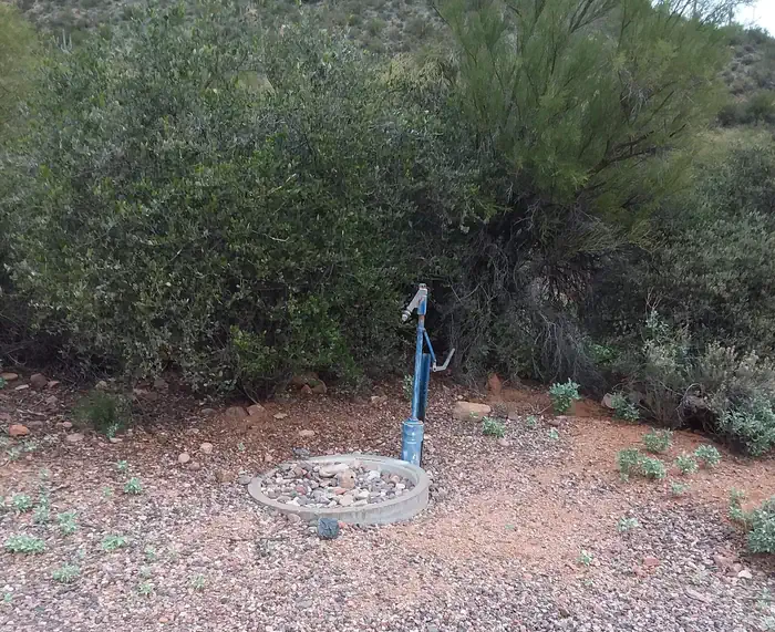
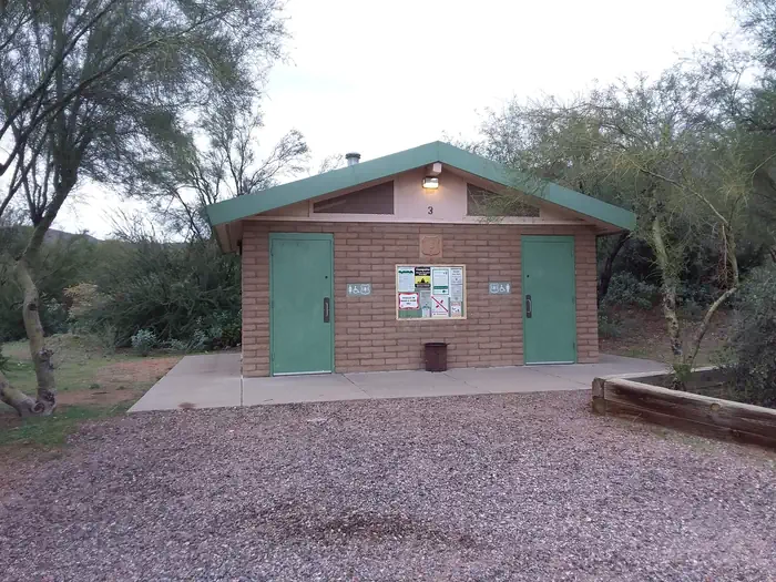
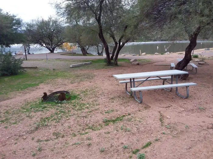
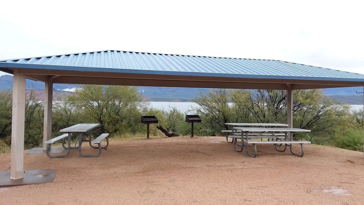
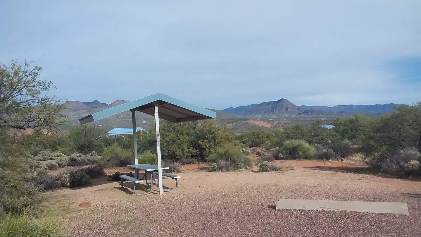
Burnt Corral Campground includes 76 camp units, vault toilets, potable water hydrants, 6 day-use picnic units, paved boat launch, boat boarding dock; Each campsite includes a parking spur, fire ring with grill, a shade ramada, and a picnic table. This campground provides access to visitors who are mobility impaired.
Individual sites vary. Confirm on Recreation.gov or with the managing office.
Season & status
| Status | Open |
| Season | Year-round |
| Forest | Tonto National Forest |
| Fees | $20/site/night for individual camp unit; $40/site/night for double camp unit; America the Beautiful Interagency Senior or Access Pass holders receive 50% discount (persons over 62 or living with a permanent disability) for single camp units only. |
| Rules | 14-day stay limit. Trailers under 22 feet. Stay limit is 14 days. Sewage dump facilities are located 5 miles north of the junction of State Hwy. 88 and State Hwy.188, across from Cholla Campground (no fee). Parts of State Hwy. 88 are a narrow gravel road. Please use trash receptacles. In the winter, temperatures drop into the teens. PACK IT IN, PACK IT OUT. |
Weather by month
Getting there
Access to Burnt Corral from Tortilla Flat HWY88E/Apache Trail is currently closed, please use an alternative route. From the Mesa area: Head to AZ-87N for approximately 59 miles. Turns right onto AZ-188S for 31.6 miles. Turn right onto AZ-88W for 6 miles and Burnt Corral Recreation Site will be on your right.
| Nearest town | Roosevelt, Arizona |
| Coordinates | 33.6274° N, 111.2033° W · Directions ↗ |
Supplies & services
| Dump station | Dump station ↗ | 19.8 mi |
| RV sales & service | RV Park Model Traders ↗ | 26.8 mi |
| Outdoor gear | Gold Dog Tents ↗ | 31.9 mi |
Locations © OpenStreetMap contributors. Call ahead; hours change seasonally.
Explore
Video
A weekend at Burnt Corral Campgrounds 2024
Trails nearby
- 3 miVineyard ↗6 mi trail · hiking, horse, bike · national_scenic_or_historic
- 3.8 miFour Peaks ↗12.2 mi trail · hiking, horse, bike · national_scenic_or_historic
- 4.3 miThompson ↗2.9 mi trail · hiking, horse, bike · national_scenic_or_historic
- 4.6 miCemetery0.2 mi trail · hiking, horse, bike
- 4.7 miTwo Bar ↗7.8 mi trail · hiking, horse · national_scenic_or_historic
Trail and trailhead records are the Forest Service's. Distances are straight-line to the nearer trail end. Trail conditions are not tracked here.
Public land it sits in
This campground sits inside Tonto National Forest.
- inTonto National Forest ↗National Forest · Forest Service · 2,966,417 acres
- 1.7 miSuperstition Wilderness ↗Wilderness · Forest Service · 160,164 acres
- 3.7 miFour Peaks Wilderness ↗Wilderness · Forest Service · 60,773 acres
Each unit is published as a centre point and an acreage rather than a boundary, so this section stands it in for a circle of the same area. Whether a campground is inside, and how far it is from one it is outside, are both approximate.
Other campgrounds nearby
On the National Register nearby
- Pine Creek BridgeStructure · Tortilla Flat · 2 mi
- Alchesay Canyon BridgeStructure · Roosevelt · 3.8 mi
- Tonto National Monument, Lower Ruin (AZ U:8:047a Asm)Site · Roosevelt · 5.1 mi
Natural features
Burnt Corral Campground is situated in what may be the most stunning Sonoran Desert landscape in Arizona. The contrast of sunshine, clear blue water, and saguaro's surrounded by the Four Peaks and Superstition Wilderness' is a magnificant sight to see. While shade is scarce in the desert, campsites are situated amongst mature mesquite and palo verde trees, and desert chaparral. Apache Lake is 17 miles long making it the longest in the chain of reservoirs on the lower Salt River below Roosevelt Dam.
Recreation
Motorboating, fishing, water-skiing, and paddlesports are very popular because of the developed and undeveloped lake access from within the campground. Others may enjoy hiking nearby trails, being challenged by local jeep trails, or practicing their landscape photography, or simply relaxing with a good book.
Nearby
Roosevelt Dam, Apache Lake Marina, Tortilla Flats, Tonto National Monument (Cliff Dwellings), Roosevelt Lake, Apache Trail Scenic Byway (AZ Hwy 88), Spines to Pines Scenic Byway (AZ Hwy 288). The City of Globe and Town of Payson are only an hour away.
Guidebooks for Tonto National Forest and Arizona
We earn a small commission if you buy through these links. It does not change what we list.
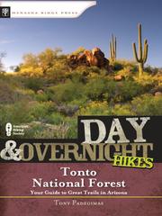
Titles come from Open Library's catalog, matched by subject heading or by title.
Reference
Questions people ask
Do I need a reservation at Burnt Corral Campground?
For some sites. Some sites take reservations on Recreation.gov. Others are first-come, first-served.
Source: Recreation.gov
How much does it cost to camp at Burnt Corral Campground?
$20/site/night for individual camp unit; $40/site/night for double camp unit; America the Beautiful Interagency Senior or Access Pass holders receive 50% discount (persons over 62 or living with a permanent disability) for single camp units only.
Source: Recreation.gov
What time is check-in at Burnt Corral Campground?
Check-in 12:00 PM, checkout 10:00 AM.
Source: Recreation.gov
Is Burnt Corral Campground open right now?
Open as of Oct 16, 2026. Season Year-round.
Source: Forest Service status
How many sites does Burnt Corral Campground have?
79 sites, including 79 standard sites without power.
Source: Recreation.gov
Will my RV fit at Burnt Corral Campground?
The longest site here provides 32 feet of vehicle capacity. Most sites are shorter. The sidebar tool checks a trailer or motorhome length against every site.
Source: Will my RV fit
Are pets allowed at Burnt Corral Campground?
Yes, pets are allowed at Burnt Corral Campground. Leash rules apply.
Source: Recreation.gov
Can I have a campfire at Burnt Corral Campground?
Fires are allowed in the provided rings under normal conditions. 14-day stay limit.
Source: Recreation.gov
What is there to do at Burnt Corral Campground?
Motorboating, fishing, water-skiing, and paddlesports are very popular because of the developed and undeveloped lake access from within the campground. The Recreation section on this page has the rest.
Source: Recreation
What is the nearest town to Burnt Corral Campground?
Roosevelt, Arizona. Roosevelt Dam, Apache Lake Marina, Tortilla Flats, Tonto National Monument (Cliff Dwellings), Roosevelt Lake, Apache Trail Scenic Byway (AZ Hwy 88), Spines to Pines Scenic Byway (AZ Hwy 288).
Source: Getting there
What if Burnt Corral Campground is full?
The nearest public campgrounds are Frazier Horse Campground (5 mi), Frazier Group Campground (5.1 mi), and Windy Hill Campground (7.2 mi, partly first-come).
Source: Campgrounds nearby