Desoto Falls Recreation Area
Desoto Falls Recreation Area is a U.S. Forest Service Campground located approximately 2 hours North of Atlanta in the North Georgia mountains of the Chattahoochee National Forest. Desoto Falls offers visitors year-round recreation opportunities including camping, fishing, picnicking, and beautiful hikes to our nearby waterfalls. The campground is situated along Frogtown Creek with at an elevation of 2,080 feet above sea level, under a dense forest of deciduous and evergreen trees. 23 campsites are neatly arranged in two loops(upper and lower), with each loop having creek sites.
More like this: reservable in Georgia · pets allowed in Georgia · group sites in Georgia
Check availability on Recreation.gov ↗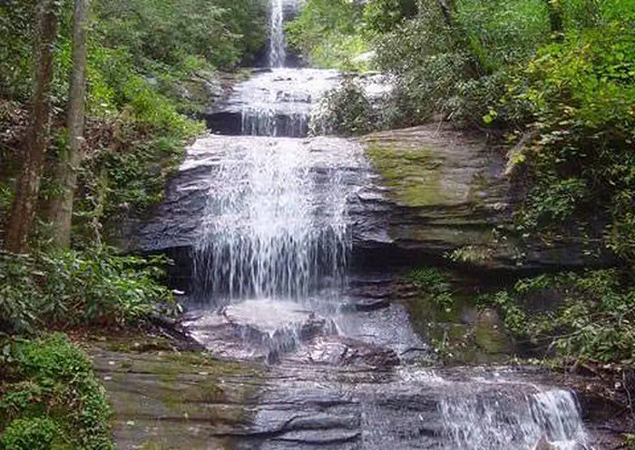
Site mix
| Standard, no hookups | 20 |
| Tent-only | 2 |
| Group sites | 1 |
Site guide
Will my RV fit
The longest site here provides 40 feet of vehicle capacity. Most sites are shorter.
23 sites in 2 loops. Tap a filter to narrow the list; the map follows.
| Site | Loop | Type | Entry | Fits, ft | Surface | People / vehicles | Fires |
|---|---|---|---|---|---|---|---|
| 1 | Lower Loop | Standard | Back-in | 40 | Gravel | 5 / 2 | Yes |
| 2 | Lower Loop | Standard | Back-in | 35 | Gravel | 5 / 2 | Yes |
| 3 | Lower Loop | Standard | Back-in | 50 | Gravel | 5 / 2 | Yes |
| 4 | Lower Loop | Standard | Back-in | 40 | Gravel | 5 / 2 | Yes |
| 5 | Upper Loop | Standard | Back-in | 24 | Gravel | 5 / 2 | Yes |
| 6 | Upper Loop | Standard | Back-in | 24 | Gravel | 5 / 2 | Yes |
| 7 | Upper Loop | Standard | Back-in | 14 | Gravel | 5 / 2 | Yes |
| 8 | Upper Loop | Standard | Back-in | 16 | Gravel | 5 / 2 | Yes |
| 9 | Upper Loop | Standard | Back-in | 40 | Gravel | 5 / 2 | Yes |
| 10 | Upper Loop | Tent only | 50 | Gravel | 5 / 2 | Yes |
Per-site records as published by the managing agency on Recreation.gov. Blank cells mean the agency listed nothing for that site. Check-in 03:00 PM, checkout 02:00 PM.
Amenities & rules
| Hookups | None |
| Equipment | RVs & trailers, Tents |
| Pets | Allowed |
| Campfires | Allowed, subject to restrictions |
| Fees | DURING NON-PEAK SEASON THE FEES CHANGE TO HALF PRICE. Standard Non Electric. $10.00. Standard Non Electric Double Site. $20.00. Tent Only Non Electric. $10.00 |
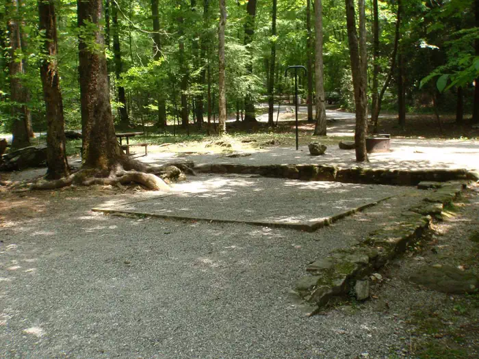
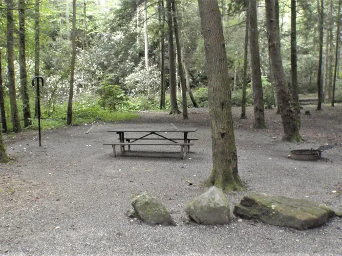
April 1st through October 31st, the campground has drinking water, warm showers, and flush toilets. The bathhouse has warm water outdoor showers connected to a flush facility, and is located on the lower loop. Hydrants are centrally located throughout the entire campground for your convenience. Centrally located in the upper loop is a vault toilet, which is a short walk from most campsites. From November 1st - March 31st, fees are reduced because no water is available. A dumpster is located near site #3 for all bagged trash to be disposed of. Amenities include a picnic area, picnic tables, fire rings, vault toilets, lantern posts, drinking water, flush toilets, water hydrants, water front sites, and garbage service.
Individual sites vary. Confirm on Recreation.gov or with the managing office.
Season & status
| Status | Open |
| Season | Yearlong |
| Forest | Chattahoochee-Oconee National Forest |
| Booking | Reservations are required to camp in this campground. Reservations can be made through the National Recreation Reservation Service (NRRS). |
| Fees | Camping Peak Season: April 1 - October 31 $20 per night/site $40 Double Site (Site #14) Camping Non-Peak Season(no water): November 1 - March 31 $10 per night/site $20 Double Site (Site #14) Day Use $5 per vehicle/day Pay for you activity pass at DeSoto Falls Day Use with the Recreation.gov Mobile… |
| Rules | 14 day stay limit. Maximum 2 vehicles per campsite. Dogs must be leashed at all times. |
Weather by month
Getting there
From Blairsville, GA take U.S. Highway 19/129 South for 17.0 miles and the campground entrance is on your right. From Dahlonega, GA take Highway 19 North for 18 miles and the entrance in on your left. From Cleveland, GA, take 19/129 North for 16 miles and the entrance to the campground is on your left.
| Nearest town | Dahlonega, Georgia |
| Coordinates | 34.7057° N, 83.9150° W · Directions ↗ |
Good to know
- Slippery rocks and fast moving water can be extremely dangerous!
- There are no hookups or a dump station avaliable in the campground.
Supplies & services
| Outdoor gear | Mountain Crossings ↗ | 2 mi |
| RV sales & service | Blairsville RV Sales ↗ | 14.4 mi |
| Dump station | Dump station ↗ | 21 mi |
Locations © OpenStreetMap contributors. Call ahead; hours change seasonally.
Explore
Video
DeSoto Falls Campground Tour! | Best Campsites in Georgia (E3)
Worth a stop
Just 1.5 miles north on 19/129 is Neels Gap and the Appalachian Trail. Drive just a short piece down to Byron Herbert Reece parking area on the left, and the Appalachian Trail can be easily accessed there. Nearby water falls to visit are Helton Creek Falls, Dukes Creeks Falls, and Raven Cliffs Falls. Just a short drive and located within the Chattahoochee-Oconee National Forests, the Brasstown Bald Recreation Area & Visitor Center is a great place to visit. It is the highest point in Georgia, rising 4,784 feet above sea level with a 360 degree view of four states. Towns within a short drive to visit are Blairsville, Helen, and Dahlonega, GA
- 0.1 miDesoto Falls Day Use Pass ↗Day use
- 5.2 miWoody Gap Trailhead ↗Trailhead
- 7.1 mi
- 7.1 miRaven Cliffs Trailhead ↗Trailhead
- 10.6 miWhissenhunt Ohv ↗OHV / range
- 13.2 miBeasley Knob Ohv ↗OHV / range
Trails nearby
- 0.2 miDesoto Falls0.9 mi trail · hiking
- 2.2 miFreeman1.8 mi trail · hiking, horse
- 2.2 miByron Herbert Reece0.7 mi trail · hiking
- 2.9 miDuncan Ridge ↗30 mi trail · hiking
- 2.9 miWoods Hole Shelter Spur0.4 mi trail · hiking
- 2.9 miSlaughter Creek2.7 mi trail · hiking
Trail and trailhead records are the Forest Service's. Distances are straight-line to the nearer trail end. Trail conditions are not tracked here.
Public land it sits in
This campground sits inside Chattahoochee-Oconee National Forests.
- inChattahoochee-Oconee National Forests ↗National Forest · Forest Service · 1,796,317 acres
- 0.5 miBlood Mountain Wilderness ↗Wilderness · Forest Service · 7,742 acres
- 1.7 miRaven Cliffs Wilderness ↗Wilderness · Forest Service · 9,240 acres
Each unit is published as a centre point and an acreage rather than a boundary, so this section stands it in for a circle of the same area. Whether a campground is inside, and how far it is from one it is outside, are both approximate.
Other campgrounds nearby
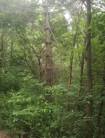
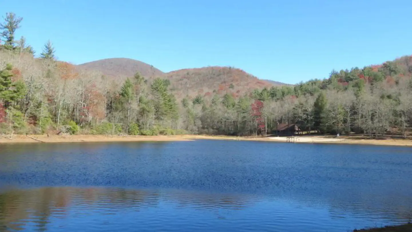

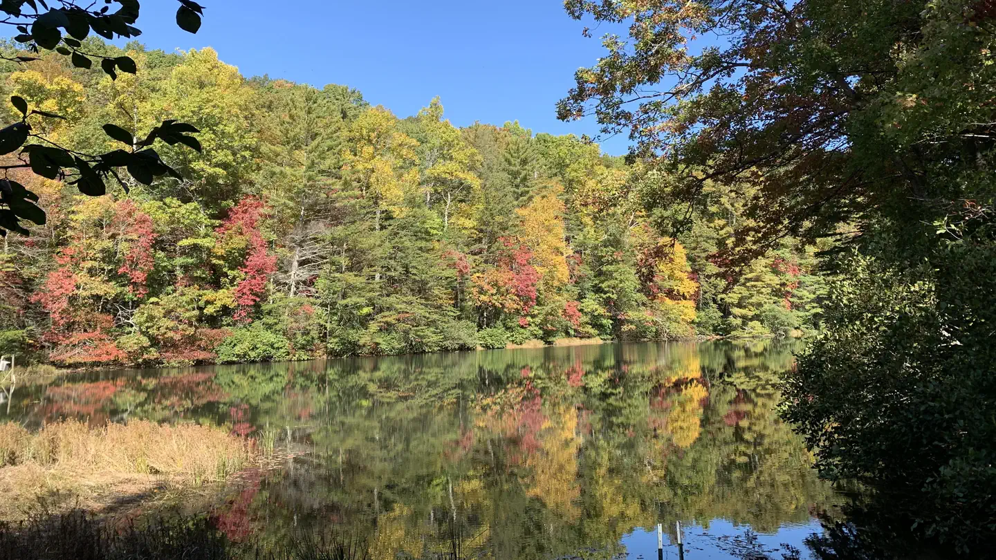
On the National Register nearby
- Walasi-Yi InnBuilding · Blairsville · 2 mi
- Blood Mountain Trail ShelterBuilding · Blairsville · 2.7 mi
- Old White County CourthouseBuilding · Cleveland · 10.6 mi
Natural features
Desoto Falls is part of the Chattahoochee National Forest and is located in a 650-acre (2.6 km2) area designated as the Desoto Falls Scenic Area. This area of the Blue Ridge Mountains in Georgia make up part of the Appalachian Mountain range stretching all the way to Canada. The hardwood coves, rushing waterfalls, creeks, and steep canyons are crisscrossed with abundant trails for hiking and fishing. During the Month of October, North Georgia’s trees put on a vibrant show. Summer's dark greens change to brilliant reds, oranges and yellows which makes the camping atmosphere amazing. Thousands make the yearly trek into the mountains near Desoto Falls for a front row seat.
Recreation
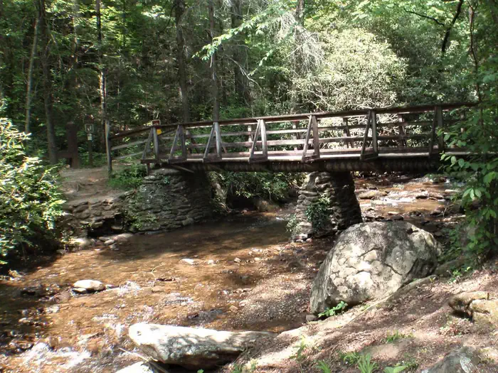
The primary attractions to this area are the two waterfalls along Frogtown Creek, which lead from the wooden bridge across from the Host Site. This hike is relatively short, kid-friendly distance and moderate elevation change make it one of North Georgia’s most popular waterfall hikes.25 hike to lower falls and.75 to the upper falls. The trail hikes through several large exposed rock outcrops, beautiful rhododendron, and under the shade of several enormous old-growth pine trees with their wide trunks reaching high into the forest canopy above. The waterfall’s newly built observation deck makes a great spot for a mid-hike rest or picnic, and a great place to soak up the waterfall’s beauty. Please don’t climb, stand on, swim near, or jump from any waterfall.
Guidebooks for Georgia
We earn a small commission if you buy through these links. It does not change what we list.
Titles come from Open Library's catalog, matched by subject heading or by title.
Reference
Questions people ask
Do I need a reservation at Desoto Falls Recreation Area?
Sites at Desoto Falls Recreation Area are reservable on Recreation.gov. Reservations are required to camp in this campground. Any walk-up sites are listed on the booking page.
Source: Recreation.gov
How much does it cost to camp at Desoto Falls Recreation Area?
DURING NON-PEAK SEASON THE FEES CHANGE TO HALF PRICE. Standard Non Electric. $10.00.
Source: Recreation.gov
What time is check-in at Desoto Falls Recreation Area?
Check-in 03:00 PM, checkout 02:00 PM.
Source: Recreation.gov
Is Desoto Falls Recreation Area open right now?
Open as of Oct 16, 2026. Season Yearlong.
Source: Forest Service status
How many sites does Desoto Falls Recreation Area have?
23 sites, including 20 standard sites without power, 2 tent-only sites, and 1 group site.
Source: Recreation.gov
Can I bring an RV to Desoto Falls Recreation Area?
Desoto Falls Recreation Area is listed for tents only.
Source: Recreation.gov
Are there showers or a dump station at Desoto Falls Recreation Area?
April 1st through October 31st, the campground has drinking water, warm showers, and flush toilets.
Source: Recreation.gov
Are pets allowed at Desoto Falls Recreation Area?
Yes, pets are allowed at Desoto Falls Recreation Area. Leash rules apply.
Source: Recreation.gov
Can I have a campfire at Desoto Falls Recreation Area?
Fires are allowed in the provided rings under normal conditions. 14 day stay limit.
Source: Recreation.gov
What is there to do at Desoto Falls Recreation Area?
The primary attractions to this area are the two waterfalls along Frogtown Creek, which lead from the wooden bridge across from the Host Site. The Recreation section on this page has the rest.
Source: Recreation
What is the nearest town to Desoto Falls Recreation Area?
Dahlonega, Georgia. Just 1.5 miles north on 19/129 is Neels Gap and the Appalachian Trail.
Source: Getting there
What if Desoto Falls Recreation Area is full?
The nearest public campgrounds are Boggs Creek Recreation Area (1.8 mi, first-come), Lake Winfield Scott Recreation Area (2.7 mi), and Lake Winfield Scott Campground (3.9 mi, first-come).
Source: Campgrounds nearby