Silesca Cabin
The historic Silesca Cabin, once used as a Ranger Station, is a semi-rustic dwelling with comfortable modern conveniences like electricity and refrigerator. Located 40 minutes west of the city of Montrose, the cabin is set back 100 feet from the main road, providing easy access with some privacy. The cabin is accessible in the summer and fall by passenger vehicle, when the road is dry. Four-wheel drive vehicles are recommended when the road is wet.
Check availability on Recreation.gov ↗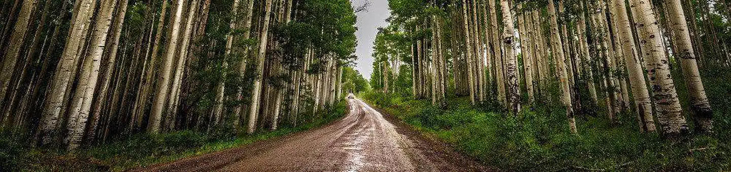

Site mix
| Cabins with electric | 1 |
Site guide
1 site. Tap a filter to narrow the list; the map follows.
| Site | Shade | Power | People / vehicles | Fires |
|---|---|---|---|---|
| Silesca Cabin | Partial | 30 amp | 6 / 4 | Yes |
Per-site records as published by the managing agency on Recreation.gov. Blank cells mean the agency listed nothing for that site.
Amenities & rules
| Hookups | Electric |
| Max vehicle length | 20 ft |
The rustic cabin accommodates up to six guests. Amenities include three bedrooms with six twin beds, electricity, refrigerator and a wood stove. Limited cooking utensils, dishes and cleaning supplies are provided. The kitchen and bathroom are located in the basement of this cabin. A campfire ring and picnic table are located outside. No drinking water is available. Items to bring include food, bedding, warm clothing, toilet paper, flashlights, towels, dish soap and toiletries.
Individual sites vary. Confirm on Recreation.gov or with the managing office.
Weather by month
Getting there
Follow Highway 90 southwest from Montrose. Watch for signs as the highway makes several turns as it weaves its way out of town. The pavement ends where the road begins to climb out of the Uncompahgre River Valley and enters lands administered by the Bureau of Land Management. In 20 miles, it enters the Uncompahgre National Forest.
| Nearest town | Montrose, Colorado |
| Coordinates | 38.3328° N, 108.1253° W · Directions ↗ |
Fire nearby
- PrescribedTransfer Rd Rx
10 mi from the campground · 139 acres
- WildfireGold Mountain
31 mi from the campground · 39,747 acres · 92% contained
- PrescribedHigh Mesa Piles Rx
35 mi from the campground · 324 acres
Distance is to the reported incident point, not the fire edge. Call the managing office before you drive.
Supplies & services
| Outdoor gear | Sportsman's Warehouse ↗ | 16 mi |
| Dump station | Dump station ↗ | 28.5 mi |
| RV sales & service | Pine Country ↗ | 57.5 mi |
Locations © OpenStreetMap contributors. Call ahead; hours change seasonally.
Explore
Worth a stop
- 10.2 miRimrocker Trailhead ↗Trailhead
Trails nearby
- 0.3 miDry Creek4.1 mi trail · hiking, horse, bike, motorcycle and 2 more
- 0.3 miBuck ↗9.7 mi trail · hiking, horse, bike, motorcycle and 2 more
- 0.6 miHighway 90 Sno ↗11.4 mi trail · snowmobile, snowshoe, ski
- 0.8 miDry Creek Spur1.2 mi trail · hiking, horse, bike, motorcycle and 2 more
- 1 miBuck Connector0.5 mi trail · hiking, horse, bike, motorcycle and 1 more
- 1.5 miAspen ↗5.2 mi trail · hiking, horse, bike, motorcycle and 1 more
Trail and trailhead records are the Forest Service's. Distances are straight-line to the nearer trail end. Trail conditions are not tracked here.
Public land it sits in
Grand Mesa, Uncompahgre and Gunnison National Forests begins about 0.6 miles away, and it is the closest of these.
- 0.6 miGrand Mesa, Uncompahgre and Gunnison National Forests ↗National Forest · Forest Service · 3,153,199 acres
Each unit is published as a centre point and an acreage rather than a boundary, so this section stands it in for a circle of the same area. Whether a campground is inside, and how far it is from one it is outside, are both approximate.
Other campgrounds nearby

On the National Register nearby
- Silesca Ranger StationBuilding · Grand Mesa · 0 mi
- Fetz-Keller Ranch HeadquartersHistoric district · Montrose · 13.6 mi
Natural features
The cabin is perched in a meadow surrounded by spruce and aspen trees at an elevation of 9,200 feet.
Recreation
Hiking, mountain biking, single track dirtbiking, UTV & ATV riding, horseback riding, hunting and wildlife viewing are all available in the vicinity. Silesca Pond is a short walk north of the cabin. Silesca Cabin is located near a limited hunting area for Rocky Mountain Elk, Unit 61.
Guidebooks for Colorado
We earn a small commission if you buy through these links. It does not change what we list.



Titles come from Open Library's catalog, matched by subject heading or by title.
Reference
Questions people ask
Do I need a reservation at Silesca Cabin?
Sites at Silesca Cabin are reservable on Recreation.gov. Any walk-up sites are listed on the booking page.
Source: Recreation.gov
How many sites does Silesca Cabin have?
1 site, including 1 cabin with power.
Source: Recreation.gov
Will my RV fit at Silesca Cabin?
The longest site here provides 20 feet of vehicle capacity. Most sites are shorter. The sidebar tool checks a trailer or motorhome length against every site.
Source: Will my RV fit
Does Silesca Cabin have hookups?
Yes, electric hookups at some sites.
Source: Recreation.gov
What is there to do at Silesca Cabin?
Hiking, mountain biking, single track dirtbiking, UTV & ATV riding, horseback riding, hunting and wildlife viewing are all available in the vicinity. The Recreation section on this page has the rest.
Source: Recreation
What is the nearest town to Silesca Cabin?
Montrose, Colorado.
Source: Getting there
What if Silesca Cabin is full?
The nearest public campgrounds are Iron Springs Campground (2.4 mi, first-come), Columbine Campground (15.3 mi, first-come), and Black Canyon Of The Gunnison South Rim Campground (28.1 mi).
Source: Campgrounds nearby