Lower Twilight Group Site
Lower Twilight Group Site offers groups a secluded camping escape from the summer desert heat. The scenic mountain setting is a great base for hiking, wildlife viewing and picnicking. The facility sits along the Swift Trail in southeastern Arizona, adjacent to Upper Twilight Group Site.
More like this: reservable in Arizona · big rigs in Arizona · pets allowed in Arizona · group sites in Arizona
Check availability on Recreation.gov ↗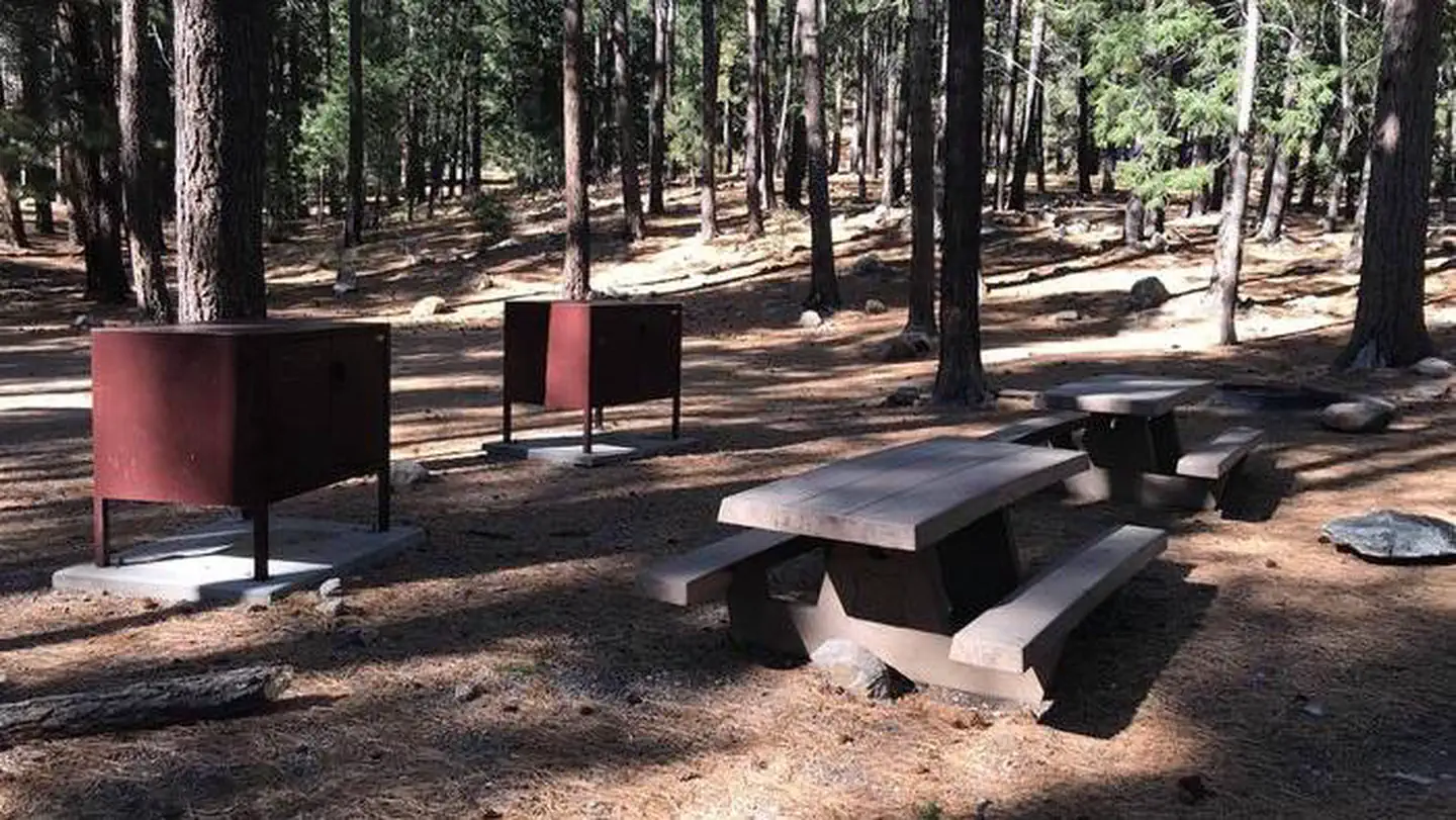
Site mix
| group standard area nonelectric | 1 |
Site guide
1 site. Tap a filter to narrow the list; the map follows.
| Site | Shade | People / vehicles | Fires | Rating |
|---|---|---|---|---|
| Lower Twilight Group Site | Partial | 50 / 6 | Yes | Prime |
Per-site records as published by the managing agency on Recreation.gov. Blank cells mean the agency listed nothing for that site. Check-in 2:00 PM, checkout 12:00 PM.
Amenities & rules
| Max vehicle length | 40 ft |
| Pets | Allowed |
| Campfires | Allowed, subject to restrictions |
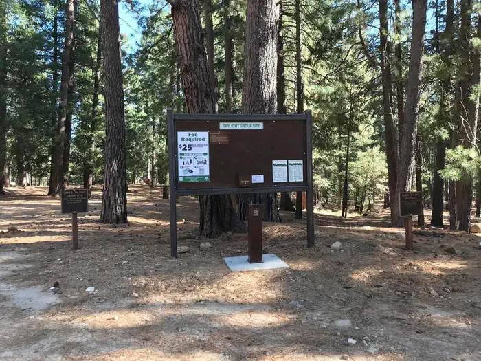
| Fees | This site has a $25 per night fee and a $5 per vehicle per night fee. Your check-out through recreation.gov will only include the Nightly/Daily rate. You must pay the per vehicle fee by cash or check upon arrival at the designated Fee Station. |
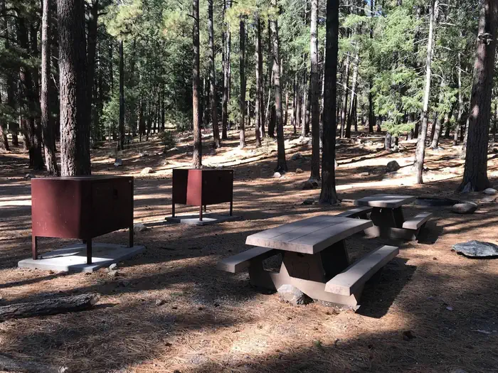
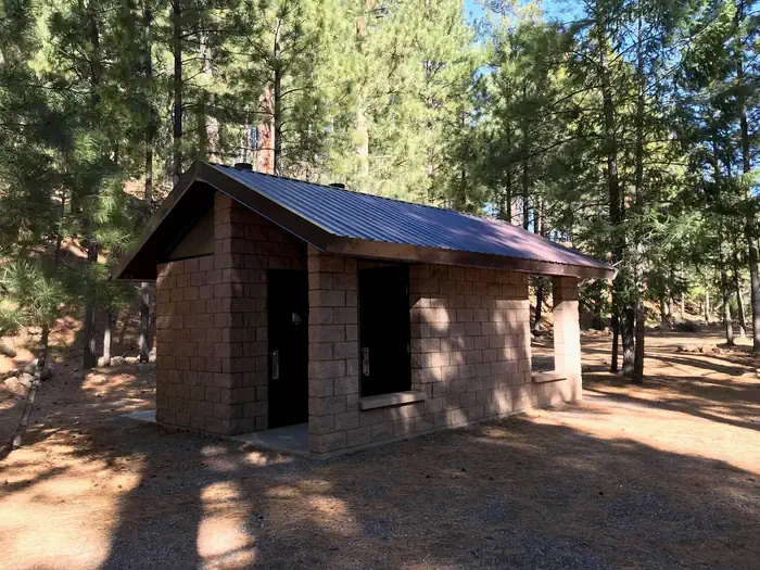
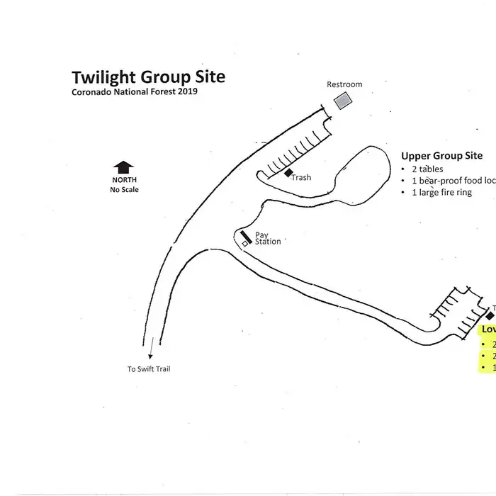
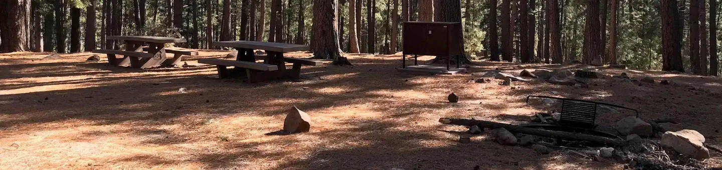
Lower Twilight can accommodate a single group of up to 50 people for camping. Parking is available for up to six vehicles. Amenities include picnic tables, campfire rings with grills, and bear-proof food lockers and trash cans. Vault toilets are located at Upper Twilight Group Site, a short walk away. Dead-and-down firewood may be collected in and around the campsite.
Individual sites vary. Confirm on Recreation.gov or with the managing office.
Season & status
| Status | Open |
| Season | Year-round |
| Forest | Coronado National Forest |
| Booking | Reservations for Upper Twilight and Lower Twilight can be made at Recreation.gov. |
| Fees | Two group sites are available. Fees for each site are $25 plus $5 per vehicle. Payable with cash or check. |
| Rules | Vehicles (including trailers) longer than 22 feet are not recommended because of the difficulty of negotiating the switchbacks on AZ 366. |
Weather by month
Getting there
From Safford, Arizona: Take State Route 191 south for 6 miles. Turn right onto State Route 366/Swift Trail and travel 14.5 miles to the Twilight Campground entrance (MM 128.4), following the road for 1 mile to the Lower Twilight Group Site. From Tucson, Arizona: Take I-10 East for 90 miles.
| Nearest town | Safford, Arizona |
| Coordinates | 32.6444° N, 109.8258° W · Directions ↗ |
Supplies & services
| Outdoor gear | Gila Outdoor ↗ | 14.7 mi |
| RV sales & service | Trek RV ↗ | 14.9 mi |
Locations © OpenStreetMap contributors. Call ahead; hours change seasonally.
Explore
Trails nearby
- 0.4 miArcadia ↗5.3 mi trail · hiking, horse, bike
- 0.6 miNoon Creek Ridge2.5 mi trail · hiking, horse, bike
- 1 miTurkey Flat0.3 mi trail · hiking, horse, bike
- 1 miRound the Mountain ↗15 mi trail · hiking, horse, bike
- 1.4 miHeliograph0.3 mi trail · hiking, horse, bike
- 1.5 miBear Canyon ↗7.3 mi trail · hiking, horse, bike
Trailheads within three miles
- 1.5 miLadybug Trailhead ↗Coronado National Forest · Season Year-round
Trail and trailhead records are the Forest Service's. Distances are straight-line to the nearer trail end. Trail conditions are not tracked here.
Other campgrounds nearby

On the National Register nearby
- Heliograph Lookout ComplexStructure · Old Columbine · 1.4 mi
- Columbine Work StationBuilding · Safford · 6.5 mi
- Webb Peak Lookout TowerStructure · Old Columbine · 7.3 mi
Natural features
At an elevation of 7,400 feet, the campground lies beneath a nice canopy of ponderosa pine trees in the scenic Pinaleño Mountains in Coronado National Forest. Temperatures are very pleasant in summer compared to the heat of surrounding lowers deserts. The Coronado National Forest covers 1.78 million acres of southeastern Arizona and southwestern New Mexico. Elevations range from 3,000 to 10,720 feet in 12 widely scattered mountain ranges, or "sky islands," that rise dramatically from the desert floor, supporting biologically diverse plant communities.
Recreation
The campground lies along the Swift Trail Scenic Drive, which takes visitors from the Sonoran Desert at 2,900 feet to alpine meadows and forest on the 9,000+ foot ridges of the Pinaleño Range. Because of its diverse habitat, the area is well-known for birding and wildlife watching. The Swift Trail provides access to a number of hiking, horseback riding and mountain biking trails, along with several other campgrounds that invite you for an afternoon picnic. A trip up to Riggs Lake, stocked with trout by Arizona Game & Fish, or to the Columbine Visitors Center could make a worth-while day trip as well.
Nearby
The Mount Graham Wilderness Study Area, which includes the 10,720-foot Mount Graham, the tallest mountain in southern Arizona. Columbine Visitors Center, Riggs Lake, and a variety of trails can be accessed along the Swift Trail Scenic Drive. The town of Safford is approximately a 45 minute drive from the Twilight campground, heading north on SR 191. Safford is home to our Ranger Station, where you can go to find information about trails, camping, hunting and fishing, and other questions you may have about our district (open Monday-Friday, 8am-4:30pm).
Guidebooks for Arizona
We earn a small commission if you buy through these links. It does not change what we list.
- Best Backpacking Trips in Utah, Arizona, and New MexicoMike White and Douglas Lorain, 2016Find at Bookshop.org
Titles come from Open Library's catalog, matched by subject heading or by title.
Reference
Questions people ask
Do I need a reservation at Lower Twilight Group Site?
Sites at Lower Twilight Group Site are reservable on Recreation.gov. Reservations for Upper Twilight and Lower Twilight can be made at Recreation.gov. Any walk-up sites are listed on the booking page.
Source: Recreation.gov
How much does it cost to camp at Lower Twilight Group Site?
This site has a $25 per night fee and a $5 per vehicle per night fee. Your check-out through recreation.gov will only include the Nightly/Daily rate. You must pay the per vehicle fee by cash or check upon arrival at the designated Fee Station.
Source: Recreation.gov
What time is check-in at Lower Twilight Group Site?
Check-in 2:00 PM, checkout 12:00 PM.
Source: Recreation.gov
Is Lower Twilight Group Site open right now?
Open as of Oct 16, 2026. Season Year-round.
Source: Forest Service status
How many sites does Lower Twilight Group Site have?
1 site, including 1 group standard area nonelectric.
Source: Recreation.gov
Will my RV fit at Lower Twilight Group Site?
The longest site here provides 40 feet of vehicle capacity. Most sites are shorter. The sidebar tool checks a trailer or motorhome length against every site.
Source: Will my RV fit
Are pets allowed at Lower Twilight Group Site?
Yes, pets are allowed at Lower Twilight Group Site. Leash rules apply.
Source: Recreation.gov
Can I have a campfire at Lower Twilight Group Site?
Fires are allowed in the provided rings under normal conditions. Vehicles (including trailers) longer than 22 feet are not recommended because of the difficulty of negotiating the switchbacks on AZ 366.
Source: Recreation.gov
Is there cell service at Lower Twilight Group Site?
FCC coverage maps show AT&T 4G LTE and T-Mobile 5G at the campground point. Terrain changes that from one site to the next.
Source: FCC Broadband Map
What is there to do at Lower Twilight Group Site?
The campground lies along the Swift Trail Scenic Drive, which takes visitors from the Sonoran Desert at 2,900 feet to alpine meadows and forest on the 9,000+ foot ridges of the Pinaleño Range. The Recreation section on this page has the rest.
Source: Recreation
What is the nearest town to Lower Twilight Group Site?
Safford, Arizona. The Mount Graham Wilderness Study Area, which includes the 10,720-foot Mount Graham, the tallest mountain in southern Arizona.
Source: Getting there
What if Lower Twilight Group Site is full?
The nearest public campgrounds are Upper Twilight Group Site (under 0.1 mi), Upper Arcadia (0.5 mi), and Shannon Campground (2.1 mi, first-come).
Source: Campgrounds nearby