Podunk Guard Station
Podunk Guard Station is located next to the East Fork Sevier River, in the Dixie National Forest in southern Utah. The cabin was constructed in 1928 and has been used by generations of Forest Service employees. Guests enjoy exploring local trails on foot, horseback, mountain bike and off-road vehicle. The river offers fishing and swimming opportunities.
Check availability on Recreation.gov ↗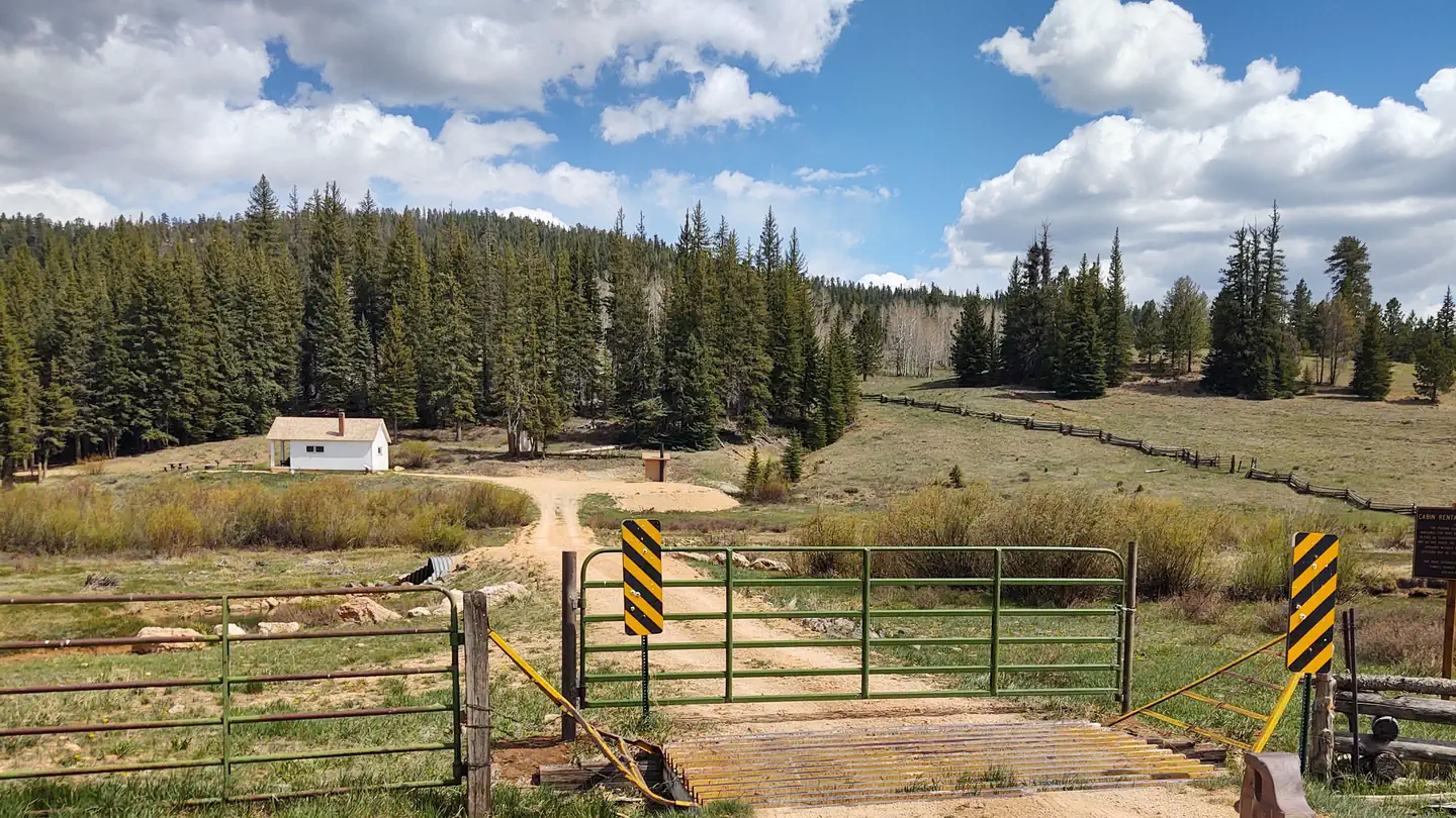
Site mix
| Cabins | 1 |
Site guide
1 site. Tap a filter to narrow the list; the map follows.
| Site | Surface | Shade | Water / sewer | Waterfront | People / vehicles | Fires | Rating |
|---|---|---|---|---|---|---|---|
| 001 | Gravel | Partial | No / – | Springs | 6 / 4 | No | Basic |
Per-site records as published by the managing agency on Recreation.gov. Blank cells mean the agency listed nothing for that site. Check-in 3:00 PM, checkout 12:00 PM.
The site record lists no campfires. The campground description says the site has a campfire ring.
Amenities & rules
| Max vehicle length | 30 ft |
| Fees | Reservation Cancellations & Change s ( see website for more informatio n ). Cancelling a Reservation: Customers may cancel their reservation prior to arrival both on-line and through the call center. A $10 service fee will be withheld from any refund for a cancellation. |
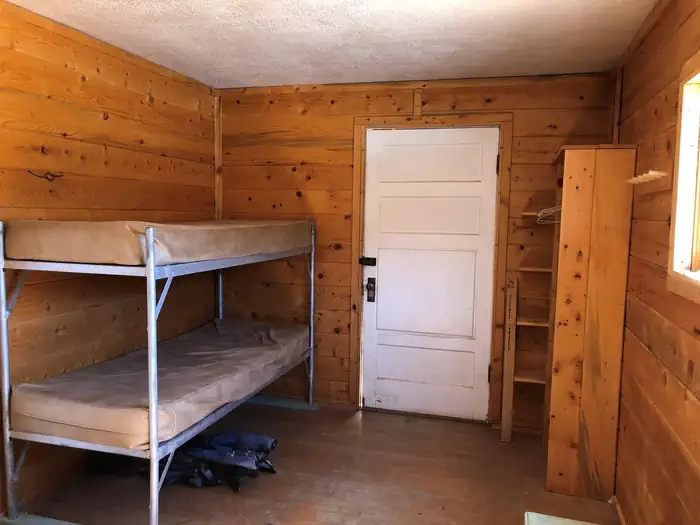
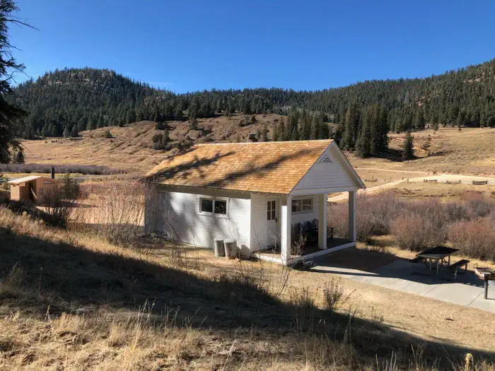
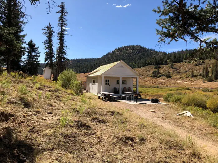
The two-room cabin can sleep six people on two, twin-size bunk beds located in the bedroom, and a double-size futon in the living room. No linens or bedding are provided. The kitchen is equipped with a propane cook top range and oven, a table and chairs. No pots, pans, dishes or utensils are available. Guests must bring their own cooking and eating euipment. The cabin has seasonal water running water in the kitchen sink only (when temperatures are freezing the water will be turned off). A vault toilet, picnic table and campfire ring are located outside.
Individual sites vary. Confirm on Recreation.gov or with the managing office.
Weather by month
Getting there
From Panguitch, turn onto State Highway 89 and travel 7 miles to State Highway 12. Drive 8 miles on Highway 12 to East Fork Road/Forest Road 30087. The sign at this junction will say, "Tropic Reservoir - 8 miles." Travel south on this well-maintained, two-lane dirt road for 16 miles. Podunk Guard Station will be on the east side of the road.
| Nearest town | Panguitch, Utah |
| Coordinates | 37.4875° N, 112.2981° W · Directions ↗ |
Good to know
- A wood stove is provided for heat, firewood is not guaranteed.
Fire nearby
- PrescribedLake Piles Rx
26 mi from the campground
Distance is to the reported incident point, not the fire edge. Call the managing office before you drive.
Supplies & services
| Dump station | Dump station ↗ | 12.4 mi |
| Outdoor gear | Roam Outdoor Adventure Co. ↗ | 23.2 mi |
| RV sales & service | Gander RV ↗ | 59.7 mi |
Locations © OpenStreetMap contributors. Call ahead; hours change seasonally.
Explore
Trails nearby
- 1 miClay Creek Connector ↗9.1 mi trail · hiking, horse, bike, ATV and 1 more
- 1.2 miDairy Hollow ATV Trail3.5 mi trail · hiking, horse, bike, e-bike
- 3.2 miCrawford Pass Trail3.2 mi trail · hiking, horse, bike
- 4.2 miBlubber Creek Connector ↗7 mi trail · hiking, horse, bike, ATV and 1 more
- 4.4 miMill Creek Trail2.2 mi trail · hiking, horse, bike
- 4.9 miPole Canyon Trail1.3 mi trail · hiking, horse, bike
Trail and trailhead records are the Forest Service's. Distances are straight-line to the nearer trail end. Trail conditions are not tracked here.
Public land it sits in
This campground sits inside Dixie National Forest.
- inDixie National Forest ↗National Forest · Forest Service · 1,711,285 acres
Each unit is published as a centre point and an acreage rather than a boundary, so this section stands it in for a circle of the same area. Whether a campground is inside, and how far it is from one it is outside, are both approximate.
Other campgrounds nearby
On the National Register nearby
- Rainbow Point Comfort Station and Overlook ShelterBuilding · Bryce Canyon · 3.3 mi
- Horse BarnBuilding · Bryce Canyon · 11.5 mi
- Bryce Canyon Lodge Historic District (Boundary Increase)Historic district · Bryce Canyon · 12 mi
Natural features
The cabin sits in a narrow mountain valley just above the meandering East Fork Sevier River. The meadow is surrounded by mature spruce trees, and grasses and willow thickets line the riverbanks. Average summer temperatures range from 74 degrees during the day to 42 degrees at night. September temperatures range from 68 to 37 degrees; October temperatures range from 57 to 27 degrees.
Recreation
Recreational opportunities in the area include hiking, mountain biking, off-roading and fishing. The Paunsaugunt, Fremont and Great Western OHV Trail Systems can be accessed easily from the guard station.
Nearby
Tropic Reservoir is 8.5 miles north of the cabin. Boating, canoeing and fishing are popular activities. Anglers fish for brook, rainbow, brown and cutthroat trout. A boat ramp is located on the west side of the reservoir.
Guidebooks for Utah
We earn a small commission if you buy through these links. It does not change what we list.


Titles come from Open Library's catalog, matched by subject heading or by title.
Reference
Questions people ask
Do I need a reservation at Podunk Guard Station?
Sites at Podunk Guard Station are reservable on Recreation.gov. Any walk-up sites are listed on the booking page.
Source: Recreation.gov
How much does it cost to camp at Podunk Guard Station?
Reservation Cancellations & Change s ( see website for more informatio n ). Cancelling a Reservation: Customers may cancel their reservation prior to arrival both on-line and through the call center. A $10 service fee will be withheld from any refund for a cancellation.
Source: Recreation.gov
What time is check-in at Podunk Guard Station?
Check-in 3:00 PM, checkout 12:00 PM.
Source: Recreation.gov
How many sites does Podunk Guard Station have?
1 site, including 1 cabin.
Source: Recreation.gov
Will my RV fit at Podunk Guard Station?
The longest site here provides 30 feet of vehicle capacity. Most sites are shorter. The sidebar tool checks a trailer or motorhome length against every site.
Source: Will my RV fit
What is there to do at Podunk Guard Station?
Recreational opportunities in the area include hiking, mountain biking, off-roading and fishing. The Recreation section on this page has the rest.
Source: Recreation
What is the nearest town to Podunk Guard Station?
Panguitch, Utah. Tropic Reservoir is 8.5 miles north of the cabin.
Source: Getting there
What if Podunk Guard Station is full?
The nearest public campgrounds are Kings Creek (8.9 mi), North Campground (12.4 mi), and Sunset Campground (12.4 mi).
Source: Campgrounds nearby