Bald Mountain Lookout
Bald Mountain Lookout offers the opportunity to enjoy unforgettable views and participate in a variety of recreational opportunities. It was built in 1956 and was used as a fire lookout until 1984. Guests can drive to the lookout in vehicles with good ground clearance, but trailers are not recommended due to some rough spots on the road. The lookout is typically open from early July through early October. The accommodations are mostly primitive, but some conveniences are provided. Guests will need to bring some of their own supplies and gear for a comfortable experience.
Check availability on Recreation.gov ↗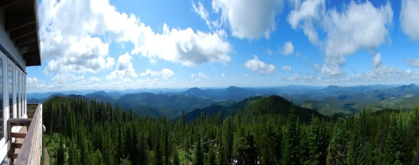
Site mix
| Cabins | 1 |
Site guide
1 site. Tap a filter to narrow the list; the map follows.
| Site | Entry | Surface | Shade | People / vehicles |
|---|---|---|---|---|
| 001 | Pull-through | Gravel | Partial | 4 / 2 |
Per-site records as published by the managing agency on Recreation.gov. Blank cells mean the agency listed nothing for that site. Check-in 2:00 PM, checkout 2:00 PM.
Amenities & rules
This lookout sits 50 feet off the ground. A stairway leads to an exterior catwalk that surrounds the cabin, which can accommodate four people. A table and four chairs, a futon that folds into a twin bed with foam pad and two cots are provided. Propane appliances include a cooking stove and heater. Cookware, dishes and utensils are provided. A pit toilet is located just below the lookout. Water and electricity are not offered at the cabin. Guests need to bring their own drinking water and lighting/ Flashlights. Garbage bags are also needed to pack out trash. Bedding and additional mattresses are not provided. The refrigerator has been removed, guests may want to consider bringing a cooler with extra ice for perishable items.
Individual sites vary. Confirm on Recreation.gov or with the managing office.
Weather by month
Getting there
From Coeur d'Alene, Idaho, drive 70 miles south on U.S. Highway 95 to State Highway 6. Turn left on State Highway 6, White Pine Scenic Byway, travel through Potlatch and continue on for 22 miles. Turn right on Forest Road 377, Palouse Divide Road. This is a single lane, dirt surface road that is rarely graded and slippery when wet.
| Nearest town | Potlatch, Idaho |
| Coordinates | 47.0319° N, 116.5719° W · Directions ↗ |
Fire nearby
- PrescribedD4 Rx Hwy 50 Roadside Salvage
47 mi from the campground
- PrescribedRx Barnyard Units Nfrd
49 mi from the campground · 41 acres
- WildfireNugget Hill
50 mi from the campground · 35 acres
Distance is to the reported incident point, not the fire edge. Call the managing office before you drive.
Supplies & services
| Dump station | Dump station ↗ | 24.2 mi |
| Outdoor gear | Hyperspud Sports ↗ | 29 mi |
| RV sales & service | Bobby Combs RV Centers ↗ | 47.4 mi |
Locations © OpenStreetMap contributors. Call ahead; hours change seasonally.
Explore
Trails nearby
- under 0.1 miStrychnine Ridge ↗5.6 mi trail
- 0.6 miBeason Meadows ↗7.3 mi trail
- 0.9 miPalouse OHV-NF Palouse Riv3.9 mi trail
- 0.9 miExcavation Gulch E0.3 mi trail
- 0.9 miPalouse OHV - Greenhorn3.1 mi trail
- 1.5 miPalouse OHV - Wemp0.8 mi trail
Trail and trailhead records are the Forest Service's. Distances are straight-line to the nearer trail end. Trail conditions are not tracked here.
Other campgrounds nearby

On the National Register nearby
- Bovill Opera HouseBuilding · Bovill · 14.4 mi
- Hotel BovillBuilding · Bovill · 14.4 mi
- St. Joseph's Catholic ChurchBuilding · Bovill · 14.6 mi
Natural features
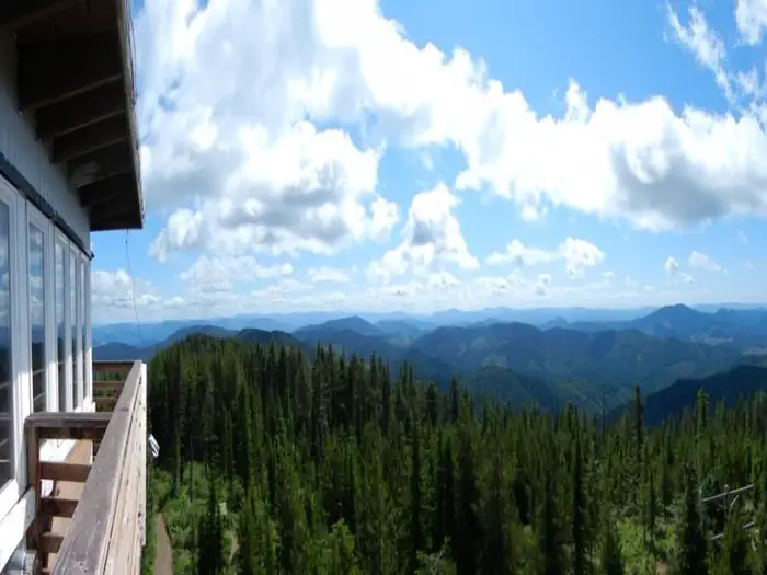
Bald Mountain is one of the highest peaks in the Hoodoo Mountain Range, and it's heavily forested with a mix of larch, red cedar, hemlock, western white pine, Douglas fir and Engelmann spruce. The lookout offers a bird's eye view of the surrounding mountains from its perch 5,334 feet above sea level. Guests who come to this rustic retreat can enjoy a panorama featuring the golden, rolling hills of the Palouse to the south and St. Maries to the north. The lookout offers an ideal vantage point to watch sunrises and sunsets or gaze at the stars. Wildlife watchers may see eagles soaring through the sky. Bear, moose, elk and deer are frequently spotted in the area.
Recreation
Access to Strychnine Ridge Trail 319 is just southwest of the lookout. This 4-mile trail intersects with Beason Meadows Trail 228 a half-mile below the lookout. The Beason Meadows Trail is 8.9 miles long and leads down to Giant White Pine Campground. These trails are open to hikers, mountain bikers, motorcyclists and equestrians.
Nearby
Bald Mountain Lookout is located just off Highway 6, which is known as the White Pine Scenic Byway. This 80-mile scenic drive takes visitors through beautiful forests, historic towns and scenic farmland.
Guidebooks for Idaho
We earn a small commission if you buy through these links. It does not change what we list.

Titles come from Open Library's catalog, matched by subject heading or by title.
Reference
Questions people ask
Do I need a reservation at Bald Mountain Lookout?
Sites at Bald Mountain Lookout are reservable on Recreation.gov. Any walk-up sites are listed on the booking page.
Source: Recreation.gov
What time is check-in at Bald Mountain Lookout?
Check-in 2:00 PM, checkout 2:00 PM.
Source: Recreation.gov
How many sites does Bald Mountain Lookout have?
1 site, including 1 cabin.
Source: Recreation.gov
What is there to do at Bald Mountain Lookout?
Access to Strychnine Ridge Trail 319 is just southwest of the lookout. The Recreation section on this page has the rest.
Source: Recreation
What is the nearest town to Bald Mountain Lookout?
Potlatch, Idaho. Bald Mountain Lookout is located just off Highway 6, which is known as the White Pine Scenic Byway.
Source: Getting there
What if Bald Mountain Lookout is full?
The nearest public campgrounds are Laird Park Campground (7 mi, first-come), Emerald Creek Campground (11.7 mi, first-come), and Cedar Creek Campground (13.4 mi, first-come).
Source: Campgrounds nearby