Cedar Creek (Sam Tobias)
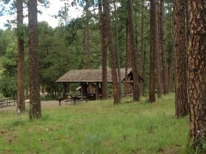
Located on the outskirts of Ruidoso, Cedar Creek provides a wonderful space for groups visiting for the day or staying overnight. With a picnic shelter and three group campsites, the recreation area is ideal for an outing in Lincoln National Forest. A popular pastime is hiking and mountain biking along the scenic multi-use trails adjacent to the Sam Tobias Memorial Group Campground. There are opporunities to see a number of different wildlife, including Mule deer and Elk in the area.
More like this: reservable in New Mexico · group sites in New Mexico
Check availability on Recreation.gov ↗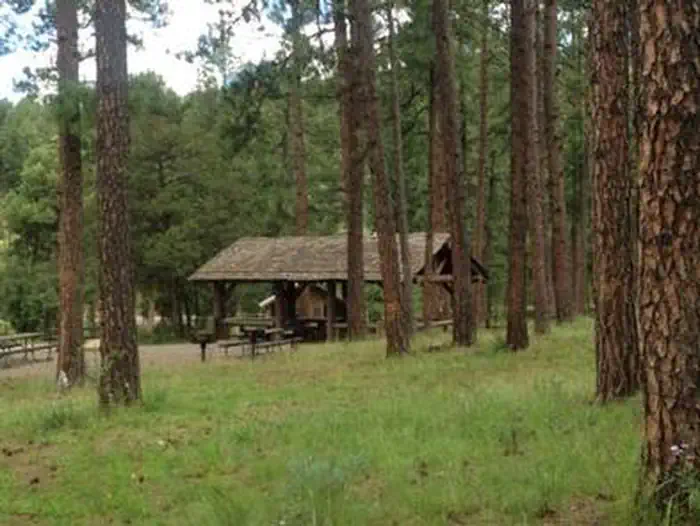

Site mix
| group standard electric | 3 |
| group shelter nonelectric | 1 |
Site guide
Will my RV fit
The longest site here provides 35 feet of vehicle capacity. Most sites are shorter.
4 sites in 4 loops. Tap a filter to narrow the list; the map follows.
| Site | Loop | Type | Entry | Fits, ft | Surface | Shade | People / vehicles |
|---|---|---|---|---|---|---|---|
| P01 | CEDAR | Group Shelter Nonelectric | Paved | Partial | 40 / 10 | ||
| 001 | GRP1 | Group Standard Electric | Back-in | 35 | Paved | Partial | 60 / 20 |
| 002 | GRP2 | Group Standard Electric | Back-in | 35 | Paved | Partial | 100 / 22 |
| 003 | GRP3 | Group Standard Electric | Back-in | 35 | Paved | Partial | 80 / 20 |
Per-site records as published by the managing agency on Recreation.gov. Blank cells mean the agency listed nothing for that site. Check-in 8:00 AM, checkout 8:00 PM.
Amenities & rules
| Hookups | None |
| Max vehicle length | 35 ft |
| Equipment | RVs & trailers, Tents |
The group picnic shelter offers drinking water and accessible vault toilets. Non-sheltered picnic tables are open to the general public. The group campgrounds range from 60 to 100 person capacities and the group picnic shelter fits up to 40 people. Each site comes with accessible picnic shelters, campfire rings, drinking water vault toilets and grills. Picnic Pavilion is for day use only. If you would like to camp overnight please book one of the group campgrounds.
Individual sites vary. Confirm on Recreation.gov or with the managing office.
Weather by month
Getting there
From Ruidoso on Mechem Drive, take Cedar Creek Road west.5 miles. Cedar Creek is the first recreational area located on the right (north).
| Nearest town | Ruidoso, New Mexico |
| Coordinates | 33.3614° N, 105.6847° W · Directions ↗ |
Fire nearby
- PrescribedD1 Programmatic Piles Rx
4 mi from the campground
Distance is to the reported incident point, not the fire edge. Call the managing office before you drive.
Supplies & services
| Dump station | RV Dump Station ↗ | 26 mi |
Locations © OpenStreetMap contributors. Call ahead; hours change seasonally.
Explore
Worth a stop
Ruidoso is a delightful town with quaint shops, restaurants and art galleries. If picnickers wish to camp overnight, they can head to Sam Tobias Memorial Group Campground.
- 0.2 miCedar Creek Picnic Shelter ↗Day use
Trails nearby
- 0.1 miUpper Cedar Creek1.1 mi trail · hiking, horse, bike
- 0.1 miLower Raven2.2 mi trail · hiking, horse, bike
- 0.2 miConnector0.1 mi trail · hiking, horse, bike
- 0.2 miCedar Creek3.4 mi trail · hiking, horse, bike
- 0.2 miUpper Raven3.5 mi trail · hiking, horse, bike
- 0.2 miDownhill1.3 mi trail · hiking, horse, bike
Trail and trailhead records are the Forest Service's. Distances are straight-line to the nearer trail end. Trail conditions are not tracked here.
Public land it sits in
White Mountain Wilderness begins about 5.5 miles away, and it is the closest of these.
- 5.5 miWhite Mountain Wilderness ↗Wilderness · Forest Service · 46,963 acres
- 6.4 miLincoln National Forest ↗National Forest · Forest Service · 1,261,954 acres
- 9.4 miFort Stanton–Snowy River Cave National Conservation Area ↗National Conservation Area · Bureau of Land Management · 27,872 acres
Each unit is published as a centre point and an acreage rather than a boundary, so this section stands it in for a circle of the same area. Whether a campground is inside, and how far it is from one it is outside, are both approximate.
Other campgrounds nearby




Cabin and lookout rentals nearby
Historic landmarks nearby
.jpg/960px-Iglesia_de_San_Juan_Bautista%2C_U.S._Highway_380%2C_Lincoln_(Lincoln_County%2C_New_Mexico).jpg)
Natural features
Cedar Creek is perched along its namesake, Cedar Creek at a 7,000 foot elevation. Lincoln National Forest, located in south-central New Mexico, is most notable as the birthplace of the original Smokey Bear.
Recreation
Hiking and biking are among the most popular activities here, with options like the T90 fitness Trail which extends 1.3 miles and includes exercise stations. Bilking trails T120 A-D and T121 A& B are also nearby. Also we have an expert-only downhill mountain bike trail, located near the water tower to the east of the Campgrounds. The trail ends at the picnic area. Dogs must be kept on leash at all times while hiking. Dogs are not allowed on the Fitness trail.
Guidebooks for New Mexico
We earn a small commission if you buy through these links. It does not change what we list.
Titles come from Open Library's catalog, matched by subject heading or by title.
Reference
Questions people ask
Do I need a reservation at Cedar Creek (Sam Tobias)?
Sites at Cedar Creek (Sam Tobias) are reservable on Recreation.gov. Any walk-up sites are listed on the booking page.
Source: Recreation.gov
What time is check-in at Cedar Creek (Sam Tobias)?
Check-in 8:00 AM, checkout 8:00 PM.
Source: Recreation.gov
How many sites does Cedar Creek (Sam Tobias) have?
4 sites, including 3 group standard electric and 1 group shelter nonelectric.
Source: Recreation.gov
Will my RV fit at Cedar Creek (Sam Tobias)?
The longest site here provides 35 feet of vehicle capacity. Most sites are shorter. The sidebar tool checks a trailer or motorhome length against every site.
Source: Will my RV fit
Is there cell service at Cedar Creek (Sam Tobias)?
FCC coverage maps show Verizon 5G, AT&T 5G, and T-Mobile 5G at the campground point. Terrain changes that from one site to the next.
Source: FCC Broadband Map
What is there to do at Cedar Creek (Sam Tobias)?
Hiking and biking are among the most popular activities here, with options like the T90 fitness Trail which extends 1.3 miles and includes exercise stations. The Recreation section on this page has the rest.
Source: Recreation
What is the nearest town to Cedar Creek (Sam Tobias)?
Ruidoso, New Mexico. Ruidoso is a delightful town with quaint shops, restaurants and art galleries.
Source: Getting there
What if Cedar Creek (Sam Tobias) is full?
The nearest public campgrounds are Sam Tobias Memorial Group Campground (under 0.1 mi), Skyline Campground (4.9 mi, first-come), and South Fork Campground (7.2 mi, first-come).
Source: Campgrounds nearby