Cougar Peak Lookout
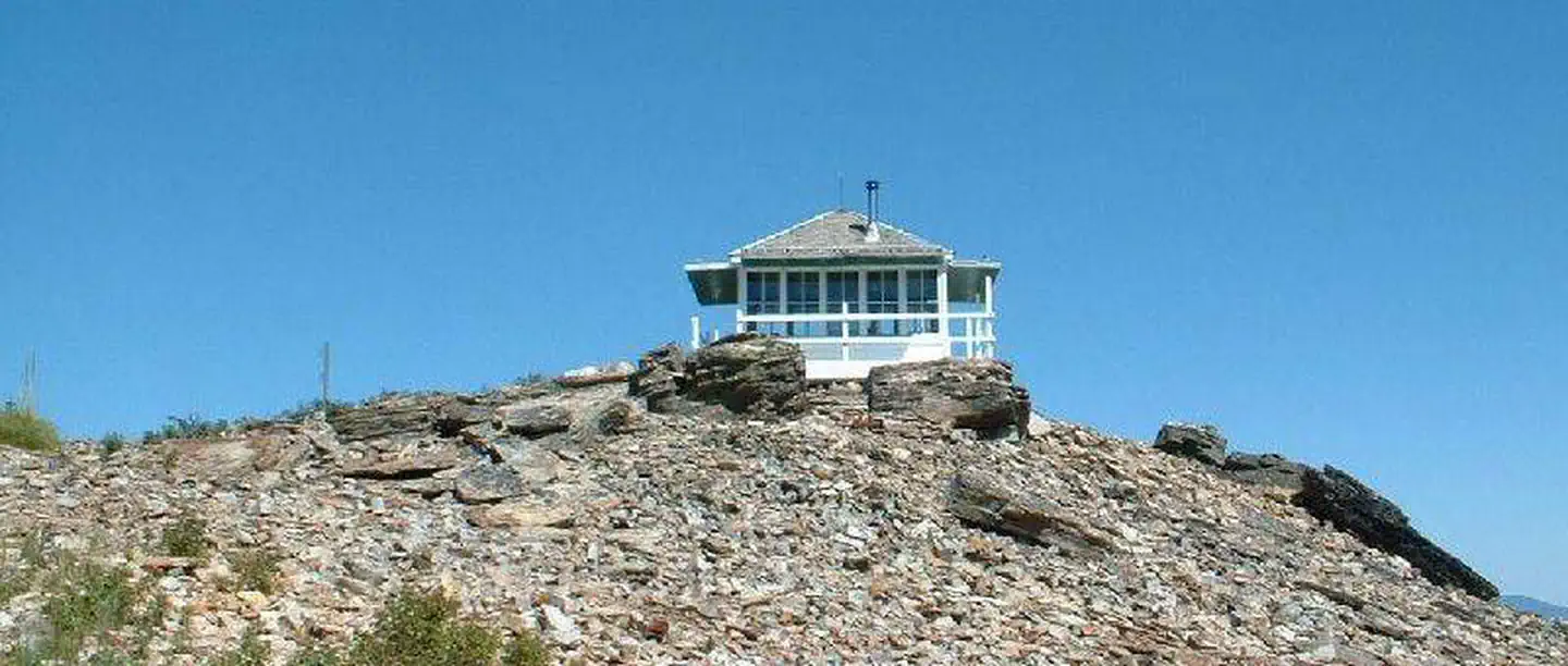
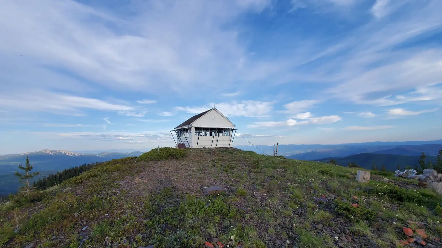
The Cougar Peak Lookout offers guests an opportunity to experience an old-time Forest Service lookout. The tower commands an impressive view of the river valley, the surrounding Cabinet Mountains and the opposing Coeur d'Alene Mountains. The lookout can be accessed by vehicle, although late spring snow drifts may compromise parts of the road, requiring visitors to hike a short distance. Guests are responsible for their own travel arrangements and safety, and must bring several of their own amenities.
Check availability on Recreation.gov ↗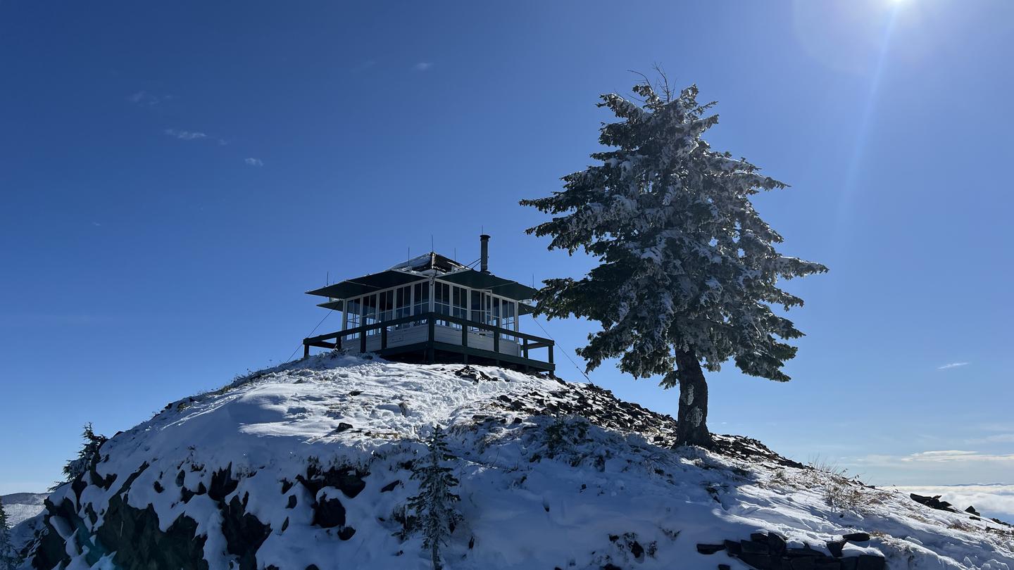
Site mix
| Cabins | 1 |
Site guide
1 site. Tap a filter to narrow the list; the map follows.
| Site | Surface | People / vehicles |
|---|---|---|
| 001 | Gravel | 4 / 2 |
Per-site records as published by the managing agency on Recreation.gov. Blank cells mean the agency listed nothing for that site. Check-in 2:00 PM, checkout 11:00 AM.
Amenities & rules
| Max vehicle length | 10 ft |
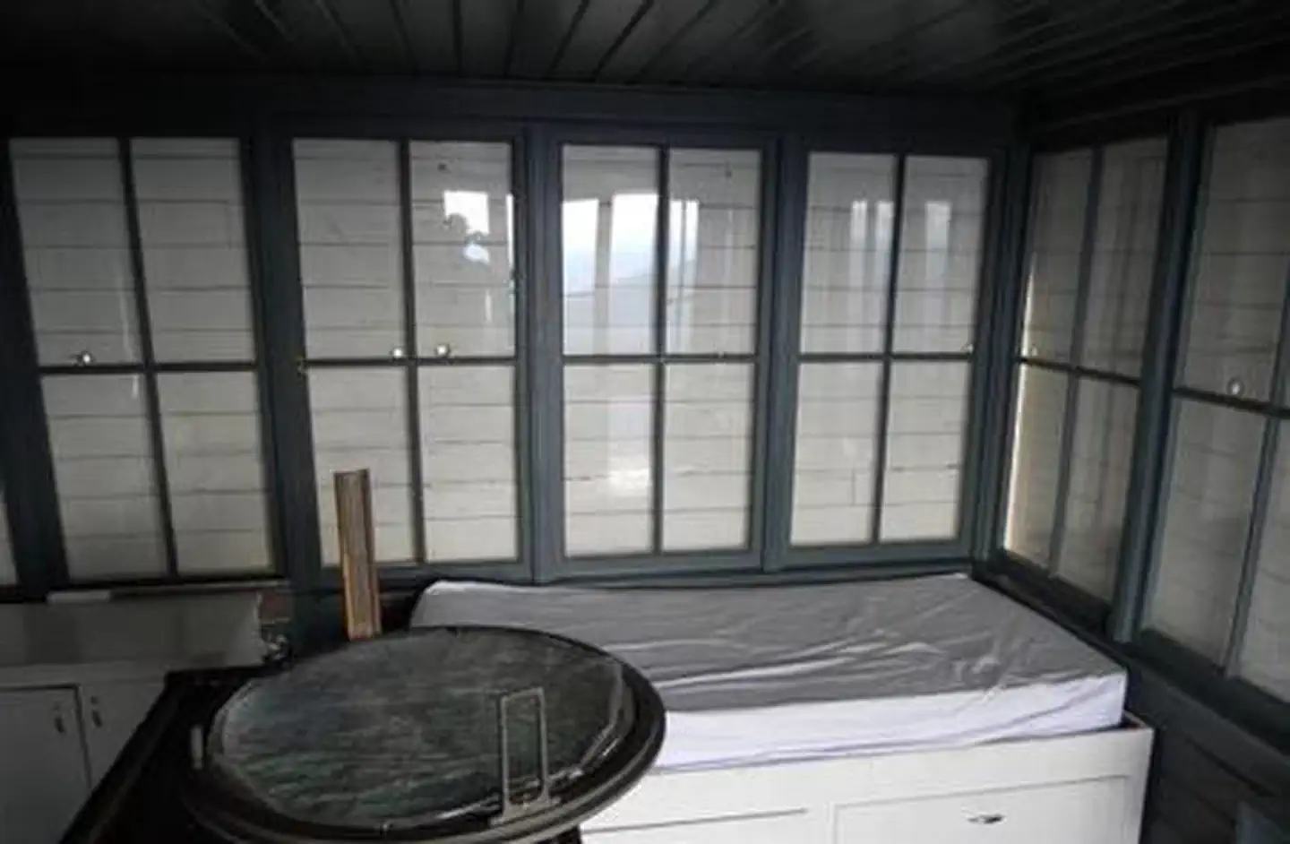
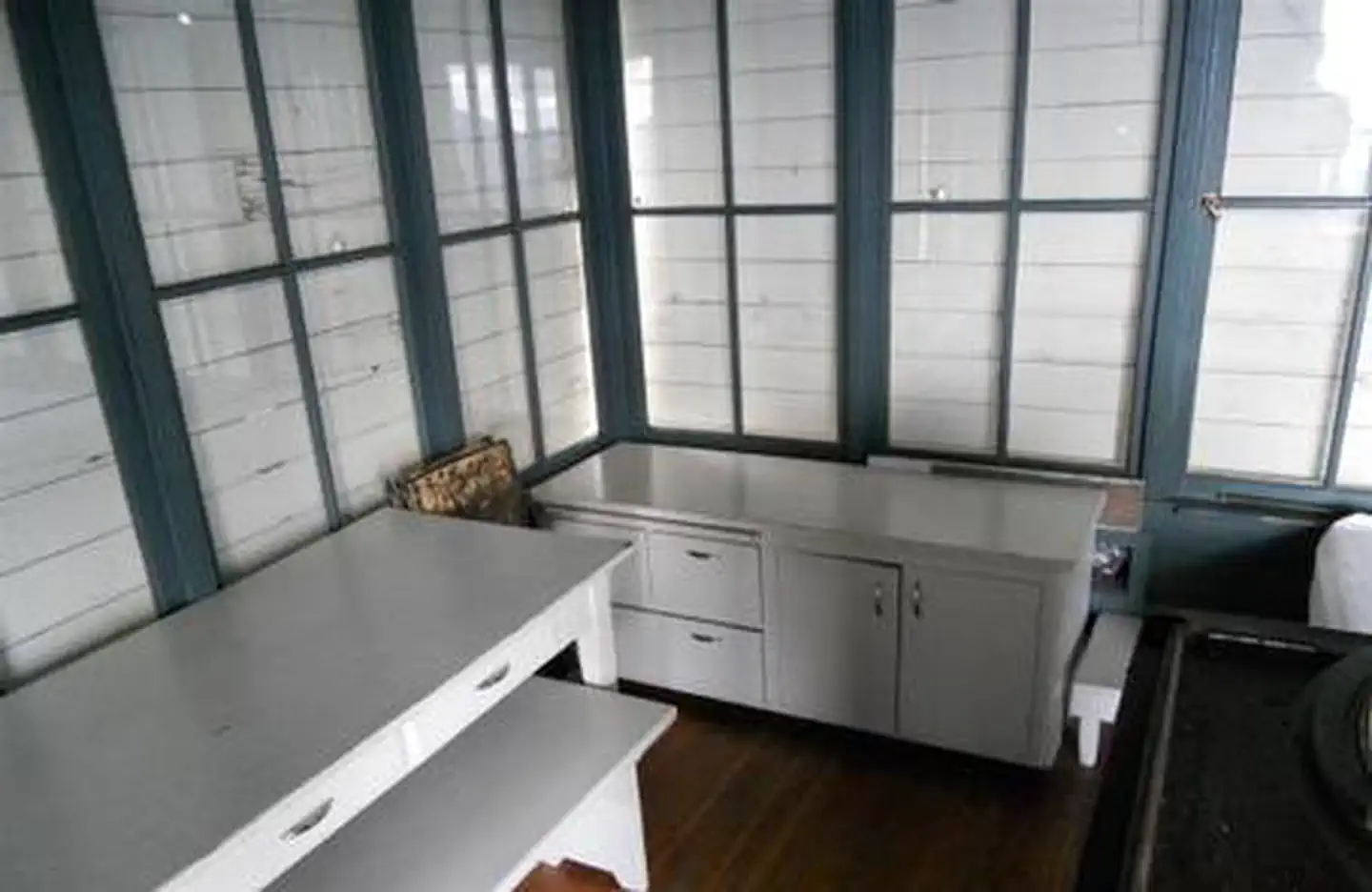
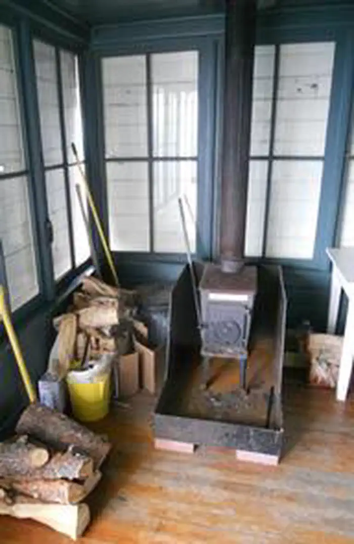
The 14-by-14 structure is small, but can accommodate up to four people. There is a full bed for two with a mattress pad, a table with two chairs, and a wood stove. No other furnishings are provided. A rustic outhouse with a vault toilet is available about 200 feet from the lookout, at the parking area. Guests will need to bring water for drinking, cooking and cleaning purposes, as well as their own bedding and cots for additional sleeping options, cooking and eating equipment and fuel, cooking and eating utensils, flashlights, matches and toilet paper, among other necessities. There is no water available at the site. There is room for a small tent outside the tower. Guests should be prepared for cold and often wet or damp weather, even if the weather in the valley is warm and dry. Food, garbage and other waste needs to be put away at all times to avoid attracting bears. Firewood may be collected locally for the wood stove.
Individual sites vary. Confirm on Recreation.gov or with the managing office.
Weather by month
Getting there
From Thompson Falls, Montana, travel west on Highway 200 for about a mile. Before crossing the Clark Fork River bridge, turn right onto Blue Slide Road and continue about 8 miles, to the junction with Forest Road 403. Turn right and travel about 14 miles to the lookout.
| Nearest town | Plains, Montana |
| Coordinates | 47.7444° N, 115.3831° W · Directions ↗ |
Good to know
- The structure is small and is not elevated like many other lookouts.
Fire nearby
- WildfireNugget Hill
37 mi from the campground · 35 acres
- PrescribedD4 Rx Hwy 50 Roadside Salvage
37 mi from the campground
- PrescribedRx D7 Lost Creek 155/559
44 mi from the campground · 17 acres
- PrescribedD4 Rx Simmons Peak
46 mi from the campground
Distance is to the reported incident point, not the fire edge. Call the managing office before you drive.
Supplies & services
| Dump station | Dump station ↗ | 37.7 mi |
| RV sales & service | Everything RV ↗ | 45.4 mi |
Locations © OpenStreetMap contributors. Call ahead; hours change seasonally.
Explore
Trails nearby
- 0.1 miCougar Peak1.9 mi trail · hiking, horse, bike
- 2.1 miWinniemuck Creek ↗6.4 mi trail · hiking, horse, bike
- 3.4 miThorne Creek ↗7.3 mi trail · hiking, horse, bike
- 3.4 miVermilion-Headley3.1 mi trail · hiking, horse, bike
- 3.4 miSlide Rock Mountain ↗6.2 mi trail · hiking, horse, bike
- 4.7 miCube Iron Mountain2.3 mi trail · hiking, horse, bike
Trail and trailhead records are the Forest Service's. Distances are straight-line to the nearer trail end. Trail conditions are not tracked here.
Public land it sits in
Idaho Panhandle National Forests begins about 3.5 miles away, and it is the closest of these.
- 3.5 miIdaho Panhandle National Forests ↗National Forest · Forest Service · 2,943,333 acres
- 11.8 miKootenai National Forest ↗National Forest · Forest Service · 2,622,202 acres
Each unit is published as a centre point and an acreage rather than a boundary, so this section stands it in for a circle of the same area. Whether a campground is inside, and how far it is from one it is outside, are both approximate.
Other campgrounds nearby

Cabin and lookout rentals nearby
On the National Register nearby
- Cougar Peak LookoutBuilding · Thompson Falls · 0 mi
- Grandchamp HouseBuilding · Thompson Falls · 10.2 mi
- Griffen HouseBuilding · Thompson Falls · 10.2 mi
Natural features
The tower is situated in the Clark Fork River drainage, at an elevation of 6,694 feet, in the Cabinet Mountains of western Montana. It was built in 1952 to replace an existing, older structure dating back to the 1930s. The lookout was part of the old Cabinet National Forest, which was divided by the Forest Service in 1954 to become the Lolo National Forest. The 2 million-acre forest includes four wilderness areas and a wide variety of trees, plants and wildlife. The area is home to mountain goats, bighorn sheep, elk, moose, deer and grizzly and black bears ( learn more about bear safety ). Both the bald and golden eagle reside in the forest, along with trumpeter swan, herons and dozens of varieties of ducks.
Recreation
A variety of trails and points of exploration are accessible from the lookout. The Cougar Peak Trail follows the ridge below the lookout and travels towards Vermillion Pass to the northeast. The Clark Fork River is dammed twice within an hour drive of the lookout. The Noxon Rapids and the Cabinet Gorge dams create reservoirs that have become popular spots for boating and fishing for large and smallmouth bass, as well as northern pike.
Guidebooks for Montana
We earn a small commission if you buy through these links. It does not change what we list.

Titles come from Open Library's catalog, matched by subject heading or by title.
Reference
Questions people ask
Do I need a reservation at Cougar Peak Lookout?
Sites at Cougar Peak Lookout are reservable on Recreation.gov. Any walk-up sites are listed on the booking page.
Source: Recreation.gov
What time is check-in at Cougar Peak Lookout?
Check-in 2:00 PM, checkout 11:00 AM.
Source: Recreation.gov
How many sites does Cougar Peak Lookout have?
1 site, including 1 cabin.
Source: Recreation.gov
Will my RV fit at Cougar Peak Lookout?
The longest site here provides 10 feet of vehicle capacity. Most sites are shorter. The sidebar tool checks a trailer or motorhome length against every site.
Source: Will my RV fit
Is there cell service at Cougar Peak Lookout?
FCC coverage maps show AT&T 4G LTE at the campground point. Terrain changes that from one site to the next.
Source: FCC Broadband Map
What is there to do at Cougar Peak Lookout?
A variety of trails and points of exploration are accessible from the lookout. The Recreation section on this page has the rest.
Source: Recreation
What is the nearest town to Cougar Peak Lookout?
Plains, Montana.
Source: Getting there
What if Cougar Peak Lookout is full?
The nearest public campgrounds are Willow Creek Campground (9.4 mi, first-come), Fishtrap Lake Campground (11.6 mi, first-come), and Copper King Campground (12.6 mi, first-come).
Source: Campgrounds nearby