Spanish Creek Campground
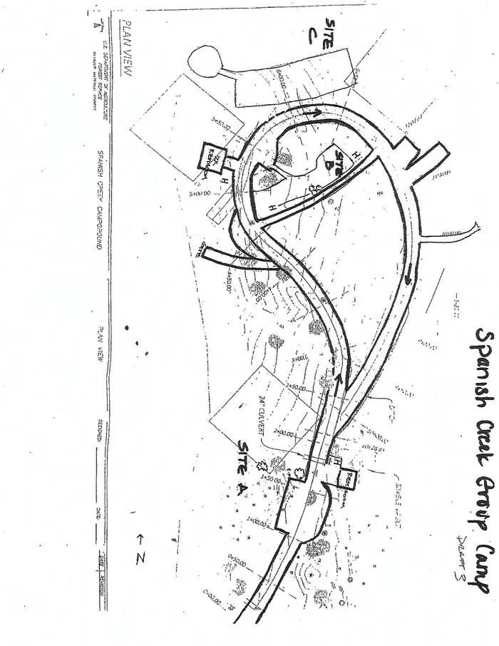
Spanish Creek Campground is located on Highway 70 just east of the Highway 89 intersection; just east of where Banish Creek and Indian Creek merge together to create the east branch of the North Fork Feather River. The campground is right on Spanish Creek with a very popular swimming hole. Although the campground has been recently upgraded, it still holds the charm that it did in years past.
Some sites take reservations on Recreation.gov. Others are first-come, first-served.
More like this: first-come in California · reservable in California · big rigs in California · pets allowed in California · group sites in California
Check availability on Recreation.gov ↗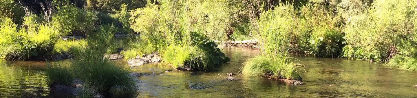
Site mix
| Standard, no hookups | 20 |
| Tent-only | 4 |
| Group sites | 3 |
Site guide
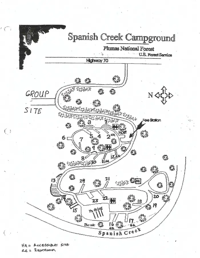
27 sites in 3 loops. Tap a filter to narrow the list; the map follows.
| Site | Loop | Type | Entry | Fits, ft | Surface | Shade | Waterfront | People / vehicles | Fires | Accessible |
|---|---|---|---|---|---|---|---|---|---|---|
| 001 | 1 | Standard | Pull-through | 30 | Paved | Partial | 8 / 1 | Yes | ||
| 002 | 1 | Standard | Back-in | 36 | Paved | Partial | 8 / 1 | Yes | Yes | |
| 003 | 1 | Standard | Pull-through | 36 | Paved | Partial | 8 / 1 | Yes | ||
| 004 | 1 | Standard | Back-in | 40 | Paved | Partial | 8 / 1 | Yes | ||
| 005 | 1 | Standard | Back-in | 34 | Paved | Partial | 8 / 1 | Yes | ||
| 006 | 1 | Standard | Back-in | Paved | Full | 8 / 1 | Yes | |||
| 007 | 1 | Standard | Back-in | Paved | Full | 8 / 1 | Yes | |||
| 008 | 1 | Standard | Back-in | Paved | Full | 8 / 1 | Yes | |||
| 009 | 1 | Tent only | Paved | Full | 8 / 1 | |||||
| 010 | 1 | Standard | Back-in | Paved | Partial | 8 / 1 |
Per-site records as published by the managing agency on Recreation.gov. Blank cells mean the agency listed nothing for that site. Check-in 2:00 PM, checkout 12:00 PM.
Amenities & rules
| Hookups | None |
| Max vehicle length | 99 ft |
| Equipment | RVs & trailers, Tents |
| Pets | Allowed |
| Campfires | Allowed, subject to restrictions |
| Accessibility | Sites 002, 011, 012, 016 and 1 more are listed accessible |
Spanish Creek campground offers several single-family campsites that accommodate both tent and RV camping, however hookups are not available. Each site is equipped with tables and campfire rings with grills. Vault toilets and drinking water are also provided. A full-service store, gas and phone service is available less than 10 miles away.
Individual sites vary. Confirm on Recreation.gov or with the managing office.
Season & status
| Status | Closed for the season. Forest Service sites close for the season; check the official page for the reopening date. |
| Forest | Plumas National Forest |
Weather by month
Getting there
From Oroville, travel east on Highway 70 for 75 miles. The turnoff to the campground is two miles past Highway 89. From Quincy, travel west on Highway 70 for 8 miles. Campground is across the Spanish Creek bridge.
| Nearest town | Quincy, California |
| Coordinates | 40.0269° N, 120.9644° W · Directions ↗ |
Fire nearby
- PrescribedCy26 Elrd Understory Drake Unit 6 8 &10 Rx
47 mi from the campground
- PrescribedCy26 Elrd Underburn Drake Unit 7 & 9 Rx
48 mi from the campground
Distance is to the reported incident point, not the fire edge. Call the managing office before you drive.
Supplies & services
| RV sales & service | Reliable RV ↗ | 31.6 mi |
| Dump station | Dump station ↗ | 36.9 mi |
| Outdoor gear | REI ↗ | 49.4 mi |
Locations © OpenStreetMap contributors. Call ahead; hours change seasonally.
Explore
Video
Spanish Creek Campground Plumas National Forest, CA
Worth a stop
Within the Plumas National Forest, Spanish Creek campground is just a few short miles from Indian Falls. This is one attraction not to miss. Some have said that the mist created by the falls resembles a feather -- thus naming the Feather River. Just southeast on Highway 70 from Spanish Creek Campground is the quaint high Sierra town of Quincy. We recommend walking around the town if you get a chance. Very close to the campground is the Butterfly Valley Botanical Area. This is also a neat spot to explore. Before you get to the town of Quincy you will pass the Mount Hough Ranger District - a wonderful stop to discover more information about local area attractions.
- 12.5 miCanyon Dam Boat Launch ↗Boat launch
Trails nearby
- 1.6 miButterfly Valley Trail2.2 mi trail
- 1.6 miKeddie3 mi trail
- 1.6 miHwy 70 Tie0.8 mi trail
- 1.6 miIndian Falls Ridge ↗5.7 mi trail
- 1.7 miPlatform1.8 mi trail
- 1.7 miCascade Trail ↗5.4 mi trail
Trail and trailhead records are the Forest Service's. Distances are straight-line to the nearer trail end. Trail conditions are not tracked here.
Public land it sits in
This campground sits inside Plumas National Forest.
- inPlumas National Forest ↗National Forest · Forest Service · 1,431,953 acres
- 0.8 miLassen National Forest ↗National Forest · Forest Service · 1,488,712 acres
- 9.2 miBucks Lake Wilderness ↗Wilderness · Forest Service · 23,578 acres
Each unit is published as a centre point and an acreage rather than a boundary, so this section stands it in for a circle of the same area. Whether a campground is inside, and how far it is from one it is outside, are both approximate.
Other campgrounds nearby


Natural features
This campground is located in the Plumas National Forest, which is attractive to outdoor enthusiasts because of its many streams and lakes, beautiful deep canyons, rich mountain valleys, meadows, and lofty peaks. Spanish Creek is in the Feather River Canyon, at an elevation of 2,000 feet.
Recreation
Anglers enjoy a healthy supply of rainbow trout in the nearby Feather River, which is within walking distance from the campground. The river and nearby Spanish Creek are also popular for swimming and wading activities.
Guidebooks for California
We earn a small commission if you buy through these links. It does not change what we list.

Titles come from Open Library's catalog, matched by subject heading or by title.
Reference
Questions people ask
Do I need a reservation at Spanish Creek Campground?
For some sites. Some sites take reservations on Recreation.gov. Others are first-come, first-served.
Source: Recreation.gov
What time is check-in at Spanish Creek Campground?
Check-in 2:00 PM, checkout 12:00 PM.
Source: Recreation.gov
Is Spanish Creek Campground open right now?
Closed for the season as of Oct 16, 2026.
Source: Forest Service status
How many sites does Spanish Creek Campground have?
27 sites, including 20 standard sites without power, 4 tent-only sites, and 3 group sites.
Source: Recreation.gov
Will my RV fit at Spanish Creek Campground?
Recreation.gov lists no practical vehicle capacity limit for the largest site here, which usually means pull-through or open parking. The sidebar tool checks a trailer or motorhome length against every site.
Source: Will my RV fit
Are pets allowed at Spanish Creek Campground?
Yes, pets are allowed at Spanish Creek Campground. Leash rules apply.
Source: Recreation.gov
Can I have a campfire at Spanish Creek Campground?
Fires are allowed in the provided rings under normal conditions. As of 2026-10-16, there are 2 active fires within 50 miles, so check current restrictions before you light one.
Source: Fire nearby
Are there accessible sites at Spanish Creek Campground?
Sites 002, 011, 012, and 016 are listed accessible on Recreation.gov, 5 sites in all. What that covers (a paved pad, an accessible table, a nearby accessible restroom) is on each site's booking page.
Source: Recreation.gov
Is there cell service at Spanish Creek Campground?
FCC coverage maps show Verizon 4G LTE at the campground point. Terrain changes that from one site to the next.
Source: FCC Broadband Map
What is there to do at Spanish Creek Campground?
Anglers enjoy a healthy supply of rainbow trout in the nearby Feather River, which is within walking distance from the campground. The Recreation section on this page has the rest.
Source: Recreation
What is the nearest town to Spanish Creek Campground?
Quincy, California. Within the Plumas National Forest, Spanish Creek campground is just a few short miles from Indian Falls.
Source: Getting there
What if Spanish Creek Campground is full?
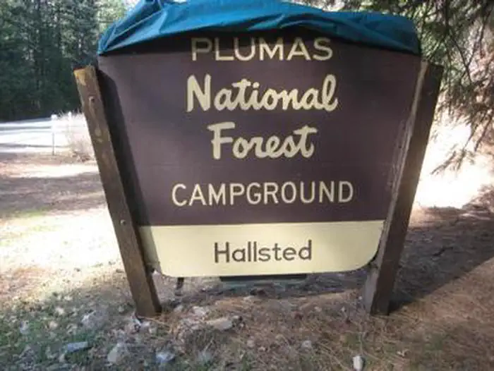
The nearest public campgrounds are Snake Lake Campground And Equestrian Camp (4.5 mi), Hallsted (5.8 mi), and Meadow Camp (7.8 mi).
Source: Campgrounds nearby