West Fork Cabin (S Of Ennis)
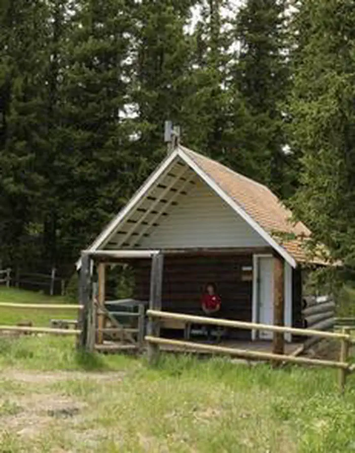
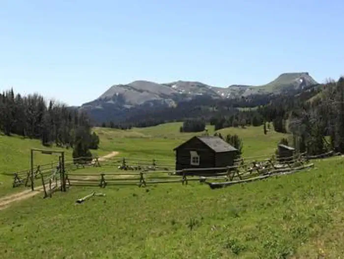
West Fork Cabin is a small, secluded cabin in the mountains of southwestern Montana, located high in the Gravelly Range. The cabin was built in 1928 as an intermediate station for patrolling grazing allotments. The area is home to a variety of wildlife and offers numerous trails for hikers, equestrians and off-road vehicle riders during warmer months and snowmobilers in the winter. The cabin is available from July 1 through March 31. It can typically be accessed by vehicle; however, a portion of the roadway may be muddy or snow-covered, requiring four-wheel drive or chains. Beginning around mid-October, snow may make access very difficult.
Check availability on Recreation.gov ↗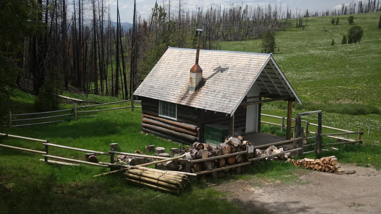
Site mix
| Cabins | 1 |
Site guide
1 site. Tap a filter to narrow the list; the map follows.
| Site | Entry | Surface | Shade | People / vehicles | Fires |
|---|---|---|---|---|---|
| 001 | Back-in | Gravel | Partial | 3 / – | Yes |
Per-site records as published by the managing agency on Recreation.gov. Blank cells mean the agency listed nothing for that site. Check-in 3:00 PM, checkout 11:00 AM.
Amenities & rules
| Fees | Reservation fees are non-refundable within 14 days of scheduled arrival. Any changes in reservation dates may be assessed an additional fee by the National Recreation Reservation Service. |
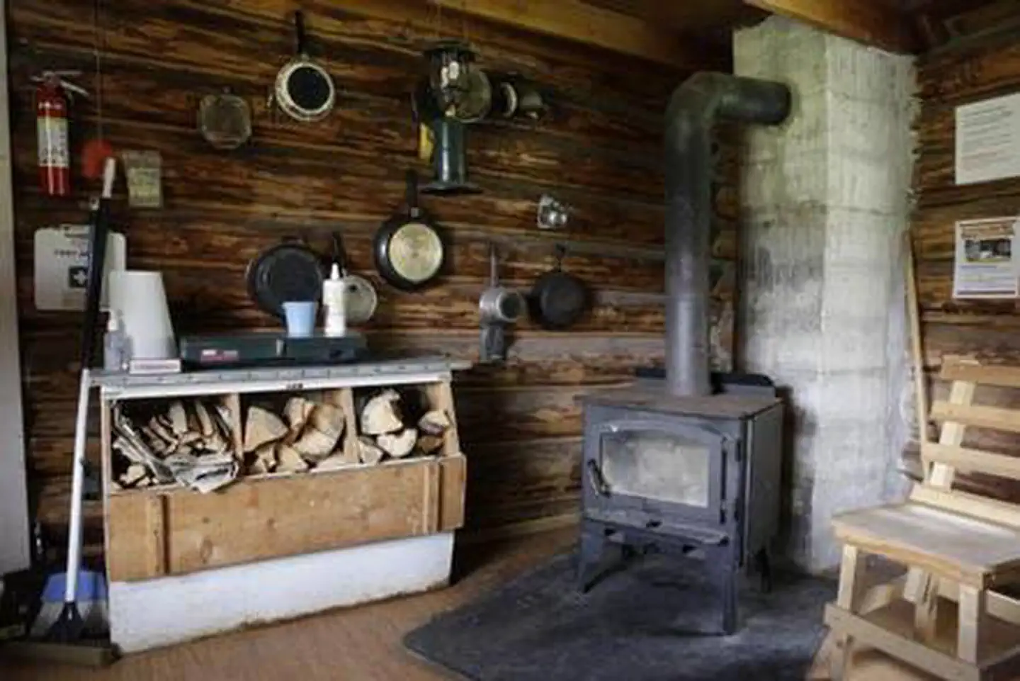
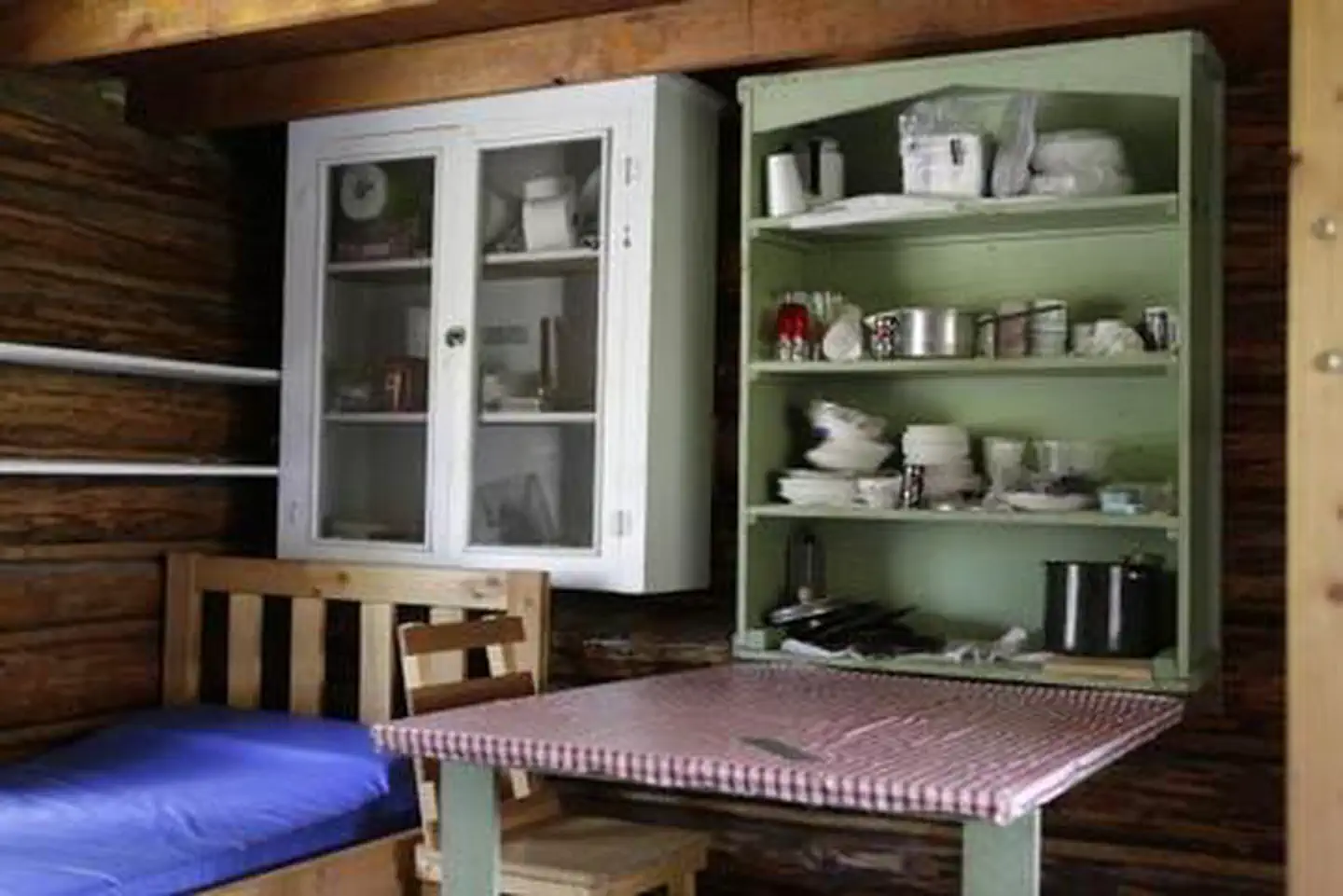
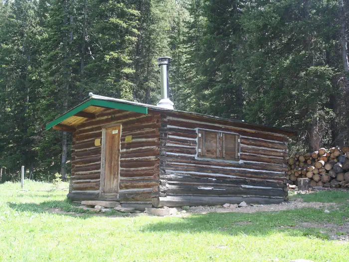
The primitive, one-room cabin is small and has a set of bunk beds and one twin bed to sleep up to three people. It has a table and chairs, a propane stove and lantern, and a wood stove for heat. Firewood is stacked against the outside fence or within a box on the porch. The cabin is also stocked with basic cookware, dishes, utensils and cleaning equipment. An outhouse with a vault toilet is located about 30 yards south of the cabin at the tree line. Guests may use the large administrative horse pasture, but the take-down fence is usually down and not maintained. The cabin does not have drinking water or electricity. Guests need to bring their own water for drinking, cooking and cleaning. Water taken from the nearby spring box should be filtered or boiled prior to use. Cell phone service may be available a few miles to the north near the Hellroaring trailhead.
Individual sites vary. Confirm on Recreation.gov or with the managing office.
Weather by month
Getting there
From Ennis, travel south on Highway 287 for about 30 miles, then head northwest on Standard Creek Road for about 20 miles and 10 miles south on Forest Road 290. The majority of the road to the cabin is gravel and has some long, steep grades, which may require four-wheel drive.
| Nearest town | Ennis, Montana |
| Coordinates | 44.8039° N, 111.8890° W · Directions ↗ |
Good to know
- It is not visible from the cabin and must be accessed through the gate in the back corner of the fence.
- Stock is not allowed within the small, rail-fenced area immediately surrounding the cabin.
- Fuel is not provided for the stove or lantern, which use the small one gallon diposable bottles.
Fire nearby
- PrescribedRx Hell'S Canyon
44 mi from the campground
Distance is to the reported incident point, not the fire edge. Call the managing office before you drive.
Supplies & services
| Dump station | Dump station ↗ | 39.8 mi |
| Outdoor gear | Eagle's Curios ↗ | 40 mi |
Locations © OpenStreetMap contributors. Call ahead; hours change seasonally.
Explore
Trails nearby
- 2.1 miLobo Mesa ↗14.7 mi trail
- 2.6 miFish Creek Ridge3.8 mi trail
- 3 miCascade Mountain ↗6.9 mi trail
- 3.4 miDry Gulch1.4 mi trail
- 3.6 miPoison Headwaters ↗5.7 mi trail
- 3.6 miBasin Creek ↗5.5 mi trail
Trail and trailhead records are the Forest Service's. Distances are straight-line to the nearer trail end. Trail conditions are not tracked here.
Public land it sits in
Red Rock Lakes National Wildlife Refuge begins about 4.9 miles away, and it is the closest of these.
- 4.9 miRed Rock Lakes National Wildlife Refuge ↗National Wildlife Refuge · Fish and Wildlife Service · 85,504 acres
- 9.5 miRed Rock Lakes Wilderness ↗Wilderness · Fish and Wildlife Service · 32,350 acres
Each unit is published as a centre point and an acreage rather than a boundary, so this section stands it in for a circle of the same area. Whether a campground is inside, and how far it is from one it is outside, are both approximate.
Other campgrounds nearby


Cabin and lookout rentals nearby
Natural features
The cabin is located on the southern end of the Gravelly Range at an elevation of 8,460 feet at the headwaters of the West Fork Madison River. Much of the area around the cabin was burned in the Eureka Fire in 2013. Black Butte, the highest peak in the range and an old volcanic cone, is about 10 miles to the north and can be easlly climbed. The area is home to some of the highest-elevation pronghorn antelope, as well as other wildlife, such as elk, moose and bears ( learn about bear safety ).
Recreation
The cabin is popular year-long, especially during hunting season. In early summer, the cabin is an excellent base camp for viewing the spectacular wildflower displays in Eureka Basin and along the Gravelly Range Road. Snowmobile use is permitted after December 1st. Visitors are encouraged to practice safe snowmobiling techniques ( learn more about avalanche danger ). Miles of hiking and horseback riding trails, which wind through the mountains and to the 10,542-foot Black Butte, can be accessed near the cabin. Hellroaring trailhead, just a few miles north of the cabin, leads to the extensive network of trails in the backcountry. Off-road vehicles must stay on designated trails at all times in the area.
Nearby
Red Rocks National Wildlife Refuge is a short drive south. Historic Virginia City is nearby to the north and Yellowstone National Park is about 60 miles east
Guidebooks for Montana
We earn a small commission if you buy through these links. It does not change what we list.

Titles come from Open Library's catalog, matched by subject heading or by title.
Reference
Questions people ask
Do I need a reservation at West Fork Cabin (S Of Ennis)?
Sites at West Fork Cabin (S Of Ennis) are reservable on Recreation.gov. Any walk-up sites are listed on the booking page.
Source: Recreation.gov
How much does it cost to camp at West Fork Cabin (S Of Ennis)?
Reservation fees are non-refundable within 14 days of scheduled arrival. Any changes in reservation dates may be assessed an additional fee by the National Recreation Reservation Service.
Source: Recreation.gov
What time is check-in at West Fork Cabin (S Of Ennis)?
Check-in 3:00 PM, checkout 11:00 AM.
Source: Recreation.gov
How many sites does West Fork Cabin (S Of Ennis) have?
1 site, including 1 cabin.
Source: Recreation.gov
What is there to do at West Fork Cabin (S Of Ennis)?
The cabin is popular year-long, especially during hunting season. The Recreation section on this page has the rest.
Source: Recreation
What is the nearest town to West Fork Cabin (S Of Ennis)?
Ennis, Montana. Red Rocks National Wildlife Refuge is a short drive south.
Source: Getting there
What if West Fork Cabin (S Of Ennis) is full?
The nearest public campgrounds are Cottonwood Campground (12.2 mi, first-come), Wade Lake (15.5 mi), and Elk Lake Dispersed Camping and Picnic Area (15.7 mi, first-come).
Source: Campgrounds nearby