Glory Hole Recreation Area
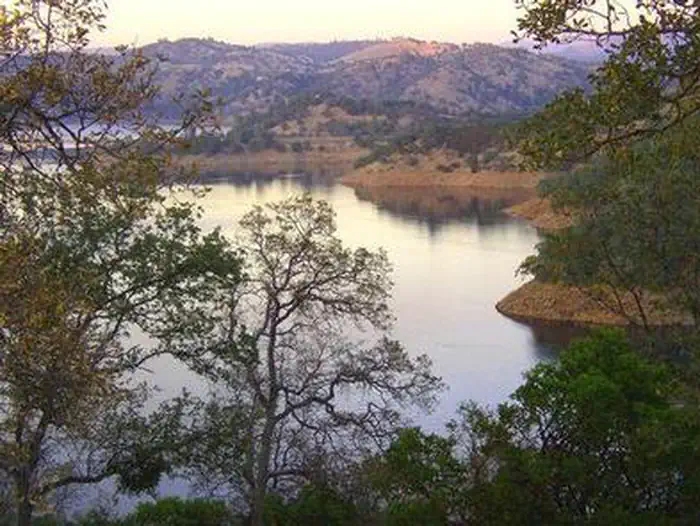
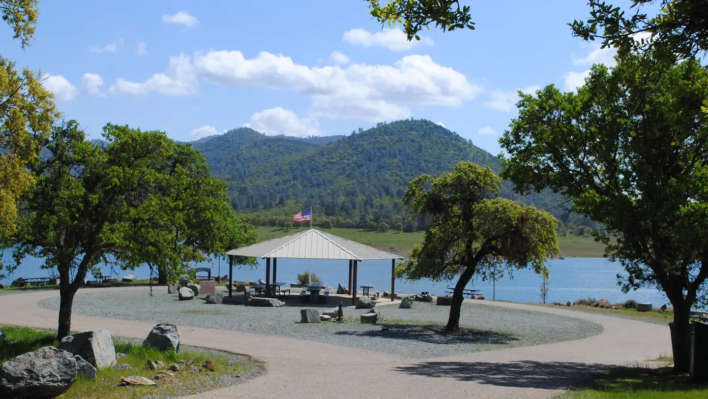
Glory Hole Recreation Area is located at New Melones Lake on the Stanislaus River. The 12,500 surface-acre lake is the fourth largest reservoir in California and is situated along the edge of the Mother Lode, the rich gold vein that prompted the California Gold Rush of 1849. At an elevation of 1100 feet, the diverse and resource-abundant Foothill Oak Woodlands hug the 100 miles of shoreline. Popular activities on and around the large, yet uncrowded lake include fishing, boating, water skiing, wake boarding, jet skiing, sailing, swimming, kayaking, canoeing, wildlife viewing, rock climbing, hiking, biking, horseback riding and picknicking.
More like this: reservable in California · big rigs in California · pets allowed in California
Check availability on Recreation.gov ↗

Site mix
| Standard, no hookups | 68 |
| RV, no hookups | 55 |
| Walk-in | 20 |
| Host/management | 1 |
Site guide
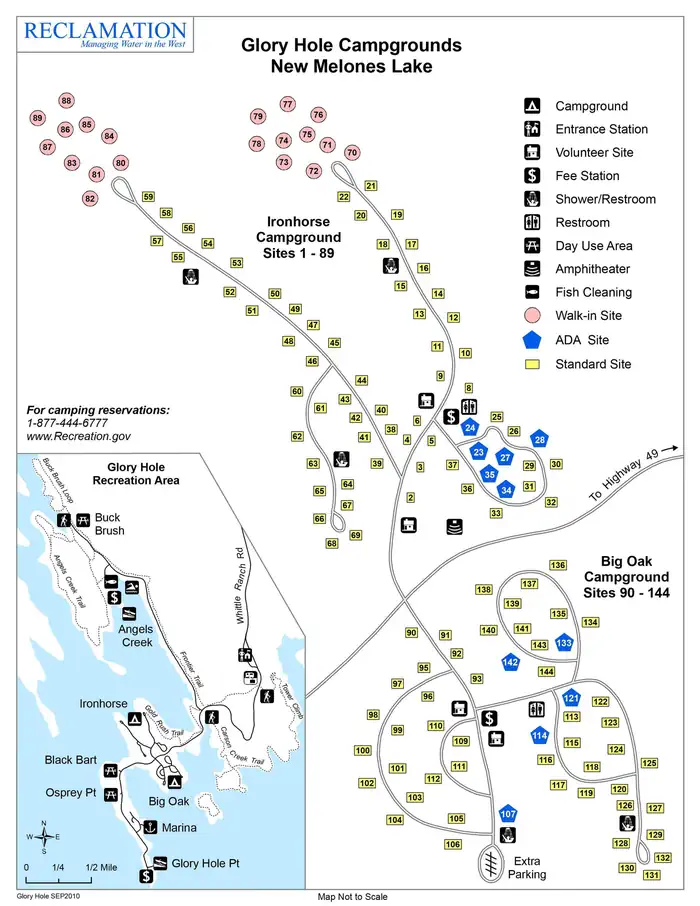
143 sites in 6 loops. Tap a filter to narrow the list; the map follows.
| Site | Loop | Type | Entry | Fits, ft | Surface | Shade | Water / sewer | People / vehicles | Fires | Accessible |
|---|---|---|---|---|---|---|---|---|---|---|
| 113 | Big Oak 113-132 | RV | Pull-through | 95 | Paved | Partial | No / – | 8 / 2 | Yes | |
| 114 | Big Oak 113-132 | RV | Back-in | 80 | Paved | None | No / – | 8 / 2 | Yes | Yes |
| 115 | Big Oak 113-132 | RV | Back-in | 50 | Paved | Partial | No / – | 8 / 2 | Yes | |
| 116 | Big Oak 113-132 | RV | Back-in | 55 | Paved | Partial | No / – | 8 / 2 | Yes | |
| 117 | Big Oak 113-132 | RV | Back-in | 65 | Paved | None | No / – | 8 / 2 | Yes | |
| 118 | Big Oak 113-132 | RV | Back-in | 55 | Paved | Partial | No / – | 8 / 2 | Yes | |
| 119 | Big Oak 113-132 | RV | Back-in | 65 | Paved | Partial | No / – | 8 / 2 | Yes | |
| 120 | Big Oak 113-132 | RV | Back-in | 40 | Paved | Partial | No / – | 8 / 2 | Yes | |
| 121 | Big Oak 113-132 | RV | Back-in | 45 | Paved | None | No / – | 8 / 2 | Yes | Yes |
| 122 | Big Oak 113-132 | RV | Back-in | 45 | Paved | None | No / – | 8 / 2 | Yes |
Per-site records as published by the managing agency on Recreation.gov. Blank cells mean the agency listed nothing for that site. Check-in 3:00 PM, checkout 2:00 PM.
Amenities & rules
| Hookups | None |
| Max vehicle length | 90 ft |
| Equipment | RVs & trailers, Tents |
| Pets | Allowed |
| Campfires | Allowed, subject to restrictions |
| Accessibility | Sites 114, 121, 133, 142 and 7 more are listed accessible |
The campground provides modern amenities like flush toilets, showers and drinking water. Visitors will also find a full-service marina, boat launch, day-use areas, barbeque grills and a fish cleaning station. There is an amphitheater for Ranger programs and horseshoe pits in the Ironhorse campground. Picnic tables and fire rings are provided at each campsite. Recreation Area entrance gates close at 9:00 PM, and open at 4:00 AM. Exit gates are never closed.
Individual sites vary. Confirm on Recreation.gov or with the managing office.
Weather by month
Getting there
From Sacramento take 99 S, 88 W and 12 E to San Andreas. Take 49 S for approximately 15 miles. Turn right onto Whittle Ranch Road and follow the road 2 miles to the recreation area. From Central California and the Bay Area take 80 E, 580 E then 205 E to 120 E in Manteca. Take the exit for 120 E/99 N. Continue on 120 E, then take 108 E to 49N.
| Nearest town | Angels Camp, California |
| Coordinates | 38.0075° N, 120.5403° W · Directions ↗ |
Supplies & services
| Outdoor gear | Sierra Nevada Adventure Co. ↗ | 9.9 mi |
| Dump station | Dump station ↗ | 18.2 mi |
| RV sales & service | Modesto RV Center ↗ | 36 mi |
Locations © OpenStreetMap contributors. Call ahead; hours change seasonally.
Explore
Video
Glory Hole Recreation Area Campground, CA
Public land it sits in
Stanislaus National Forest begins about 7.2 miles away, and it is the closest of these.
- 7.2 miStanislaus National Forest ↗National Forest · Forest Service · 1,090,354 acres
Each unit is published as a centre point and an acreage rather than a boundary, so this section stands it in for a circle of the same area. Whether a campground is inside, and how far it is from one it is outside, are both approximate.
Other campgrounds nearby
On the National Register nearby
- Angels HotelBuilding · Angels Camp · 4.3 mi
- Calaveras County BankBuilding · Angels Camp · 4.3 mi
- Sam Choy Brick StoreBuilding · Angels Camp · 4.3 mi
Natural features
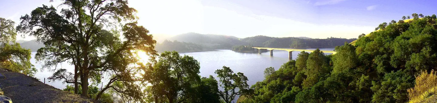
New Melones Lake is located in Northern California between the historic gold rush towns of Sonora and Angels Camp. The terrain varies from rolling hills to steep marble cliffs, and the vegetation consists of oaks, Ponderosa pines, chamise and buckbrush shrubs. Visitors can experience the beauty of New Melones by hiking the many trails in the Tuttletown and Glory Hole Recreation Areas. The climate is Mediterranean with warm, dry summers and cool, wet winters. For those who wish to venture outside the main recreation areas, there are many unique places to visit. Overall, the geography is quite varied and provides many opportunities for all types of recreation.
Recreation
Hiking, fishing, wakeboarding, waterskiing, boating, sailing and road and mountain biking are just a few of the activities available in Glory Hole Recreation Area. Camping is also permitted in designated campsites. Equestrian trails are also present in the Peoria Wildlife Mitigation Area and open for the general public. Other interesting sites include Natural Bridges, which can be accessed from Parrott's Ferry Road and has a nice hiking trail and a creek that flows through a marble cave. The Table Mountain Trail provides visitors an opportunity to hike to the top of an extensive lava flow which occurred over nine million years ago.
Nearby
Glory Hole Recreation Area is surrounded by many places of natural beauty including Natural Bridges, Camp Nine, Yosemite National Park, Stanislaus National Forest, Moaning Caverns, Big Trees State Park and Columbia State Park. Angels Camp Museum, Calaveras County Museum and Sonora Military Museum also provide great opportunities for learning interesting information about the area. Surrounding communities are popular vacation and retirement destinations and provide necessary services and shopping opportunities. Golfing, snow skiing, river rafting, commercial caves, historical railroad and Native American museums are close by as well.
Guidebooks for California
We earn a small commission if you buy through these links. It does not change what we list.

Titles come from Open Library's catalog, matched by subject heading or by title.
Reference
Questions people ask
Do I need a reservation at Glory Hole Recreation Area?
Sites at Glory Hole Recreation Area are reservable on Recreation.gov. Any walk-up sites are listed on the booking page.
Source: Recreation.gov
What time is check-in at Glory Hole Recreation Area?
Check-in 3:00 PM, checkout 2:00 PM.
Source: Recreation.gov
How many sites does Glory Hole Recreation Area have?
144 sites, including 68 standard sites without power, 55 RV sites without hookups, and 20 walk-in sites.
Source: Recreation.gov
Will my RV fit at Glory Hole Recreation Area?
Recreation.gov lists no practical vehicle capacity limit for the largest site here, which usually means pull-through or open parking. The sidebar tool checks a trailer or motorhome length against every site.
Source: Will my RV fit
Are there showers or a dump station at Glory Hole Recreation Area?
The campground provides modern amenities like flush toilets, showers and drinking water.
Source: Recreation.gov
Are pets allowed at Glory Hole Recreation Area?
Yes, pets are allowed at Glory Hole Recreation Area. Leash rules apply.
Source: Recreation.gov
Can I have a campfire at Glory Hole Recreation Area?
Fires are allowed in the provided rings under normal conditions.
Source: Recreation.gov
Are there accessible sites at Glory Hole Recreation Area?
Sites 114, 121, 133, and 142 are listed accessible on Recreation.gov, 11 sites in all. What that covers (a paved pad, an accessible table, a nearby accessible restroom) is on each site's booking page.
Source: Recreation.gov
Is there cell service at Glory Hole Recreation Area?
FCC coverage maps show Verizon 4G LTE, AT&T 5G, and T-Mobile 5G at the campground point. Terrain changes that from one site to the next.
Source: FCC Broadband Map
What is there to do at Glory Hole Recreation Area?
Hiking, fishing, wakeboarding, waterskiing, boating, sailing and road and mountain biking are just a few of the activities available in Glory Hole Recreation Area. The Recreation section on this page has the rest.
Source: Recreation
What is the nearest town to Glory Hole Recreation Area?
Angels Camp, California. Glory Hole Recreation Area is surrounded by many places of natural beauty including Natural Bridges, Camp Nine, Yosemite National Park, Stanislaus National Forest, Moaning Caverns, Big Trees State Park and Columbia State Park.
Source: Getting there
What if Glory Hole Recreation Area is full?
The nearest public campgrounds are Tuttletown Recreation Area (2.4 mi), Coyote Point (16.7 mi), and Deer Flat Boat In Campground (18 mi).
Source: Campgrounds nearby