Manzanita Lake
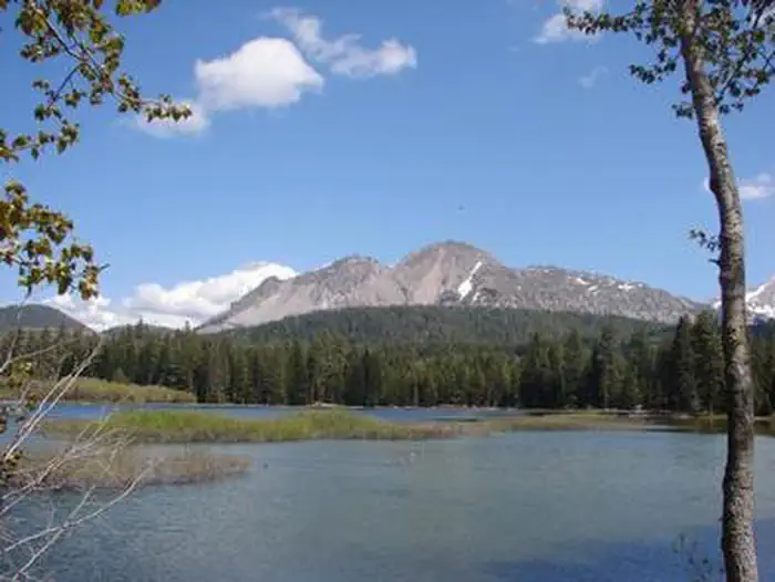
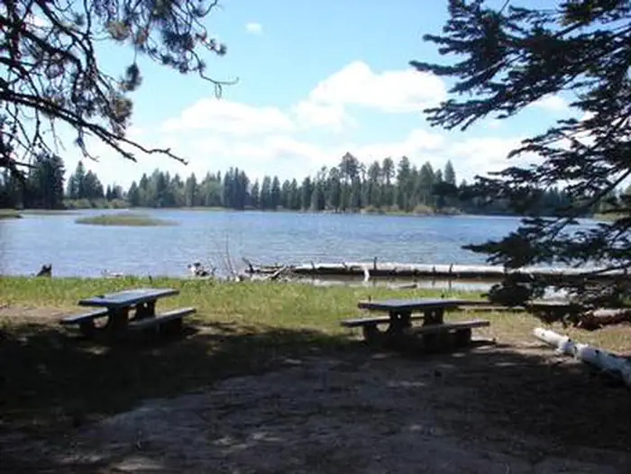
Manzanita Lake Campground (elevation 5,900 ft.) is the largest campground in Lassen Volcanic National Park. It is within walking distance of the scenic Manzanita Lake, a popular fishing and family destination, and offers impressive views of Lassen Peak, the largest volcano in the park at 10,457 feet. The facility is conveniently located one mile south of the park entrance, close to The Loomis Museum, Loomis Ranger Station and popular hiking trails. Educational programs are presented at the museum and amphitheater.
The group site has its own page: Manzanita Lake Group Campground.
More like this: reservable in California · big rigs in California · pets allowed in California
Check availability on Recreation.gov ↗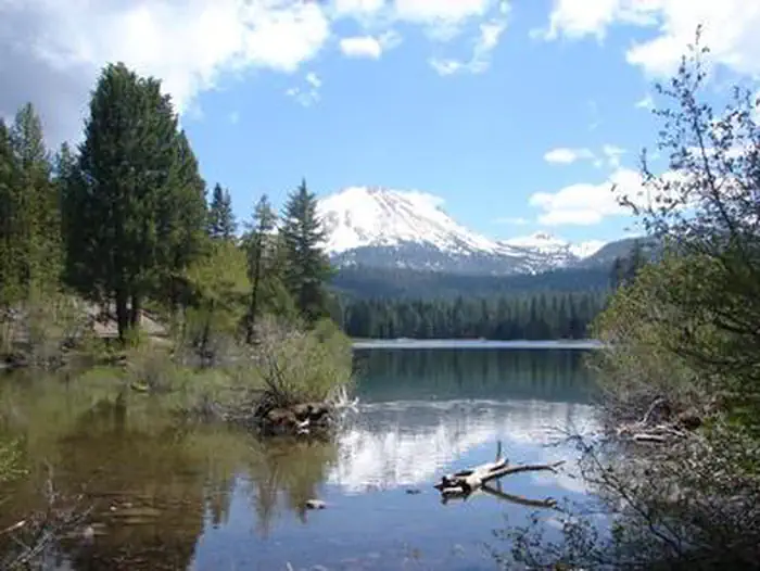
Site mix
| Standard, no hookups | 133 |
| Tent-only | 36 |
| RV, no hookups | 1 |
| Host/management | 10 |
Site guide
Will my RV fit
The longest site here provides 45 feet of vehicle capacity. Most sites are shorter.
170 sites in 4 loops. Tap a filter to narrow the list; the map follows.
| Site | Loop | Type | Entry | Fits, ft | Surface | Shade | People / vehicles | Fires | Accessible |
|---|---|---|---|---|---|---|---|---|---|
| A03 | Manzanita Loop A | Standard | Pull-through | 40 | Paved | Partial | 6 / 2 | Yes | |
| A04 | Manzanita Loop A | Standard | Back-in | 37 | Paved | Partial | 6 / 2 | Yes | |
| A05 | Manzanita Loop A | Tent only | Back-in | 25 | Paved | Partial | 6 / 2 | ||
| A06 | Manzanita Loop A | Tent only | Back-in | 20 | Paved | Partial | 6 / 2 | ||
| A07 | Manzanita Loop A | Standard | Back-in | 25 | Paved | Partial | 6 / 2 | Yes | |
| A08 | Manzanita Loop A | Standard | Pull-through | 35 | Paved | Partial | 6 / 2 | Yes | |
| A09 | Manzanita Loop A | Standard | Back-in | 24 | Paved | Partial | 6 / 2 | Yes | |
| A10 | Manzanita Loop A | Standard | Back-in | 40 | Paved | Partial | 6 / 2 | Yes | |
| A13 | Manzanita Loop A | Standard | Back-in | 35 | Paved | Partial | 6 / 2 | Yes | |
| A14 | Manzanita Loop A | Tent only | Back-in | 20 | Paved | Partial | 6 / 2 |
Per-site records as published by the managing agency on Recreation.gov. Blank cells mean the agency listed nothing for that site. Check-in 1:00 PM, checkout 12:00 PM.
Amenities & rules
| Hookups | None |
| Max vehicle length | 45 ft |
| Equipment | RVs & trailers, Tents |
| Pets | Allowed |
| Campfires | Allowed, subject to restrictions |
| Accessibility | Sites A32, B09 are listed accessible |
Manzanita Lake Campground is forested with Jeffrey and Ponderosa pines and has many comforts in the campground or close by, including pay showers, a general store and paved roads. Flush toilets and running water are turned on during the summer, vault toilets are available outside of the peak season.
Individual sites vary. Confirm on Recreation.gov or with the managing office.
Weather by month
Getting there
From Redding, California drive 48 miles east on State Highway 44. Turn right into Lassen Volcanic National Park and continue one mile south to Manzanita Lake Campground.
| Nearest town | Mineral, California |
| Coordinates | 40.5292° N, 121.5639° W · Directions ↗ |
Fire nearby
- PrescribedCy26 Elrd Underburn Drake Unit 7 & 9 Rx
23 mi from the campground
- PrescribedCy26 Elrd Understory Drake Unit 6 8 &10 Rx
23 mi from the campground
- PrescribedShf Rx
39 mi from the campground
Distance is to the reported incident point, not the fire edge. Call the managing office before you drive.
Supplies & services
| Dump station | Dump station ↗ | 0.4 mi |
| Outdoor gear | Camping World ↗ | 39.1 mi |
| RV sales & service | RV sales & service ↗ | 39.2 mi |
Locations © OpenStreetMap contributors. Call ahead; hours change seasonally.
Explore
Video
Manzanita Lake Campground Overview
Worth a stop
- 12.7 miOld Station Day Use Picnic ↗Day use
- 12.9 miBrokenshire Picnic Area ↗Day use
- 14.6 miCypress Trailhead ↗Trailhead
Trails nearby
- 1.8 mi17 Road ↗21.7 mi trail · snowmobile, snowshoe, ski
- 2.1 miManzanita Chutes ↗7.1 mi trail · snowmobile, snowshoe, ski
- 4.5 mi16 Road ↗9.9 mi trail · snowmobile, snowshoe, ski
- 4.7 miAshpan Butte3.2 mi trail · snowmobile, snowshoe, ski
- 4.7 miAshpan Flat ↗5.5 mi trail · snowmobile, snowshoe, ski
- 4.8 miRed Lake4.3 mi trail · snowmobile, snowshoe, ski
Trail and trailhead records are the Forest Service's. Distances are straight-line to the nearer trail end. Trail conditions are not tracked here.
Public land it sits in
Lassen National Forest begins about 0.6 miles away, and it is the closest of these.
- 0.6 miLassen National Forest ↗National Forest · Forest Service · 1,488,712 acres
- 3 miLassen Volcanic Wilderness ↗Wilderness · National Park Service · 79,061 acres
- 9 miThousand Lakes Wilderness ↗Wilderness · Forest Service · 16,526 acres
Each unit is published as a centre point and an acreage rather than a boundary, so this section stands it in for a circle of the same area. Whether a campground is inside, and how far it is from one it is outside, are both approximate.
Other campgrounds nearby

Cabin and lookout rentals nearby
On the National Register nearby
- Loomis Vistor Center, Bldg. 43Building · Manzanita Lake · 0.5 mi
- Summit Lake Ranger StationBuilding · Mineral · 7.5 mi
- Twin Lakes Fire Tool CacheBuilding · Mineral · 10.8 mi
Natural features
The national park is known for its volcanic history, as well as its diversity of plants and animals. It contains 300 active volcanic domes, as well as many hydrothermal features, such as mud pots and steam vents. Lassen Peak is the southernmost active volcano in the Cascades, and the second most recent to erupt in the lower 48 of the United States before Mount Saint Helens. Lassen National Park boasts over 700 species of flowering plants and 250 species of birds, mammals, reptiles and fish. The park is at the junction of the Cascade Mountains, the Sierra Nevada Mountains and the Great Basin, thus providing many unique habitats.
Recreation
Manzanita Lake is popular with fly fishermen, but the campground does maintain a catch-and-release policy. Non-motorized boating is also permitted and Kayak rentals are available nearby. The park boasts more than 150 miles of hiking trails, a variety of which can be accessed from the campground, including family-friendly hikes as well as those for more experienced hikers.
Guidebooks for Lassen Volcanic National Park
We earn a small commission if you buy through these links. It does not change what we list.
- Monitoring the American Pika in the Pacific West Region: Crater Lake National Park, Craters of the Moon National Monument and Preserve, Lassen Volcanic National Park, and Lava Beds National Monument: Standard Operating ProceduresNational Park Service, 2013Find at Bookshop.org
Titles come from Open Library's catalog, matched by subject heading or by title.
Reference
Questions people ask
Do I need a reservation at Manzanita Lake?
Sites at Manzanita Lake are reservable on Recreation.gov. Any walk-up sites are listed on the booking page.
Source: Recreation.gov
What time is check-in at Manzanita Lake?
Check-in 1:00 PM, checkout 12:00 PM.
Source: Recreation.gov
How many sites does Manzanita Lake have?
180 sites, including 133 standard sites without power, 36 tent-only sites, and 1 RV site without hookups.
Source: Recreation.gov
Will my RV fit at Manzanita Lake?
The longest site here provides 45 feet of vehicle capacity. Most sites are shorter. The sidebar tool checks a trailer or motorhome length against every site.
Source: Will my RV fit
Are there showers or a dump station at Manzanita Lake?
Manzanita Lake Campground is forested with Jeffrey and Ponderosa pines and has many comforts in the campground or close by, including pay showers, a general store and paved roads.
Source: Recreation.gov
Are pets allowed at Manzanita Lake?
Yes, pets are allowed at Manzanita Lake. Leash rules apply.
Source: Recreation.gov
Can I have a campfire at Manzanita Lake?
Fires are allowed in the provided rings under normal conditions. As of 2026-10-16, there are 3 active fires within 50 miles, so check current restrictions before you light one.
Source: Fire nearby
Are there accessible sites at Manzanita Lake?
Sites A32 and B09 are listed accessible on Recreation.gov. What that covers (a paved pad, an accessible table, a nearby accessible restroom) is on each site's booking page.
Source: Recreation.gov
What is there to do at Manzanita Lake?
Manzanita Lake is popular with fly fishermen, but the campground does maintain a catch-and-release policy. The Recreation section on this page has the rest.
Source: Recreation
What is the nearest town to Manzanita Lake?
Mineral, California.
Source: Getting there
What if Manzanita Lake is full?
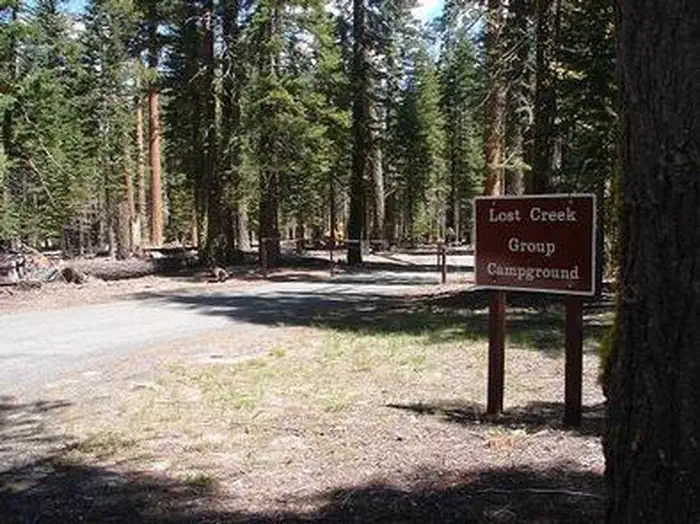
The nearest public campgrounds are Manzanita Lake Group Campground (under 0.1 mi), Lost Creek Group (3.4 mi), and Southwest Campground - Winter/Spring (6.6 mi, first-come).
Source: Campgrounds nearby
Which national park is Manzanita Lake in?
Manzanita Lake is a Lassen Volcanic National Park campground. Entrance fees, alerts, and hours are on Park Atlas.
Source: Lassen Volcanic National Park