Clear Lake Group Site
Clear Lake Group Campground is along the North Fork of the Tieton River in the Okanogan-Wenatchee National Forest. The campground sits between popular Rimrock Lake and the quieter Clear Lake beneath a canopy of towering pine and fir trees. Perched on a rocky bluff overlooking the area, this secluded spot offers access to a variety of recreational opportunities. It is an ideal setting for large family and group gatherings.
More like this: reservable in Washington · group sites in Washington
Check availability on Recreation.gov ↗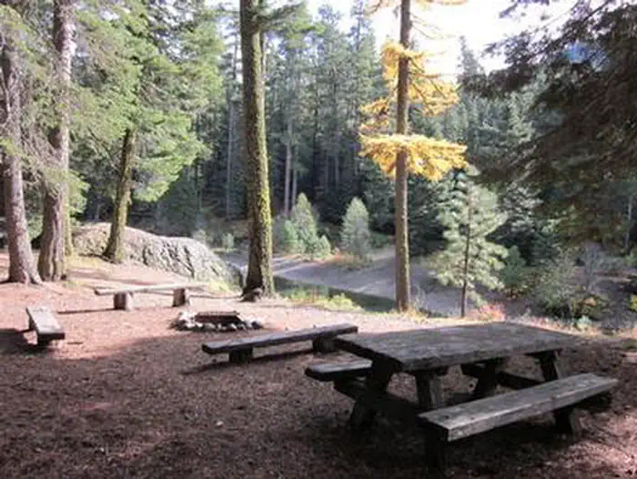
Site mix
| group standard area nonelectric | 1 |
Site guide
Will my RV fit
The longest site here provides 30 feet of vehicle capacity. Most sites are shorter.
1 site. Tap a filter to narrow the list; the map follows.
| Site | Entry | Fits, ft | Surface | Shade | People / vehicles | Fires |
|---|---|---|---|---|---|---|
| 001 | Pull-through | 30 | Gravel | Full | 40 / 10 | Yes |
Per-site records as published by the managing agency on Recreation.gov. Blank cells mean the agency listed nothing for that site. Check-in 1:00 PM, checkout 11:00 AM.
Amenities & rules
| Hookups | None |
| Max vehicle length | 30 ft |
| Equipment | RVs & trailers, Tents |
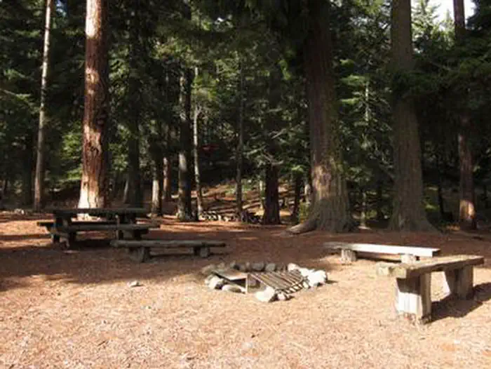
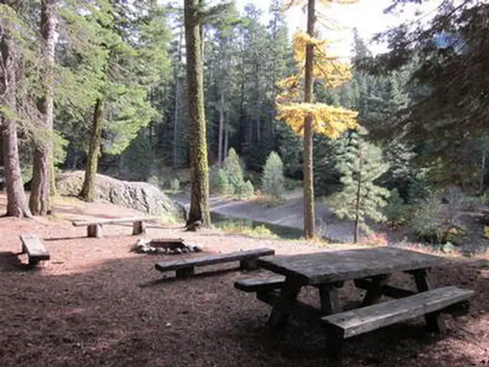
Clear Lake Group Campground is a single group site that can accommodate 40 guests. The parking area can hold about ten cars or five RVs and provides walk-in access to a large tent camping area. The site is equipped with picnic tables, accessible vault toilets and a group campfire ring.
Individual sites vary. Confirm on Recreation.gov or with the managing office.
Weather by month
Getting there
From Naches, follow Highway 12 west for approximately 34 miles to County Road 1200/Tieton Reservoir Road at the west end of Rimrock Lake. Turn south/left on County Road 1200 and follow for about.3 miles to Road 740. Continue for a half-mile, and the reservation site is the second campsite on the left along the North Fork Tieton River.
| Nearest town | Naches, Washington |
| Coordinates | 46.6315° N, 121.2679° W · Directions ↗ |
Fire nearby
- WildfireWest Fork
30 mi from the campground · 310 acres · 16% contained
Distance is to the reported incident point, not the fire edge. Call the managing office before you drive.
Supplies & services
| Dump station | Dump station ↗ | 4.1 mi |
| RV sales & service | RV sales & service ↗ | 31.3 mi |
| Outdoor gear | RMI Rentals ↗ | 37.4 mi |
Locations © OpenStreetMap contributors. Call ahead; hours change seasonally.
Explore
Video
Is Clear Lake in California a Nice Place?
Worth a stop
A boat ramp is available within 10 miles of the campground. Visitors enjoy Mt. Rainer National Park, where interpretive programs and exhibits offer education about the diverse landscape and history of the area. The spectacular Pacific Crest Trail (PCT), one of the world's premier National Scenic Trails, showcases some of North America's most fantastic scenery, winding its way its way from Mexico to Canada through California, Oregon and Washington, and is accessible near the campground.
- 3.2 miHorseshoe Cove Boat Launch ↗Boat launch
- 4.7 miDog Lake Day Use/Boat Launch/Trailhead ↗Boat launch
- 5.6 miSection 3 Lake Trailhead ↗Trailhead
- 8 miTrailhead: Sand Lake ↗Trailhead
Trails nearby
- 0.6 miPinegrass Snowmobile ↗4.8 mi trail
- 0.9 miLeafy Arches1.1 mi trail
- 0.9 miWay Through the Wilds0.9 mi trail
- 0.9 miClear Lake Barrier Free0.5 mi trail
- 1 miTwilight Trail0.7 mi trail
- 1 miStreamside Pass0.9 mi trail
Trailheads within three miles
- 2.3 miAndy Creek Trailhead ↗Okanogan-Wenatchee National Forest
Trail and trailhead records are the Forest Service's. Distances are straight-line to the nearer trail end. Trail conditions are not tracked here.
Public land it sits in
William O. Douglas Wilderness begins about 2.4 miles away, and it is the closest of these.
- 2.4 miWilliam O. Douglas Wilderness ↗Wilderness · Forest Service · 168,955 acres
- 3.4 miGoat Rocks Wilderness ↗Wilderness · Forest Service · 108,020 acres
- 10.9 miGifford Pinchot National Forest ↗National Forest · Forest Service · 1,496,308 acres
Each unit is published as a centre point and an acreage rather than a boundary, so this section stands it in for a circle of the same area. Whether a campground is inside, and how far it is from one it is outside, are both approximate.
Other campgrounds nearby


Cabin and lookout rentals nearby

On the National Register nearby
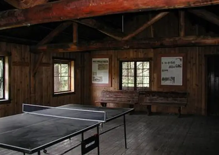
- Three Lakes Patrol CabinBuilding · Ohanapecosh · 13.4 mi
Natural features
Okanogan-Wenatchee National Forest offers stunning scenic views, with high, glaciated alpine peaks, valleys of old growth forest and rugged shrub-steppe country making up the diverse landscape. Elevations range from below 1,000 feet to more than 9,000 feet. Visitors can expect many days of warm, sunny weather in the summer, and winters with clear skies and plenty of snow. The Tieton River, adjacent to Clear Lake Group Campground, is a tributary of the Naches River. Its headwaters originate in Goat Rocks Wilderness, collecting water from snow melt and glaciers in high rugged peaks. These peaks are remnants of an extinct volcano, taking the name "Goat Rocks," in honor of the mountain goats traversing this isolated region.
Recreation
Clear Lake Group Campground offers outdoor enthusiasts the opportunity to hike, fish, ski, raft and enjoy a multitude of outdoor recreational activities throughout the year. Visitors enjoy the nearby Rimrock Lake for its myriad of water activities, including fishing for kokanee salmon or trout and kayaking along the shore. River enthusiasts may enjoy a whitewater rafting trip on one of the many scenic rivers in the area. The Tieton River is especially exciting in September, when the Bureau of Reclamation floods the Tieton Valley. The river is perfect for river enthusiasts seeking the thrill of whitewater.
Guidebooks for Washington
We earn a small commission if you buy through these links. It does not change what we list.
Titles come from Open Library's catalog, matched by subject heading or by title.
Reference
Questions people ask
Do I need a reservation at Clear Lake Group Site?
Sites at Clear Lake Group Site are reservable on Recreation.gov. Any walk-up sites are listed on the booking page.
Source: Recreation.gov
What time is check-in at Clear Lake Group Site?
Check-in 1:00 PM, checkout 11:00 AM.
Source: Recreation.gov
How many sites does Clear Lake Group Site have?
1 site, including 1 group standard area nonelectric.
Source: Recreation.gov
Will my RV fit at Clear Lake Group Site?
The longest site here provides 30 feet of vehicle capacity. Most sites are shorter. The sidebar tool checks a trailer or motorhome length against every site.
Source: Will my RV fit
Is there cell service at Clear Lake Group Site?
FCC coverage maps show AT&T 4G LTE at the campground point. Terrain changes that from one site to the next.
Source: FCC Broadband Map
What is there to do at Clear Lake Group Site?
Clear Lake Group Campground offers outdoor enthusiasts the opportunity to hike, fish, ski, raft and enjoy a multitude of outdoor recreational activities throughout the year. The Recreation section on this page has the rest.
Source: Recreation
What is the nearest town to Clear Lake Group Site?
Naches, Washington. A boat ramp is available within 10 miles of the campground.
Source: Getting there
What if Clear Lake Group Site is full?
The nearest public campgrounds are Clear Lake North Group Campground (0.1 mi), Clear Lake North Campground (0.1 mi, first-come), and Indian Creek Campground (1.5 mi).
Source: Campgrounds nearby