Crook Campground
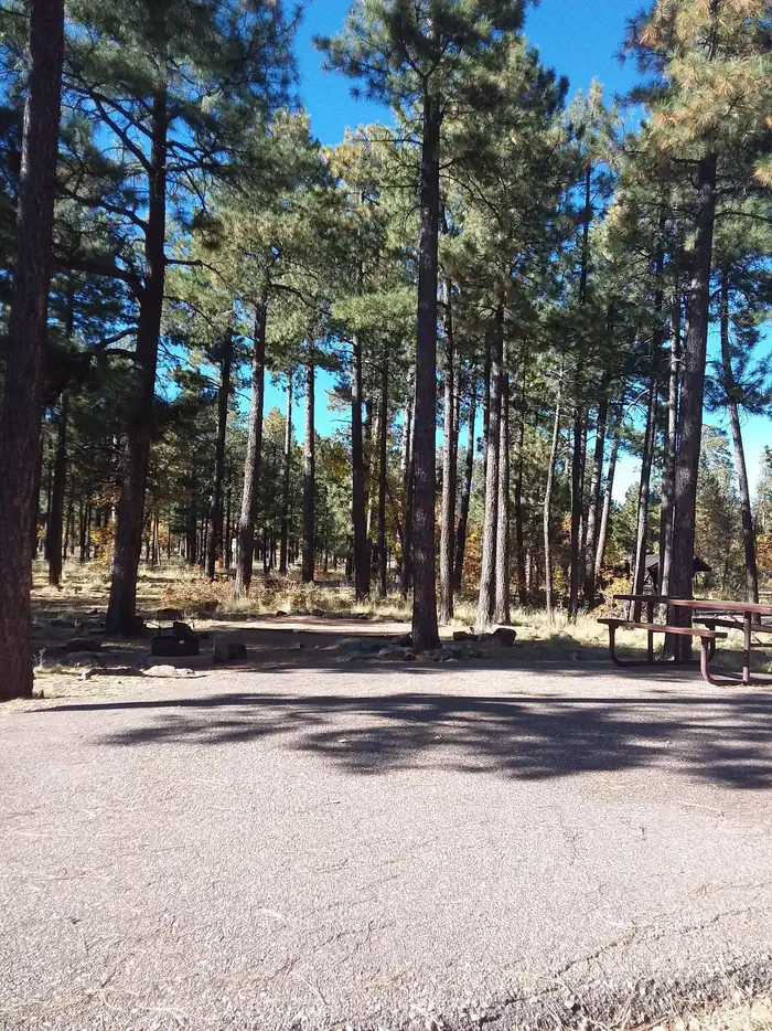
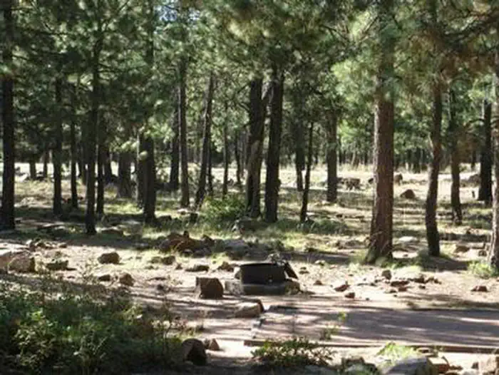
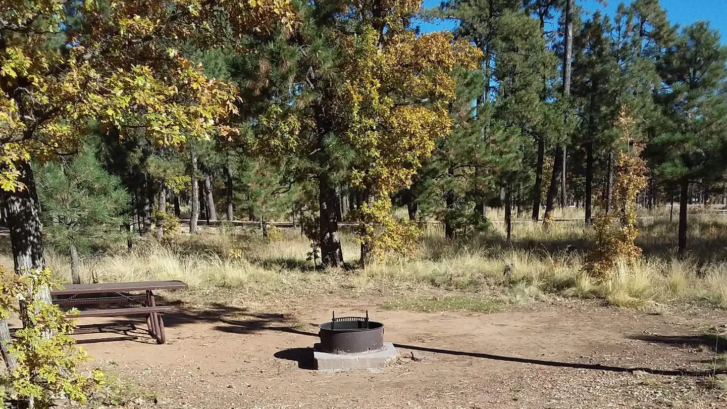
This group campground is situated in a tall ponderosa pine forest, just down the road from the popular Woods Canyon Lake in north central Arizona. The shaded campground is a nice hideaway for large groups with opportunities for boaters, anglers, hikers, families and photographers.
More like this: reservable in Arizona · pets allowed in Arizona · group sites in Arizona
Check availability on Recreation.gov ↗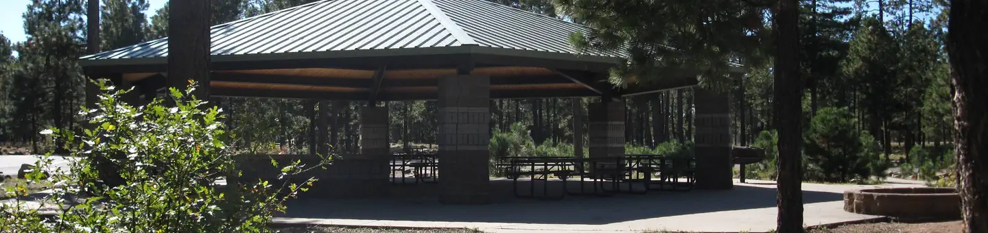
Site mix
| Group sites | 2 |
Site guide
Will my RV fit
The longest site here provides 30 feet of vehicle capacity. Most sites are shorter.
2 sites. Tap a filter to narrow the list; the map follows.
| Site | Fits, ft | Surface | Shade | Water / sewer | People / vehicles | Fires |
|---|---|---|---|---|---|---|
| GRPA | 30 | Paved | Full | No / – | 110 / 26 | Yes |
| GRPB | 30 | Paved | Full | No / – | 110 / 26 | Yes |
Per-site records as published by the managing agency on Recreation.gov. Blank cells mean the agency listed nothing for that site. Check-in 02:00 PM, checkout 11:00 AM.
Amenities & rules
| Hookups | None |
| Max vehicle length | 30 ft |
| Equipment | RVs & trailers, Tents |
| Pets | Allowed |
| Campfires | Allowed, subject to restrictions |
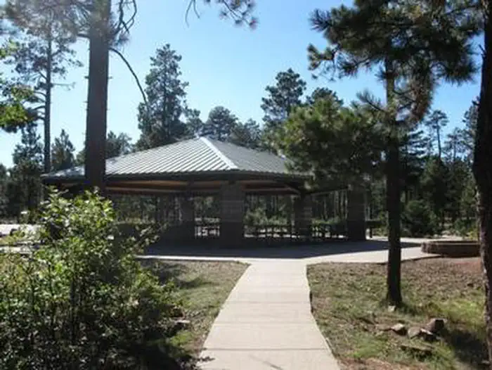
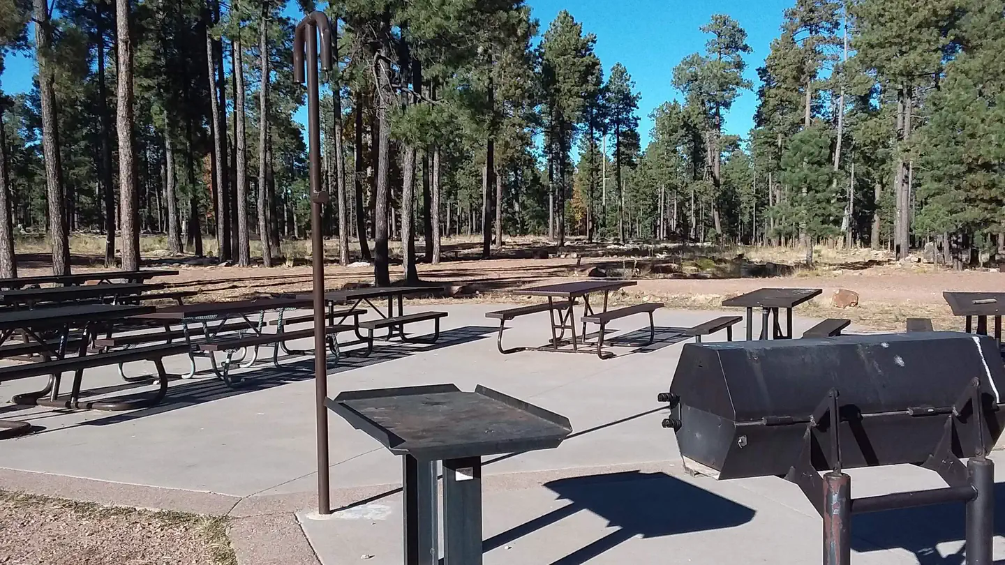
The campground is arranged in two loops in a cul-de-sac design. Each has a group area that can host up to 110 campers and 26 vehicles (parallel parking only). The sites can accommodate both RVs and tents, though some areas are less suited for tent camping. A picnic shelter is located in the middle of the group use area. Groceries are available at the Woods Canyon Store, and a dump station is located near the park. Firewood is available for sale at the store and onsite.
Individual sites vary. Confirm on Recreation.gov or with the managing office.
Season & status
| Status | Open |
| Forest | Apache-Sitgreaves National Forest |
| Booking | Reservations required. 1-877-444-6777 or at Recreation.gov |
| Fees | Single non-electrical, (when not reserved) $24, up to 8 people and 1 vehicle. Group Loop A site non-electrical $315, up to 110 people and 26 vehicles. Group Loop B site non-electrical $315, up to 110 people and 26 vehicles. |
Weather by month
Getting there
From Heber: Travel 25 miles west on State Highway 260. Turn right onto Forest Road 300 which is located directly across from the Rim Visitor Information Station. Travel about 4 miles north of State Highway 260 toward Woods Canyon Lake. Turn right onto Forest Road 105 toward Woods Canyon Lake. Watch for signs for Crook Campground.
| Coordinates | 34.3164° N, 110.9417° W · Directions ↗ |
Fire nearby
- PrescribedD2 Sinkhole Rx
4 mi from the campground · 875 acres
- PrescribedD2 Dye Rx
8 mi from the campground · 5,246 acres
- PrescribedD2 Vincent Rx
9 mi from the campground · 2,258 acres
- PrescribedTillman Rx
10 mi from the campground
Distance is to the reported incident point, not the fire edge. Call the managing office before you drive.
Supplies & services
| Dump station | Woods Canyon Dump Station ↗ | 0.4 mi |
Locations © OpenStreetMap contributors. Call ahead; hours change seasonally.
Explore
Video
Crook Group Campground - Sitgreaves National Forest, AZ
Worth a stop
Gas, food, and groceries are available in Forest Lakes 9 miles east. The nearest full service community is Payson, Arizona, 34 miles west on Highway 260. Visitors can explore endless vistas and take part in many outdoor activities in the surrounding Apache-Sitgreaves National Forest, which encompasses 2 million acres of magnificent mountain country in east-central Arizona and New Mexico.
- 0.2 miOld Rim Trailhead ↗Trailhead
- 0.8 miMogollon Trailhead ↗Trailhead
- 1.4 miRocky Point Picnic Site ↗Day use
- 3 mi
- 3.5 miWillow Springs Lake Fishing And Boating Site ↗Fishing site
- 13.7 miBlack Canyon Lake Fishing And Boating Site ↗Fishing site
Trails nearby
- 0.2 miMeadow ↗2.1 mi trail · hiking, horse, bike
- 0.9 miHighline ↗50.2 mi trail · hiking, horse, bike · national_scenic_or_historic
- 0.9 miMilitary Sink Hole2.3 mi trail · hiking, horse, bike
- 0.9 miRim Lakes Vista ↗4.3 mi trail · hiking, horse, bike
- 1 miMilitary Sinkhole0.4 mi trail · hiking, horse, bike
- 1.2 miWoods Canyon Nature0.9 mi trail · hiking, horse, bike
Trailheads within three miles
- 0.2 miOld Rim Trailhead ↗Apache-Sitgreaves National Forest
- 0.8 miMogollon Trailhead ↗Apache-Sitgreaves National Forest · Season May 29
- 1.2 miMeadow Trailhead ↗Apache-Sitgreaves National Forest
- 1.2 miRocky Point Trailhead ↗Apache-Sitgreaves National Forest
Trail and trailhead records are the Forest Service's. Distances are straight-line to the nearer trail end. Trail conditions are not tracked here.
Public land it sits in
This campground sits inside Tonto National Forest.
- inTonto National Forest ↗National Forest · Forest Service · 2,966,417 acres
- 6.4 miHellsgate Wilderness ↗Wilderness · Forest Service · 37,457 acres
Each unit is published as a centre point and an acreage rather than a boundary, so this section stands it in for a circle of the same area. Whether a campground is inside, and how far it is from one it is outside, are both approximate.
Other campgrounds nearby

On the National Register nearby
- Promontory Butte Lookout ComplexStructure · Beaver Park · 5.4 mi
- Pleasant Valley Ranger StationBuilding · Young · 13.9 mi
- Diamond Point Lookout CabinBuilding · Tonto Village · 14.5 mi
Natural features
The campground is situated a ponderosa pine forest at an elevation of 7,500 feet. Wildlife viewing includes birds, squirrels, deer and elk. Hikers who venture onto nearby trails are afforded expansive views of the land beneath the Mogollon Rim. The Mogollon Rim, pronounced by locals as "muggy-own," is a 200-mile long escarpment in northern Arizona that ranges between 5,000 and 7,000 ft. in elevation and serves as the geographical divide between the cool high country above and the hot, dry desert below. Summer temperatures can be very pleasant because of the elevation. However, the rainy season often brings afternoon thunderstorms from late June through August. Visitors should come prepared for rain and cool nighttime temperatures.
Recreation
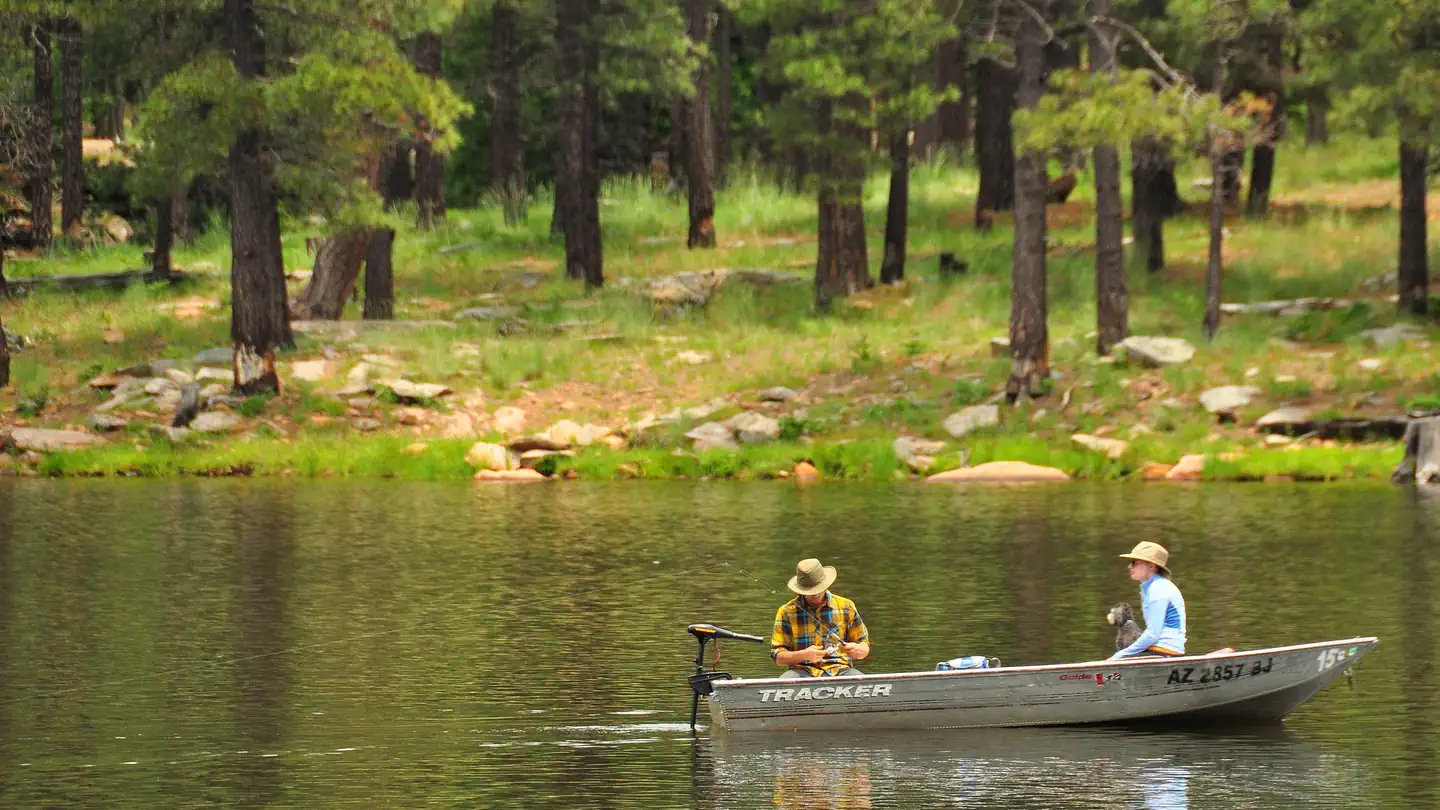
Popular activities include trout fishing, hiking, boating, cycling, horseback riding, and photography. Woods Canyon Lake is the most popular of four lakes in the Rim Lakes Recreation Area. Woods Canyon Lake only allows electric boat motors. The paved Meadow Trail borders Crook Campground and will bring you about 1 mile north to Woods Canyon Lake or one quarter mile south to the The Rim Lakes Vista and Rim Trail is just a quarter mile from the campground and leads to spectacular views of the Mogollon Rim and surrounding area.
Guidebooks for Arizona
We earn a small commission if you buy through these links. It does not change what we list.
- Best Backpacking Trips in Utah, Arizona, and New MexicoMike White and Douglas Lorain, 2016Find at Bookshop.org
Titles come from Open Library's catalog, matched by subject heading or by title.
Reference
Questions people ask
Do I need a reservation at Crook Campground?
Sites at Crook Campground are reservable on Recreation.gov. Reservations required. Any walk-up sites are listed on the booking page.
Source: Recreation.gov
How much does it cost to camp at Crook Campground?
Single non-electrical, (when not reserved) $24, up to 8 people and 1 vehicle. Group Loop A site non-electrical $315, up to 110 people and 26 vehicles. Group Loop B site non-electrical $315, up to 110 people and 26 vehicles.
Source: Recreation.gov
What time is check-in at Crook Campground?
Check-in 02:00 PM, checkout 11:00 AM.
Source: Recreation.gov
Is Crook Campground open right now?
Open as of Oct 16, 2026.
Source: Forest Service status
How many sites does Crook Campground have?
2 sites, including 2 group sites.
Source: Recreation.gov
Will my RV fit at Crook Campground?
The longest site here provides 30 feet of vehicle capacity. Most sites are shorter. The sidebar tool checks a trailer or motorhome length against every site.
Source: Will my RV fit
Are there showers or a dump station at Crook Campground?
Groceries are available at the Woods Canyon Store, and a dump station is located near the park.
Source: Recreation.gov
Are pets allowed at Crook Campground?
Yes, pets are allowed at Crook Campground. Leash rules apply.
Source: Recreation.gov
Can I have a campfire at Crook Campground?
Fires are allowed in the provided rings under normal conditions. As of 2026-10-16, there are 4 active fires within 50 miles, so check current restrictions before you light one.
Source: Fire nearby
Is there cell service at Crook Campground?
FCC coverage maps show Verizon 4G LTE at the campground point. Terrain changes that from one site to the next.
Source: FCC Broadband Map
What is there to do at Crook Campground?
Popular activities include trout fishing, hiking, boating, cycling, horseback riding, and photography. The Recreation section on this page has the rest.
Source: Recreation
What if Crook Campground is full?
The nearest public campgrounds are Aspen (0.7 mi, partly first-come), Woods Canyon Lake Group (0.9 mi), and Mogollon Campground (0.9 mi).
Source: Campgrounds nearby