Damsite
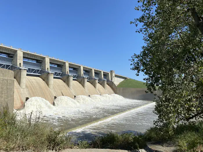
Fall River Dam is located on Fall River, a tributary of the Verdigris River, in Greenwood County, Kansas. Opportunities for outdoor family fun and recreation include swimming, boating, water skiing, camping, picnicking and sightseeing.
More like this: electric hookups in Kansas · full hookups in Kansas · reservable in Kansas · big rigs in Kansas · pets allowed in Kansas · group sites in Kansas
Check availability on Recreation.gov ↗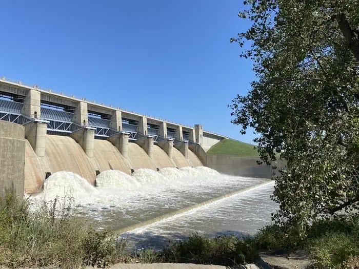
Site mix
| Standard with electric | 27 |
| Standard, no hookups | 5 |
| group standard electric | 1 |
Site guide
Will my RV fit
The longest site here provides 85 feet of vehicle capacity. Most sites are shorter.
33 sites. Tap a filter to narrow the list; the map follows.
| Site | Type | Entry | Fits, ft | Surface | Shade | Power | Water / sewer | People / vehicles | Fires | Accessible |
|---|---|---|---|---|---|---|---|---|---|---|
| GS | Group Standard Electric | Back-in | 50 | Gravel | Partial | 30 amp | Yes / No | 150 / 10 | Yes | |
| 001 | Electric | Back-in | 60 | Gravel | Full | 30 amp | Yes / – | 8 / 2 | Yes | |
| 002 | Electric | Back-in | 55 | Gravel | Full | 30 amp | Yes / – | 8 / 2 | Yes | |
| 003 | Electric | Back-in | 62 | Gravel | Full | 30 amp | Yes / – | 8 / 2 | Yes | |
| 004 | Electric | Back-in | 63 | Gravel | Full | 30 amp | Yes / – | 8 / 2 | Yes | |
| 005 | Electric | Back-in | 60 | Gravel | Full | 30 amp | Yes / – | 8 / 2 | Yes | |
| 006 | Standard | Back-in | 85 | Gravel | Full | No | Yes / – | 8 / 2 | Yes | |
| 007 | Standard | Pull-through | 40 | Gravel | Full | No | Yes / – | 8 / 2 | Yes | |
| 008 | Standard | Pull-through | 40 | Gravel | Full | No | Yes / – | 8 / 2 | Yes | |
| 009 | Standard | Back-in | 63 | Gravel | Full | No | Yes / – | 8 / 2 | Yes |
Per-site records as published by the managing agency on Recreation.gov. Blank cells mean the agency listed nothing for that site. Check-in 04:00 PM, checkout 03:00 PM.
Amenities & rules
| Hookups | Electric, water, sewer |
| Max vehicle length | 85 ft |
| Equipment | RVs & trailers, Tents |
| Pets | Allowed |
| Campfires | Allowed, subject to restrictions |
| Accessibility | Sites 029, 031 are listed accessible |
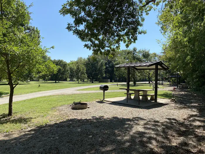
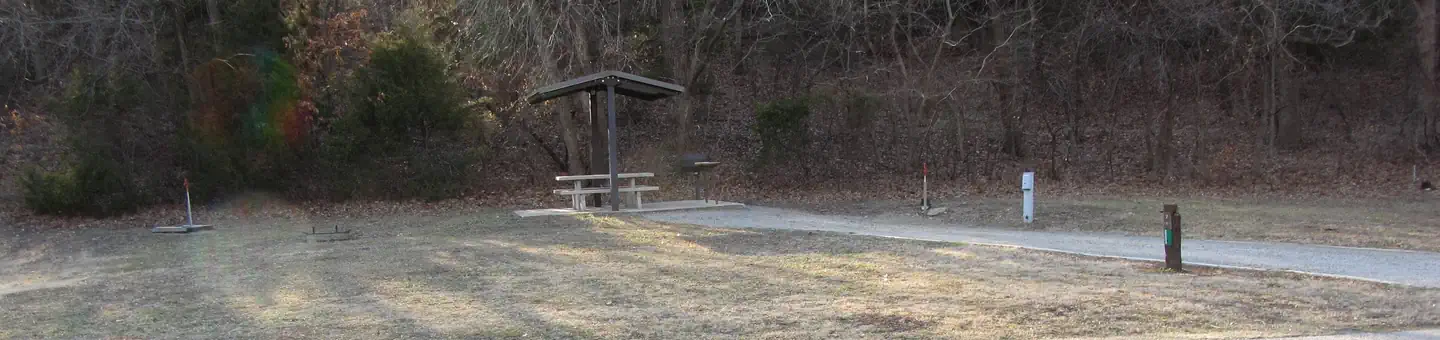
This campground straddles Fall River below the spillway. There are 13 rentable sites. 2 sites with 50 amp and water and 6 sites with 30 amp and water. There are 5 sites with water only. Additional amenities include vault toilets, drinking water, and a playground.
Individual sites vary. Confirm on Recreation.gov or with the managing office.
Weather by month
Getting there
From US HWY 400, turn left (north) at mile marker 344 (Z 50 Rd) 0.09 miles, turn right (east) 2.4 miles, turn right (south) at entrance to park.
| Nearest town | Fall River, Kansas |
| Coordinates | 37.6449° N, 96.0693° W · Directions ↗ |
Supplies & services
| Dump station | Dump station ↗ | 24.2 mi |
Locations © OpenStreetMap contributors. Call ahead; hours change seasonally.
Explore
Video
Morning At The Fall River State Park RV Fishing in The Rain Driveover Bridge To Damsite Ca
Other campgrounds nearby

On the National Register nearby
- Brush Creek BridgeStructure · Coyville · 9.7 mi
Natural features
Rolling prairies and tree-dotted valleys sheltered by limestone-capped ridges surround Fall Lake. The lake is about a mile wide at the dam site and stretches up the picturesque Fall River for 15 miles. This scenic area has a wealth of native wildlife and vegetation.
Recreation
Fall River and Lake provide visitors with endless boating, water skiing, jet skiing and swimming opportunities. Anglers will find white bass, bluegill, crappie, green sunfish and channel catfish, to be plentiful. For birdwatchers and nature lovers, there is an 8,000 acre public wildlife area, where prairie chickens, waterfowl of all kinds, rabbits, wild turkeys, white tail deer, doves and quail are commonly seen.
Nearby
Fall River State Park is nearby, offering great fishing and birding along the river. Canoeing is also a popular activity in the park.
Guidebooks for Kansas and camping across the country
We earn a small commission if you buy through these links. It does not change what we list.
Titles come from Open Library's catalog, matched by subject heading or by title.
Reference
Questions people ask
Do I need a reservation at Damsite?
Sites at Damsite are reservable on Recreation.gov. Any walk-up sites are listed on the booking page.
Source: Recreation.gov
What time is check-in at Damsite?
Check-in 04:00 PM, checkout 03:00 PM.
Source: Recreation.gov
How many sites does Damsite have?
33 sites, including 27 standard sites with power, 5 standard sites without power, and 1 group standard electric.
Source: Recreation.gov
Will my RV fit at Damsite?
Recreation.gov lists no practical vehicle capacity limit for the largest site here, which usually means pull-through or open parking. The sidebar tool checks a trailer or motorhome length against every site.
Source: Will my RV fit
Does Damsite have hookups?
Yes, electric, water, and sewer hookups at some sites.
Source: Recreation.gov
Are pets allowed at Damsite?
Yes, pets are allowed at Damsite. Leash rules apply.
Source: Recreation.gov
Can I have a campfire at Damsite?
Fires are allowed in the provided rings under normal conditions.
Source: Recreation.gov
Are there accessible sites at Damsite?
Sites 029 and 031 are listed accessible on Recreation.gov. What that covers (a paved pad, an accessible table, a nearby accessible restroom) is on each site's booking page.
Source: Recreation.gov
Is there cell service at Damsite?
FCC coverage maps show T-Mobile 4G LTE at the campground point. Terrain changes that from one site to the next.
Source: FCC Broadband Map
What is there to do at Damsite?
Fall River and Lake provide visitors with endless boating, water skiing, jet skiing and swimming opportunities. The Recreation section on this page has the rest.
Source: Recreation
What is the nearest town to Damsite?
Fall River, Kansas. Fall River State Park is nearby, offering great fishing and birding along the river.
Source: Getting there
What if Damsite is full?
The nearest public campgrounds are Whitehall Bay (1.6 mi), Timber Hill Park (41.8 mi), and Mound Valley (42.4 mi).
Source: Campgrounds nearby