Crystal Springs
Crystal Springs Campground, perched on the shores of Lake Ouachita in Arkansas, is an ideal spot for families, friends and couples. Approximately 1.2 million people visit the lake each year to explore its crystal clear waters and scenic mountain landscape.
More like this: electric hookups in Arkansas · full hookups in Arkansas · reservable in Arkansas · pets allowed in Arkansas · group sites in Arkansas
Check availability on Recreation.gov ↗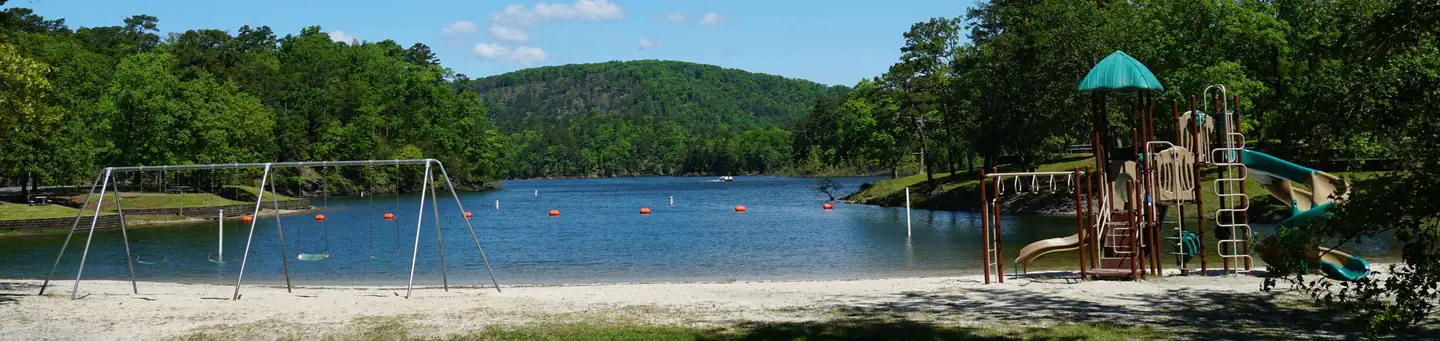
Site mix
| Standard with electric | 59 |
| tent only electric | 4 |
| group standard electric | 1 |
| Host/management | 11 |
Site guide
Will my RV fit
The longest site here provides 60 feet of vehicle capacity. Most sites are shorter.
64 sites in 4 loops. Tap a filter to narrow the list; the map follows.
| Site | Loop | Type | Entry | Fits, ft | Surface | Shade | Power | Water / sewer | Waterfront | People / vehicles | Fires | Accessible |
|---|---|---|---|---|---|---|---|---|---|---|---|---|
| 01 | A | Tent Only Electric | Partial | 30/20 amp | No / – | 8 / 2 | Yes | |||||
| 02 | A | Tent Only Electric | Partial | 30/20 amp | No / – | 8 / 2 | Yes | |||||
| 03 | A | Electric | Back-in | 40 | Gravel | Full | 50/30/20 amp | Yes / – | 12 / 2 | Yes | ||
| 04 | A | Electric | Pull-through | 35 | Gravel | Full | 50/30/20 amp | Yes / – | 12 / 2 | Yes | ||
| 05 | A | Electric | Back-in | 45 | Gravel | Full | 50/30/20 amp | Yes / – | 12 / 2 | Yes | ||
| 06 | A | Electric | Back-in | 55 | Gravel | Full | 50/30/20 amp | Yes / – | 12 / 2 | Yes | ||
| 07 | A | Electric | Back-in | 35 | Gravel | Full | 50/30/20 amp | Yes / – | 12 / 2 | Yes | ||
| 08 | A | Electric | Back-in | 45 | Gravel | Full | 50/30/20 amp | Yes / – | 12 / 2 | Yes | ||
| 09 | A | Electric | Back-in | 40 | Gravel | Full | 50/30/20 amp | Yes / – | 12 / 2 | Yes | ||
| 10 | A | Electric | Back-in | 40 | Gravel | Full | 50/30/20 amp | Yes / – | 12 / 2 | Yes |
Per-site records as published by the managing agency on Recreation.gov. Blank cells mean the agency listed nothing for that site. Check-in 06:00 PM, checkout 04:00 PM.
Amenities & rules
| Hookups | Electric, water, sewer |
| Max vehicle length | 20 ft |
| Equipment | RVs & trailers, Tents |
| Pets | Allowed |
| Campfires | Allowed, subject to restrictions |
| Tent pads | Yes |
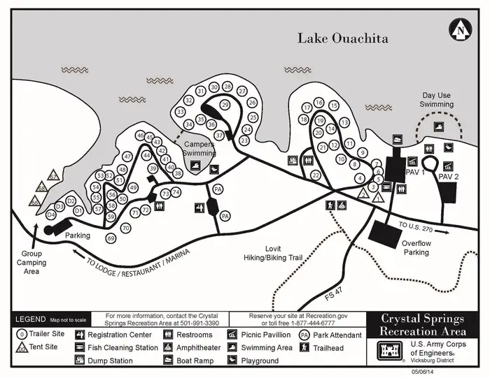
| Accessibility | Sites 22, 73, PAV 1, PAV 2 are listed accessible |
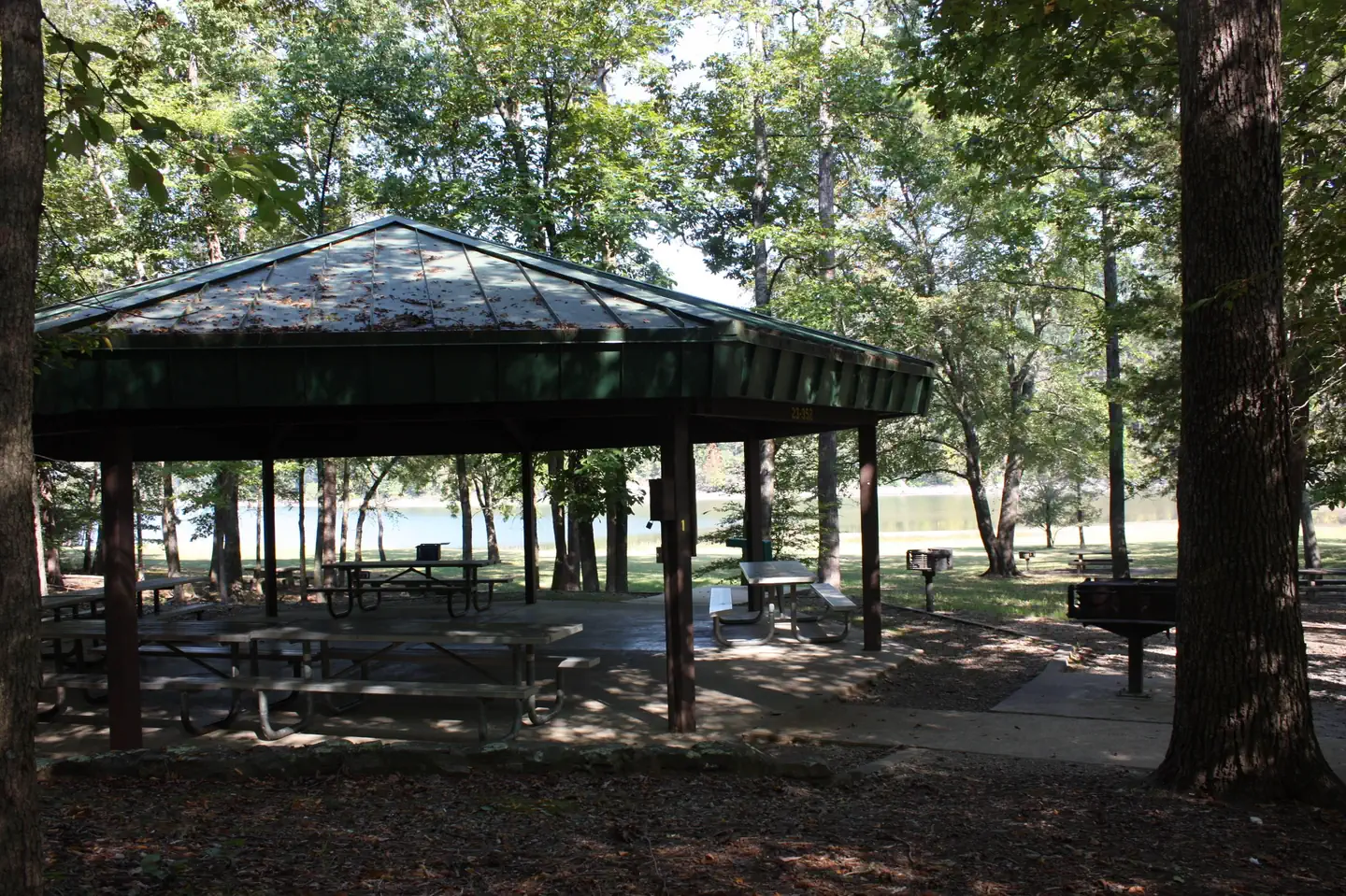
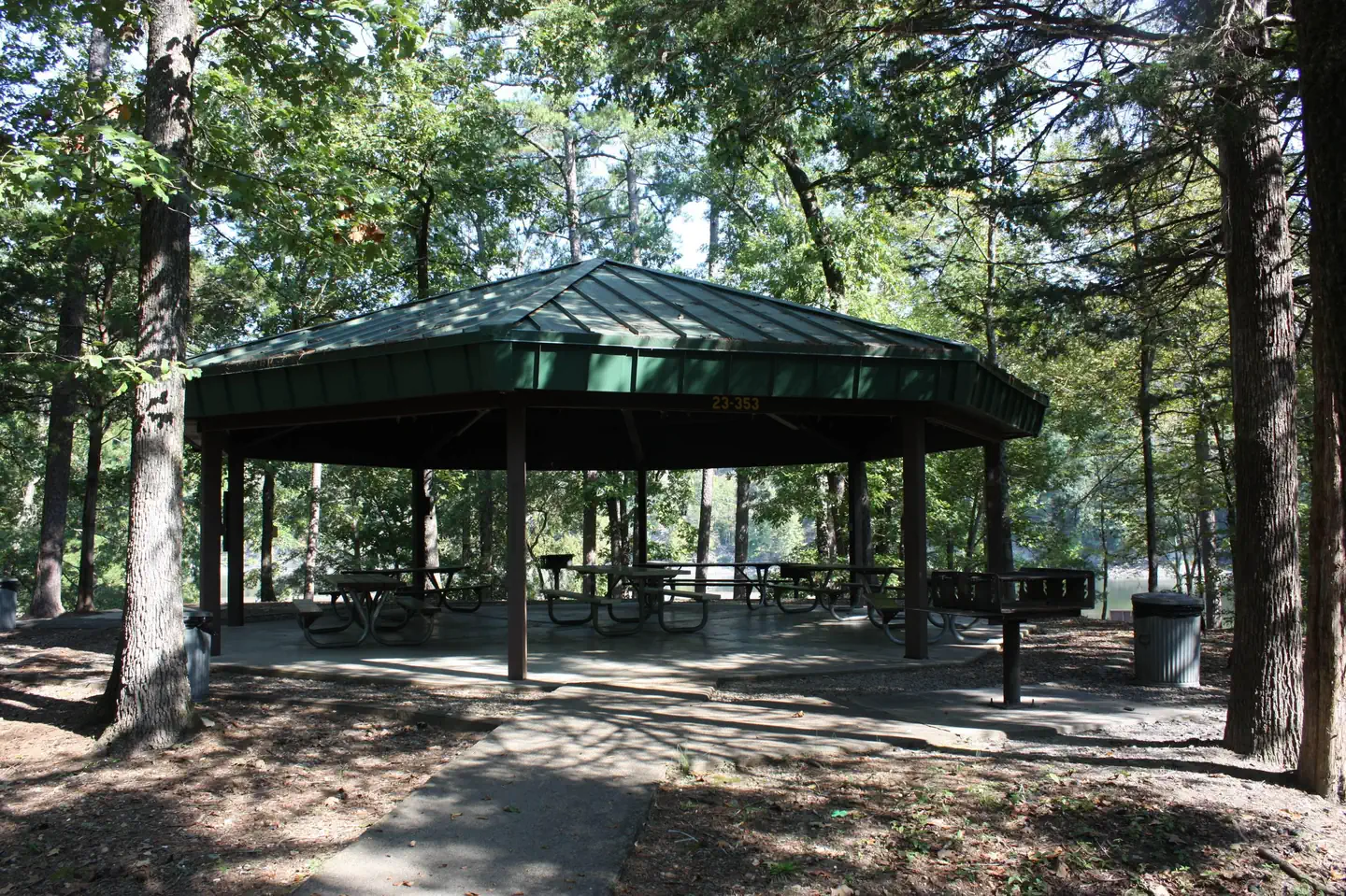
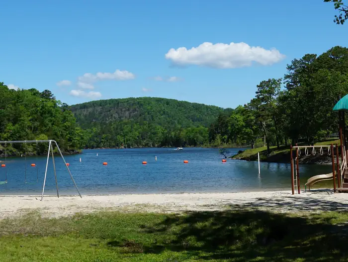
The campground consists of 63 sites with electric and water hookups. There is also a reservable group campsite that includes electrical and water hookups. The two group picnic shelters have electricity. Other amenities include a dump station, fish cleaning station, hot showers, boat ramp, playground and a swim beach.
Individual sites vary. Confirm on Recreation.gov or with the managing office.
Weather by month
Getting there
From Hot Springs, Arkansas, take US 270 west about 15.4 miles to North Crystal Springs Road. Turn right and follow access road three miles north to the park.
| Nearest town | Royal, Arkansas |
| Coordinates | 34.5425° N, 93.3544° W · Directions ↗ |
Supplies & services
| RV sales & service | Razorback Camper Sales, Inc. ↗ | 14.4 mi |
Locations © OpenStreetMap contributors. Call ahead; hours change seasonally.
Explore
Video
Retirement Travel | Crystal Springs Campground Tour | Lake Ouachita Camping Near Hot Sprin
Worth a stop
Part of the scenic 223-mile Ouachita National Recreation Trail runs just north of the lake. Here, hikers and mountain bikers can explore an array of breathtaking views in the Ouachita Mountains.
- 5.8 miBrady Mountain Resort And Marina ↗Boat launch
- 8 miEcho Canyon Resort And Marina ↗Boat launch
- 12.2 miHighway 27 Fishing Village ↗Fishing site
Trails nearby
- 0.2 miCharlton Trail4.2 mi trail
- 2.2 miPrayer of the Woods Trail0.7 mi trail
- 2.2 miHickory Nut Vista Trail1.6 mi trail
- 2.7 miHickory Nut Lakeside Trail1.7 mi trail
- 3.1 miClearfork Lake ↗0.6 mi trail
- 4 miLovit - Fire Tower Spur0.3 mi trail
Trail and trailhead records are the Forest Service's. Distances are straight-line to the nearer trail end. Trail conditions are not tracked here.
Public land it sits in
This campground sits inside Ouachita National Forest.
- inOuachita National Forest ↗National Forest · Forest Service · 2,724,422 acres
Each unit is published as a centre point and an acreage rather than a boundary, so this section stands it in for a circle of the same area. Whether a campground is inside, and how far it is from one it is outside, are both approximate.
Other campgrounds nearby

Historic landmarks nearby

Natural features
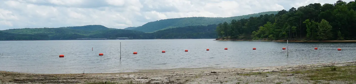
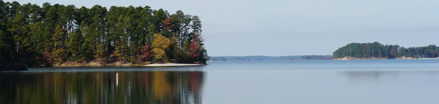
Lake Ouachita is nestled in the Ouachita Mountains just 10 miles west of Hot Springs National Park. The pool is fed by the cool waters of the Ouachita River and extends about 30 miles over 40,000 surface acres.
Recreation
Visitors enjoy fishing, water skiing, hiking and boating. Scuba diving is particularly popular because of the lake's high underwater visibility. Small and rare freshwater jellyfish (non-stinging) can be found, in addition to many types of fish, including the striped bass, lazily drifting between rocks. Bald eagles are a big attraction for bird watchers and photographers in winter months.
Guidebooks for Arkansas
We earn a small commission if you buy through these links. It does not change what we list.
Titles come from Open Library's catalog, matched by subject heading or by title.
Reference
Questions people ask
Do I need a reservation at Crystal Springs?
Sites at Crystal Springs are reservable on Recreation.gov. Any walk-up sites are listed on the booking page.
Source: Recreation.gov
What time is check-in at Crystal Springs?
Check-in 06:00 PM, checkout 04:00 PM.
Source: Recreation.gov
How many sites does Crystal Springs have?
75 sites, including 59 standard sites with power, 4 tent only electric, and 1 group standard electric.
Source: Recreation.gov
Will my RV fit at Crystal Springs?
The longest site here provides 20 feet of vehicle capacity. Most sites are shorter. The sidebar tool checks a trailer or motorhome length against every site.
Source: Will my RV fit
Does Crystal Springs have hookups?
Yes, electric, water, and sewer hookups at some sites.
Source: Recreation.gov
Are there showers or a dump station at Crystal Springs?
Other amenities include a dump station, fish cleaning station, hot showers, boat ramp, playground and a swim beach.
Source: Recreation.gov
Are pets allowed at Crystal Springs?
Yes, pets are allowed at Crystal Springs. Leash rules apply.
Source: Recreation.gov
Can I have a campfire at Crystal Springs?
Fires are allowed in the provided rings under normal conditions.
Source: Recreation.gov
Are there accessible sites at Crystal Springs?
Sites 22, 73, PAV 1, and PAV 2 are listed accessible on Recreation.gov. What that covers (a paved pad, an accessible table, a nearby accessible restroom) is on each site's booking page.
Source: Recreation.gov
Is there cell service at Crystal Springs?
FCC coverage maps show AT&T 4G LTE and T-Mobile 4G LTE at the campground point. Terrain changes that from one site to the next.
Source: FCC Broadband Map
What is there to do at Crystal Springs?
Visitors enjoy fishing, water skiing, hiking and boating. The Recreation section on this page has the rest.
Source: Recreation
What is the nearest town to Crystal Springs?
Royal, Arkansas. Part of the scenic 223-mile Ouachita National Recreation Trail runs just north of the lake.
Source: Getting there