Kenck Cabin
Guests can stay at Kenck Cabin for a rustic getaway in the fresh mountain air. The cabin was built in 1924 by a traveling doctor who arrived in the area in 1904 and spent his entire career along the Rocky Mountain Front. In 2003 the property was donated to the Forest Service by the Kenck Family Trust, and it has since been listed on the National Register of Historic Places.
Check availability on Recreation.gov ↗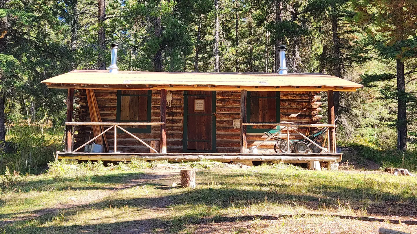
Site mix
| Cabins | 1 |
Site guide
1 site. Tap a filter to narrow the list; the map follows.
| Site | Shade | People / vehicles | Fires |
|---|---|---|---|
| KENCK CABIN | Partial | 6 / – | Yes |
Per-site records as published by the managing agency on Recreation.gov. Blank cells mean the agency listed nothing for that site. Check-in 2:00 PM, checkout 2:00 PM.
Amenities & rules
| Campfires | Allowed, subject to restrictions |
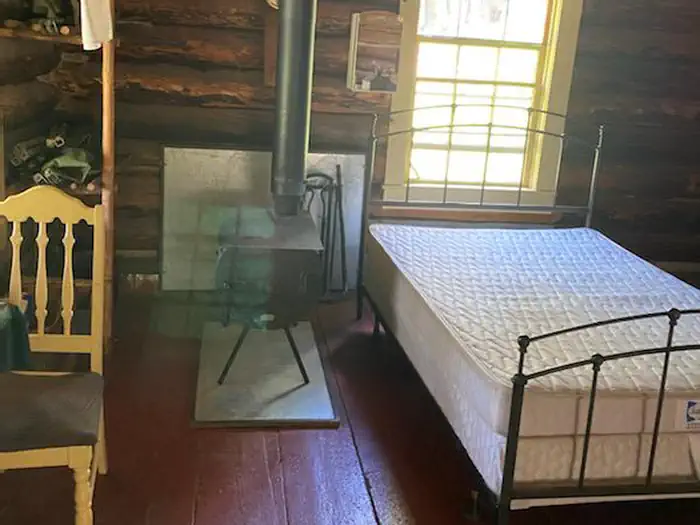
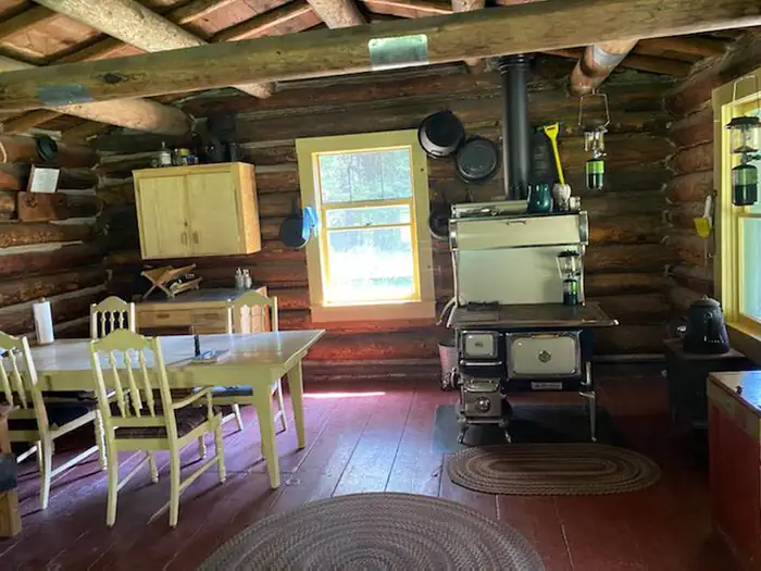
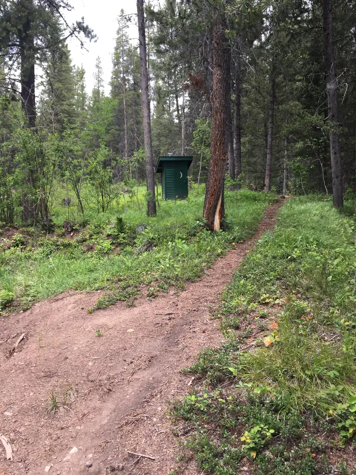
Kenck is comprised of one room that sleeps six on a double bed, a futon that turns into a double bed and two cots. Heating and cooking is from two wood stoves, and firewood is provided. Cooking utensils and dishes are also provided. The cabin has a replica of an old monarch stove and classic wood dining chairs. No water is available. Renters should bring their own drinking water or be prepared to filter or boil stream water. A bucket and shovel is provided. An outhouse is available directly behind the cabin. Items to bring include trash bags, coolers, food, toilet paper, bedding, flashlights, small propane cylinders for the lanterns.)
Individual sites vary. Confirm on Recreation.gov or with the managing office.
Weather by month
Getting there
From Augusta, head west Laura Street, which becomes Benchmark Road. Travel 13 miles to a "Y" intersection and turn left continuing on Benchmark Road. Drive 15 miles to the end of the road at South Fork Trailhead. Take the main trail that runs in front of the outhouse.
| Nearest town | Choteau, Montana |
| Coordinates | 47.5061° N, 112.8911° W · Directions ↗ |
Fire nearby
- PrescribedGlade Creek Piles Rx
1 mi from the campground · 1 acres
- PrescribedRx D6 Horseshoe West Unit 23
34 mi from the campground
- PrescribedRx D6 Horseshoe West Unit 37
35 mi from the campground
- PrescribedRx D6 Horseshoe West Unit 20
35 mi from the campground
Distance is to the reported incident point, not the fire edge. Call the managing office before you drive.
Explore
Worth a stop
The nearest town with conveniences is Augusta. The distance is about 30 miles, but due to rough, winding gravel roads, travel time can take an hour and a half to two hours.
- 0.5 miSouth Fork Sun Trailhead ↗Trailhead
- 2.6 miRon Janikula Trailhead ↗Trailhead
Trails nearby
- under 0.1 miSouth Fork Sun Access0.3 mi trail · hiking, horse
- under 0.1 miSouth Fk Sun TH Connector0.8 mi trail · hiking, horse, bike, snowshoe and 1 more
- 0.2 miKencks Cabin0.6 mi trail · hiking, horse
- 0.2 miSouth Fork Sun Tieunder 0.1 mi trail · hiking, horse
- 0.4 miBenchmark Cabin Spur0.2 mi trail · hiking, horse, bike
- 0.4 miBenchmark Corral Spur0.3 mi trail · hiking, horse, bike
Trailheads within three miles
- 0.5 miSouth Fork Sun Trailhead ↗Helena-Lewis and Clark National Forest
- 2.6 miRon Janikula Trailhead ↗Helena-Lewis and Clark National Forest
Trail and trailhead records are the Forest Service's. Distances are straight-line to the nearer trail end. Trail conditions are not tracked here.
Public land it sits in
This campground sits inside Bob Marshall Wilderness, which overlaps Lolo National Forest.
- inBob Marshall Wilderness ↗Wilderness · Forest Service · 1,062,694 acres
- inLolo National Forest ↗National Forest · Forest Service · 2,625,457 acres
- 6.5 miScapegoat Wilderness ↗Wilderness · Forest Service · 259,756 acres
Each unit is published as a centre point and an acreage rather than a boundary, so this section stands it in for a circle of the same area. Whether a campground is inside, and how far it is from one it is outside, are both approximate.
Other campgrounds nearby



Natural features
Perched at an elevation of about 5,200 feet, the cabin sits near a series of flowing water, including Benchmark Creek, South Fork Sun River and Burned Creek. The surrounding area is a mixed conifer forest. The Helena-Lewis and Clark National Forest boasts 1,600 miles of streams and a mix of small natural and man-made lakes. Native wildlife includes grizzly and black bears, white-tailed deer, bald eagles, lynx, bighorn sheep and grey wolves.
Recreation
Guests can relax by the stream, watch for birds and hike the surrounding area. Photographers will particularly enjoy the views of Patrol Lookout found by the gate to the cabin.
Guidebooks for Montana
We earn a small commission if you buy through these links. It does not change what we list.

Titles come from Open Library's catalog, matched by subject heading or by title.
Reference
Questions people ask
Do I need a reservation at Kenck Cabin?
Sites at Kenck Cabin are reservable on Recreation.gov. Any walk-up sites are listed on the booking page.
Source: Recreation.gov
What time is check-in at Kenck Cabin?
Check-in 2:00 PM, checkout 2:00 PM.
Source: Recreation.gov
How many sites does Kenck Cabin have?
1 site, including 1 cabin.
Source: Recreation.gov
Can I have a campfire at Kenck Cabin?
Fires are allowed in the provided rings under normal conditions. As of 2026-10-16, there are 4 active fires within 50 miles, so check current restrictions before you light one.
Source: Fire nearby
What is there to do at Kenck Cabin?
Guests can relax by the stream, watch for birds and hike the surrounding area. The Recreation section on this page has the rest.
Source: Recreation
What is the nearest town to Kenck Cabin?
Choteau, Montana. The nearest town with conveniences is Augusta.
Source: Getting there
What if Kenck Cabin is full?
The nearest public campgrounds are South Fork Campground (0.4 mi), Benchmark Campground (1.5 mi), and Van Deriet Campground (2.4 mi, first-come).
Source: Campgrounds nearby