Molino
Visitors are drawn to Molino Campground for its group camping area, scenic mountain surroundings and hiking and mountain biking opportunities. While most other campgrounds in the Catalina Mountains are closed in winter, Molino Campground and its picnic area are open in late fall, winter and early spring. The pleasant winter weather at this elevation makes it a great time to visit. Molino Basin is conveniently located 5.5 miles from the base of Mt. Lemmon on the Catalina Highway, and about 10 miles northeast of Tucson.
More like this: reservable in Arizona · pets allowed in Arizona · group sites in Arizona
Check availability on Recreation.gov ↗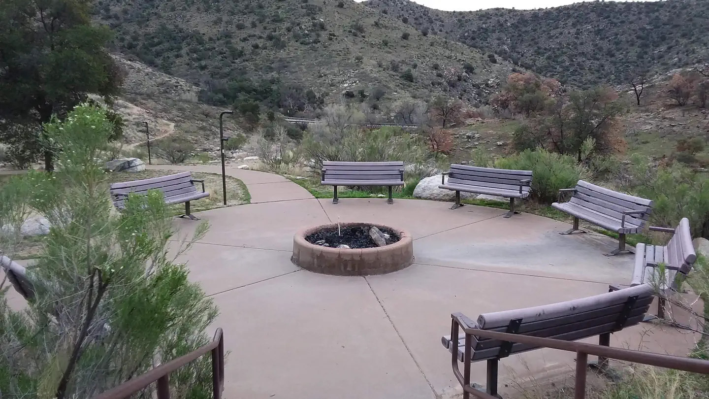
Site mix
| group standard area nonelectric | 1 |
Site guide
1 site. Tap a filter to narrow the list; the map follows.
| Site | Surface | People / vehicles | Fires | Accessible | Rating |
|---|---|---|---|---|---|
| Molino | Paved | 100 / 17 | Yes | Yes | Standard |
Per-site records as published by the managing agency on Recreation.gov. Blank cells mean the agency listed nothing for that site. Check-in 2:00 PM, checkout 1:00 PM.
Amenities & rules
| Max vehicle length | 22 ft |
| Pets | Allowed |
| Campfires | Allowed, subject to restrictions |
| Tent pads | Yes |
| Accessibility | Site Molino is listed accessible |
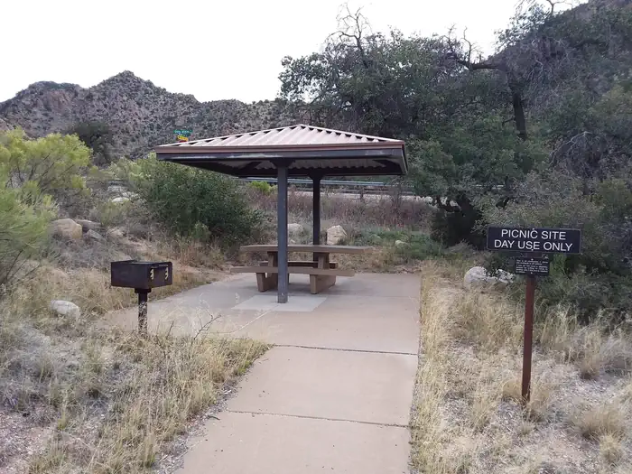
This facility has a few dozen individual campsites available on a first-come, first-served basis, along with a reservable group camping and picnic area. The group area is accessible with a paved walkway, and is equipped with a large picnic shelter covering several picnic tables, two serving tables, grills and food storage lockers for bear safety. Six cleared tent pads, as well as one accessible tent site, are adjacent to the picnic area. Most of the tent sites are open and sunny. RVs and trailers are permitted. Visitors must bring their own drinking water; none is provided.
Individual sites vary. Confirm on Recreation.gov or with the managing office.
Season & status
| Status | Open |
| Season | November to April |
| Forest | Coronado National Forest |
| Fees | Single site: $20. With Golden Age/Access or Interagency Senior/Access pass $10. Group site: $50 plus $10 per vehicle. Payable with cash or check. |
| Rules | No hookups. Trailers and RVs under 22’ permitted. No pack and saddle stock permitted in campground. The Sheep Management Area in nearby Pusch Ridge Wilderness is closed to dogs for the protection of desert bighorn sheep. Pets must be leashed at all times. Mountain bike access is generally east of the campground and not allowed in Wilderness. Limit of 2 vehicles and 10 persons per site. |
Weather by month
Getting there
From Tucson, Arizona, take Catalina Highway off Tanque Verde Road in Tucson. Drive 4.2 miles northeast to the Coronado National Forest boundary and continue 5.7 miles to the campground. The campground is between mileposts 5 and 6. All campsites are adjacent to paved roads.
| Nearest town | Tucson, Arizona |
| Coordinates | 32.3350° N, 110.6958° W · Directions ↗ |
Supplies & services
| Dump station | Dump station ↗ | 16 mi |
| Outdoor gear | REI ↗ | 16.6 mi |
| RV sales & service | RV sales & service ↗ | 17.3 mi |
Locations © OpenStreetMap contributors. Call ahead; hours change seasonally.
Explore
Worth a stop
Catalina Highway (also known as General Hitchcock Highway and Sky Island Scenic Byway), the only paved road that leads to the upper reaches of Mt. Lemmon and the Santa Catalina Range, is one of the most scenic highways in the Southwest and definitely worth a day trip. Other notable attractions include Saguaro National Park, Sabino Canyon, Colossal Cave and the city of Tucson.
- 11 mi
Trails nearby
- 0.3 miMolino Basin ↗2.4 mi trail · hiking, horse, bike · national_scenic_or_historic
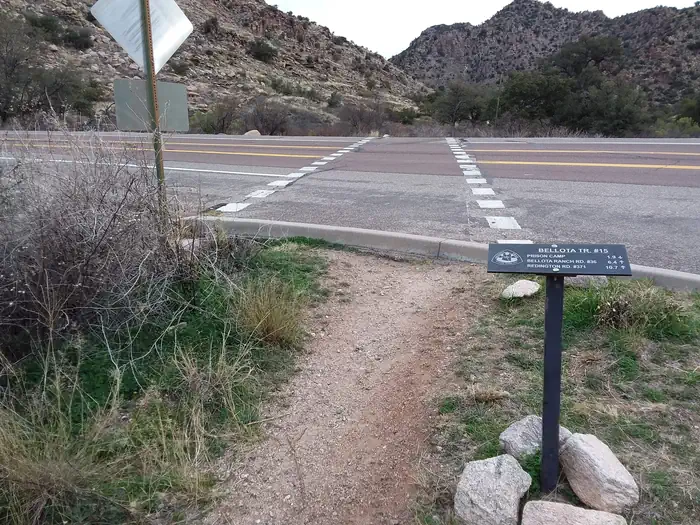
- 0.4 miBellota ↗10.5 mi trail · hiking, horse, bike · national_scenic_or_historic
- 0.5 miAviator0.4 mi trail · hiking, horse, bike
- 0.6 miMolino Vista ↗0.08 mi trail · hiking, horse, bike
- 1.2 miBabad Do'Ag2.5 mi trail · hiking, horse, bike
- 1.3 miBug Springs ↗4.7 mi trail · hiking, horse, bike
Trail and trailhead records are the Forest Service's. Distances are straight-line to the nearer trail end. Trail conditions are not tracked here.
Public land it sits in
Pusch Ridge Wilderness begins about 2.5 miles away, and it is the closest of these.
- 2.5 miPusch Ridge Wilderness ↗Wilderness · Forest Service · 56,973 acres
- 3.4 miSaguaro Wilderness ↗Wilderness · National Park Service · 70,905 acres
- 12.4 miRincon Mountain Wilderness ↗Wilderness · Forest Service · 36,949 acres
Each unit is published as a centre point and an acreage rather than a boundary, so this section stands it in for a circle of the same area. Whether a campground is inside, and how far it is from one it is outside, are both approximate.
Other campgrounds nearby


Cabin and lookout rentals nearby
On the National Register nearby
- Lowell Ranger StationBuilding · Tucson · 7.3 mi
- Charles S. Todd HouseBuilding · Tucson · 7.4 mi
- Lemmon Rock Lookout HouseBuilding · Tucson · 8.8 mi
Natural features
Campsites sit amid a high desert oak scrub ecosystem at an elevation of 4,500 feet on the slopes of the Santa Catalina Mountains. Along the banks of Molino Creek, which flows during and immediately after rain or snowmelt, species such as cottonwood, Arizona live oak and mesquite provide a scenic setting. Views are dominated by rugged, rocky hills. Colorful wildflowers bloom in spring.
Recreation
Hiking, mountain biking and horseback riding are popular activities. The Arizona Trail, which extends from Mexico to Utah, passes through the campground, and the Molino Trail leads to the Pusch Ridge Wilderness (hiking and horseback riding only). A variety of additional trails, including some on 9,157' Mt. Lemmon, are available in the area for those who wish to venture away from the campground for the day.
Guidebooks for Arizona
We earn a small commission if you buy through these links. It does not change what we list.
- Best Backpacking Trips in Utah, Arizona, and New MexicoMike White and Douglas Lorain, 2016Find at Bookshop.org
Titles come from Open Library's catalog, matched by subject heading or by title.
Reference
Questions people ask
Do I need a reservation at Molino?
Sites at Molino are reservable on Recreation.gov. Any walk-up sites are listed on the booking page.
Source: Recreation.gov
How much does it cost to camp at Molino?
Single site: $20. With Golden Age/Access or Interagency Senior/Access pass $10. Group site: $50 plus $10 per vehicle.
Source: Recreation.gov
What time is check-in at Molino?
Check-in 2:00 PM, checkout 1:00 PM.
Source: Recreation.gov
Is Molino open right now?
Open as of Oct 16, 2026. Season November to April.
Source: Forest Service status
How many sites does Molino have?
1 site, including 1 group standard area nonelectric.
Source: Recreation.gov
Will my RV fit at Molino?
The longest site here provides 22 feet of vehicle capacity. Most sites are shorter. The sidebar tool checks a trailer or motorhome length against every site.
Source: Will my RV fit
Are pets allowed at Molino?
Yes, pets are allowed at Molino. Leash rules apply.
Source: Recreation.gov
Can I have a campfire at Molino?
Fires are allowed in the provided rings under normal conditions. No hookups.
Source: Recreation.gov
Are there accessible sites at Molino?
Site Molino is listed accessible on Recreation.gov. What that covers (a paved pad, an accessible table, a nearby accessible restroom) is on each site's booking page.
Source: Recreation.gov
What is there to do at Molino?
Hiking, mountain biking and horseback riding are popular activities. The Recreation section on this page has the rest.
Source: Recreation
What is the nearest town to Molino?
Tucson, Arizona. Catalina Highway (also known as General Hitchcock Highway and Sky Island Scenic Byway), the only paved road that leads to the upper reaches of Mt.
Source: Getting there
What if Molino is full?
The nearest public campgrounds are Gordon Hirabayashi Campground (1.4 mi, first-come), General Hitchcock Campground (3 mi, first-come), and Rose Canyon (4.2 mi, partly first-come).
Source: Campgrounds nearby