Timber Butte Cabin
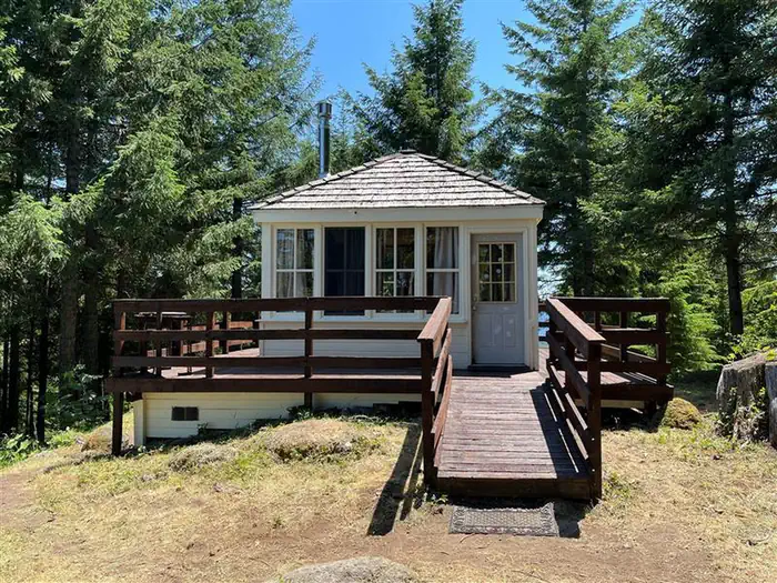
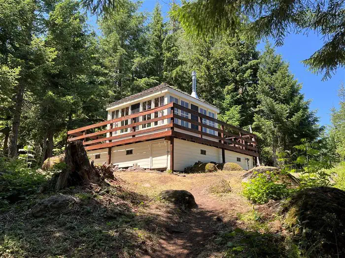
Timber Butte Lookout is located in the Fall Creek area of the Willamette National Forest at an elevation of 3,650 feet 19 miles from Lowell, Oregon. The cabin is open from mid-April through late October, offering the chance to enjoy beautiful scenery and a variety of recreational activities. The lookout was constructed in 2005 as a replica of the L-4 gabled-style lookout with wooden catwalk commonly built in this region in the 1930s. It was built through volunteer efforts with a $10,000 grant from Lane County and other contributions by individuals and organizations. The cabin can be accessed by car, but guests should expect to walk about 300 feet uphill from their parking spot.
Check availability on Recreation.gov ↗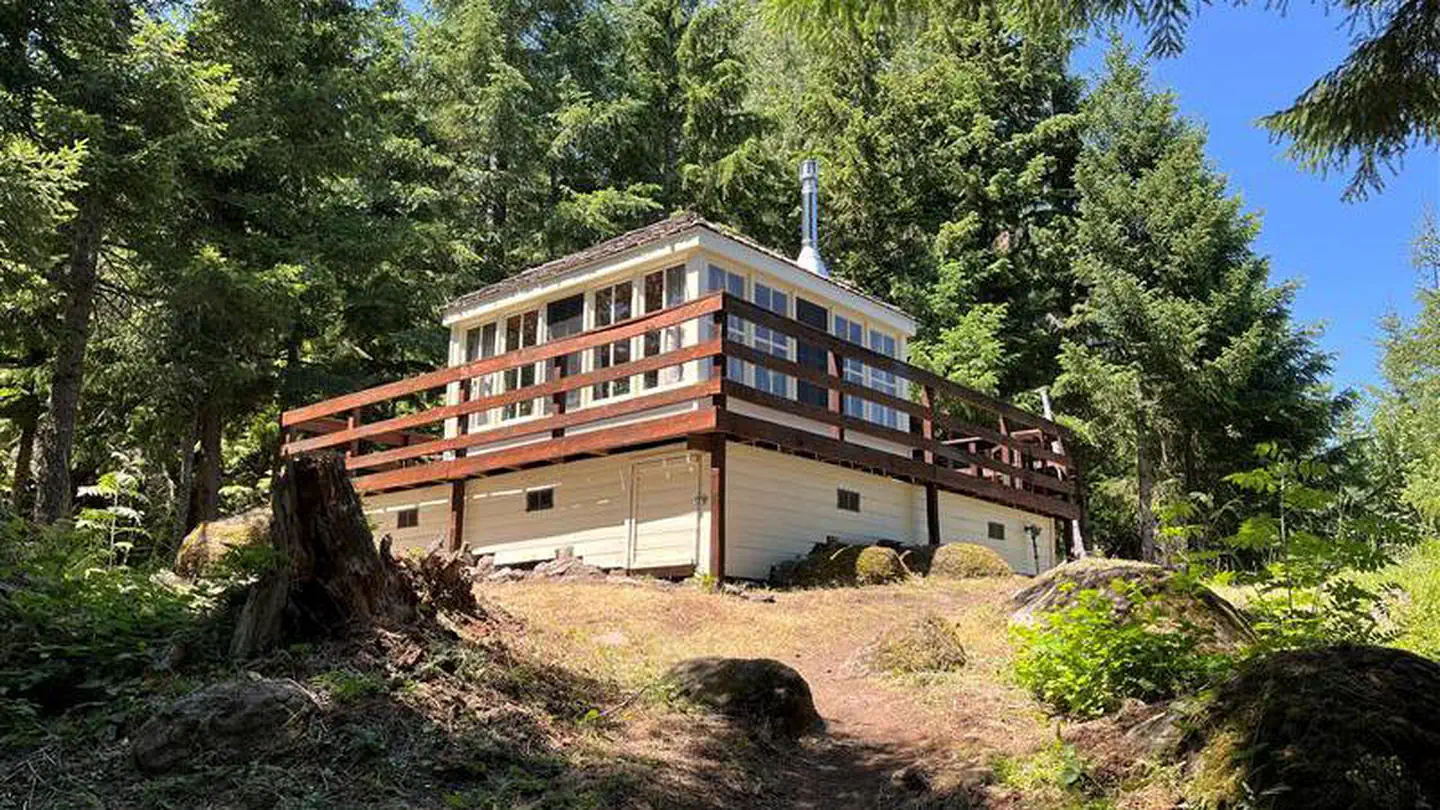
Site mix
| Cabins | 1 |
Site guide
1 site. Tap a filter to narrow the list; the map follows.
| Site | Surface | Shade | People / vehicles | Fires | Pets |
|---|---|---|---|---|---|
| Timber Butte Cabin | Gravel | None | 4 / 2 | Yes | No |
Per-site records as published by the managing agency on Recreation.gov. Blank cells mean the agency listed nothing for that site. Check-in 12:00 PM, checkout 11:00 AM.
Amenities & rules
| Max vehicle length | 24 ft |
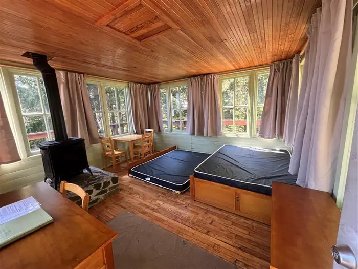
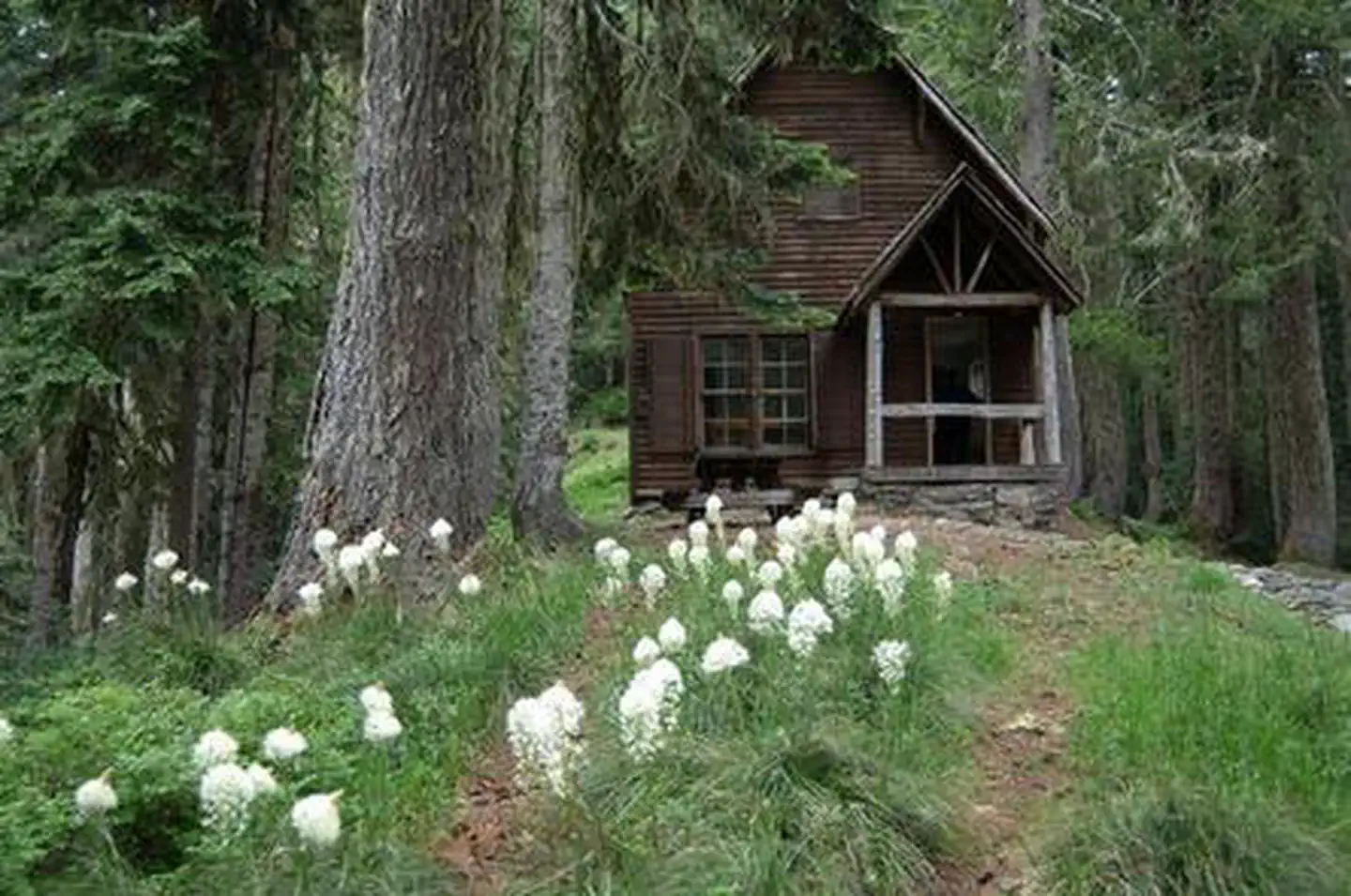
The 14x14-ft. cabin is encircled by a catwalk. It sits slightly off the ground and is accessed by a ramp. The cabin accommodates 4 people and contains a double bed with sleeping pad, a propane heating stove, fire extinguisher, broom and dustpan. A 3-burner propane cook top is located on the deck. Propane is provided. Dishes and cookware are available. A picnic table and fire ring are located in a nearby group of trees, and a vault toilet is located about 300 feet away. No drinking water or electricity is provided. Guests must bring their own supply of drinking water. Items such as bedding, lanterns or flashlights, matches, extra toilet paper, first aid supplies, trash bags, dish soap, towels and an ice chest are not available. Guests are expected to pack out their trash and clean the cabin before leaving.
Individual sites vary. Confirm on Recreation.gov or with the managing office.
Weather by month
Getting there
Do not use the Google map suggested routes as they will take you through areas with many rock/logging trucks on one lane roads. Total mileage from Lowell to Timber Butte Cabin is 19 miles and will be around a 45 minute drive time. From Interstate 5 (I-5), take Highway 58 East (Exit 188) and travel for 13 miles toward Oakridge.
| Nearest town | Westfir, Oregon |
| Coordinates | 43.9256° N, 122.5708° W · Directions ↗ |
Fire nearby
- PrescribedCamas Ts Rx
36 mi from the campground
- PrescribedRx Cold Springs
44 mi from the campground · 158 acres
Distance is to the reported incident point, not the fire edge. Call the managing office before you drive.
Supplies & services
| Dump station | The RV Store ↗ | 21 mi |
| RV sales & service | Oregon West RV ↗ | 21.9 mi |
| Outdoor gear | Cabela's ↗ | 25.7 mi |
Locations © OpenStreetMap contributors. Call ahead; hours change seasonally.
Explore
Worth a stop
Guests can explore up to 20 historic covered bridges in nearby Lane County by car. Within 10 miles there is creek access, fishing, swimming, and hiking.
- 3.3 miClark Creek Nature Trailhead ↗Trailhead
- 6.1 miEugene To Crest Trailhead #1 ↗Trailhead
Trails nearby
- 3.1 miSaddleblanket1.8 mi trail · hiking, horse, bike, motorcycle and 1 more
- 3.3 miClark Creek Nature Trail0.9 mi trail · hiking, bike
- 3.3 miClark/Fall Tie0.1 mi trail · hiking, horse, bike
- 3.3 miClark Butte2.1 mi trail · hiking, horse, bike
- 3.6 miFall Creek National Recreation ↗13.7 mi trail · hiking, horse, bike · national_recreation_or_other
- 3.7 miJones ↗5.8 mi trail · hiking, horse, bike
Trailheads within three miles
- 2.9 miStation Butte Trailhead ↗Willamette National Forest
Trail and trailhead records are the Forest Service's. Distances are straight-line to the nearer trail end. Trail conditions are not tracked here.
Public land it sits in
This campground sits inside Willamette National Forest.
- inWillamette National Forest ↗National Forest · Forest Service · 1,801,292 acres
Each unit is published as a centre point and an acreage rather than a boundary, so this section stands it in for a circle of the same area. Whether a campground is inside, and how far it is from one it is outside, are both approximate.
Other campgrounds nearby


Cabin and lookout rentals nearby
On the National Register nearby
- Unity BridgeStructure · Lowell · 10.3 mi
- Lowell BridgeStructure · Lowell · 10.4 mi
- Lowell GrangeBuilding · Lowell · 10.6 mi
Natural features
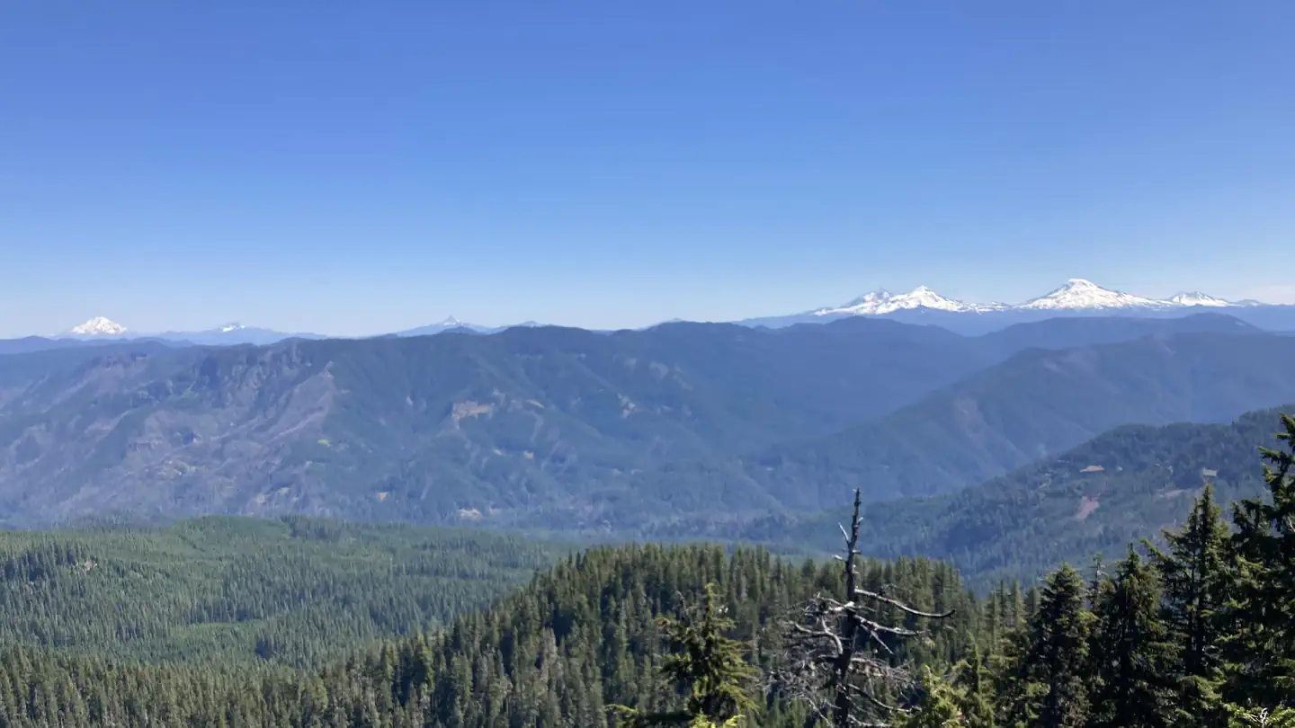
The lookout offers panoramic views of the Cascade Mountains and the surrounding evergreen forest. On clear days, guests may see Mount Jefferson and the peaks of the Three Sisters. Willamette National Forest offers prime habitat for such species as Roosevelt elk, black bear, bald eagles, black tail deer and bobcats, among other wildlife.
Recreation
The lookout is located near the Fall Creek Trail Area. Several hiking trails can be accessed from this area, including the Fall Creek National Recreation Trail, which also offers opportunities for fishing and picnicking. Swimming holes can also be found along this trail. Hunting is another popular activity in this area.
Guidebooks for Oregon
We earn a small commission if you buy through these links. It does not change what we list.

Titles come from Open Library's catalog, matched by subject heading or by title.
Reference
Questions people ask
Do I need a reservation at Timber Butte Cabin?
Sites at Timber Butte Cabin are reservable on Recreation.gov. Any walk-up sites are listed on the booking page.
Source: Recreation.gov
What time is check-in at Timber Butte Cabin?
Check-in 12:00 PM, checkout 11:00 AM.
Source: Recreation.gov
How many sites does Timber Butte Cabin have?
1 site, including 1 cabin.
Source: Recreation.gov
Will my RV fit at Timber Butte Cabin?
The longest site here provides 24 feet of vehicle capacity. Most sites are shorter. The sidebar tool checks a trailer or motorhome length against every site.
Source: Will my RV fit
Is there cell service at Timber Butte Cabin?
FCC coverage maps show AT&T 4G LTE at the campground point. Terrain changes that from one site to the next.
Source: FCC Broadband Map
What is there to do at Timber Butte Cabin?
The lookout is located near the Fall Creek Trail Area. The Recreation section on this page has the rest.
Source: Recreation
What is the nearest town to Timber Butte Cabin?
Westfir, Oregon. Guests can explore up to 20 historic covered bridges in nearby Lane County by car.
Source: Getting there
What if Timber Butte Cabin is full?
The nearest public campgrounds are Broken Bowl (3.2 mi), Clark Creek Organization Camp (3.4 mi), and Dolly Varden (3.5 mi).
Source: Campgrounds nearby