Rancheria
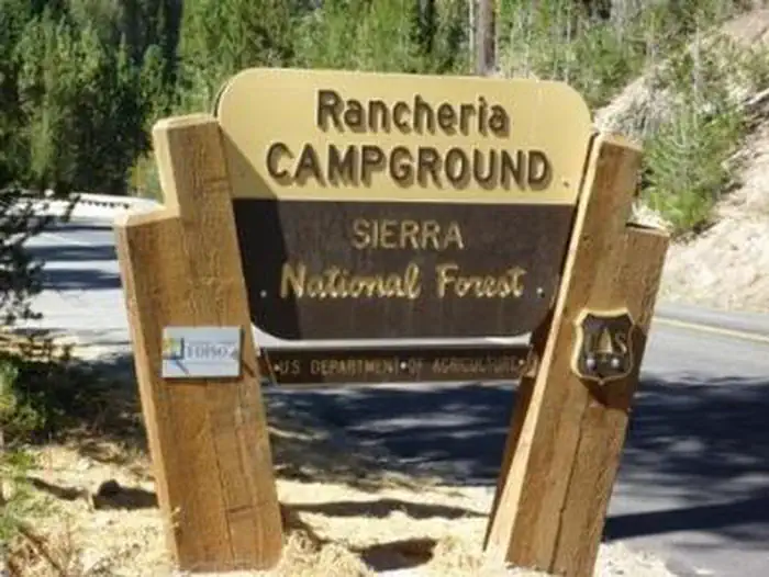
Rancheria Campground is located on the shores of Huntington Lake near the Kaiser Wilderness. The campsites sit under a dense canopy of fir and pine, and some tent-only sites are right on the shore and allow for informal mooring of boats. The campground's location makes it possible to discover all the activities and attractions at Huntington Lake, and it's an excellent base for further exploration of the Kaiser Wilderness.
More like this: electric hookups in California · reservable in California · big rigs in California · pets allowed in California · group sites in California
Check availability on Recreation.gov ↗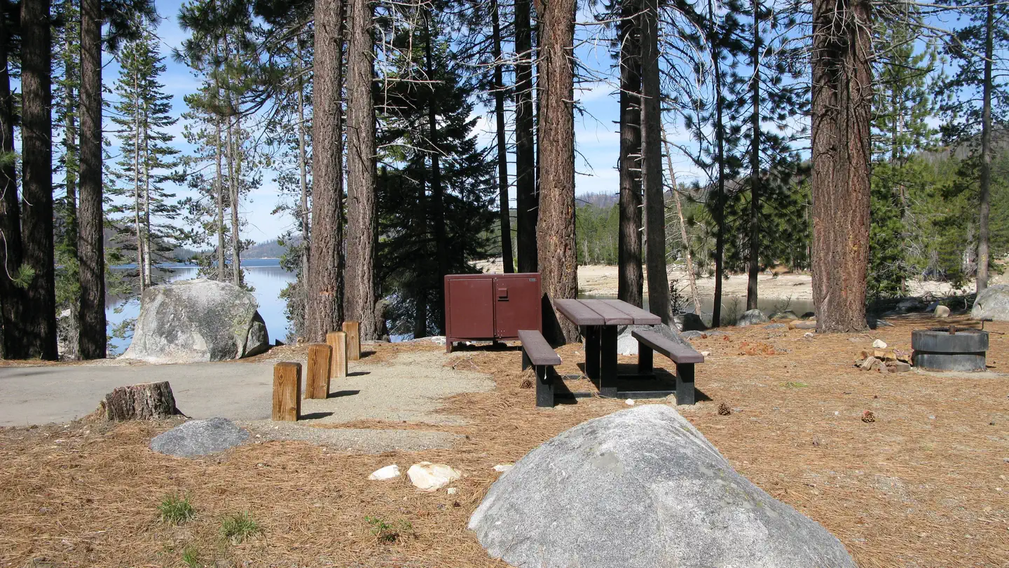
Site mix
| Standard, no hookups | 64 |
| Tent-only | 60 |
| group standard electric | 3 |
| Host/management | 1 |
Site guide
Will my RV fit
The longest site here provides 71 feet of vehicle capacity. Most sites are shorter.
127 sites. Tap a filter to narrow the list; the map follows.
| Site | Type | Entry | Fits, ft | Surface | Shade | Power | Waterfront | People / vehicles | Fires | Accessible |
|---|---|---|---|---|---|---|---|---|---|---|
| 001 | Standard | Back-in | 40 | Paved | Partial | No | 6 / 2 | Yes | ||
| 002 | Standard | Back-in | 38 | Paved | Partial | No | 6 / 2 | Yes | ||
| 003 | Tent only | Back-in | 20 | Paved | Partial | No | 6 / 2 | Yes | ||
| 004 | Standard | Back-in | 40 | Paved | Full | No | 6 / 2 | Yes | ||
| 005 | Standard | Back-in | 58 | Paved | Partial | No | 6 / 2 | Yes | ||
| 006 | Tent only | Back-in | 24 | Paved | Full | No | 6 / 2 | Yes | Yes | |
| 007 | Standard | Back-in | 40 | Paved | Full | No | 6 / 2 | Yes | ||
| 008 | Standard | Back-in | 51 | Paved | Full | No | 6 / 2 | Yes | ||
| 009 | Standard | Back-in | 26 | Paved | Full | No | 6 / 2 | Yes | Yes | |
| 010 | Standard | Back-in | 36 | Paved | Full | No | 6 / 2 | Yes |
Per-site records as published by the managing agency on Recreation.gov. Blank cells mean the agency listed nothing for that site. Check-in 2:00 PM, checkout 12:00 PM.
Amenities & rules
| Hookups | Electric, water |
| Max vehicle length | 71 ft |
| Equipment | RVs & trailers, Tents |
| Pets | Allowed |
| Campfires | Allowed, subject to restrictions |
| Accessibility | Sites 006, 009, 015, 029 and 18 more are listed accessible |
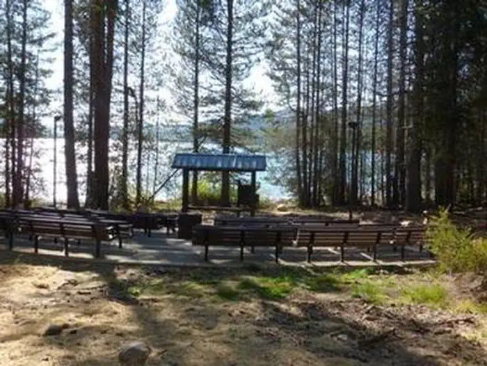
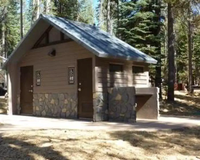
This large campground has several walk-to tent sites; the rest are standard and can accommodate RVs up to 40 feet. Each site has a dirt parking spur, picnic table, campfire ring and grill. A pay phone, drinking water and accessible flush and vault restrooms are provided. An on-site amphitheater is used to host campfire programs on summer weekends. A museum sits next to the campground, offering history of the area, its early Native American inhabitants and the Forest Service.
Individual sites vary. Confirm on Recreation.gov or with the managing office.
Season & status
| Status | Closed for the season. Forest Service sites close for the season; check the official page for the reopening date. |
| Season | June to October |
| Forest | Sierra National Forest |
| Booking | Reservations through the National Recreation Reservation Service (NRRS) @ 1-877-444-6777 or www.recreation.gov. Reservations can be made up to 3 days prior to arrival. |
| Fees | $44.00 per night, Standard Nonelectric, Holidays/$2.00 additional/night. $87.00 per night, Standard Nonelectric Double, Holidays/$4.00 additional/night. $112.00 Group site, Holidays $2.00 additional/night. $44.00 per night, Tent Only Nonelectric, Holidays/$2.00 additional/night. |
| Rules | Maximum length of stay = 14 days Maximum vehicle length = 40' Maximum group size = 6 per site 2 night minimum on weekends. 3 night minimum on holidays. Check in at California Land Management office (east end of Huntington Lake). |
Weather by month
Getting there
From Clovis, take Highway 168 north 70 miles to Huntington Lake Campground office at Eastwood. Check in at office prior to setting up camp.
| Coordinates | 37.2537° N, 119.1604° W · Directions ↗ |
Charges and cancellations
Any location or activity requiring a permit or lottery will have unique requirements and policies. Please check individual facility pages for pertinent information for those sites. Booking Window For most locations, you can reserve six months in advance of your stay for individual sites and 12 months in advance for group sites. There are some exceptions, so it is best to check with each facility. Change and Cancellation Policies and Fees Overnight and Day Use Facilities: To ensure fairness, reservation arrival or departure dates may not be changed beyond the booking window until 18 days after booking the reservation. Camping / Day Use: A $10.00 service fee will apply if you change or cancel your reservation (including campsites, cabins, lookouts, group facilities, etc.).
Fire nearby
- WildfireDome
33 mi from the campground · 6,788 acres · 95% contained
- PrescribedGrant Grove Rx Spring
36 mi from the campground · 15 acres
- PrescribedGrant Grove Fall Rx
36 mi from the campground
- WildfireLand
42 mi from the campground · 20 acres
Distance is to the reported incident point, not the fire edge. Call the managing office before you drive.
Supplies & services
| Dump station | Dump station ↗ | 12.3 mi |
| Outdoor gear | Captain Jack's Tackle ↗ | 13.4 mi |
Locations © OpenStreetMap contributors. Call ahead; hours change seasonally.
Explore
Video
Rancheria Campground | Sierra National Forest | Huntington Lake | Site by Site Exploration
Worth a stop
The 84-mile Sierra Vista Scenic Byway (Highway 168) makes a great day trip from the Huntington Lake area.
- 0.7 miHuntington Boat Ramp & Launching Site ↗Boat launch
- 1 miPotter Pass Trailhead ↗Trailhead
- 1.1 miBear Cove Picnic Site ↗Day use
- 1.2 miPotter Cutoff Trailhead ↗Trailhead
- 3.7 miBilly Creek Picnic Area ↗Day use
Trails nearby
- under 0.1 miRancheria0.8 mi trail · snowshoe, ski
- 0.1 miHuntintgon ↗8.3 mi trail · snowmobile, snowshoe, ski
- 0.1 miKaiser Pass ↗16 mi trail · snowmobile, snowshoe, ski
- 0.4 miChina Peak1.7 mi trail · snowmobile, snowshoe, ski
- 0.5 miBear Butte ↗6.1 mi trail · snowmobile, snowshoe, ski
- 0.7 miRancheria Falls NRT ↗0.8 mi trail · hiking, horse, bike · national_recreation_or_other
Trailheads within three miles
- 1 miPotter Pass Trailhead ↗Sierra National Forest
- 1.2 miPotter Cutoff Trailhead ↗Sierra National Forest
- 2.5 miBadger Flat Trailhead ↗Sierra National Forest
Trail and trailhead records are the Forest Service's. Distances are straight-line to the nearer trail end. Trail conditions are not tracked here.
Public land it sits in
This campground sits inside Kaiser Wilderness, which overlaps Sierra National Forest.
- inKaiser Wilderness ↗Wilderness · Forest Service · 21,986 acres
- inSierra National Forest ↗National Forest · Forest Service · 1,418,790 acres
- 5 miDinkey Lakes Wilderness ↗Wilderness · Forest Service · 30,863 acres
Each unit is published as a centre point and an acreage rather than a boundary, so this section stands it in for a circle of the same area. Whether a campground is inside, and how far it is from one it is outside, are both approximate.
Other campgrounds nearby
On the National Register nearby
- Dinkey Creek BridgeStructure · Dinkey Creek · 12.9 mi
Natural features
The Sierra National Forest, located on the western slope of the central Sierra Nevada, is known for its spectacular mountain scenery and abundant natural resources. The terrain includes rolling, oak-covered foothills, heavily forested middle elevation slopes and the starkly beautiful alpine landscape of the High Sierra.
Recreation
Many hiking trails are in the area, including Rancheria Falls (1 mile), Indian Pools (1 mile) and Black Point (.7 miles). Hikers and horseback riders can access the 12-mile Kaiser Loop Trail, which connects to a network of trails within the Kaiser Wilderness. Huntington Lake offers swimming, sailing, boating, canoeing, kayaking, fishing and water skiing. Additionally, California Land Management sponsors a variety of interpretive programs and nature walks throughout the summer at several locations in the area.
Guidebooks for California
We earn a small commission if you buy through these links. It does not change what we list.

Titles come from Open Library's catalog, matched by subject heading or by title.
Reference
Questions people ask
Do I need a reservation at Rancheria?
Sites at Rancheria are reservable on Recreation.gov. Reservations through the National Recreation Reservation Service (NRRS) @ 1-877-444-6777 or www.recreation.gov. Any walk-up sites are listed on the booking page.
Source: Recreation.gov
How much does it cost to camp at Rancheria?
$44.00 per night, Standard Nonelectric, Holidays/$2.00 additional/night. $87.00 per night, Standard Nonelectric Double, Holidays/$4.00 additional/night. $112.00 Group site, Holidays $2.00 additional/night.
Source: Recreation.gov
What time is check-in at Rancheria?
Check-in 2:00 PM, checkout 12:00 PM.
Source: Recreation.gov
What does it cost to cancel a reservation at Rancheria?
Camping / Day Use: A $10.00 service fee will apply if you change or cancel your reservation (including campsites, cabins, lookouts, group facilities, etc.).
Source: Charges and cancellations
Is Rancheria open right now?
Closed for the season as of Oct 16, 2026. Season June to October.
Source: Forest Service status
How many sites does Rancheria have?
128 sites, including 64 standard sites without power, 60 tent-only sites, and 3 group standard electric.
Source: Recreation.gov
Will my RV fit at Rancheria?
The longest site here provides 71 feet of vehicle capacity. Most sites are shorter. The sidebar tool checks a trailer or motorhome length against every site.
Source: Will my RV fit
Does Rancheria have hookups?
Yes, electric and water hookups at some sites.
Source: Recreation.gov
Are pets allowed at Rancheria?
Yes, pets are allowed at Rancheria. Leash rules apply.
Source: Recreation.gov
Can I have a campfire at Rancheria?
Fires are allowed in the provided rings under normal conditions. As of 2026-10-16, there are 4 active fires within 50 miles, so check current restrictions before you light one. Maximum length of stay = 14 days Maximum vehicle length = 40' Maximum group size = 6 per site 2 night minimum on weekends.
Source: Fire nearby
Are there accessible sites at Rancheria?
Sites 006, 009, 015, and 029 are listed accessible on Recreation.gov, 22 sites in all. What that covers (a paved pad, an accessible table, a nearby accessible restroom) is on each site's booking page.
Source: Recreation.gov
Is there cell service at Rancheria?
FCC coverage maps show Verizon 5G and AT&T 4G LTE at the campground point. Terrain changes that from one site to the next.
Source: FCC Broadband Map