Quarry Cove
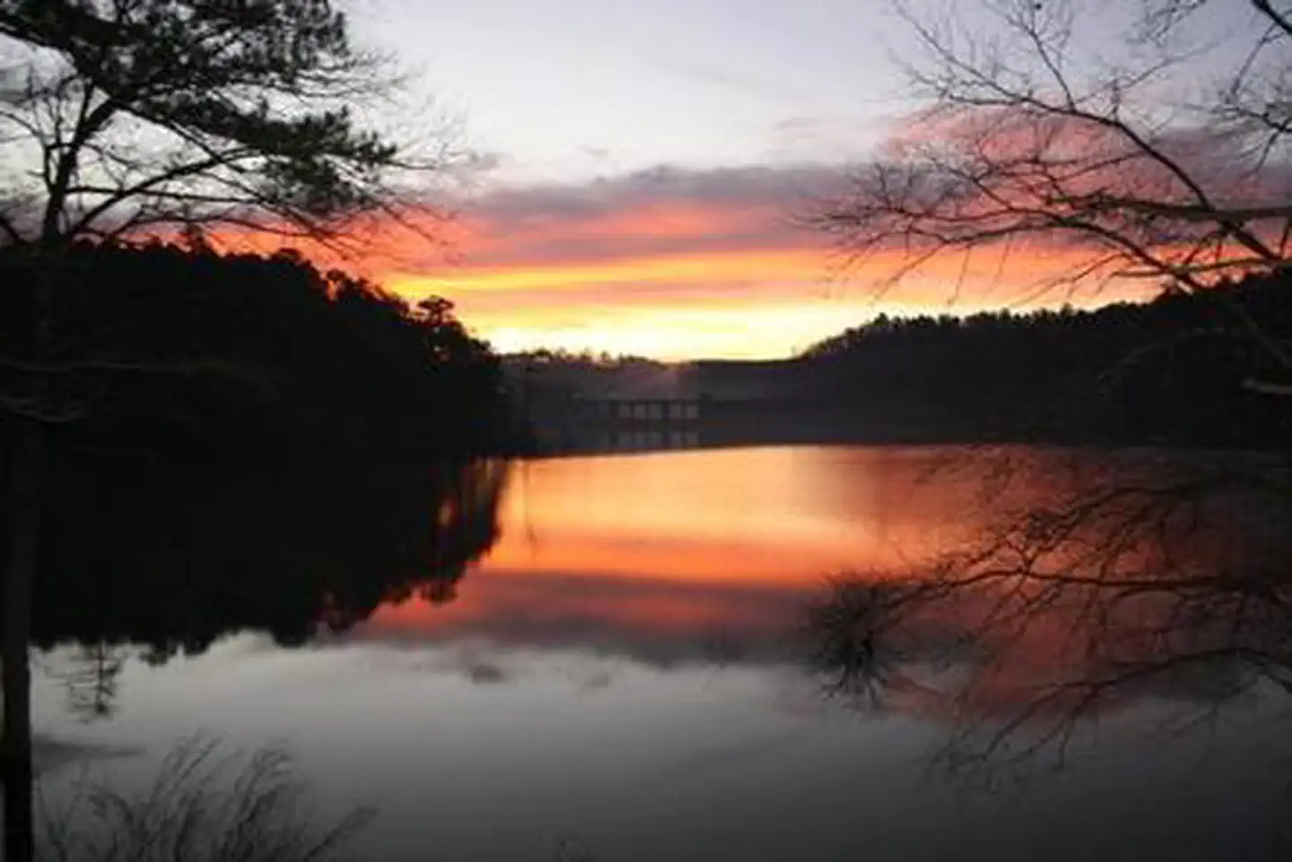
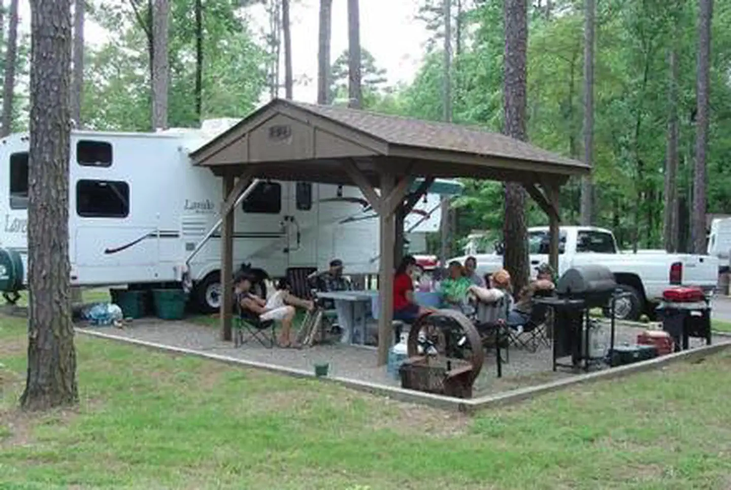
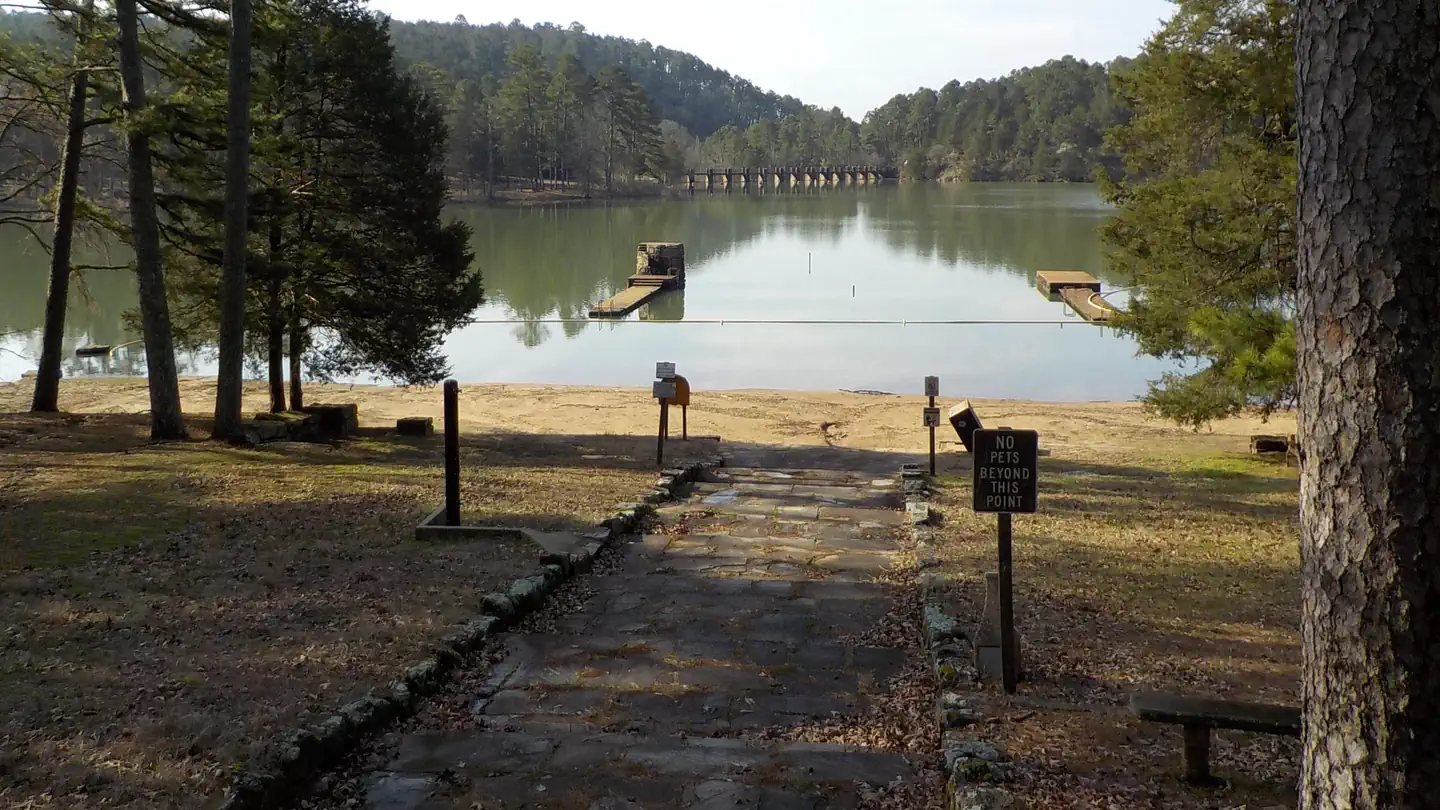
Quarry Cove Campground sits along the shores of Nimrod Lake and Dam, cradled between Arkansas' Ouachita and Ozark Mountains. Visitors are greeted with shaded campsites, beautiful scenery and many outdoor recreation opportunities. Nimrod Lake provides the ideal spot to get away from it all, relax and enjoy yourself.
More like this: electric hookups in Arkansas · reservable in Arkansas · big rigs in Arkansas · pets allowed in Arkansas · group sites in Arkansas
Check availability on Recreation.gov ↗
Site mix
| Standard with electric | 30 |
| group shelter electric | 1 |
| Host/management | 1 |
Site guide
Will my RV fit
The longest site here provides 70 feet of vehicle capacity. Most sites are shorter.
31 sites. Tap a filter to narrow the list; the map follows.
| Site | Type | Entry | Fits, ft | Surface | Shade | Power | Water / sewer | People / vehicles | Fires |
|---|---|---|---|---|---|---|---|---|---|
| 01 | Electric | Back-in | 42 | Paved | Partial | 30 amp | Yes / – | 8 / 1 | Yes |
| 02 | Electric | Back-in | 44 | Paved | Partial | 30 amp | Yes / – | 8 / 1 | Yes |
| 03 | Electric | Back-in | 41 | Paved | Partial | 50 amp | Yes / – | 8 / 1 | Yes |
| 04 | Electric | Back-in | 45 | Paved | Partial | 50 amp | Yes / – | 8 / 2 | Yes |
| 05 | Electric | Back-in | 60 | Paved | None | 30 amp | Yes / – | 16 / 4 | Yes |
| 06 | Electric | Back-in | 48 | Paved | Partial | 30 amp | Yes / – | 8 / 1 | Yes |
| 07 | Electric | Back-in | 38 | Paved | Partial | 30 amp | Yes / – | 8 / 1 | Yes |
| 08 | Electric | Back-in | 36 | Paved | Partial | 30 amp | Yes / – | 8 / 1 | Yes |
| 09 | Electric | Pull-through | 45 | Paved | Partial | 30 amp | Yes / – | 8 / 2 | Yes |
| 10 | Electric | Back-in | 68 | Paved | Partial | 30 amp | Yes / – | 8 / 2 | Yes |
Per-site records as published by the managing agency on Recreation.gov. Blank cells mean the agency listed nothing for that site. Check-in 3:00 PM, checkout 1:00 PM.
Amenities & rules
| Hookups | Electric, water |
| Max vehicle length | 80 ft |
| Equipment | RVs & trailers, Tents |
| Pets | Allowed |
| Campfires | Allowed, subject to restrictions |
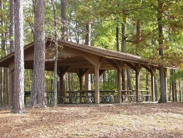
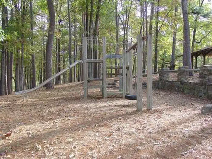
With 31 spacious and modern campsites and one large day use group picnic shelter, Quarry Cove Campground has plenty of room for the family. A swimming beach, boat ramp and playground are also provided.
Individual sites vary. Confirm on Recreation.gov or with the managing office.
Weather by month
Getting there
From Ola, Arkansas, take Route 7 south for 9 miles. Turn west onto US-60, and continue for.5 miles and follow signs into campground.
| Nearest town | Plainview, Arkansas |
| Coordinates | 34.9591° N, 93.1650° W · Directions ↗ |
Supplies & services
| Dump station | Dump station ↗ | 19.6 mi |
| Outdoor gear | American Outdoor Sports ↗ | 21.9 mi |
| RV sales & service | Razorback Camper Sales, Inc. ↗ | 32.4 mi |
Locations © OpenStreetMap contributors. Call ahead; hours change seasonally.
Explore
Video
Quarry Cove Corps of Engineer Campground/Nimrod Lake/Central Arkansas
Public land it sits in
Flatside Wilderness begins about 11.1 miles away, and it is the closest of these.
- 11.1 miFlatside Wilderness ↗Wilderness · Forest Service · 10,180 acres
- 12 miOuachita National Forest ↗National Forest · Forest Service · 2,724,422 acres
- 12.1 miHolla Bend National Wildlife Refuge ↗National Wildlife Refuge · Fish and Wildlife Service · 6,012 acres
Each unit is published as a centre point and an acreage rather than a boundary, so this section stands it in for a circle of the same area. Whether a campground is inside, and how far it is from one it is outside, are both approximate.
Other campgrounds nearby
On the National Register nearby
- Fourche LaFave River BridgeStructure · Nimrod · 0.9 mi
- Wallace BridgeStructure · Nimrod · 6.4 mi
- Hollis Country StoreBuilding · Hollis · 6.6 mi
Natural features
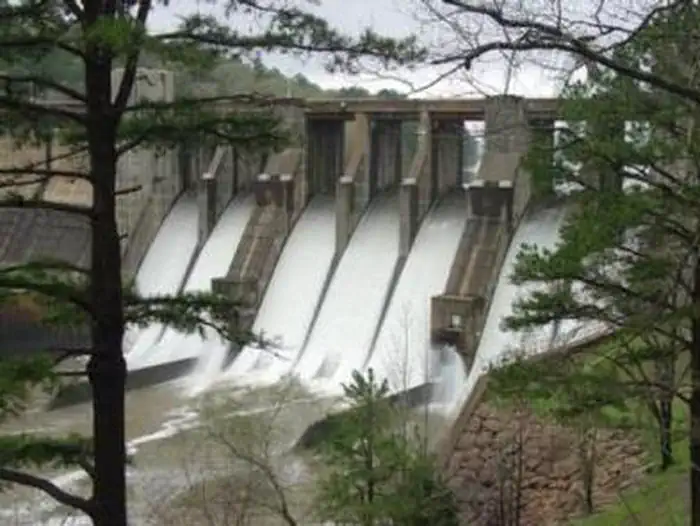
Nimrod Dam was completed in 1942 as part of a comprehensive plan for flood control and development of water resources in the Fourche LaFave River. Although recreation was not part of the initial mission of the dam project, the lake and surrounding 21,000 acres of pristine land have now become a recreational oasis for outdoor enthusiasts.
Recreation
Fishing is one of the most popular activities at the lake, with an abundance of catfish, bluegill, bass and crappie available. Boating, water skiing and tubing are also popular, with 11 boat ramps conveniently located around the lake, however, skiing and tubing are only allowed from the tip of Carden Point eastward toward the dam because areas west of there are too hazardous. Campers are likely to spot white-tailed deer, eastern wild turkey, bobwhite quail, squirrel, rabbit, fox, mink, black bear, dove and waterfowl in the area. Seasonal hunting is also permitted throughout the lake, except in or near recreation areas.
Nearby
Nimrod Lake is conveniently located adjacent to State Highway 7, a National Scenic Byway and other nearby points of interest like Petit Jean State Park, Mount Nebo State Park and Hot Springs National Park.
Guidebooks for Arkansas
We earn a small commission if you buy through these links. It does not change what we list.
Titles come from Open Library's catalog, matched by subject heading or by title.
Reference
Questions people ask
Do I need a reservation at Quarry Cove?
Sites at Quarry Cove are reservable on Recreation.gov. Any walk-up sites are listed on the booking page.
Source: Recreation.gov
What time is check-in at Quarry Cove?
Check-in 3:00 PM, checkout 1:00 PM.
Source: Recreation.gov
How many sites does Quarry Cove have?
32 sites, including 30 standard sites with power and 1 group shelter electric.
Source: Recreation.gov
Will my RV fit at Quarry Cove?
Recreation.gov lists no practical vehicle capacity limit for the largest site here, which usually means pull-through or open parking. The sidebar tool checks a trailer or motorhome length against every site.
Source: Will my RV fit
Does Quarry Cove have hookups?
Yes, electric and water hookups at some sites.
Source: Recreation.gov
Are pets allowed at Quarry Cove?
Yes, pets are allowed at Quarry Cove. Leash rules apply.
Source: Recreation.gov
Can I have a campfire at Quarry Cove?
Fires are allowed in the provided rings under normal conditions.
Source: Recreation.gov
What is there to do at Quarry Cove?
Fishing is one of the most popular activities at the lake, with an abundance of catfish, bluegill, bass and crappie available. The Recreation section on this page has the rest.
Source: Recreation
What is the nearest town to Quarry Cove?
Plainview, Arkansas. Nimrod Lake is conveniently located adjacent to State Highway 7, a National Scenic Byway and other nearby points of interest like Petit Jean State Park, Mount Nebo State Park and Hot Springs National Park.
Source: Getting there
What if Quarry Cove is full?
The nearest public campgrounds are River Road (0.8 mi), Carter Cove (4.2 mi), and Sunlight Bay (7.9 mi).
Source: Campgrounds nearby