Aux Arc
"Aux Arc" is a name that originated with French explorers when they mapped the territory. The term means "the big bend," describing the bend in the Arkansas River. Over time, the name was simplified to "Ozark," thus the name for Ozark Lake.
More like this: electric hookups in Arkansas · full hookups in Arkansas · reservable in Arkansas · big rigs in Arkansas · pets allowed in Arkansas · group sites in Arkansas
Check availability on Recreation.gov ↗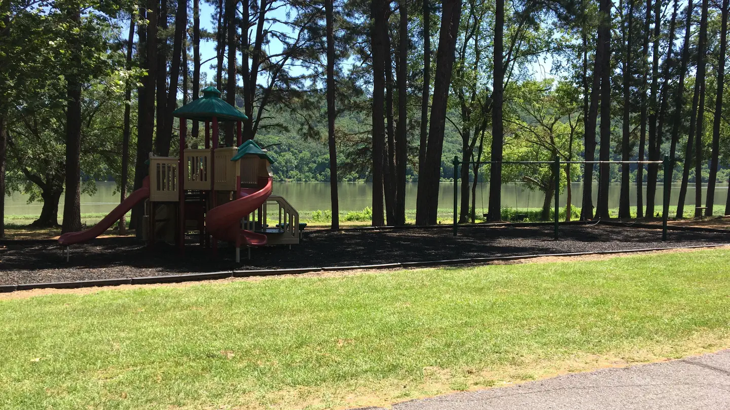
Site mix
| Standard with electric | 81 |
| Standard, no hookups | 3 |
| group shelter electric | 3 |
| RV with electric | 1 |
| Host/management | 3 |
Site guide
Will my RV fit
The longest site here provides 86 feet of vehicle capacity. Most sites are shorter.
88 sites in 4 loops. Tap a filter to narrow the list; the map follows.
| Site | Loop | Type | Entry | Fits, ft | Surface | Shade | Power | Water / sewer | People / vehicles | Fires | Accessible |
|---|---|---|---|---|---|---|---|---|---|---|---|
| A02 | AARC | Standard | Back-in | Paved | Partial | No | 8 / 1 | Yes | |||
| A03 | AARC | Standard | Back-in | Paved | Partial | No | 8 / 1 | Yes | |||
| A04 | AARC | Standard | Back-in | Paved | Partial | No | 8 / 1 | Yes | |||
| C01 | AARC | Electric | Back-in | 80 | Paved | Partial | 50 amp | Yes / – | 8 / 2 | Yes | |
| C02 | AARC | Electric | Back-in | 76 | Paved | Partial | 50 amp | Yes / – | 8 / 2 | Yes | |
| C03 | AARC | Electric | Back-in | 52 | Paved | Partial | 50 amp | Yes / – | 8 / 2 | Yes | |
| C04 | AARC | Electric | Back-in | 50 | Paved | Partial | 50 amp | Yes / – | 8 / 2 | Yes | |
| C05 | AARC | Electric | Back-in | 50 | Paved | Partial | 50 amp | Yes / – | 8 / 2 | Yes | |
| C06 | AARC | Electric | Back-in | 55 | Paved | Partial | 50 amp | Yes / – | 8 / 2 | Yes | |
| C07 | AARC | Electric | Back-in | 51 | Paved | Partial | 50 amp | Yes / – | 8 / 2 | Yes |
Per-site records as published by the managing agency on Recreation.gov. Blank cells mean the agency listed nothing for that site. Check-in 4:00 PM, checkout 3:00 PM.
Amenities & rules
| Hookups | Electric, water, sewer |
| Max vehicle length | 86 ft |
| Equipment | RVs & trailers, Tents |
| Pets | Allowed |
| Campfires | Allowed, subject to restrictions |
| Accessibility | Sites GS1, GS2, GS3 are listed accessible |
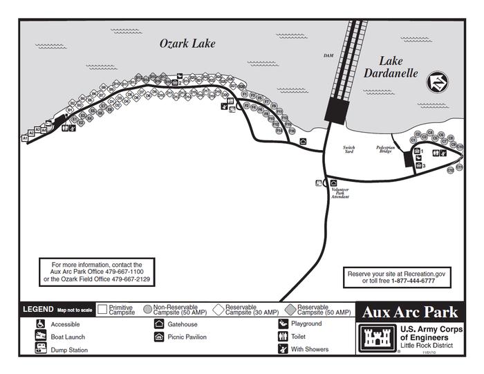
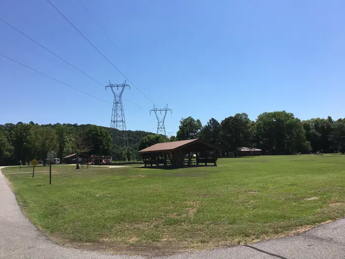
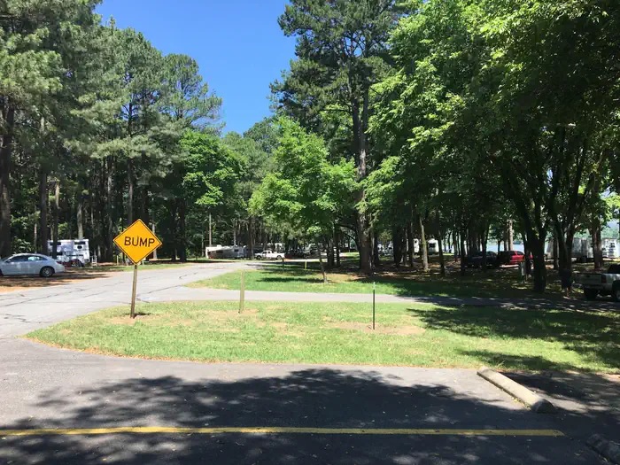
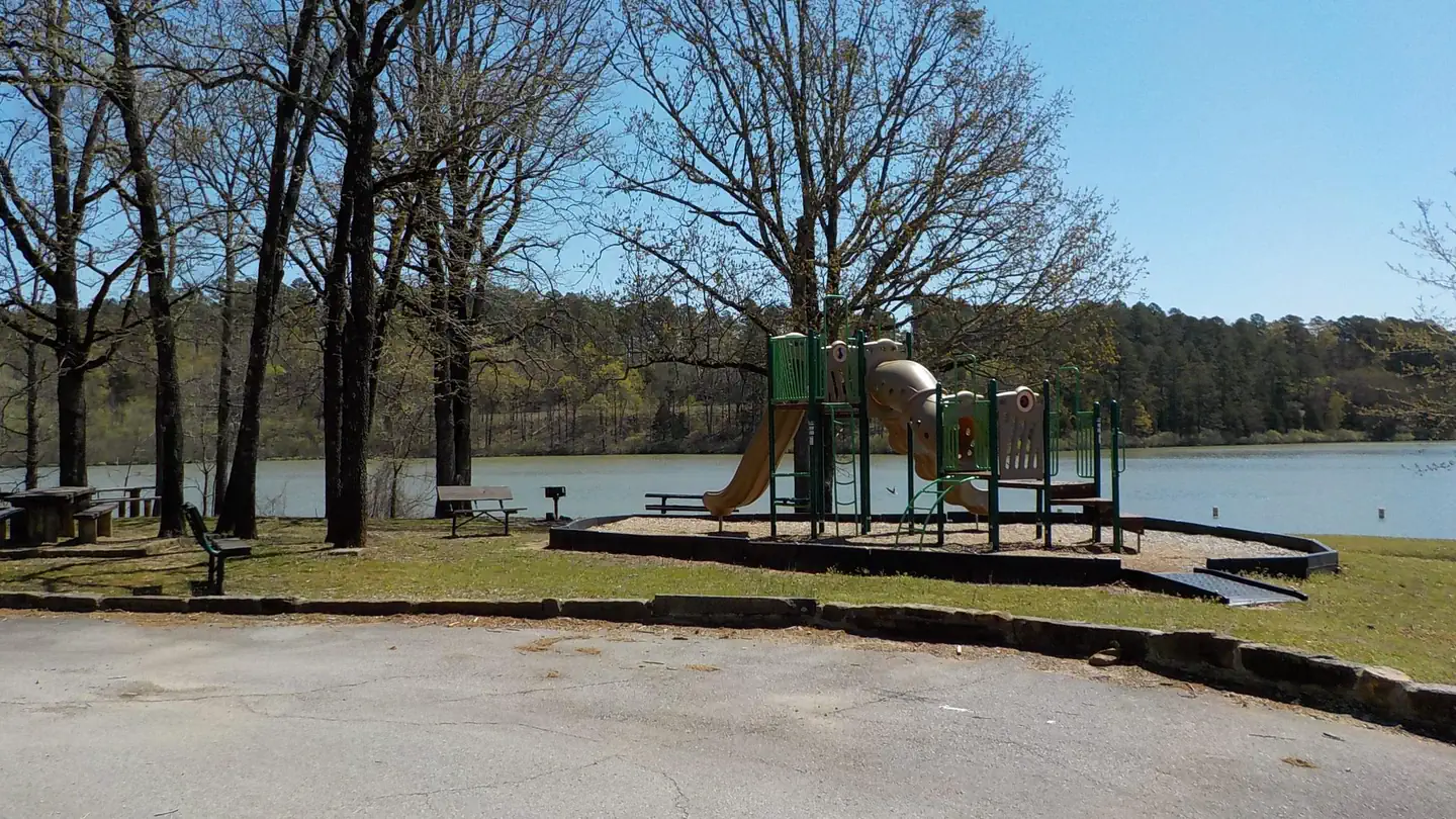
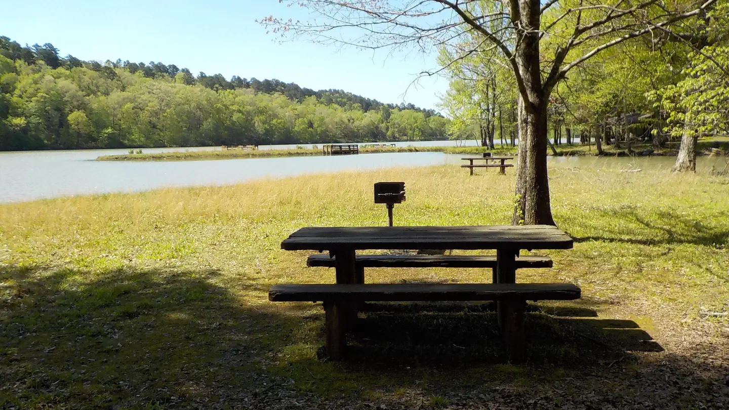
Aux Arc Campground offers spacious, shady campsites with electric and water hookups. Three picnic shelters, with electricity, can be reserved as well. Additional amenities include a dump station, two playgrounds, hot showers and a boat ramp.
Individual sites vary. Confirm on Recreation.gov or with the managing office.
Weather by month
Getting there
From Ozark, Arkansas, take SR-23 south for 1.5 miles to SR-309. Turn left and follow signs to the park.
| Nearest town | Ozark, Arkansas |
| Coordinates | 35.4703° N, 93.8181° W · Directions ↗ |
Supplies & services
| Dump station | Dump station ↗ | 0.1 mi |
| Outdoor gear | Dixon Ridge Trailhead ↗ | 31.6 mi |
| RV sales & service | Victory Lane Motors ↗ | 43.3 mi |
Locations © OpenStreetMap contributors. Call ahead; hours change seasonally.
Explore
Video
Cargo Conversion Living At Aux Arc Campground/We Didn't Want To Leave
Worth a stop
Two of the largest wineries in the state are located in the nearby town of Altus. Here, large grape vineyards reminiscent of the European Rhineland dot the countryside.
- 0.2 miAux Arc Day Use ↗Day use
- 14.2 mi
Public land it sits in
Ozark-St. Francis National Forest begins about 5.4 miles away, and it is the closest of these.
- 5.4 miOzark-St. Francis National Forest ↗National Forest · Forest Service · 1,532,900 acres
Each unit is published as a centre point and an acreage rather than a boundary, so this section stands it in for a circle of the same area. Whether a campground is inside, and how far it is from one it is outside, are both approximate.
Other campgrounds nearby

On the National Register nearby
- Franklin County JailBuilding · Ozark · 1.1 mi
- Missouri–Pacific Depot–OzarkBuilding · Ozark · 1.1 mi
- Bristow HotelBuilding · Ozark · 1.2 mi
Natural features
Ozark Lake extends 36 miles along the Arkansas River. The shoreline of the lake varies from steep bluffs and tree-lined banks to open farm lands and level fields.
Recreation
Boating, hiking and picnicking are favorites with locals and visitors alike. Anglers find success with both boat and bank fishing, and popular fish species include catfish, bream, crappie and bass. Public land surrounding the lake yields deer, quail, squirrels, rabbits, dove, wild turkey, ducks and geese for hunting season.
Guidebooks for Arkansas
We earn a small commission if you buy through these links. It does not change what we list.
Titles come from Open Library's catalog, matched by subject heading or by title.
Reference
Questions people ask
Do I need a reservation at Aux Arc?
Sites at Aux Arc are reservable on Recreation.gov. Any walk-up sites are listed on the booking page.
Source: Recreation.gov
What time is check-in at Aux Arc?
Check-in 4:00 PM, checkout 3:00 PM.
Source: Recreation.gov
How many sites does Aux Arc have?
91 sites, including 81 standard sites with power, 3 standard sites without power, 3 group shelter electric, and 1 RV site with electric.
Source: Recreation.gov
Will my RV fit at Aux Arc?
Recreation.gov lists no practical vehicle capacity limit for the largest site here, which usually means pull-through or open parking. The sidebar tool checks a trailer or motorhome length against every site.
Source: Will my RV fit
Does Aux Arc have hookups?
Yes, electric, water, and sewer hookups at some sites.
Source: Recreation.gov
Are there showers or a dump station at Aux Arc?
Additional amenities include a dump station, two playgrounds, hot showers and a boat ramp.
Source: Recreation.gov
Are pets allowed at Aux Arc?
Yes, pets are allowed at Aux Arc. Leash rules apply.
Source: Recreation.gov
Can I have a campfire at Aux Arc?
Fires are allowed in the provided rings under normal conditions.
Source: Recreation.gov
Are there accessible sites at Aux Arc?
Sites GS1, GS2, and GS3 are listed accessible on Recreation.gov. What that covers (a paved pad, an accessible table, a nearby accessible restroom) is on each site's booking page.
Source: Recreation.gov
Is there cell service at Aux Arc?
FCC coverage maps show Verizon 5G, AT&T 5G, and T-Mobile 5G at the campground point. Terrain changes that from one site to the next.
Source: FCC Broadband Map
What is there to do at Aux Arc?
Boating, hiking and picnicking are favorites with locals and visitors alike. The Recreation section on this page has the rest.
Source: Recreation
What is the nearest town to Aux Arc?
Ozark, Arkansas. Two of the largest wineries in the state are located in the nearby town of Altus.
Source: Getting there