Table Rock
Table Rock Campground is located in a small but scenic canyon near Kelly Canyon Ski Resort, approximately 30 miles from Idaho Falls, Idaho. Hiking, mountain biking and ATV riding are popular activities.
More like this: reservable in Idaho · group sites in Idaho
Check availability on Recreation.gov ↗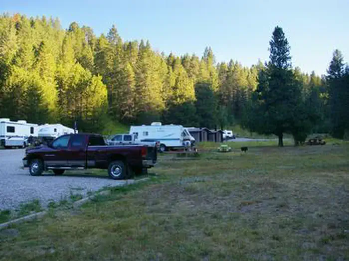
Site mix
| Group sites | 1 |
Site guide
Will my RV fit
The longest site here provides 20 feet of vehicle capacity. Most sites are shorter.
1 site. Tap a filter to narrow the list; the map follows.
| Site | Entry | Fits, ft | Surface | Shade | People / vehicles | Fires |
|---|---|---|---|---|---|---|
| GS-1 | Back-in | 20 | Gravel | Partial | 200 / 25 | Yes |
Per-site records as published by the managing agency on Recreation.gov. Blank cells mean the agency listed nothing for that site. Check-in 2:00 PM, checkout 12:00 PM.
Amenities & rules
| Hookups | None |
| Max vehicle length | 20 ft |
| Equipment | RVs & trailers, Tents |
| Campfires | Allowed, subject to restrictions |
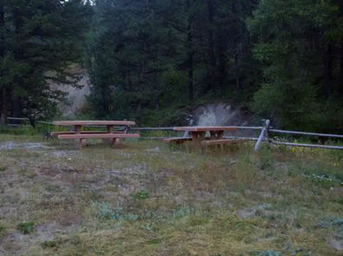
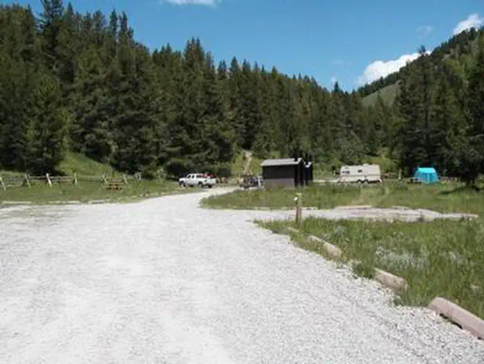
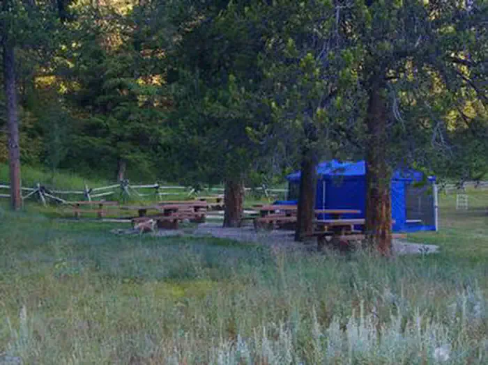
Table Rock is a large group campground that can accommodate up to 200 people. Accessible vault toilets are provided, but there is no electricity. Picnic tables, campfire circles and grills are scattered throughout the site. The road and oversized parking spur are gravel.
Individual sites vary. Confirm on Recreation.gov or with the managing office.
Season & status
| Status | Closed for the season. Forest Service sites close for the season; check the official page for the reopening date. |
| Season | May |
| Forest | Caribou-Targhee National Forest |
| Booking | This site can be reserved by calling Toll Free 1-877-444-6777 (International 518-885-3639 or TDD 877-833-6777) or on-line at www.recreation.gov Reservations must be made 4 days ahead of arrival and… |
| Fees | For current fees, please go to Recreation.gov |
Weather by month
Getting there
From Idaho Falls, Idaho, take Highway 26 east for 20 miles. Turn onto Heise Road and travel past Kelly Canyon Ski Resort. Take Forest Road 218 for 1 mile to junction with Forest Road 217. At the Y intersection, bear slight right and travel 1.25 miles to the campground.
| Coordinates | 43.6308° N, 111.5897° W · Directions ↗ |
Supplies & services
| Outdoor gear | Outdoor Resource Center ↗ | 16.4 mi |
| Dump station | Dump station ↗ | 19.7 mi |
| RV sales & service | Camping World of Idaho Falls ↗ | 25.5 mi |
Locations © OpenStreetMap contributors. Call ahead; hours change seasonally.
Explore
Trails nearby
- 0.4 miHawley Gulch2.2 mi trail · hiking, horse, bike, motorcycle and 2 more
- 0.5 miRiverview ↗0.4 mi trail · hiking, horse, bike
- 0.6 miMcCarthy ↗0.9 mi trail · hiking, horse, bike
- 0.7 miHidden Vista Overlook ↗0.1 mi trail · hiking, horse, bike
- 0.9 miGlens Grunt0.8 mi trail · hiking, horse, bike
- 0.9 miPine Loop1.4 mi trail · hiking, horse, bike
Trail and trailhead records are the Forest Service's. Distances are straight-line to the nearer trail end. Trail conditions are not tracked here.
Public land it sits in
This campground sits inside Caribou-Targhee National Forest.
- inCaribou-Targhee National Forest ↗National Forest · Forest Service · 3,077,758 acres
Each unit is published as a centre point and an acreage rather than a boundary, so this section stands it in for a circle of the same area. Whether a campground is inside, and how far it is from one it is outside, are both approximate.
Other campgrounds nearby



On the National Register nearby
- Ririe A Pegram Truss Railroad BridgeStructure · Ririe · 7.8 mi
- Ririe B Pegram Truss Railroad BridgeStructure · Ririe · 7.8 mi
- Shelton L.D.S. Ward ChapelBuilding · Ririe · 11.7 mi
Natural features
The campground is situated in a quiet draw covered by an open grassy meadow dotted with summer wildflowers. Aspens and towering pines border the site, offering partial shade.
Recreation
Hawley Gulch Trail begins at the campground, offering great opportunities for ATV enthusiasts, hikers and mountain bikers. Numerous forest roads and trails in the area allow ATV travel, hiking, horseback riding and mountain biking.
Guidebooks for Idaho
We earn a small commission if you buy through these links. It does not change what we list.

Titles come from Open Library's catalog, matched by subject heading or by title.
Reference
Questions people ask
Do I need a reservation at Table Rock?
Sites at Table Rock are reservable on Recreation.gov. This site can be reserved by calling Toll Free 1-877-444-6777 (International 518-885-3639 or TDD 877-833-6777) or on-line at www.recreation.gov Reservations must be made 4 days ahead of arrival and… Any walk-up sites are listed on the booking page.
Source: Recreation.gov
How much does it cost to camp at Table Rock?
For current fees, please go to Recreation.gov
Source: Recreation.gov
What time is check-in at Table Rock?
Check-in 2:00 PM, checkout 12:00 PM.
Source: Recreation.gov
Is Table Rock open right now?
Closed for the season as of Oct 16, 2026. Season May.
Source: Forest Service status
How many sites does Table Rock have?
1 site, including 1 group site.
Source: Recreation.gov
Will my RV fit at Table Rock?
The longest site here provides 20 feet of vehicle capacity. Most sites are shorter. The sidebar tool checks a trailer or motorhome length against every site.
Source: Will my RV fit
Can I have a campfire at Table Rock?
Fires are allowed in the provided rings under normal conditions.
Source: Recreation.gov
Is there cell service at Table Rock?
FCC coverage maps show AT&T 5G and T-Mobile 5G at the campground point. Terrain changes that from one site to the next.
Source: FCC Broadband Map
What is there to do at Table Rock?
Hawley Gulch Trail begins at the campground, offering great opportunities for ATV enthusiasts, hikers and mountain bikers. The Recreation section on this page has the rest.
Source: Recreation
What if Table Rock is full?
The nearest public campgrounds are Kelly Island Campground (3.5 mi, first-come), Falls Campground (17.8 mi), and Pine Creek Campground (19.6 mi, first-come).
Source: Campgrounds nearby