Lodgepole Campground
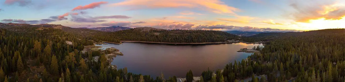
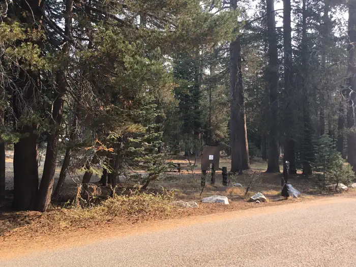
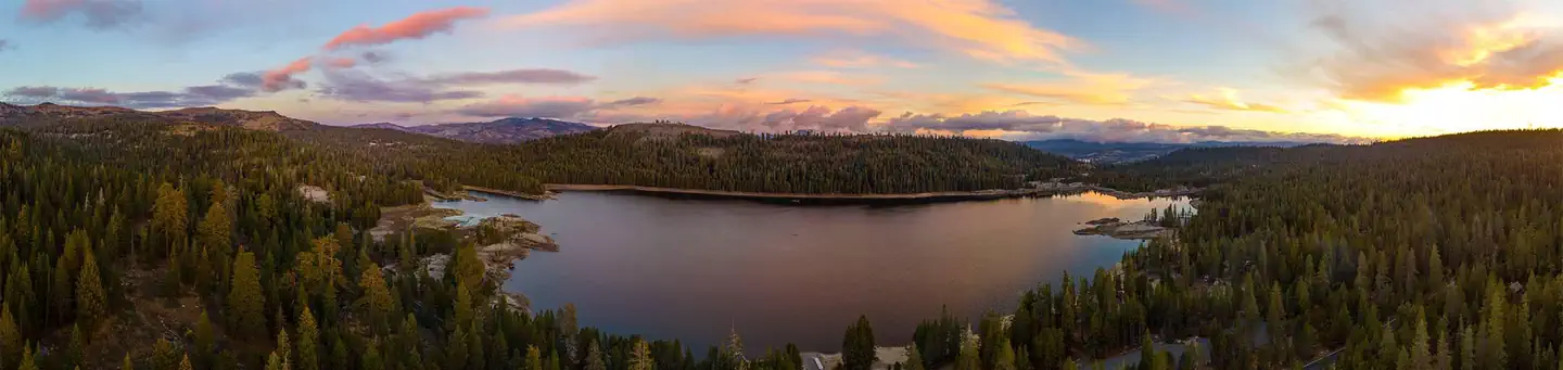
Lodgepole Group Campground is located just two miles west of Lake Alpine in northern California. The campground affords breathtaking views of the surrounding Stanislaus National Forest. Campground may open earlier and close later on a first come first serve basis as weather (snow level) allows. This information will be posted on this page as soon as it becomes available. The current dates for reservations have historically allowed for comfortable camping, but please take into consideration the high alpine location when making a reservation. It is possible to have snow, rain, mud, and overall cold/wet conditions any time of year.
More like this: reservable in California · big rigs in California · pets allowed in California · group sites in California
Check availability on Recreation.gov ↗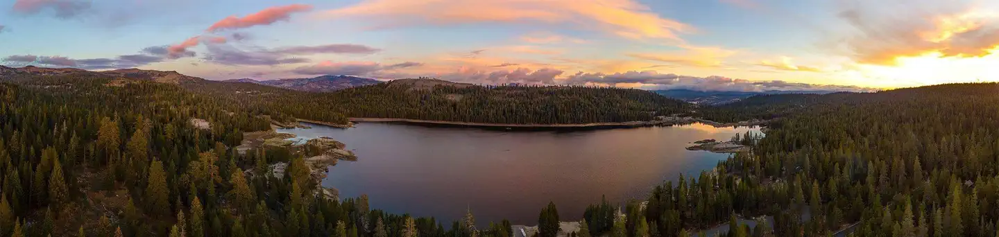
Site mix
| Standard, no hookups | 17 |
| Group sites | 2 |
| Host/management | 1 |
Site guide
Will my RV fit
The longest site here provides 33 feet of vehicle capacity. Most sites are shorter.
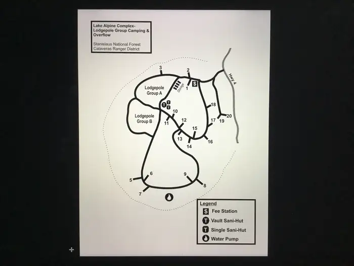
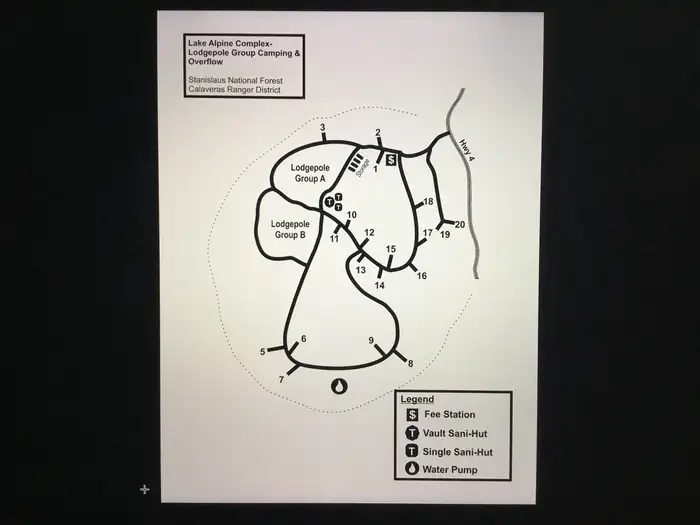
19 sites in 3 loops. Tap a filter to narrow the list; the map follows.
| Site | Loop | Type | Entry | Fits, ft | Surface | Shade | Water / sewer | People / vehicles | Fires |
|---|---|---|---|---|---|---|---|---|---|
| 1 | A | Standard | Back-in | 34 | Gravel | Partial | No / No | 6 / 2 | Yes |
| 2 | A | Standard | Back-in | 40 | Gravel | Partial | No / No | 6 / 2 | Yes |
| 3 | A | Standard | Back-in | 20 | Gravel | Partial | No / No | 6 / 2 | |
| 6 | A | Standard | Back-in | 34 | Gravel | None | No / No | 6 / 2 | Yes |
| 7 | A | Standard | Back-in | 45 | Gravel | Partial | No / No | 6 / 2 | Yes |
| 9 | A | Standard | Back-in | 32 | Gravel | Partial | No / No | 6 / 2 | Yes |
| 10 | A | Standard | Back-in | 50 | Gravel | Partial | No / No | 6 / 2 | Yes |
| 11 | A | Standard | Back-in | 20 | Gravel | Partial | No / No | 6 / 2 | Yes |
| 12 | A | Standard | Back-in | 31 | Gravel | Partial | No / No | 6 / 2 | Yes |
| 13 | A | Standard | Back-in | 24 | Gravel | Partial | No / No | 6 / 2 | Yes |
Per-site records as published by the managing agency on Recreation.gov. Blank cells mean the agency listed nothing for that site. Check-in 2:00 PM, checkout 1:00 PM.
Amenities & rules
| Hookups | None |
| Max vehicle length | 50 ft |
| Equipment | RVs & trailers, Tents |
| Pets | Allowed |
| Campfires | Allowed, subject to restrictions |
| Fees | Fees will NOT be waived for things like changes in weather, or naturally occurring wildlife in the area. |
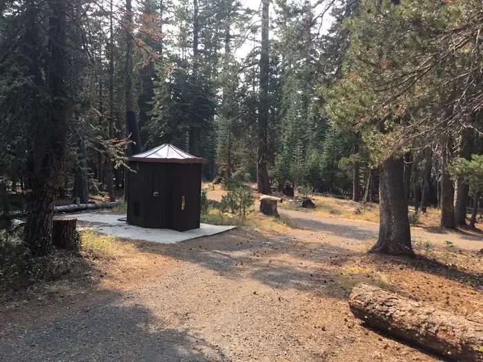
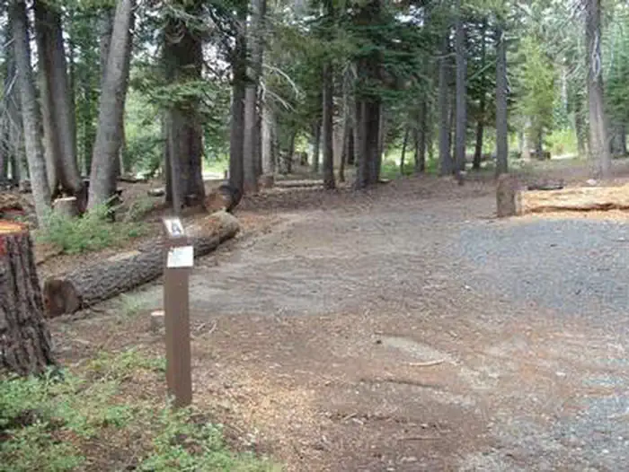
Campsites with room for up to 6 people, 3 tents, and 2 vehicles per campsite. Picnic tables, campfire rings, toilets are available. Hot showers and laundromat available at nearby Lake Alpine Lodge. No electricity or hook-ups. Pets are welcome. Firewood, camping and fishing supplies, food, and apparel is available in the general store at Lake Alpine Lodge.
Individual sites vary. Confirm on Recreation.gov or with the managing office.
Season & status
| Status | Closed for the season. Forest Service sites close for the season; check the official page for the reopening date. |
| Forest | Stanislaus National Forest |
| Booking | All sites are reservable. Unreserved sites will be available on a walk-in, first-come, first-served basis. |
| Fees | $30.00 per night |
| Rules | Maximum Length of Stay - 48 hours |
Weather by month
Getting there
From Angel Camp, drive 50 miles east on Highway 4.
| Coordinates | 38.4773° N, 120.0242° W · Directions ↗ |
Fire nearby
- PrescribedTmu Rx Support
31 mi from the campground
Distance is to the reported incident point, not the fire edge. Call the managing office before you drive.
Supplies & services
| Outdoor gear | Bear Valley Adventure Company ↗ | 1.4 mi |
| Dump station | Dump station ↗ | 30.6 mi |
| RV sales & service | Custom Truck Accessories ↗ | 47.7 mi |
Locations © OpenStreetMap contributors. Call ahead; hours change seasonally.
Explore
Video
Lake Alpine West Shore Campground, CA
Worth a stop
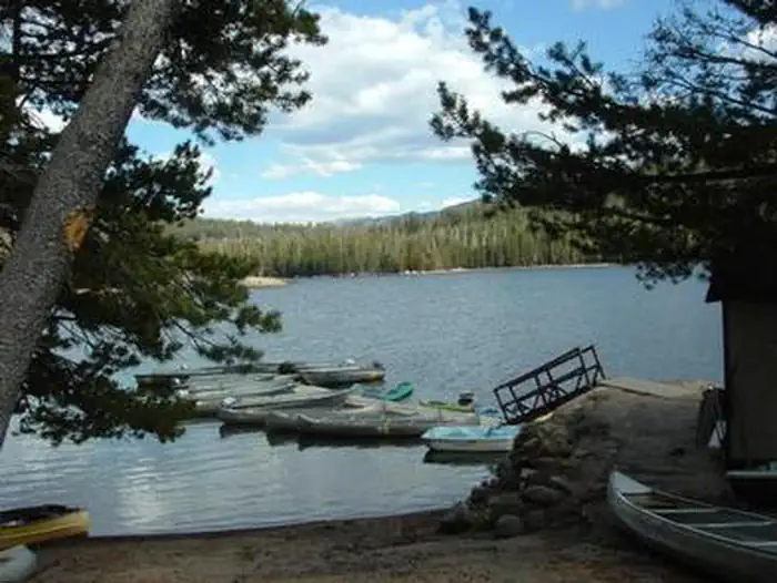
A restaurant, bar, general store, and boat rentals can be found at nearby Lake Alpine Lodge. The immediate area is suited for forest and wilderness recreation. A short car ride away is Big Trees State Park, Grover Hot Springs, Mercer Caverns, Mountain Adventure Seminars, and the wine country of Calaveras County.
- 2.1 miSilver Valley Trailhead ↗Trailhead
- 2.1 miSilver Valley Trailhead ↗Trailhead
- 11.5 miBlack Springs Ohv Area ↗OHV / range
- 11.6 miBlack Springs Ohv Campground ↗OHV / range
- 12.3 mi
- 12.6 miCottonwood Day Use ↗Day use
Trails nearby
- 0.1 miLodgepole0.6 mi trail · hiking, horse, bike
- 0.2 mi17e02lg Snow Trail0.4 mi trail · snowmobile, snowshoe, ski, snowcoach
- 0.2 miLp01g Snow Trail ↗0.5 mi trail · snowmobile, snowshoe, ski, snowcoach
- 0.2 miNorth Lake Alpine2.7 mi trail · hiking, horse, bike
- 0.3 mi18ev288g Snow Trail0.9 mi trail · snowmobile, snowshoe, ski, snowcoach
- 0.4 miOsborn Crest1 mi trail · hiking, horse, bike
Trailheads within three miles
- 0.8 miEmigrant/ MCCT Trail (Emigrant West Trailhead) ↗Stanislaus National Forest
- 1.8 miBee Gulch Trailhead ↗Stanislaus National Forest
- 1.9 miLakeshore Trail/ Inspiration Point Trailhead ↗Stanislaus National Forest
- 2.1 miSilver Valley Trailhead ↗Stanislaus National Forest
Trail and trailhead records are the Forest Service's. Distances are straight-line to the nearer trail end. Trail conditions are not tracked here.
Public land it sits in
This campground sits inside Stanislaus National Forest.
- inStanislaus National Forest ↗National Forest · Forest Service · 1,090,354 acres
- 0.3 miMokelumne Wilderness ↗Wilderness · Forest Service · 104,048 acres
- 6.2 miCarson-Iceberg Wilderness ↗Wilderness · Forest Service · 158,147 acres
Each unit is published as a centre point and an acreage rather than a boundary, so this section stands it in for a circle of the same area. Whether a campground is inside, and how far it is from one it is outside, are both approximate.
Other campgrounds nearby
Cabin and lookout rentals nearby
Natural features
Lodgepole Campground is situated on a large, flat plain, not far from a creek. It sits at an elevation of 7,290 feet, within the Stanislaus National Forest in the central Sierra Nevada Mountains. The forest lies between Lake Tahoe and Yosemite and boasts gorgeous views of snow-capped peaks and California's Great Central Valley. A wide variety of wildlife makes its home in the area, including marmots, squirrels, coyotes, deer and many birds.
Recreation
Lake Alpine provides a wide variety of recreation opportunities. Hike, bike, or ride a horse on Bear Valley, an accessible trail that winds along the lakeshore to the community of Bear Valley. It connects with the historic Emigrant Trail, the route pioneers once traveled via covered wagon to settle in California. Interpretive programs are offered by Forest Service rangers during the summer months.
Guidebooks for California
We earn a small commission if you buy through these links. It does not change what we list.

Titles come from Open Library's catalog, matched by subject heading or by title.
Reference
Questions people ask
Do I need a reservation at Lodgepole Campground?
Sites at Lodgepole Campground are reservable on Recreation.gov. All sites are reservable. Any walk-up sites are listed on the booking page.
Source: Recreation.gov
How much does it cost to camp at Lodgepole Campground?
Fees will NOT be waived for things like changes in weather, or naturally occurring wildlife in the area.
Source: Recreation.gov
What time is check-in at Lodgepole Campground?
Check-in 2:00 PM, checkout 1:00 PM.
Source: Recreation.gov
Is Lodgepole Campground open right now?
Closed for the season as of Oct 16, 2026.
Source: Forest Service status
How many sites does Lodgepole Campground have?
20 sites, including 17 standard sites without power and 2 group sites.
Source: Recreation.gov
Will my RV fit at Lodgepole Campground?
The longest site here provides 50 feet of vehicle capacity. Most sites are shorter. The sidebar tool checks a trailer or motorhome length against every site.
Source: Will my RV fit
Are there showers or a dump station at Lodgepole Campground?
Hot showers and laundromat available at nearby Lake Alpine Lodge.
Source: Recreation.gov
Are pets allowed at Lodgepole Campground?
Yes, pets are allowed at Lodgepole Campground. Leash rules apply.
Source: Recreation.gov
Can I have a campfire at Lodgepole Campground?
Fires are allowed in the provided rings under normal conditions. As of 2026-10-16, there is 1 active fire within 50 miles, so check current restrictions before you light one. Maximum Length of Stay - 48 hours
Source: Fire nearby
Is there cell service at Lodgepole Campground?
FCC coverage maps show Verizon 4G LTE and AT&T 5G at the campground point. Terrain changes that from one site to the next.
Source: FCC Broadband Map
What is there to do at Lodgepole Campground?
Lake Alpine provides a wide variety of recreation opportunities. The Recreation section on this page has the rest.
Source: Recreation
What if Lodgepole Campground is full?
The nearest public campgrounds are Silver Tip Campground (0.5 mi), West Shore (0.9 mi), and Backpackers (1.1 mi).
Source: Campgrounds nearby