Trail River
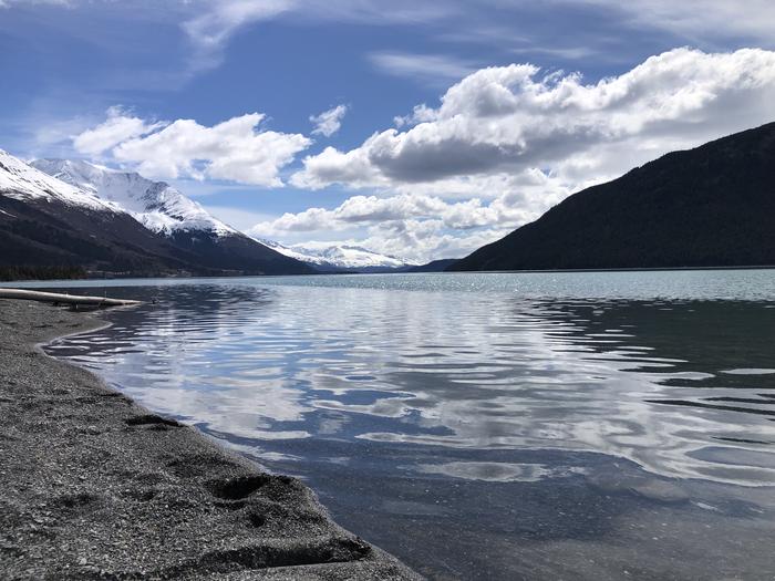
Trail River Campground, set between the Trail River and Kenai Lake, provides lake, river and snow-capped mountain scenery among the hemlock and spruce forests of the Chugach National Forest. It lies within driving distance of two main tourism destinations; 24 miles north of Seward and 40 miles east of Cooper Landing, AK. Miles of hiking and biking trails weave throughout the area. Moose, brown and black bear, sheep and goats can be found across a large parts of the forest. Kenai Lake marks the headwaters of the Kenai River. The campground is situated on the Eastern Kenai Peninsula at elevation 450 feet.
More like this: reservable in Alaska · big rigs in Alaska · group sites in Alaska
Check availability on Recreation.gov ↗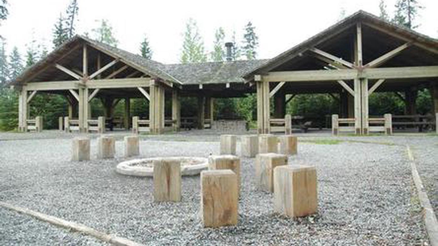


Site mix
| RV, no hookups | 75 |
| Tent-only | 16 |
| group shelter nonelectric | 1 |
Site guide
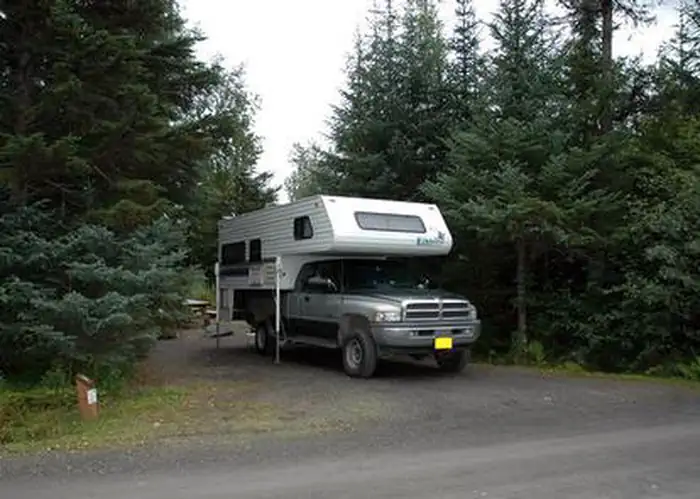
Will my RV fit
The longest site here provides 45 feet of vehicle capacity. Most sites are shorter.
92 sites in 4 loops. Tap a filter to narrow the list; the map follows.
| Site | Loop | Type | Entry | Surface | People / vehicles |
|---|---|---|---|---|---|
| 062 | Eagle Point | RV | Pull-through | Gravel | 8 / 1 |
| 063 | Eagle Point | RV | Back-in | Gravel | 8 / 1 |
| 064 | Eagle Point | Tent only | Back-in | Gravel | 8 / 1 |
| 065 | Eagle Point | Tent only | Back-in | Gravel | 8 / 1 |
| 066 | Eagle Point | RV | Back-in | Gravel | 8 / 1 |
| 067 | Eagle Point | RV | Back-in | Gravel | 8 / 1 |
| 068 | Eagle Point | RV | Back-in | Gravel | 8 / 1 |
| 069 | Eagle Point | RV | Back-in | Gravel | 8 / 1 |
| 070 | Eagle Point | RV | Back-in | Gravel | 8 / 1 |
| 071 | Eagle Point | RV | Back-in | Gravel | 8 / 1 |
Per-site records as published by the managing agency on Recreation.gov. Blank cells mean the agency listed nothing for that site. Check-in 2:00 PM, checkout 12:00 PM.
Amenities & rules
| Hookups | None |
| Max vehicle length | 88 ft |
| Equipment | RVs & trailers, Tents |
| Tent pads | Yes |
The campground is divided into three loops. Spruce Tree loop has ample shade and stellar views of the mountains. Eagle Point Loop overlooks Kenai Lake and the River Terrace Loop is nearest to the river. The group campsite, which accommodates 70 guests, is part of Trail River Loop. The picnic shelter at the group site is a great place for large gatherings such as wedding receptions, retirement parties or birthdays. It has a beautiful, timber frame pavilion with a large central grill and covered picnic tables. The adjacent volleyball court, horseshoe pit and playground make it fun for all ages. There is also a large fire ring with seating, and plenty of parking. Amenities include vault toilets, trash collection and drinking water. The Day Use Area (mentioned above) includes lake shore access, picnic tables and vault toilets.
Individual sites vary. Confirm on Recreation.gov or with the managing office.
Weather by month
Getting there
From Anchorage, go south on Seward Highway approximately 100 miles to Crown Point. Turn at Milepost 24.2 on Trail River Road for 2 miles to campground.
| Nearest town | Seward, Alaska |
| Coordinates | 60.4161° N, 149.3814° W · Directions ↗ |
Good to know
- Kenai Lake is not open to salmon fishing.
Explore
Video
The prettiest mountain lake -- Kenai Lake + Trail River Campground, Alaska
Worth a stop
Trail River Campground is located close to many tourist destinations. Within the Seward Ranger District, many world-class trailheads and day use areas await discovery. The newly-remodeled Seward Ranger District Information Office, is one mile south on Ranger Station Spur. There, friendly forest service employees can help you gather information, interpret the local ecology, purchase area maps, and offer advice about the Chugach National Forest. From this campground, possible day trips include wildlife viewing in Kenai Fjords National Park, rafting down the Kenai River, and a visit to Portage Glacier. Portage Glacier, is located in Portage Valley, a 14-mile isthmus that connects the Kenai Peninsula to mainland Alaska. Glacial remnants that can be seen today are Explorer, Middle, Byron, Burns and Shakespeare glaciers. Portage Valley is also home to the Begich Boggs Visitor Center, a world-class visitor center with a full-time interpretive staff and exhibits ready to inspire and explain the natural area.
- 9.9 miTern Lake Day Use Area ↗Day use
Trails nearby
- 0.5 miFalls Creek ORV Trail3.9 mi trail · hiking, motorcycle, ATV, 4WD and 1 more
- 1.2 miPtarmigan Creek Trail3.5 mi trail · hiking
- 1.3 miInht Access: Vagt Lake Trail1.4 mi trail · hiking
- 1.4 miPtarmigan Creek Cutoff Trail0.9 mi trail · hiking
- 1.9 miCrown Point ATV Trail ↗4.6 mi trail · hiking, motorcycle, ATV, 4WD and 1 more
- 2.6 miPtarmigan Lake Tr3.7 mi trail · hiking
Trail and trailhead records are the Forest Service's. Distances are straight-line to the nearer trail end. Trail conditions are not tracked here.
Public land it sits in
This campground sits inside Chugach National Forest.
- inChugach National Forest ↗National Forest · Forest Service · 6,244,689 acres
- 7.6 miKenai National Wildlife Refuge ↗National Wildlife Refuge · Fish and Wildlife Service · 1,943,006 acres
Each unit is published as a centre point and an acreage rather than a boundary, so this section stands it in for a circle of the same area. Whether a campground is inside, and how far it is from one it is outside, are both approximate.
Other campgrounds nearby


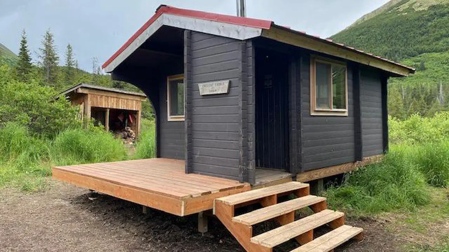
Cabin and lookout rentals nearby

On the National Register nearby
- Alaska Nellie's HomesteadBuilding · Lawing · 1.3 mi
Natural features
The Chugach National Forest covers the eastern half of the Kenai Peninsula and extends around Prince William Sound. It covers over 5 million acres and is characterized by jagged mountains, deep fjords, glacier-fed rivers, and dense forests. This rich natural area supports many miles of productive fishing streams as well as wildlife populations.
Recreation
The Day Use Site at Trail River Campground provides beach access to Kenai Lake. Many people enjoy fishing, collecting driftwood, skipping rocks and walking along the beach. The view of the mountains surrounding Kenai Lake is gorgeous. Snow is present in the high peaks and avalanche chutes until the end of August. Trout fishing can be very productive from the beach at Trail River Campground as well as at many nearby streams. The lake is home to Dolly Varden, rainbow trout and lake trout. Although trout fishing is open year-round in Kenai Lake, special restrictions apply within 1/4 mile of inlet streams. Anglers are required to have a State of Alaska Fishing license and obey all regulations. Within a one-mile radius of the campground entrance, are five trails: Falls Creek Trail, Crown Point Mine Road, Ptarmigan Creek Trail and Vagt Lake Trail. All of these trails run roughly east-west and provide access to the Iditarod National Historic Trail (INHT) which runs north-south. The INHT is an ongoing project to build a '"southern trek" connecting Seward (Mile 0 of the Iditarod Trail) to Eagle River (north of Anchorage).
Guidebooks for Alaska
We earn a small commission if you buy through these links. It does not change what we list.
Titles come from Open Library's catalog, matched by subject heading or by title.
Reference
Questions people ask
Do I need a reservation at Trail River?
Sites at Trail River are reservable on Recreation.gov. Any walk-up sites are listed on the booking page.
Source: Recreation.gov
What time is check-in at Trail River?
Check-in 2:00 PM, checkout 12:00 PM.
Source: Recreation.gov
How many sites does Trail River have?
92 sites, including 75 RV sites without hookups, 16 tent-only sites, and 1 group shelter nonelectric.
Source: Recreation.gov
Will my RV fit at Trail River?
Recreation.gov lists no practical vehicle capacity limit for the largest site here, which usually means pull-through or open parking. The sidebar tool checks a trailer or motorhome length against every site.
Source: Will my RV fit
Is there cell service at Trail River?
FCC coverage maps show Verizon 4G LTE at the campground point. Terrain changes that from one site to the next.
Source: FCC Broadband Map
What is there to do at Trail River?
The Day Use Site at Trail River Campground provides beach access to Kenai Lake. The Recreation section on this page has the rest.
Source: Recreation
What is the nearest town to Trail River?
Seward, Alaska. Trail River Campground is located close to many tourist destinations.
Source: Getting there
What if Trail River is full?
The nearest public campgrounds are Ptarmigan Creek (0.9 mi), Primrose Campground (5.2 mi, first-come), and Crescent Creek Campground (11.6 mi, first-come).
Source: Campgrounds nearby