Holly Bay
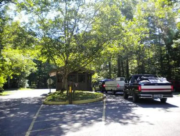
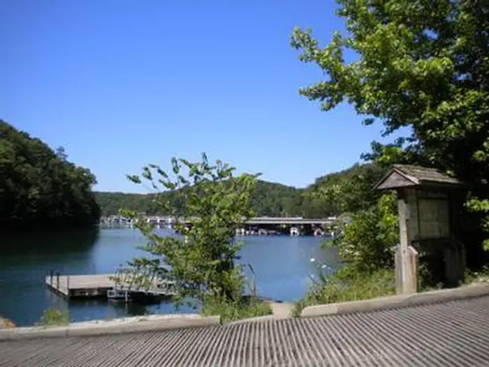
Holly Bay, located two miles north of the Laurel River Dam, sits on the west side of Laurel River Lake. Visitors enjoy the campground for its proximity to the water and beautifully forested location. Plus, Holly Bay is ideal for activities like power boating, canoeing and fishing. The forest was named after Daniel Boone, a famous frontiersman and explorer who settled in Kentucky in the late 18th century.
Some sites take reservations on Recreation.gov. Others are first-come, first-served.
More like this: electric hookups in Kentucky · full hookups in Kentucky · first-come in Kentucky · reservable in Kentucky · big rigs in Kentucky · pets allowed in Kentucky
Check availability on Recreation.gov ↗

Site mix
| Standard with electric | 70 |
| Host/management | 68 |
Site guide
Will my RV fit
The longest site here provides 50 feet of vehicle capacity. Most sites are shorter.
70 sites in 6 loops. Tap a filter to narrow the list; the map follows.
| Site | Loop | Entry | Fits, ft | Surface | Shade | Power | Water / sewer | Waterfront | People / vehicles | Fires | Accessible | Rating |
|---|---|---|---|---|---|---|---|---|---|---|---|---|
| 1 | A | Back-in | Paved | Partial | 50 amp | Yes / – | 6 / 1 | Yes | ||||
| 2 | A | Back-in | Paved | Partial | 50 amp | Yes / – | 12 / 1 | Yes | ||||
| 3 | A | Back-in | Paved | Partial | 50 amp | Yes / – | 6 / 1 | Yes | ||||
| 5 | A | Back-in | Paved | Partial | 50 amp | Yes / – | 6 / 1 | Yes | ||||
| 6 | A | Back-in | Paved | Partial | 50 amp | Yes / – | Lakefront | 6 / 1 | Yes | |||
| 7 | A | Back-in | Paved | Partial | 50 amp | Yes / – | Lakefront | 12 / 1 | Yes | |||
| 9 | A | Back-in | Paved | Partial | 50 amp | Yes / – | 6 / 1 | Yes | ||||
| 10 | A | Back-in | Paved | Partial | 50 amp | Yes / – | 6 / 1 | Yes | ||||
| 11 | A | Back-in | Paved | Partial | 50 amp | Yes / – | 6 / 1 | Yes | ||||
| 12 | A | Back-in | Paved | Partial | 50 amp | Yes / – | 6 / 1 | Yes |
Per-site records as published by the managing agency on Recreation.gov. Blank cells mean the agency listed nothing for that site. Check-in 2:00 PM, checkout 11:00 AM.
Amenities & rules
| Hookups | Electric, water, sewer |
| Max vehicle length | 50 ft |
| Equipment | RVs & trailers, Tents |
| Pets | Allowed |
| Campfires | Allowed, subject to restrictions |
| Tent pads | Yes |
| Accessibility | Sites E1, E2, E3, E4 and 14 more are listed accessible |
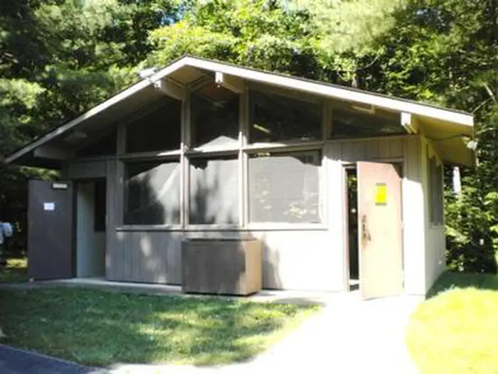
The campground features both single- and double-family campsites, with select sites offering 20-, 30-, or 50-amp electric hookups. Several campsites provide scenic views overlooking the lake, creating a relaxing and picturesque setting for guests. Campers have access to modern amenities, including flush toilets (with one accessible facility), two shower houses, potable drinking water, and a convenient dump station. Firewood and ice are also available for purchase.
Individual sites vary. Confirm on Recreation.gov or with the managing office.
Season & status
| Status | Open |
| Season | Mid-April through October |
| Forest | Daniel Boone National Forest |
| Booking | Reservations are required for drive-in sites in Loops A, D, E, F, G, H. Reserve a site by visiting www.recreation.gov. Reservations are not required for Loops B, C, or sites 14-21 in Loop G. |
| Fees | Holly Bay Drive-In Campground (Loops A, D, E, F, G, H) $38/single (includes $12 hookup surcharge). $25/single w/Discount Pass. $76/double (includes $24 hookup surcharge). Extra vehicle fee/$10. Dump fee/$10 (non-registered camper). Holly Bay Walk-In Campground (Loops B, C, and G) $26/single. |
Weather by month
Getting there
From London, Kentucky, take Exit 38 off I-75. Turn west on KY 192, then go 14.2 miles and turn south (left) on KY 1193. Follow signs to Holly Bay Campground entrance (3 miles).
| Nearest town | London, Kentucky |
| Coordinates | 36.9792° N, 84.2667° W · Directions ↗ |
Fire nearby
- PrescribedSte-Wildlife Openings Rx
18 mi from the campground · 8 acres
Distance is to the reported incident point, not the fire edge. Call the managing office before you drive.
Supplies & services
| Outdoor gear | Sheltowee Trace Outfitters ↗ | 9.5 mi |
| Dump station | Dump station ↗ | 27.8 mi |
Locations © OpenStreetMap contributors. Call ahead; hours change seasonally.
Explore
Video
Holly Bay Campground #1 - Corbin - Ky - Review
Worth a stop
Cumberland Falls – Known as the “Niagara of the South,” this stunning waterfall is just a short drive from Holly Bay. Enjoy hiking trails, scenic overlooks, and the rare chance to see a moonbow on clear nights. Cumberland Falls State Resort Park – Offers picnic areas, hiking trails, and a lodge with dining, perfect for a day trip with the family. Laurel River Lake – Just minutes from the campground, enjoy fishing, boating, and peaceful lakeside views. Sheltowee Trace Trail – A 4.2-mile trail near the campground that leads to the dam, ideal for family hikes and nature walks. Dog Slaughter Falls – A hidden gem waterfall and short hiking trail for adventurous families. Local Historic Sites – Explore nearby small-town museums, historic bridges, and landmarks for a taste of Appalachian culture.
- 0.7 miLong Bend Fishing Site ↗Fishing site
- 0.7 miFishing Point ↗Fishing site
- 2.7 miWhitman Branch Shooting Range ↗OHV / range
- 4.5 miBee Rock Boat Ramp ↗Boat launch
- 10.6 miGoodwater Ohv Route #504 ↗OHV / range
Trails nearby
- 0.2 miAmphitheater Trail0.1 mi trail
- 0.3 miMarina Trail0.4 mi trail
- 0.3 miWintergreen0.7 mi trail
- 0.4 miBoat Ramp Trail0.4 mi trail
- 0.5 miHolly Bay1.1 mi trail
- 0.7 miCraigs Creek0.7 mi trail
Trail and trailhead records are the Forest Service's. Distances are straight-line to the nearer trail end. Trail conditions are not tracked here.
Public land it sits in
This campground sits inside Daniel Boone National Forest.
- inDaniel Boone National Forest ↗National Forest · Forest Service · 2,043,073 acres
- 9.4 miBeaver Creek Wilderness ↗Wilderness · Forest Service · 4,816 acres
Each unit is published as a centre point and an acreage rather than a boundary, so this section stands it in for a circle of the same area. Whether a campground is inside, and how far it is from one it is outside, are both approximate.
Other campgrounds nearby


On the National Register nearby
- Harland Sanders CafeBuilding · Corbin · 9.6 mi
- Corbin Bank BuildingBuilding · Corbin · 9.6 mi
- First Christian ChurchBuilding · Corbin · 9.6 mi
Natural features
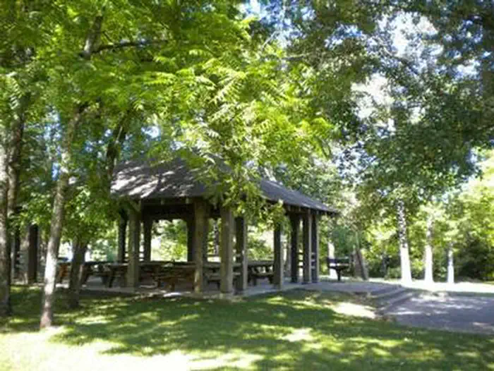
Most campsites are nestled among a beautiful mix of hardwood trees, offering shade in the summer and picture-perfect colors during the autumn season. The Laurel River Lake spans 5,600 acres of deep, clear water, with 192 miles of scenic, cliff-lined shoreline to explore and enjoy. Rolling hills from the Appalachian foothills surround the lake, creating a peaceful and memorable backdrop for family adventures, relaxation, and time spent together in nature.
Recreation
Boating and water activities are a favorite among campers of all ages. For the convenience and safety of our guests, a private boat ramp is located within the campground and is available exclusively for registered camping guests—there is no public access. Anglers will enjoy fishing in Laurel River Lake, which is well known for its healthy populations of bass, trout, crappie, and bluegill, making it a great spot for both experienced fishermen and families introducing children to fishing. A public-use swimming beach is located just a couple of miles away and is available at no cost. Guests who enjoy hiking can explore the 4.2-mile Sheltowee Trace Trail, which begins near the campground and leads to the dam, offering a scenic and family-friendly way to experience the natural beauty of the area. Recreation Sites offer: Standard Electric Campsite (Overnight Use) - Includes electric and water hookups for a comfortable overnight stay. Primitive Campsites - (No Electric or Water Hookups) for a peaceful simple camping experience.
Guidebooks for Daniel Boone National Forest and Kentucky
We earn a small commission if you buy through these links. It does not change what we list.
Titles come from Open Library's catalog, matched by subject heading or by title.
Reference
Questions people ask
Do I need a reservation at Holly Bay?
For some sites. Some sites take reservations on Recreation.gov. Others are first-come, first-served.
Source: Recreation.gov
How much does it cost to camp at Holly Bay?
Holly Bay Drive-In Campground (Loops A, D, E, F, G, H) $38/single (includes $12 hookup surcharge). $25/single w/Discount Pass. $76/double (includes $24 hookup surcharge).
Source: Recreation.gov
What time is check-in at Holly Bay?
Check-in 2:00 PM, checkout 11:00 AM.
Source: Recreation.gov
Is Holly Bay open right now?
Open as of Oct 16, 2026. Season Mid-April through October.
Source: Forest Service status
How many sites does Holly Bay have?
138 sites, including 70 standard sites with power.
Source: Recreation.gov
Will my RV fit at Holly Bay?
The longest site here provides 50 feet of vehicle capacity. Most sites are shorter. The sidebar tool checks a trailer or motorhome length against every site.
Source: Will my RV fit
Does Holly Bay have hookups?
Yes, electric, water, and sewer hookups at some sites.
Source: Recreation.gov
Are there showers or a dump station at Holly Bay?
Campers have access to modern amenities, including flush toilets (with one accessible facility), two shower houses, potable drinking water, and a convenient dump station.
Source: Recreation.gov
Are pets allowed at Holly Bay?
Yes, pets are allowed at Holly Bay. Leash rules apply.
Source: Recreation.gov
Can I have a campfire at Holly Bay?
Fires are allowed in the provided rings under normal conditions. As of 2026-10-16, there is 1 active fire within 50 miles, so check current restrictions before you light one.
Source: Fire nearby
Are there accessible sites at Holly Bay?
Sites E1, E2, E3, and E4 are listed accessible on Recreation.gov, 18 sites in all. What that covers (a paved pad, an accessible table, a nearby accessible restroom) is on each site's booking page.
Source: Recreation.gov
Is there cell service at Holly Bay?
FCC coverage maps show Verizon 4G LTE and AT&T 4G LTE at the campground point. Terrain changes that from one site to the next.
Source: FCC Broadband Map