Hat Creek
Hat Creek is one of six campgrounds available in the Hat Creek Recreation Area, home to some of the area's best trout fishing. Scenic hiking trails and an active volcanic area can easily be accessed from the facility.
Some sites take reservations on Recreation.gov. Others are first-come, first-served.
More like this: first-come in California · reservable in California · big rigs in California · group sites in California
Check availability on Recreation.gov ↗

Site mix
| Standard, no hookups | 9 |
| Group sites | 3 |
| Host/management | 67 |
Site guide
Will my RV fit
The longest site here provides 45 feet of vehicle capacity. Most sites are shorter.
12 sites in 2 loops. Tap a filter to narrow the list; the map follows.
| Site | Loop | Type | Entry | Fits, ft | Surface | Shade | People / vehicles |
|---|---|---|---|---|---|---|---|
| GS1 | GRP | Group | 40 | Gravel | Full | 50 / 10 | |
| GS2 | GRP | Group | 40 | Gravel | Full | 50 / 12 | |
| GS3 | GRP | Group | 40 | Gravel | Full | 50 / 8 | |
| 001 | HAT | Standard | Back-in | 40 | Gravel | 8 / 1 | |
| 002 | HAT | Standard | Back-in | 45 | Gravel | 8 / 1 | |
| 003 | HAT | Standard | Back-in | 45 | Gravel | 8 / 1 | |
| 004 | HAT | Standard | Back-in | 40 | Gravel | 8 / 1 | |
| 005 | HAT | Standard | Back-in | 40 | Gravel | 8 / 1 | |
| 006 | HAT | Standard | Back-in | 45 | Gravel | 8 / 1 | |
| 007 | HAT | Standard | Back-in | 45 | Gravel | 8 / 1 |
Per-site records as published by the managing agency on Recreation.gov. Blank cells mean the agency listed nothing for that site. Check-in 12:00 PM, checkout 12:00 PM.
Amenities & rules
| Hookups | None |
| Max vehicle length | 45 ft |
| Equipment | RVs & trailers, Tents |
Hat Creek offers three group campsites that can accommodate up to 50 people each. Individual sites are also available on a first-come, first-served basis. Picnic tables and campfire rings with grills are provided, as are accessible flush and vault toilets, utility sinks and drinking water. The RV dump-station is located 1.5 miles north of the campground behind the Old Station Visitors Center.
Individual sites vary. Confirm on Recreation.gov or with the managing office.
Season & status
| Status | Closed for the season. Forest Service sites close for the season; check the official page for the reopening date. |
| Season | April to October |
| Forest | Lassen National Forest |
| Booking | Reservations must be made 4 days ahead of arrival and can be made up to 12 months in advance. |
| Fees | $80.00 per group site per night. |
| Rules | 14-day limit; campfires in designated fire rings only. |
Weather by month
Getting there
From Highways 44 and 89, go through Old Station and continue 1.5 miles west to the campground.
| Nearest town | Fall River Mills, California |
| Coordinates | 40.6678° N, 121.4456° W · Directions ↗ |
Fire nearby
- PrescribedCy26 Elrd Underburn Drake Unit 7 & 9 Rx
14 mi from the campground
- PrescribedCy26 Elrd Understory Drake Unit 6 8 &10 Rx
14 mi from the campground
- PrescribedShf Rx
46 mi from the campground
Distance is to the reported incident point, not the fire edge. Call the managing office before you drive.
Supplies & services
| Dump station | Dump station ↗ | 11 mi |
| RV sales & service | Reliable RV ↗ | 47.2 mi |
| Outdoor gear | Camping World ↗ | 47.2 mi |
Locations © OpenStreetMap contributors. Call ahead; hours change seasonally.
Explore
Video
Hat Creek Campground Best Campsites - Lassen National Forest, CA
Worth a stop
The campground is located about a mile west of the town of Old Station, and 12 miles east of the northwest entrance to Lassen Volcanic National Park, where active, hissing fumaroles and boiling mud pots are continually shaping the landscape. The Pacific Crest National Scenic Trail can be accessed near the Spatter Cones Nature Trailhead.
- 1.4 miOld Station Day Use Picnic ↗Day use
- 9.8 miCypress Trailhead ↗Trailhead
Trails nearby
- 0.2 miSpattercone Crest Trail1.2 mi trail · hiking, horse, bike
- 0.3 miOld Station Access Trail ↗under 0.1 mi trail · hiking, horse, bike
- 0.6 miPotato Butte 450.2 mi trail · hiking, horse, bike, motorcycle and 4 more
- 0.7 miPotato Butte 170.3 mi trail · hiking, horse, bike, motorcycle and 4 more
- 0.7 miPotato Butte 60.4 mi trail · hiking, horse, bike, e-bike
- 0.9 miPotato Butte 130.1 mi trail · hiking, horse, bike, motorcycle and 4 more
Trail and trailhead records are the Forest Service's. Distances are straight-line to the nearer trail end. Trail conditions are not tracked here.
Public land it sits in
This campground sits inside Lassen National Forest.
- inLassen National Forest ↗National Forest · Forest Service · 1,488,712 acres
- 4.9 miThousand Lakes Wilderness ↗Wilderness · Forest Service · 16,526 acres
- 6.2 miLassen Volcanic Wilderness ↗Wilderness · National Park Service · 79,061 acres
Each unit is published as a centre point and an acreage rather than a boundary, so this section stands it in for a circle of the same area. Whether a campground is inside, and how far it is from one it is outside, are both approximate.
Other campgrounds nearby



Cabin and lookout rentals nearby
On the National Register nearby
- Prospect Peak Fire LookoutBuilding · Mineral · 8.4 mi
- Loomis Vistor Center, Bldg. 43Building · Manzanita Lake · 11 mi
- Twin Lakes Fire Tool CacheBuilding · Mineral · 11.5 mi
Natural features
The campground is situated next to Hat Creek in a mixed conifer forest at an elevation of about 4,390 feet. Pine needles, grasses and volcanic rocks cover the forest floor. Sites are widely spaced for privacy.
Recreation
Hat Creek is popular for its trophy trout fishing. The cold waters of the creek allow for a refreshing play on hot summer days. Other popular activities in the area include wildlife viewing, hunting, backpacking, hiking and caving. A variety of day hikes are available in the area, including the Spatter Cones Nature Trail, which is located just across the highway from the campground. The 1.5-mile loop trail provides hikers with a unique opportunity to explore craters, cones and crevices, as well as other geologic features left by the Hat Creek Lava Flow. Nearby, visitors can take a self-guided tour of Subway Cave. The trail is less than a half-mile long and explores the underground world of a lava tube. Visitors are encouraged to bring flashlights for hiking through the cave.
Guidebooks for California
We earn a small commission if you buy through these links. It does not change what we list.

Titles come from Open Library's catalog, matched by subject heading or by title.
Reference
Questions people ask
Do I need a reservation at Hat Creek?
For some sites. Some sites take reservations on Recreation.gov. Others are first-come, first-served.
Source: Recreation.gov
How much does it cost to camp at Hat Creek?
$80.00 per group site per night.
Source: Recreation.gov
What time is check-in at Hat Creek?
Check-in 0:00 AM, checkout 0:00 AM.
Source: Recreation.gov
Is Hat Creek open right now?
Closed for the season as of Oct 16, 2026. Season April to October.
Source: Forest Service status
How many sites does Hat Creek have?
79 sites, including 9 standard sites without power and 3 group sites.
Source: Recreation.gov
Will my RV fit at Hat Creek?
The longest site here provides 45 feet of vehicle capacity. Most sites are shorter. The sidebar tool checks a trailer or motorhome length against every site.
Source: Will my RV fit
Is there cell service at Hat Creek?
FCC coverage maps show AT&T 4G LTE and T-Mobile 4G LTE at the campground point. Terrain changes that from one site to the next.
Source: FCC Broadband Map
What is there to do at Hat Creek?
Hat Creek is popular for its trophy trout fishing. The Recreation section on this page has the rest.
Source: Recreation
What is the nearest town to Hat Creek?
Fall River Mills, California. The campground is located about a mile west of the town of Old Station, and 12 miles east of the northwest entrance to Lassen Volcanic National Park, where active, hissing fumaroles and boiling mud pots are continually shaping the landscape.
Source: Getting there
What if Hat Creek is full?
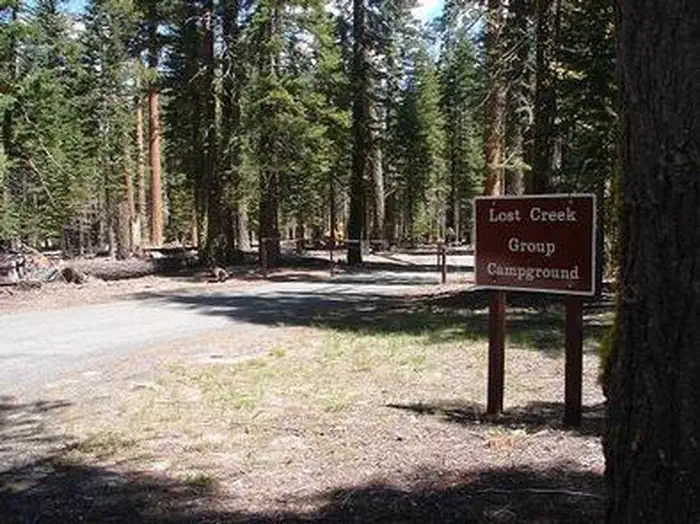
The nearest public campgrounds are Cave Campground (1.7 mi, first-come), Bridge Campground (4.4 mi, first-come), and Lost Creek Group (8.2 mi).
Source: Campgrounds nearby