Tanners Flat
Tanners Flat Campground is located in scenic Little Cottonwood Canyon at an elevation of 7,200 feet, just 6 miles from Sandy, Utah. The canyon offers many hiking and biking opportunities.
More like this: reservable in Utah · big rigs in Utah · group sites in Utah
Check availability on Recreation.gov ↗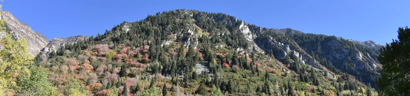
Site mix
| Standard, no hookups | 13 |
| Group tent areas | 4 |
| group walk to | 3 |
| Tent-only | 2 |
| Host/management | 26 |
Site guide
Will my RV fit
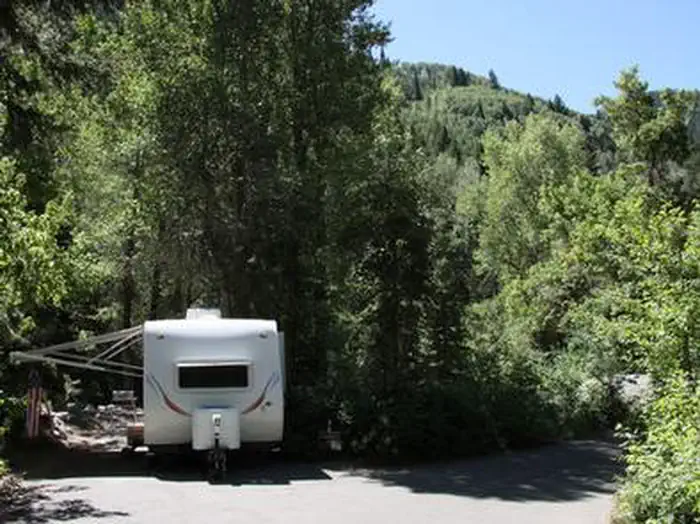
The longest site here provides 80 feet of vehicle capacity. Most sites are shorter.
22 sites in 2 loops. Tap a filter to narrow the list; the map follows.
| Site | Loop | Type | Entry | Surface | Shade | People / vehicles | Fires | Accessible |
|---|---|---|---|---|---|---|---|---|
| AMPHAF | Amphitheater | Group Walk To | Paved | Full | 30 / 6 | Yes | ||
| AMPHEV | Amphitheater | Group Walk To | Paved | Full | 30 / 6 | Yes | ||
| AMPHMO | Amphitheater | Group Walk To | Paved | Full | 30 / 6 | Yes | ||
| 021 | UPPR | Standard | Back-in | Paved | Full | 8 / 1 | Yes | |
| 023 | UPPR | Standard | Back-in | Paved | Full | 8 / 1 | Yes | |
| 024 | UPPR | Standard | Back-in | Paved | Full | 8 / 1 | Yes | Yes |
| 025 | UPPR | Standard | Back-in | Paved | Full | 8 / 1 | Yes | |
| 026 | UPPR | Standard | Back-in | Paved | Full | 8 / 1 | Yes | |
| 027 | UPPR | Standard | Back-in | Paved | Full | 8 / 1 | Yes | |
| 028 | UPPR | Standard | Back-in | Paved | Full | 8 / 1 | Yes |
Per-site records as published by the managing agency on Recreation.gov. Blank cells mean the agency listed nothing for that site. Check-in 1:00 PM, checkout 5:00 PM.
Amenities & rules
| Hookups | None |
| Max vehicle length | 43 ft |
| Equipment | RVs & trailers, Tents |
| Campfires | Allowed, subject to restrictions |
| Fees | Cash, Check, or Scan & Pay (with recreation.gov app). 29 Single Sites - $33.00, capacity - 8 people + 1 vehicle. 3 Double Sites - $67.00, capacity - 16 people + 2 vehicle. 2 Single Glamping Sites - $119.00, capacity - 8 people (deposit required) + 1 vehicle. |
| Accessibility | Sites AMPHAF, AMPHEV, AMPHMO, 001 and 16 more are listed accessible |
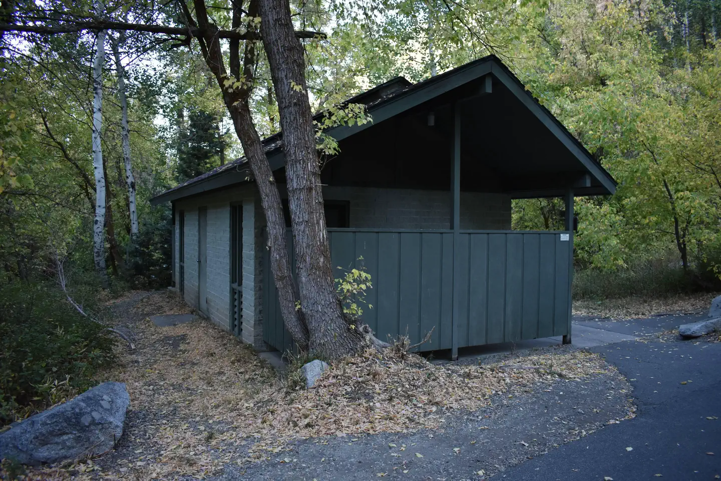
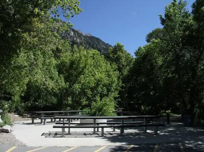
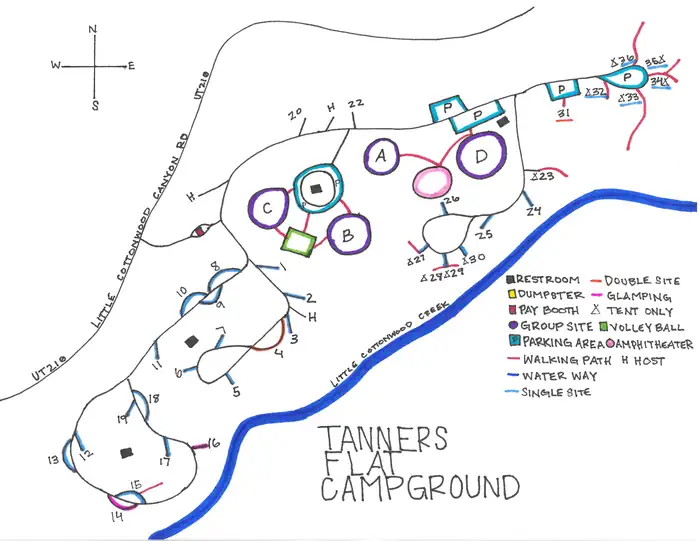
The campground contains 31 single sites, three double sites, four overnight group sites and an amphitheater. The family and overnight group sites have picnic tables and campfire rings. The group overnight sites also have grills and serving tables. The amphitheater has benches and a presentation area, but does not have tables or a fire ring. The amphitheater is available in four hour blocks (8am-12pm, 1pm-5pm, 6pm-10pm). Flush and vault toilets are provided, as is drinking water. A volleyball court is available but campers must bring their own net and ball. Firewood is available for purchase from the host. Roads and parking spurs are paved.
Individual sites vary. Confirm on Recreation.gov or with the managing office.
Season & status
| Status | Closed for the season. Forest Service sites close for the season; check the official page for the reopening date. |
| Forest | Uinta-Wasatch-Cache National Forest |
| Rules | This campground is located Little Cottonwood Canyon, which is in the Salt Lake City Watershed. Special regulations apply and are strictly enforced. No pets allowed. This area is closed to swimming. |
Weather by month
Getting there
From I-215, take the 6200 South exit and travel a mile east to Wasatch Blvd. Take Wasatch Blvd 3 miles south to junction with Little Cottonwood Canyon/Highway 210. Take a left at the junction and travel up Little Cottonwood Canyon for 4.1 miles to the campground.
| Nearest town | Sandy, Utah |
| Coordinates | 40.5725° N, 111.6983° W · Directions ↗ |
Charges and cancellations
- Change and Cancellation Policies and Fees
- Overnight and Day Use Facilities: To ensure fairness, reservation arrival or departure dates may not be changed beyond the booking window until 18 days after booking the reservation.
- Camping / Day Use: A $10.00 service fee will apply if you change or cancel your reservation (including campsites, cabins, lookouts, group facilities, etc.). The $10.00 service fee will be deducted from the refund amount.
- You can cancel or change reservations through Recreation.gov or by calling 1-877-444-6777.
- Late Cancellations
- Overnight and Day Use Facilities: Late cancellations are those cancelled between 12:01 a.m. (Eastern) on the day before arrival and check out time on the day after arrival.
- Individual Campsites: If a customer cancels a reservation the day before or on the day of arrival they will be charged a $10.00 service fee and will also forfeit the first night's use fee (not to exceed the total paid for the original reservation). Cancellations for a single night's reservation will forfeit the entire use fee but no cancellation fee will apply.
- Cabins / Lookouts: Customers will be charged a $10.00 cancellation fee and forfeit the first night's use fee if a cabin or lookout reservation is cancelled within 14 days of the scheduled arrival date. Cancellations for a single night's use will not be assessed a service fee.
- Group Facility: If a customer cancels a group overnight facility reservation within 14 days of the scheduled arrival date they will be charged the $10.00 service fee and forfeit the first night's use fee. Cancellations for a single night's use will not be assessed a service fee.
- Group Day Use Area: If a customer cancels a group day use facility reservation within 14 days of the scheduled arrival date, they will forfeit the total day use fee with no service fee charge.
- No-Shows
- Camping / Day Use: A camping no-show customer is one who does not arrive at a campground and does not cancel the reservation by check-out time on the day after the scheduled arrival date. Reserved campsites and group overnight facilities will be held until check-out time on the day following your scheduled arrival. Group day-use facilities will be held until check-in time on your scheduled arrival
- If a customer does not arrive at the campground or group facility by check-out time the day after arrival or does not cancel the reservation by the times listed under "Late Cancellations" above, the customer may be assessed a $20.00 service fee and forfeit use fees.
- Refunds
- Customers must request refunds no later than 14 days after the scheduled departure date. Recreation.gov will not grant refund requests after 14 days of departure.
- Reservation Fee: For some facilities, tours or permits an additional reservation fee is charged. For some overnight and day-use facilities, an additional non-refundable reservation fee may apply. The non-refundable reservation fee for tours and tickets is $1.00. The non-refundable reservation fee for permits varies by location.
- Refunds for Bankcard Purchases: Refunds for bank card payments will be issued as a credit to the original bank card.
- Refunds for Check or Cash Purchases: Refunds for Recreation.gov payments made by check or money order, and cash payments at selected campgrounds will be issued a check refund. A refund will be processed within 30 days of receipt and approval. Please Note: Refund requests made during or after departure can only be processed when approved by the facility management staff based upon local policy.
- Refunds for Emergency Closures: In the event of an emergency closure, the Recreation.gov team will attempt to notify users and offer alternate dates (as appropriate). If this is not possible, reservations will be cancelled and all fees paid will be refunded. Reservation fees for free tickets are non-refundable in the event of an emergency closure.
- Recreation.gov Billing Information
Fire nearby
- PrescribedPepperwood Rx
6 mi from the campground
- PrescribedMill Creek State Piles Rx
8 mi from the campground
- PrescribedMill Creek Piles Rx
8 mi from the campground
- PrescribedCorner Canyon Rx
9 mi from the campground
Distance is to the reported incident point, not the fire edge. Call the managing office before you drive.
Supplies & services
| Outdoor gear | The Gear Room ↗ | 6.2 mi |
| RV sales & service | Camping World ↗ | 10.8 mi |
| Dump station | Dump station ↗ | 11 mi |
Locations © OpenStreetMap contributors. Call ahead; hours change seasonally.
Explore
Video
Tanners Flat Campground UTAH Camping Review
Worth a stop
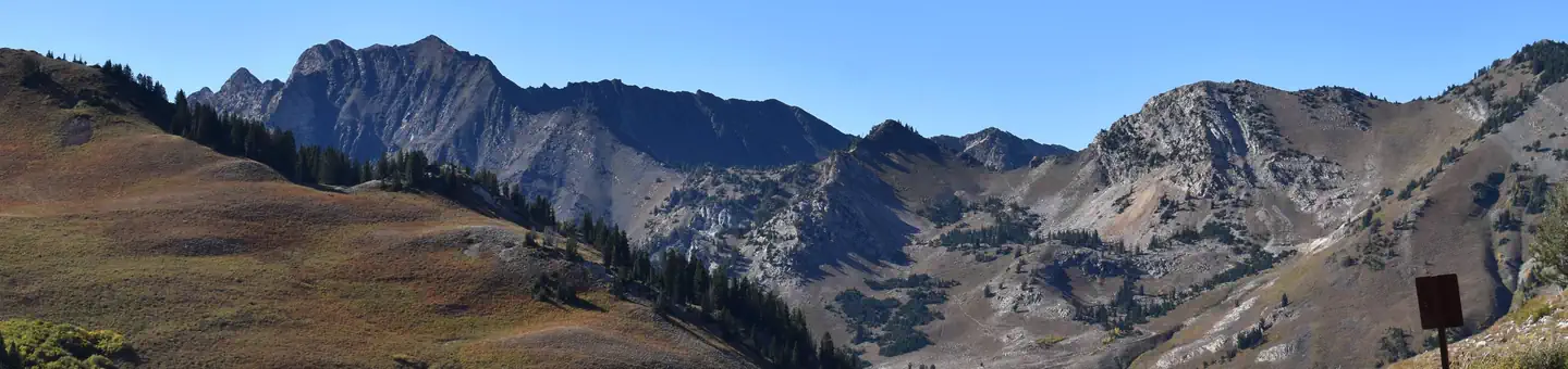
Little Cottonwood Canyon is a beautiful area known for its soaring peaks, unique geology, pristine hidden lakes and cascading streams. Numerous hiking and mountain biking trails are in the area. Rock climbing is a popular activity as well. Snowbird Resort is a few miles up-canyon, offering scenic tram rides, hiking, mountain biking, restaurants, groceries, an Alpine Slide, zip line rides, concerts and various festivals. Albion Basin, part of Alta Ski Resort just a few miles further up-canyon, hosts the Wasatch Wildflower Festival annually in late July/early August, complete with guided nature walks. Numerous hiking trails can be found in Albion Basin, including the 1.5-mile round-trip hike to Cecret Lake.
- 4.7 miBirches Picnic Area ↗Day use
- 4.9 miLedgemere Picnic Area ↗Day use
- 8.9 miTerraces Trailhead #006 ↗Trailhead
Trails nearby
- 0.6 miRed Pine2.5 mi trail · hiking, horse, bike
- 0.9 miWhite Pine ↗5.4 mi trail · hiking, bike
- 0.9 miWhite Pine - Snowbird Link0.9 mi trail · hiking, bike
- 1.3 miMaybird Gulch1.2 mi trail · hiking, horse
- 1.5 miLisa Falls0.1 mi trail · hiking
- 1.5 miLittle Cottonwood Creek2.7 mi trail · hiking, bike
Trail and trailhead records are the Forest Service's. Distances are straight-line to the nearer trail end. Trail conditions are not tracked here.
Public land it sits in
Twin Peaks Wilderness begins under a tenth of a mile away, and it is the closest of these.
- under 0.1 miTwin Peaks Wilderness ↗Wilderness · Forest Service · 11,436 acres
- 0.7 miLone Peak Wilderness ↗Wilderness · Forest Service · 30,632 acres
- 3.6 miMount Olympus Wilderness ↗Wilderness · Forest Service · 15,291 acres
Each unit is published as a centre point and an acreage rather than a boundary, so this section stands it in for a circle of the same area. Whether a campground is inside, and how far it is from one it is outside, are both approximate.
Other campgrounds nearby

On the National Register nearby
- Anne P. Marriott HouseBuilding · Sandy · 3.1 mi
- Granite Hydroelectric Power Plant Historic DistrictHistoric district · Salt Lake City · 5.4 mi
- Granite LDS Ward Chapel–Avard Fairbanks StudioBuilding · Sandy · 5.6 mi
Natural features
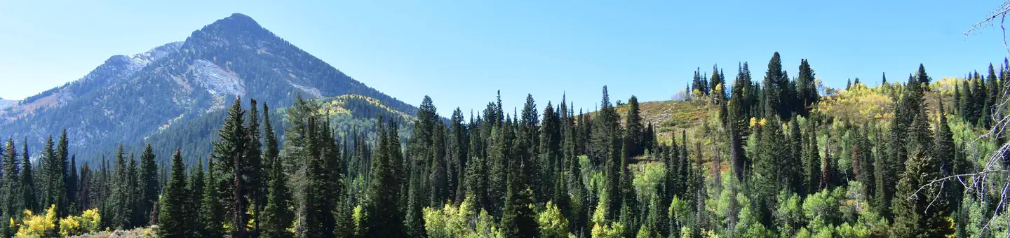
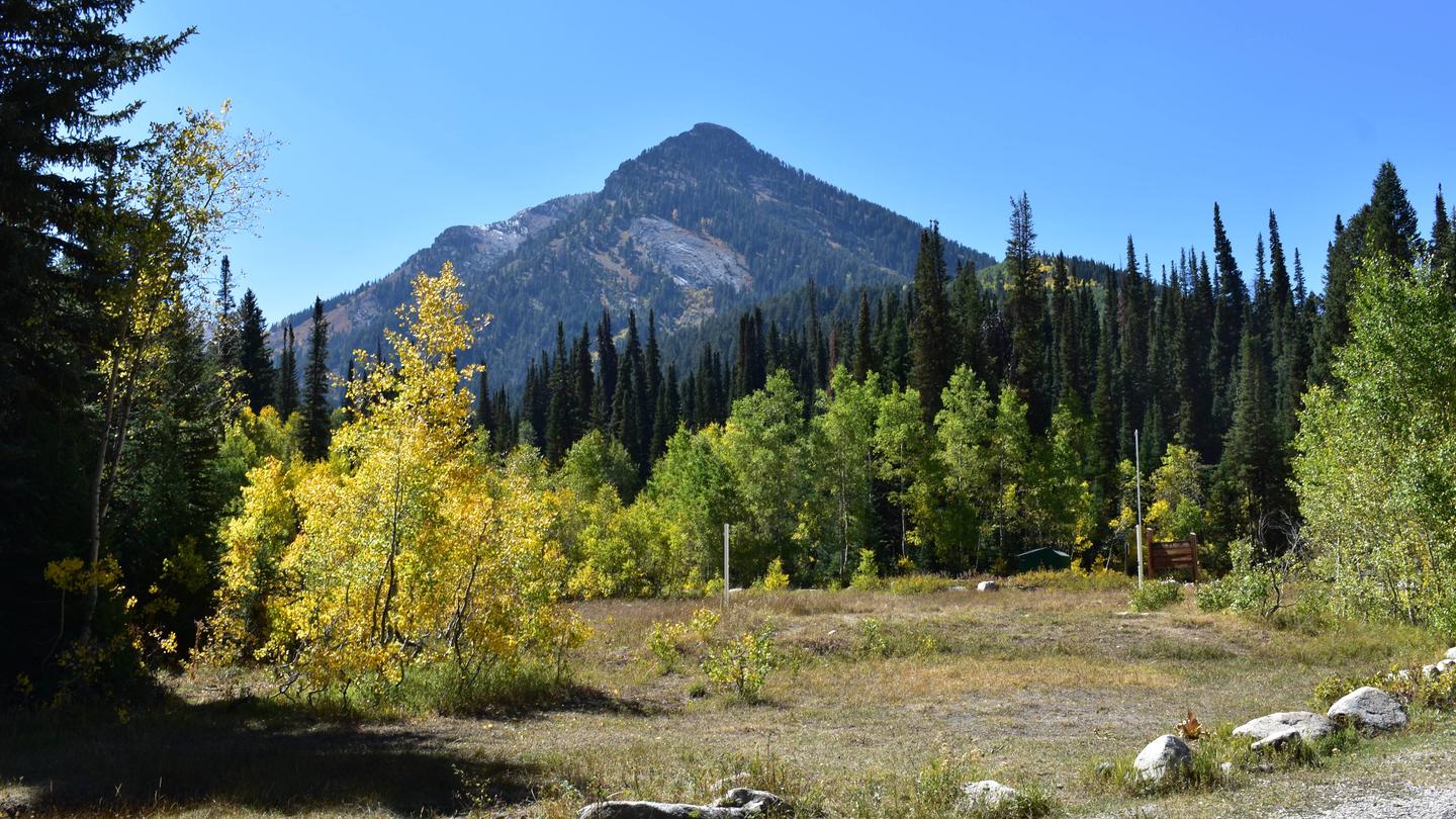
The campground is set among a forest of shady pine, aspen, oak and maple trees. Vivid summer wildflowers are abundant, and autumn leaves put on quite a show. Little Cottonwood Creek runs along the edge of the campground.
Recreation
Hiking and mountain biking trailheads can be found throughout the canyon. Hikers enjoy Red Pine Lake, White Pine Lake and Maybird Gulch, all beautiful hikes leading to alpine lakes. Mountain bikers enjoy the Cottonwood Creek Trail and Albion Meadows Trail. Little Cottonwood Creek offers good trout fishing and is a favorite among local fly-fishermen.
Guidebooks for Utah
We earn a small commission if you buy through these links. It does not change what we list.


Titles come from Open Library's catalog, matched by subject heading or by title.
Reference
Questions people ask
Do I need a reservation at Tanners Flat?
Sites at Tanners Flat are reservable on Recreation.gov. Any walk-up sites are listed on the booking page.
Source: Recreation.gov
How much does it cost to camp at Tanners Flat?
Cash, Check, or Scan & Pay (with recreation.gov app). 29 Single Sites - $33.00, capacity - 8 people + 1 vehicle. 3 Double Sites - $67.00, capacity - 16 people + 2 vehicle.
Source: Recreation.gov
What time is check-in at Tanners Flat?
Check-in 1:00 PM, checkout 5:00 PM.
Source: Recreation.gov
What does it cost to cancel a reservation at Tanners Flat?
Camping / Day Use: A $10.00 service fee will apply if you change or cancel your reservation (including campsites, cabins, lookouts, group facilities, etc.). The $10.00 service fee will be deducted from the refund amount.
Source: Charges and cancellations
Is Tanners Flat open right now?
Closed for the season as of Oct 16, 2026.
Source: Forest Service status
How many sites does Tanners Flat have?
48 sites, including 13 standard sites without power, 4 group tent areas, 3 group walk to, and 2 tent-only sites.
Source: Recreation.gov
Will my RV fit at Tanners Flat?
The longest site here provides 43 feet of vehicle capacity. Most sites are shorter. The sidebar tool checks a trailer or motorhome length against every site.
Source: Will my RV fit
Can I have a campfire at Tanners Flat?
Fires are allowed in the provided rings under normal conditions. As of 2026-10-16, there are 4 active fires within 50 miles, so check current restrictions before you light one. This campground is located Little Cottonwood Canyon, which is in the Salt Lake City Watershed.
Source: Fire nearby
Are there accessible sites at Tanners Flat?
Sites AMPHAF, AMPHEV, AMPHMO, and 001 are listed accessible on Recreation.gov, 20 sites in all. What that covers (a paved pad, an accessible table, a nearby accessible restroom) is on each site's booking page.
Source: Recreation.gov
Is there cell service at Tanners Flat?
FCC coverage maps show Verizon 4G LTE, AT&T 4G LTE, and T-Mobile 5G at the campground point. Terrain changes that from one site to the next.
Source: FCC Broadband Map
What is there to do at Tanners Flat?
Hiking and mountain biking trailheads can be found throughout the canyon. The Recreation section on this page has the rest.
Source: Recreation
What is the nearest town to Tanners Flat?
Sandy, Utah. Little Cottonwood Canyon is a beautiful area known for its soaring peaks, unique geology, pristine hidden lakes and cascading streams.
Source: Getting there