Council
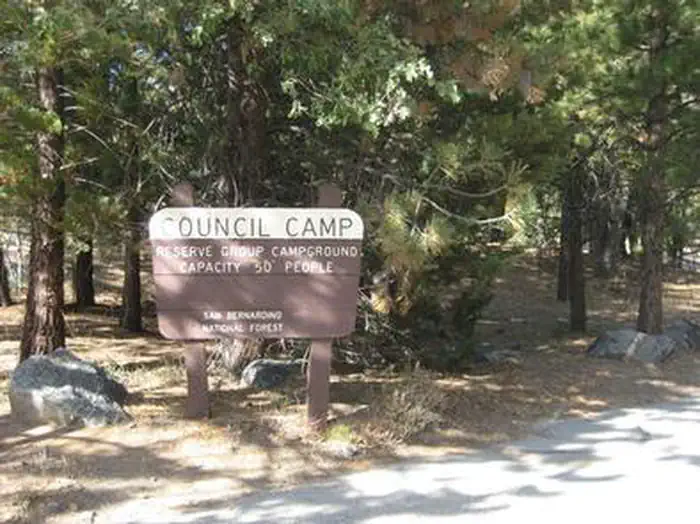
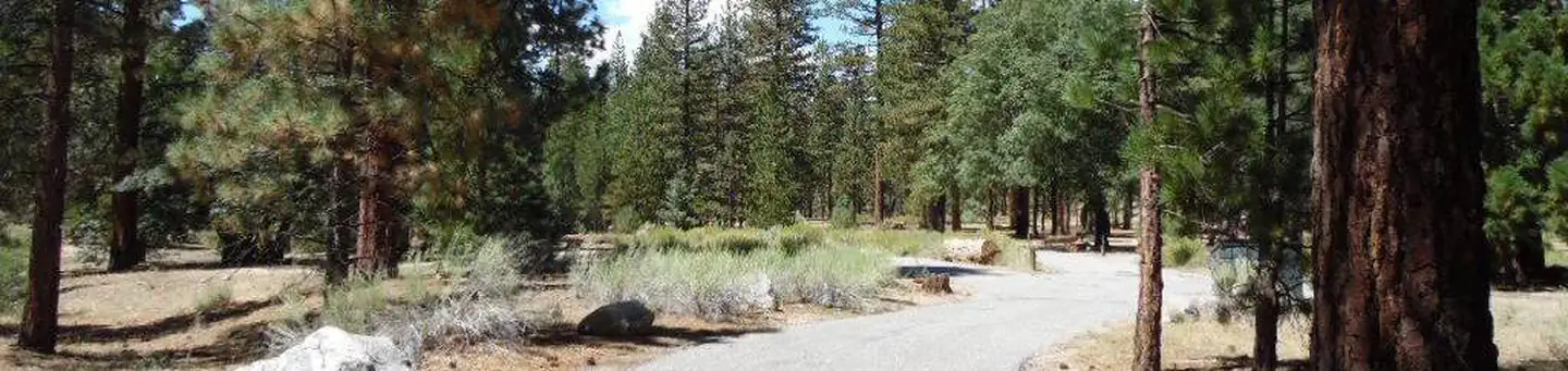
The Council Group Campground is a great place to enjoy a large outdoor gathering with just about everything the San Bernardino National Forest has to offer. Its location provides a great place for visitors to relax, take in the fresh mountain air and enjoy the beautiful scenery. In addition to a nearby lake and river access, a variety hiking, biking and horseback riding trails can be accessed from the campground.
More like this: reservable in California · tent only in California · pets allowed in California · group sites in California
Check availability on Recreation.gov ↗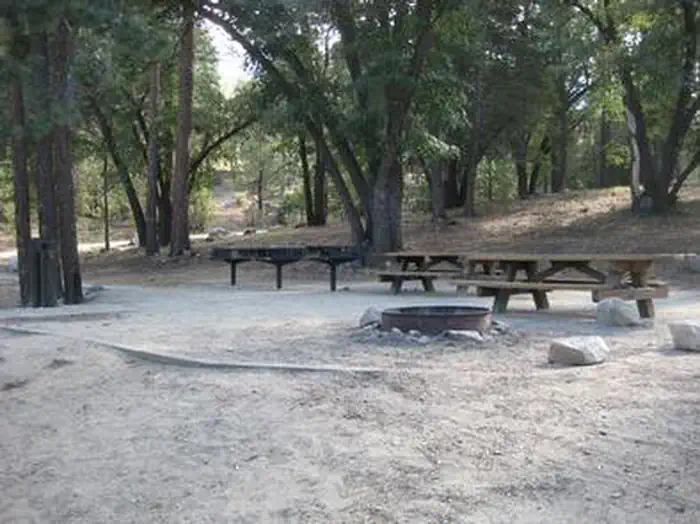
Site mix
| Group tent areas | 1 |
Site guide
1 site. Tap a filter to narrow the list; the map follows.
| Site | Entry | Surface | Shade | People / vehicles | Fires |
|---|---|---|---|---|---|
| 1 | Back-in | Paved | Partial | 50 / 13 | Yes |
Per-site records as published by the managing agency on Recreation.gov. Blank cells mean the agency listed nothing for that site. Check-in 2:00 PM, checkout 12:00 PM.
Amenities & rules
| Max vehicle length | 30 ft |
| Equipment | Tents |
| Pets | Allowed |
| Campfires | Allowed, subject to restrictions |
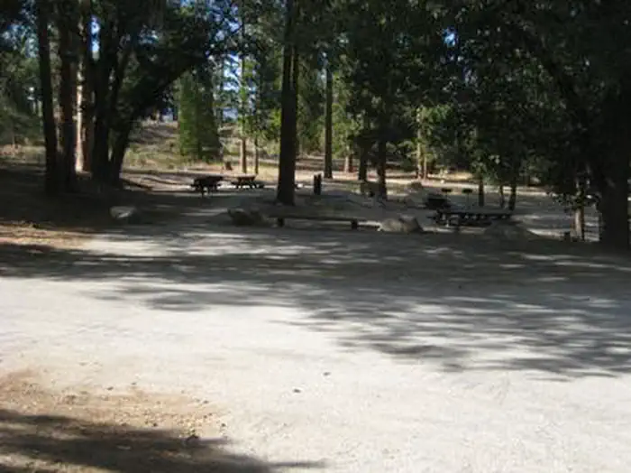
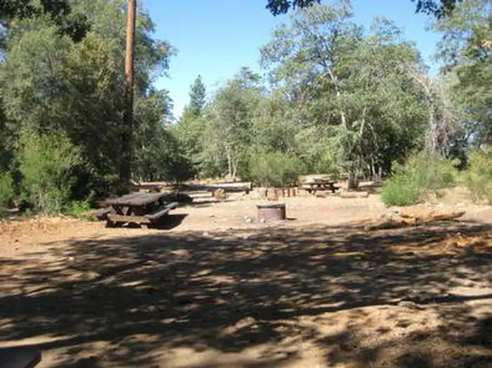
The campground offers one accessible group campsite, available for tent and RV camping. The site can accommodate up to 50 people and 13 vehicles. A campground host is available at nearby Barton Flats Campground if needed for check-in assistance and to answer questions regarding the area. The site is equipped with tables and campfire rings with grills. Larger campfire circles are available as well. Accessible vault toilets and drinking water are provided.
Individual sites vary. Confirm on Recreation.gov or with the managing office.
Season & status
| Status | Closed for the season. Forest Service sites close for the season; check the official page for the reopening date. |
| Forest | San Bernardino National Forest |
| Booking | Call 1-877-444-6777 or www.recreation.gov. Reservations can be made as early as 6 months or as late as 24 hours in advance. |
| Fees | Group $243 per night, Holiday $253 per night |
| Rules | This campground requires a 2 day minimum stay on the weekends and a 3 day minimum stay on holiday weekends. Parking is limited. No discharge of fireworks or firearms allowed in campground. All pets must be leashed. |
Weather by month
Getting there
Take I-10 East to Redlands. Take the University Street exit, EXIT 80. Turn left (northbound) on University Street. Turn right onto E. Lugonia Avenue/SR-38. Continue on State Highway 38 for approximately 17 miles to the campground entrance.
| Nearest town | Angelus Oaks, California |
| Coordinates | 34.1715° N, 116.8821° W · Directions ↗ |
Charges and cancellations
Any location or activity requiring a permit or lottery will have unique requirements and policies. Please check individual facility pages for pertinent information for those sites. Booking Window For most locations, you can reserve six months in advance of your stay for individual sites and 12 months in advance for group sites. There are some exceptions, so it is best to check with each facility. Change and Cancellation Policies and Fees Overnight and Day Use Facilities: To ensure fairness, reservation arrival or departure dates may not be changed beyond the booking window until 18 days after booking the reservation. Camping / Day Use: A $10.00 service fee will apply if you change or cancel your reservation (including campsites, cabins, lookouts, group facilities, etc.).
Supplies & services
| Dump station | Dump station ↗ | 0.4 mi |
| RV sales & service | Mountain Air Mobile Home Sales ↗ | 17 mi |
| Outdoor gear | Sportsman's Warehouse ↗ | 23.6 mi |
Locations © OpenStreetMap contributors. Call ahead; hours change seasonally.
Explore
Video
campground review wild boar campground, council bluff recreation area, council bluff lake
Worth a stop
The Grayback Amphitheater on State Route 38 provides evening educational programs on most Saturdays and Sundays throughout the summer months. Programs are hosted by the San Gorgonio Wilderness Association and pertain to the area's background and rich history.
- 0.4 miJenks Lake Day Use Area ↗Day use
- 5.1 mi
- 7 mi
- 7.3 miGrays Peak Trailhead Day Use ↗Trailhead
- 10.1 miCactus Flat Ohv Staging Area ↗OHV / range
Trails nearby
- 0.1 miRio Monte ↗2.3 mi trail
- 0.3 miJenks Lake ↗1.1 mi trail
- 0.4 miSanta Ana River Trail C Spur ↗1 mi trail
- 0.6 miSanta Ana River Trail D Spur ↗0.5 mi trail
- 0.9 miSanta Ana River Trail B Spur ↗1.1 mi trail
- 1 miSouth Fork ↗9.9 mi trail
Trail and trailhead records are the Forest Service's. Distances are straight-line to the nearer trail end. Trail conditions are not tracked here.
Public land it sits in
This campground sits inside San Bernardino National Forest.
- inSan Bernardino National Forest ↗National Forest · Forest Service · 805,483 acres
- 3.1 miSan Gorgonio Wilderness ↗Wilderness · BLM/FS · 101,574 acres
- 3.6 miSand to Snow National Monument ↗National Monument · Bureau of Land Management · 174,844 acres
Each unit is published as a centre point and an acreage rather than a boundary, so this section stands it in for a circle of the same area. Whether a campground is inside, and how far it is from one it is outside, are both approximate.
Other campgrounds nearby

On the National Register nearby
- Henry Washington Survey MarkerObject · Big Bear City · 4.5 mi
- Judson and Brown DitchStructure · Redlands · 14.9 mi
Natural features
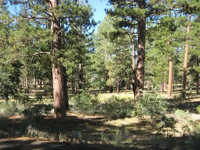
The campground is located northeast of San Bernardino, just off of Highway 38, in the Barton Flats area of the San Bernardino Mountains. The highway is part of the Rim of the World Scenic Byway. The campground is situated in a pine forest, at an elevation of about 6,360 feet.
Recreation
The campground provides access to the famed Santa Ana River Trail, which when completed will travel all the way from the mountains to the pacific ocean, providing spectacular views along the way. It is currently popular with hikers, bikers and horseback riders. The Rio Monte Trail is also accessible from the campground, leading visitors to the Rio Monte Panorama, which overlooks the deep gorge of the Santa Ana River Valley. Visitors can also enjoy fishing and non-motorized boating, including kayaking and canoeing at the nearby Jenks Lake, a small mountain lake with a picnic area and access to hiking trails. The lake is stocked with rainbow trout and there are also some largemouth bass, bluegill, sunfish and catfish available. Fishing is also available in the nearby Santa Ana River.
Guidebooks for California
We earn a small commission if you buy through these links. It does not change what we list.

Titles come from Open Library's catalog, matched by subject heading or by title.
Reference
Questions people ask
Do I need a reservation at Council?
Sites at Council are reservable on Recreation.gov. Call 1-877-444-6777 or www.recreation.gov. Any walk-up sites are listed on the booking page.
Source: Recreation.gov
How much does it cost to camp at Council?
Group $243 per night, Holiday $253 per night
Source: Recreation.gov
What time is check-in at Council?
Check-in 2:00 PM, checkout 12:00 PM.
Source: Recreation.gov
What does it cost to cancel a reservation at Council?
Camping / Day Use: A $10.00 service fee will apply if you change or cancel your reservation (including campsites, cabins, lookouts, group facilities, etc.).
Source: Charges and cancellations
Is Council open right now?
Closed for the season as of Oct 16, 2026.
Source: Forest Service status
How many sites does Council have?
1 site, including 1 group tent area.
Source: Recreation.gov
Will my RV fit at Council?
The longest site here provides 30 feet of vehicle capacity. Most sites are shorter. The sidebar tool checks a trailer or motorhome length against every site.
Source: Will my RV fit
Are pets allowed at Council?
Yes, pets are allowed at Council. Leash rules apply.
Source: Recreation.gov
Can I have a campfire at Council?
Fires are allowed in the provided rings under normal conditions. This campground requires a 2 day minimum stay on the weekends and a 3 day minimum stay on holiday weekends.
Source: Recreation.gov
Is there cell service at Council?
FCC coverage maps show Verizon 5G, AT&T 5G, and T-Mobile 5G at the campground point. Terrain changes that from one site to the next.
Source: FCC Broadband Map
What is there to do at Council?
The campground provides access to the famed Santa Ana River Trail, which when completed will travel all the way from the mountains to the pacific ocean, providing spectacular views along the way. The Recreation section on this page has the rest.
Source: Recreation
What is the nearest town to Council?
Angelus Oaks, California. The Grayback Amphitheater on State Route 38 provides evening educational programs on most Saturdays and Sundays throughout the summer months.
Source: Getting there