Mackinaw
Mackinaw Campground is located next to Fish Lake and the Fishlake Scenic Byway in central Utah at an elevation of 9,000 feet. Visitors enjoy boating, fishing and exploring local trails.
Some sites take reservations on Recreation.gov. Others are first-come, first-served.
More like this: first-come in Utah · reservable in Utah · big rigs in Utah · group sites in Utah
Check availability on Recreation.gov ↗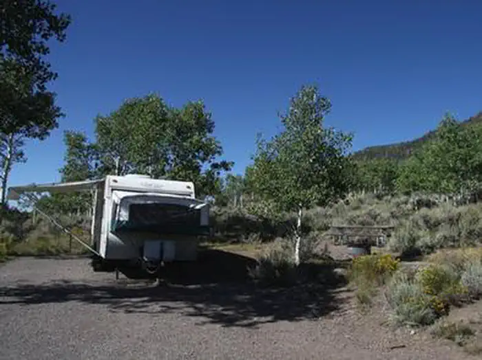

Site mix
| Standard, no hookups | 57 |
| Group sites | 6 |
| group rv area nonelectric | 3 |
| Tent-only | 1 |
Site guide
Will my RV fit
The longest site here provides 115 feet of vehicle capacity. Most sites are shorter.
67 sites in 4 loops. Tap a filter to narrow the list; the map follows.
| Site | Loop | Type | Entry | Fits, ft | Surface | Shade | People / vehicles | Fires | Accessible |
|---|---|---|---|---|---|---|---|---|---|
| 025 | DOUBLE | Group | Pull-through | Paved | 20 / 2 | Yes | |||
| 026 | DOUBLE | Group | Pull-through | 115 | Paved | 20 / 2 | Yes | ||
| 027 | DOUBLE | Group | Pull-through | 110 | Paved | 20 / 2 | Yes | ||
| 046 | DOUBLE | Group | Pull-through | 75 | Paved | 20 / 2 | Yes | ||
| 035 | Double | Group | Back-in | 35 | Paved | Partial | 20 / 2 | Yes | |
| 029 | MACK | Group Rv Area Nonelectric | Gravel | 20 / 2 | Yes | ||||
| 031 | MACK | Group Rv Area Nonelectric | Gravel | 20 / 2 | Yes | ||||
| 032 | MACK | Group Rv Area Nonelectric | Gravel | 20 / 2 | Yes | ||||
| 001 | SING | Standard | Gravel | 10 / 1 | Yes | ||||
| 002 | SING | Standard | Gravel | 10 / 1 | Yes |
Per-site records as published by the managing agency on Recreation.gov. Blank cells mean the agency listed nothing for that site. Check-in 2:00 PM, checkout 12:00 PM.
Amenities & rules
| Hookups | None |
| Max vehicle length | 125 ft |
| Equipment | RVs & trailers, Tents |
| Campfires | Allowed, subject to restrictions |
| Accessibility | Sites 013, 014 are listed accessible |
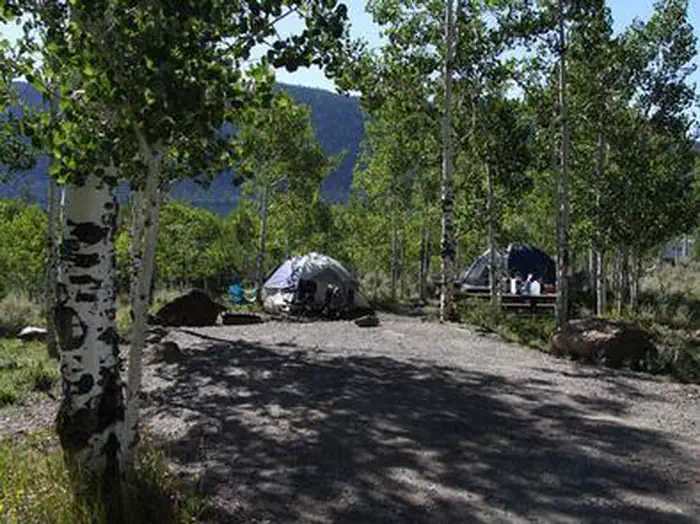
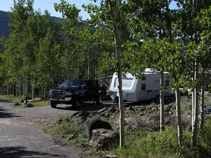
The campground contains four group sites that can accommodate up to 20 people each. Picnic tables and fire rings with grills are provided. Several single-family sites are available as well. Most sites have lake views. Flush toilets, showers and drinking water are provided. Roads and parking spurs are paved. Three resorts are located in the Fish Lake Basin, offering camping and fishing supplies, RV parks with hookups, cabin and boat rentals, marinas, gas, restaurants, groceries, laundry facilities and showers. The resorts are open from Memorial Day to Labor Day.
Individual sites vary. Confirm on Recreation.gov or with the managing office.
Season & status
| Status | Closed for the season. Forest Service sites close for the season; check the official page for the reopening date. |
| Season | May to September |
| Forest | Fishlake National Forest |
| Booking | Reservations required for half of the sites can be made through the Recreation.gov or by calling them toll-free at 1-877-444-6777 or visiting Mackinaw Campground on rec.gov. |
| Fees | Please Note: All campgrounds on the Fishlake National Forest are managed by High Country Recreation under the terms and conditions of a concession permit that was issued to them by the Forest Service in 2020. Email: [email protected] Phone: 435-979-6868 |
| Rules | No OHV riding in campground Camping is limited to 16 consecutive days. Pets are required to be on a leash. |
Weather by month
Getting there
From Highway 24 northwest of Loa, Utah, take Highway 25 northeast 9 miles to the campground.
| Nearest town | Loa, Utah, Utah |
| Coordinates | 38.5556° N, 111.7161° W · Directions ↗ |
Fire nearby
- PrescribedFremont River Rd Piles Rx
3 mi from the campground
- PrescribedSalina Canyon East Rx
19 mi from the campground · 17,375 acres
Distance is to the reported incident point, not the fire edge. Call the managing office before you drive.
Supplies & services
| Dump station | Dump station ↗ | 2.2 mi |
Locations © OpenStreetMap contributors. Call ahead; hours change seasonally.
Explore
Video
Is Mackinaw City's Most Popular KOA Worth It?
Worth a stop
Johnson Valley Reservoir is just north of Fish Lake, offering additional fishing and boating opportunities.
- 1.5 miPelican Trailhead ↗Trailhead
- 4.5 miRust Spring Trailhead ↗Trailhead
- 7.7 miKoosharem Day Use Site ↗Day use
Trails nearby
- 1.5 miPelican Canyon3.7 mi trail · hiking, horse, bike
- 2 miRight Fork Pelican Canyon1.8 mi trail · hiking, horse, bike
- 2.1 miDoctor Creek1.7 mi trail · hiking, horse, bike
- 2.3 miLakeshore ↗18.2 mi trail · hiking, horse, bike
- 2.4 miPole Canyon ↗9.5 mi trail · hiking, horse, bike, e-bike
- 3.3 miReflection Spring3.1 mi trail · hiking, horse, bike
Trailheads within three miles
- 1.5 miPELICAN TRAILHEAD ↗Fishlake National Forest · Season June
- 2.3 miDOCTOR CREEK TRAILHEAD ↗Fishlake National Forest · Season June
Trail and trailhead records are the Forest Service's. Distances are straight-line to the nearer trail end. Trail conditions are not tracked here.
Public land it sits in
This campground sits inside Fishlake National Forest.
- inFishlake National Forest ↗National Forest · Forest Service · 1,787,979 acres
Each unit is published as a centre point and an acreage rather than a boundary, so this section stands it in for a circle of the same area. Whether a campground is inside, and how far it is from one it is outside, are both approximate.
Other campgrounds nearby

Cabin and lookout rentals nearby
On the National Register nearby
- Loa Tithing OfficeBuilding · Loa · 11.3 mi
Natural features
The campground sits on a sagebrush-covered hillside above the valley floor and offers views of Fish Lake. Aspen trees forest the site, providing partial shade.
Recreation
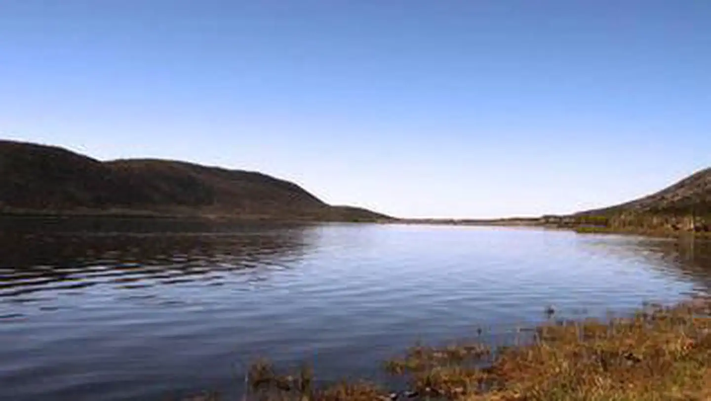
Fish Lake is Utah's largest natural mountain lake, covering 2,500 acres. It is famous for its 20-40 pound Mackinaw lake trout. Anglers also enjoy fishing for rainbow trout and splake. Boating, canoeing, swimming and scuba diving are popular activities. The 5-mile Pelican Canyon Trail begins next door at Bowery Creek Campground. It leads through meadows and dense forests of spruce, pine and aspen as it climbs to the 11,633-foot Fish Lake Hightop. The popular Lakeshore National Recreation Trail extends around the eastern side of the lake. Hikers are rewarded with stunning lake views after climbing 900 feet in elevation.
Guidebooks for Utah
We earn a small commission if you buy through these links. It does not change what we list.


Titles come from Open Library's catalog, matched by subject heading or by title.
Reference
Questions people ask
Do I need a reservation at Mackinaw?
For some sites. Some sites take reservations on Recreation.gov. Others are first-come, first-served.
Source: Recreation.gov
How much does it cost to camp at Mackinaw?
Please Note: All campgrounds on the Fishlake National Forest are managed by High Country Recreation under the terms and conditions of a concession permit that was issued to them by the Forest Service in 2020. Email: [email protected] Phone: 435-979-6868
Source: Recreation.gov
What time is check-in at Mackinaw?
Check-in 2:00 PM, checkout 12:00 PM.
Source: Recreation.gov
Is Mackinaw open right now?
Closed for the season as of Oct 16, 2026. Season May to September.
Source: Forest Service status
How many sites does Mackinaw have?
67 sites, including 57 standard sites without power, 6 group sites, 3 group rv area nonelectric, and 1 tent-only site.
Source: Recreation.gov
Will my RV fit at Mackinaw?
Recreation.gov lists no practical vehicle capacity limit for the largest site here, which usually means pull-through or open parking. The sidebar tool checks a trailer or motorhome length against every site.
Source: Will my RV fit
Are there showers or a dump station at Mackinaw?
Flush toilets, showers and drinking water are provided.
Source: Recreation.gov
Can I have a campfire at Mackinaw?
Fires are allowed in the provided rings under normal conditions. As of 2026-10-16, there are 2 active fires within 50 miles, so check current restrictions before you light one. No OHV riding in campground Camping is limited to 16 consecutive days.
Source: Fire nearby
Are there accessible sites at Mackinaw?
Sites 013 and 014 are listed accessible on Recreation.gov. What that covers (a paved pad, an accessible table, a nearby accessible restroom) is on each site's booking page.
Source: Recreation.gov
What is there to do at Mackinaw?
Fish Lake is Utah's largest natural mountain lake, covering 2,500 acres. The Recreation section on this page has the rest.
Source: Recreation
What is the nearest town to Mackinaw?
Loa, Utah, Utah. Johnson Valley Reservoir is just north of Fish Lake, offering additional fishing and boating opportunities.
Source: Getting there
What if Mackinaw is full?
The nearest public campgrounds are Bowery Creek (1.8 mi), Mallard bay overflow rec site (2.1 mi, first-come), and Doctor Creek (2.5 mi).
Source: Campgrounds nearby