Lone Rock Campground
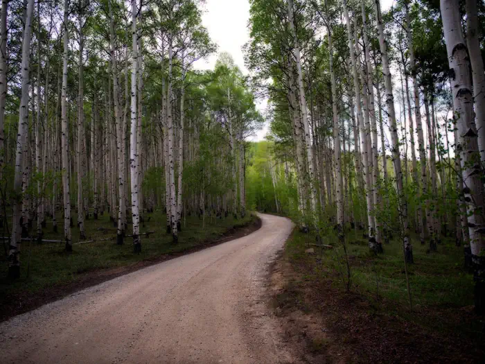
Lone Rock Campground, located along the South Platte River, boasts spectacular views and top-notch fly fishing waters. Hikers thoroughly enjoy the nearby Gill Trail and kayakers are drawn to the rapids of the rushing river. Wildlife viewing is rewarding here and campers may spot moose, mule deer, owls, golden eagles and more.
More like this: reservable in Colorado · big rigs in Colorado · pets allowed in Colorado
Check availability on Recreation.gov ↗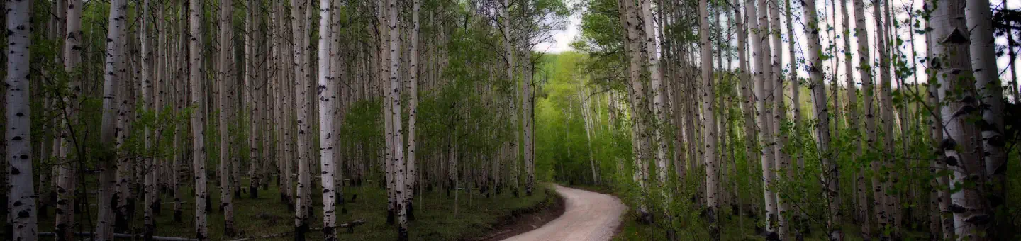
Site mix
| Standard, no hookups | 16 |
| Tent-only | 1 |
| Host/management | 2 |
Site guide
Will my RV fit
The longest site here provides 40 feet of vehicle capacity. Most sites are shorter.
17 sites. Tap a filter to narrow the list; the map follows.
| Site | Type | Entry | Fits, ft | Surface | Shade | Water / sewer | People / vehicles | Fires | Accessible |
|---|---|---|---|---|---|---|---|---|---|
| 002 | Standard | Back-in | 40 | Paved | Partial | No / No | 8 / 2 | Yes | |
| 003 | Standard | Back-in | 35 | Paved | Partial | No / No | 8 / 2 | Yes | |
| 004 | Standard | Back-in | 30 | Paved | Partial | No / No | 8 / 2 | Yes | |
| 005 | Standard | Pull-through | 25 | Paved | Partial | No / No | 8 / 2 | Yes | |
| 006 | Standard | Back-in | 20 | Paved | Partial | No / No | 8 / 2 | Yes | Yes |
| 007 | Standard | Back-in | 20 | Paved | Partial | No / No | 8 / 2 | Yes | |
| 008 | Standard | Pull-through | 25 | Paved | No / No | 8 / 2 | Yes | ||
| 009 | Standard | Pull-through | 25 | Paved | No / No | 8 / 2 | Yes | ||
| 010 | Standard | Pull-through | 25 | Gravel | No / No | 8 / 1 | Yes | ||
| 012 | Standard | Pull-through | 25 | Gravel | No / No | 8 / 1 | Yes |
Per-site records as published by the managing agency on Recreation.gov. Blank cells mean the agency listed nothing for that site. Check-in 2:00 PM, checkout 12:00 PM.
Amenities & rules
| Hookups | None |
| Max vehicle length | 40 ft |
| Equipment | RVs & trailers, Tents |
| Pets | Allowed |
| Campfires | Allowed, subject to restrictions |
| Accessibility | Site 006 is listed accessible |
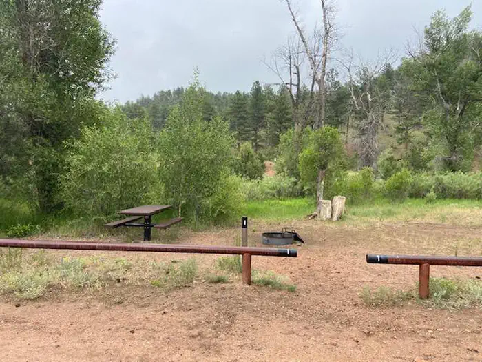
Amenities include two vault toilets and drinking water from a community hydrant. Parking aprons and roads are paved, and each campsite has a picnic table and campfire ring. No RV hookups are available. Services include trash collection and firewood is available for sale.
Individual sites vary. Confirm on Recreation.gov or with the managing office.
Season & status
| Season | year-round |
| Forest | Pike-San Isabel National Forests |
| Booking | Between Memorial and Labor Day weekends, phone 877-444-6777 or visit www.recreation.gov at least 4 days in advance. Friday and Saturday night minimum required stay on weekends. |
| Fees | $28.00 fee per site for overnight. Two (2) vehicles or one (1) RV per site is included in the camping fee. $11.00 for a third vehicle. $11.00 day use fee if not camping overnight. Fees are payable by cash, check or money order. |
| Rules | The following restrictions apply to this campground: Maximum 8 persons per site, 2 tents and 2 vehicles or 1 recreation vehicle. Dogs must be leashed at all times. No discharge of firearms or fireworks. Only licensed vehicles can operate inside campground. Camping is NOT ALLOWED behind a LOCKED GATE. |
Weather by month
Getting there
From Denver, Colorado, take Highway 285 southwest to Pine Junction, Colorado. Turn south on Jefferson County 126 and travel 28 miles. Look for signs into campground.
| Nearest town | S.Platte Ranger Dist, Colorado |
| Coordinates | 39.2517° N, 105.2342° W · Directions ↗ |
Charges and cancellations
Cancellations Individual Campsites: Cancellations up to 2 days before a reservation start date incur a $10.00 cancellation fee. A visitor who cancels a reservation the day before or on the day of arrival will pay a $10.00 service fee AND forfeit the first night's use fee including tax and applicable add-on for a campsite. Cancellations for a one-night reservation will forfeit the entire amount paid and will not be subject to an additional service fee. No-Shows A no-show visitor is one who does not arrive at a campground and does not cancel the reservation by check-out time on the day after the scheduled arrival date. Staff will hold a campsite until check-out time on the day following the arrival date. No-shows are assessed $20.00 service fee and forfeit the first night's rate, taxes and applicable add-on for a campsite. Refunds will not be issued after the 7 days has ended. Refunds for debit or credit card payments will be issued as a credit to the original bank or credit card used to pay.
Fire nearby
- PrescribedO'Brien 2 Broadcast Rx
20 mi from the campground · 267 acres
- PrescribedRainbow Gulch Rx
23 mi from the campground · 912 acres
- PrescribedHarris Park Broadcast Rx
23 mi from the campground · 390 acres
Distance is to the reported incident point, not the fire edge. Call the managing office before you drive.
Supplies & services
| Outdoor gear | South Platte Fly Shop ↗ | 20.6 mi |
| RV sales & service | Berkenkotter Motors ↗ | 21.6 mi |
| Dump station | Dump station ↗ | 21.8 mi |
Locations © OpenStreetMap contributors. Call ahead; hours change seasonally.
Explore
Video
Lone Rock Campground - Pike National Forest
Worth a stop
The drive along Highway 126 from Pine Junction affords magnificent views of the valleys below. Pikes Peak can be seen in the distance and other prominent rock formations present themselves throughout the scenic drive. Limited groceries are available in the town of Decker.
- 1.8 miCheesman Canyon Trailhead ↗Trailhead
- 5.8 miScraggy View Picnic Area ↗Day use
- 6.3 miTopaz Point Picnic Area ↗Day use
- 6.9 miShinglemill Trailhead ↗Trailhead
Trails nearby
- 1.8 miGill ↗4.7 mi trail · hiking, horse
- 4 miDevils Revenge ↗9.3 mi trail · hiking, horse, bike, motorcycle and 1 more
- 4.1 miKelsey Cut-Off0.3 mi trail · hiking, horse, bike
- 4.1 miKelsey Loop0.3 mi trail · hiking, horse, bike
- 4.8 miLog Jumper ↗7 mi trail · hiking, horse, bike, motorcycle and 2 more
- 4.8 miNoddle ↗7.2 mi trail · hiking, horse, bike, motorcycle and 2 more
Trailheads within three miles
- 1.8 miCheesman Canyon Trailhead ↗Pike-San Isabel National Forests · Season Open year-round
Trail and trailhead records are the Forest Service's. Distances are straight-line to the nearer trail end. Trail conditions are not tracked here.
Public land it sits in
Lost Creek Wilderness begins about 2.6 miles away, and it is the closest of these.
- 2.6 miLost Creek Wilderness ↗Wilderness · Forest Service · 114,864 acres
Each unit is published as a centre point and an acreage rather than a boundary, so this section stands it in for a circle of the same area. Whether a campground is inside, and how far it is from one it is outside, are both approximate.
Other campgrounds nearby


On the National Register nearby
- Green Mountain RanchBuilding · Buffalo Creek · 3.7 mi
- Blue Jay InnBuilding · Buffalo Creek · 9.7 mi
- Green Mercantile StoreBuilding · Buffalo Creek · 10.1 mi
Natural features
The campground is situated on a hillside rising up from the South Platte River at an elevation of 6,479 feet. Many sites are open and feature a view of the river. Privacy is minimal but ponderosa pines provide some shade. Temperatures are generally mild.
Recreation
Anglers flock to the river, renowned for rainbow and brown trout fishing. Tubing is also a popular activity. The Gill Trail is an intermediate hike that weaves through Cheesman Canyon. The trailhead is near the campground and extends 7 miles southwest to the Cheesman Dam at Cheesman Lake.
Guidebooks for Colorado
We earn a small commission if you buy through these links. It does not change what we list.



Titles come from Open Library's catalog, matched by subject heading or by title.
Reference
Questions people ask
Do I need a reservation at Lone Rock Campground?
Sites at Lone Rock Campground are reservable on Recreation.gov. Between Memorial and Labor Day weekends, phone 877-444-6777 or visit www.recreation.gov at least 4 days in advance. Any walk-up sites are listed on the booking page.
Source: Recreation.gov
How much does it cost to camp at Lone Rock Campground?
$28.00 fee per site for overnight. Two (2) vehicles or one (1) RV per site is included in the camping fee. $11.00 for a third vehicle.
Source: Recreation.gov
What time is check-in at Lone Rock Campground?
Check-in 2:00 PM, checkout 12:00 PM.
Source: Recreation.gov
What does it cost to cancel a reservation at Lone Rock Campground?
Cancellations Individual Campsites: Cancellations up to 2 days before a reservation start date incur a $10.00 cancellation fee.
Source: Charges and cancellations
How many sites does Lone Rock Campground have?
19 sites, including 16 standard sites without power and 1 tent-only site.
Source: Recreation.gov
Will my RV fit at Lone Rock Campground?
The longest site here provides 40 feet of vehicle capacity. Most sites are shorter. The sidebar tool checks a trailer or motorhome length against every site.
Source: Will my RV fit
Are pets allowed at Lone Rock Campground?
Yes, pets are allowed at Lone Rock Campground. Leash rules apply.
Source: Recreation.gov
Can I have a campfire at Lone Rock Campground?
Fires are allowed in the provided rings under normal conditions. As of 2026-10-16, there are 3 active fires within 50 miles, so check current restrictions before you light one. The following restrictions apply to this campground: Maximum 8 persons per site, 2 tents and 2 vehicles or 1 recreation vehicle.
Source: Fire nearby
Are there accessible sites at Lone Rock Campground?
Site 006 is listed accessible on Recreation.gov. What that covers (a paved pad, an accessible table, a nearby accessible restroom) is on each site's booking page.
Source: Recreation.gov
Is there cell service at Lone Rock Campground?
FCC coverage maps show AT&T 4G LTE at the campground point. Terrain changes that from one site to the next.
Source: FCC Broadband Map
What is there to do at Lone Rock Campground?
Anglers flock to the river, renowned for rainbow and brown trout fishing. The Recreation section on this page has the rest.
Source: Recreation
What is the nearest town to Lone Rock Campground?
S.Platte Ranger Dist, Colorado. The drive along Highway 126 from Pine Junction affords magnificent views of the valleys below.
Source: Getting there