Mogote
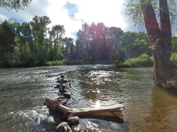
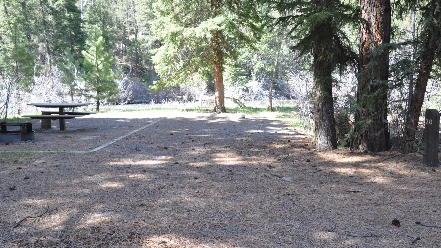
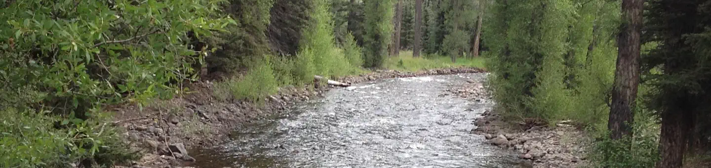
Mogote Campground is located along the Conejos River, making it a perfect location for fishing and hiking. The pleasant campground is well shaded by groves of ponderosa pine and a mixture of cottonwood, spruce, willow and aspen. The campground is also in close proximity to the Cumbres & Toltec Scenic Railroad, home of America's highest and longest, coal fired, steam operated narrow-gauge railroad.
More like this: reservable in Colorado · big rigs in Colorado · pets allowed in Colorado · group sites in Colorado
Check availability on Recreation.gov ↗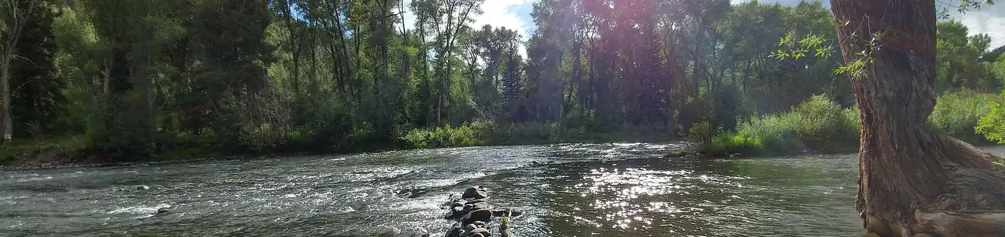
Site mix
| Standard, no hookups | 41 |
| Group sites | 2 |
Site guide
Will my RV fit
The longest site here provides 60 feet of vehicle capacity. Most sites are shorter.
43 sites in 4 loops. Tap a filter to narrow the list; the map follows.
| Site | Loop | Type | Entry | Fits, ft | Surface | Shade | Waterfront | People / vehicles | Fires | Accessible | Rating |
|---|---|---|---|---|---|---|---|---|---|---|---|
| G0J | JGRP | Group | Back-in | 45 | Gravel | 100 / 20 | Yes | Standard | |||
| 022 | LOWE | Standard | Back-in | 50 | Gravel | Partial | Riverfront | 8 / 1 | Yes | Standard | |
| 023 | LOWE | Standard | Back-in | 40 | Gravel | Partial | Riverfront | 8 / 1 | Yes | Standard | |
| 024 | LOWE | Standard | Pull-through | 40 | Gravel | Partial | Riverfront | 8 / 1 | Yes | Standard | |
| 025 | LOWE | Standard | Back-in | 30 | Gravel | Partial | Riverfront | 8 / 1 | Yes | Standard | |
| 026 | LOWE | Standard | Back-in | 40 | Gravel | Partial | Riverfront | 8 / 1 | Yes | Standard | |
| 027 | LOWE | Standard | Back-in | 25 | Gravel | Partial | Riverfront | 8 / 1 | Yes | Standard | |
| 028 | LOWE | Standard | Back-in | 25 | Gravel | Partial | Riverfront | 8 / 1 | Yes | Standard | |
| 029 | LOWE | Standard | Pull-through | 50 | Gravel | Partial | Riverfront | 8 / 1 | Yes | Standard | |
| 030 | LOWE | Standard | Pull-through | 40 | Gravel | Partial | Riverfront | 8 / 1 | Yes | Standard |
Per-site records as published by the managing agency on Recreation.gov. Blank cells mean the agency listed nothing for that site. Check-in 2:00 PM, checkout 12:00 PM.
Amenities & rules
| Hookups | None |
| Max vehicle length | 60 ft |
| Equipment | RVs & trailers, Tents |
| Pets | Allowed |
| Campfires | Allowed, subject to restrictions |
| Accessibility | Site GOP is listed accessible |
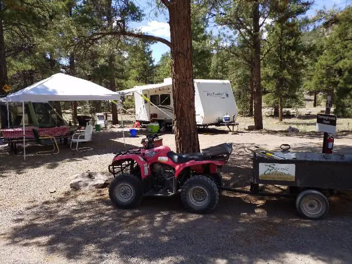
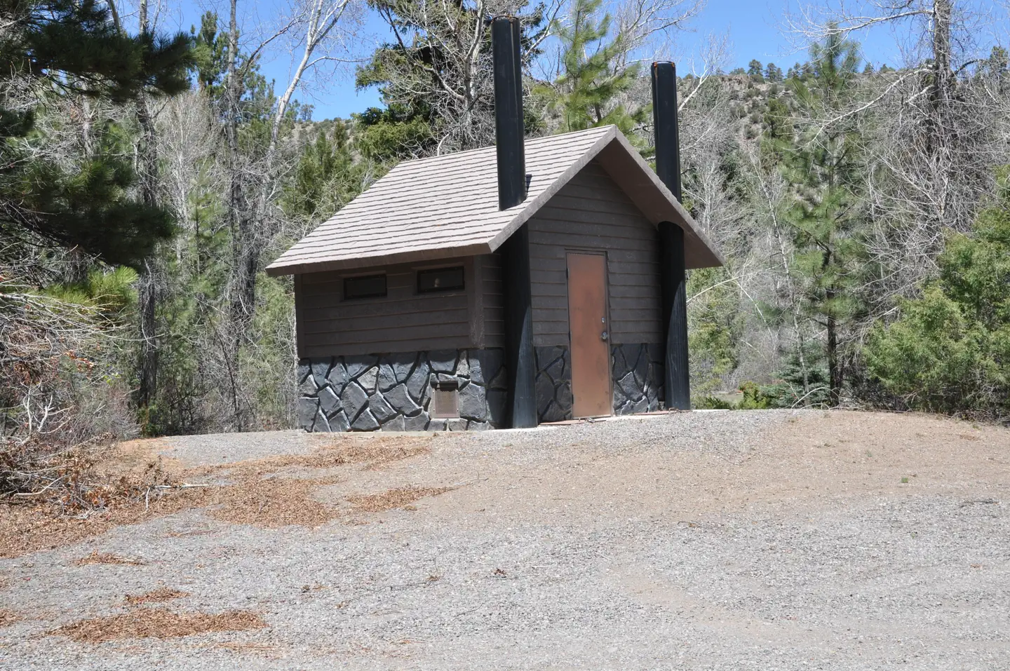
Campsites are equipped with picnic tables and campfire rings with grills. Vault toilets, drinking water and trash bins are provided. An accessible toilet is located in the upper loop. No electric hookups are available. Firewood can be purchased on site.
Individual sites vary. Confirm on Recreation.gov or with the managing office.
Season & status
| Status | Closed for the season. Forest Service sites close for the season; check the official page for the reopening date. |
| Season | Memorial Day weekend to The second Monday of September |
| Forest | Rio Grande National Forest |
| Booking | Reservations can be made up to 6 months in advance, but they must be made at least four days prior to your intended arrival date. |
| Fees | Single site - $29 to $31/night $12 for day use (picnicking). Fee envelopes and a collection box are provided near the entrance. |
Weather by month
Getting there
From Antonito, Colorado, go west on Highway 17 about 15 miles to the campground access road. Turn right and travel 1/4 mile to the Upper Loop Road.
| Nearest town | La Jara, Colorado |
| Coordinates | 37.0647° N, 106.2344° W · Directions ↗ |
Fire nearby
- PrescribedMartinez Fall Rx
26 mi from the campground
- PrescribedMesa Juan Domingo Fall Rx
46 mi from the campground
- PrescribedStone Angel Fall Rx
48 mi from the campground
Distance is to the reported incident point, not the fire edge. Call the managing office before you drive.
Supplies & services
| Dump station | Dump station ↗ | 21.8 mi |
| Outdoor gear | Kristi's Mountain Sports ↗ | 34 mi |
| RV sales & service | RV sales & service ↗ | 46 mi |
Locations © OpenStreetMap contributors. Call ahead; hours change seasonally.
Explore
Video
Mogote Campground - Rio Grande National Forest - Antonito Colorado
Worth a stop
The Cumbres & Toltec Scenic Railroad can be accessed from Antonito. The train makes a 640-mile journey through abandoned mining towns, creating great entertainment for young and old.
- 9.7 miRed Lake Trailhead, Trail 733 ↗Trailhead
- 13.3 miLagunitas Creek Fishing ↗Fishing site
- 13.4 miSpectacle Lake Fishing Site ↗Fishing site
Public land it sits in
Cruces Basin Wilderness begins about 6.9 miles away, and it is the closest of these.
- 6.9 miCruces Basin Wilderness ↗Wilderness · Forest Service · 18,881 acres
- 10.5 miRio San Antonio Wilderness ↗Wilderness · Bureau of Land Management · 8,120 acres
- 10.9 miCarson National Forest ↗National Forest · Forest Service · 1,592,477 acres
Each unit is published as a centre point and an acreage rather than a boundary, so this section stands it in for a circle of the same area. Whether a campground is inside, and how far it is from one it is outside, are both approximate.
Other campgrounds nearby


On the National Register nearby
- Engine No. 463Structure · Antonito · 12.3 mi
- Warshauer MansionBuilding · Antonito · 12.4 mi
- Denver & Rio Grande Railroad San Juan Extension (Boundary Increase)Historic district · Antonito · 12.5 mi
Natural features
The campground sits at an elevation of 8,400 feet, and is separated into an upper and lower loop. The lower loop sits along the fast-flowing Conejos River and many sites face the water. The campground is perched in a wooded section along the river valley. Rio Grande National Forest stretches across 1.86 million acres in south-central Colorado. The forest encompasses a myriad of ecosystems ranging from high elevation desert at 7,600 feet above sea level to rocky crags at over 14,300 feet in the majestic Sangre de Cristo Mountains.
Recreation
The Conejos River is a Gold Medal River, offering a high potential for trophy trout fishing. Rainbow and brown trout are the most common species in the river. Popular hikes include the 15-mile Elk Creek Trail and the 10.9-mile South Fork Conejos Trail.
Guidebooks for Colorado
We earn a small commission if you buy through these links. It does not change what we list.



Titles come from Open Library's catalog, matched by subject heading or by title.
Reference
Questions people ask
Do I need a reservation at Mogote?
Sites at Mogote are reservable on Recreation.gov. Reservations can be made up to 6 months in advance, but they must be made at least four days prior to your intended arrival date. Any walk-up sites are listed on the booking page.
Source: Recreation.gov
How much does it cost to camp at Mogote?
Single site - $29 to $31/night $12 for day use (picnicking). Fee envelopes and a collection box are provided near the entrance.
Source: Recreation.gov
What time is check-in at Mogote?
Check-in 2:00 PM, checkout 12:00 PM.
Source: Recreation.gov
Is Mogote open right now?
Closed for the season as of Oct 16, 2026. Season Memorial Day weekend to The second Monday of September.
Source: Forest Service status
How many sites does Mogote have?
43 sites, including 41 standard sites without power and 2 group sites.
Source: Recreation.gov
Will my RV fit at Mogote?
The longest site here provides 60 feet of vehicle capacity. Most sites are shorter. The sidebar tool checks a trailer or motorhome length against every site.
Source: Will my RV fit
Are pets allowed at Mogote?
Yes, pets are allowed at Mogote. Leash rules apply.
Source: Recreation.gov
Can I have a campfire at Mogote?
Fires are allowed in the provided rings under normal conditions. As of 2026-10-16, there are 3 active fires within 50 miles, so check current restrictions before you light one.
Source: Fire nearby
Are there accessible sites at Mogote?
Site GOP is listed accessible on Recreation.gov. What that covers (a paved pad, an accessible table, a nearby accessible restroom) is on each site's booking page.
Source: Recreation.gov
What is there to do at Mogote?
The Conejos River is a Gold Medal River, offering a high potential for trophy trout fishing. The Recreation section on this page has the rest.
Source: Recreation
What is the nearest town to Mogote?
La Jara, Colorado. The Cumbres & Toltec Scenic Railroad can be accessed from Antonito.
Source: Getting there
What if Mogote is full?
The nearest public campgrounds are Aspen Glade (2.2 mi), Elk Creek Campground (8.5 mi), and Trujillo Meadows Campground (12.1 mi, first-come).
Source: Campgrounds nearby