Ranger Creek Recreation Area
Ranger Creek Group Campground is located just off the Bighorn Scenic Byway (U.S. Highway 14) at an elevation of 7,500 feet. The Bighorn National Forest offers a wide variety of activities, including hiking, fishing, scenic driving and a number of historic sites.
More like this: reservable in Wyoming · big rigs in Wyoming · pets allowed in Wyoming · group sites in Wyoming
Check availability on Recreation.gov ↗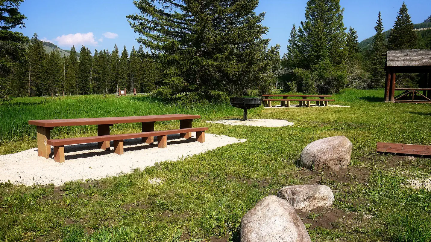
active
Site mix
| Standard, no hookups | 11 |
| group standard area nonelectric | 1 |
Site guide
Will my RV fit
The longest site here provides 75 feet of vehicle capacity. Most sites are shorter.
12 sites in 2 loops. Tap a filter to narrow the list; the map follows.
| Site | Loop | Type | Entry | Fits, ft | Surface | Shade | Waterfront | People / vehicles | Fires | Accessible |
|---|---|---|---|---|---|---|---|---|---|---|
| 001 | East | Standard | Back-in | 66 | Gravel | Partial | 8 / 2 | Yes | ||
| 002 | East | Standard | Back-in | 75 | Gravel | Partial | 8 / 2 | Yes | ||
| 003 | East | Standard | Back-in | 51 | Gravel | Partial | 8 / 2 | Yes | ||
| 004 | East | Standard | Back-in | 48 | Gravel | Riverfront | 8 / 2 | Yes | ||
| 005 | East | Standard | Back-in | 50 | Gravel | Riverfront | 8 / 2 | Yes | ||
| 006 | West | Standard | Back-in | 60 | Gravel | Partial | 8 / 2 | Yes | ||
| 007 | West | Standard | Back-in | 60 | Gravel | Partial | 8 / 2 | Yes | ||
| 008 | West | Standard | Back-in | 30 | Gravel | Partial | Riverfront | 8 / 2 | Yes | |
| 009 | West | Standard | Back-in | 20 | Gravel | Partial | Riverfront | 8 / 2 | Yes | |
| 010 | West | Standard | Back-in | 20 | Gravel | Partial | Riverfront | 8 / 2 | Yes | Yes |
Per-site records as published by the managing agency on Recreation.gov. Blank cells mean the agency listed nothing for that site. Check-in 02:00 PM, checkout 02:00 PM.
Amenities & rules
| Hookups | None |
| Max vehicle length | 75 ft |
| Equipment | RVs & trailers, Tents |
| Pets | Allowed |
| Campfires | Allowed, subject to restrictions |
| Tent pads | Yes |
| Fees | Group reservation prices depend on number of people in a group; extra fees will be charged for exceeding the number of people stated in the reservation and will be collected at the campground. |
| Accessibility | Sites 010, 011 are listed accessible |
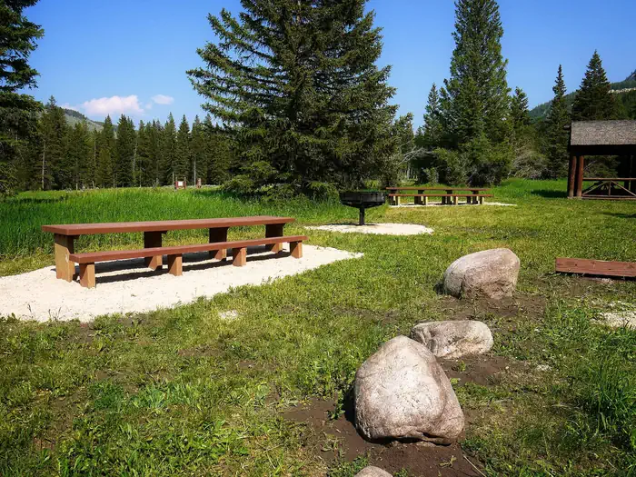
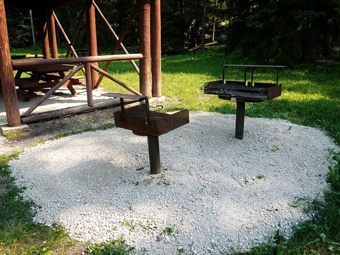
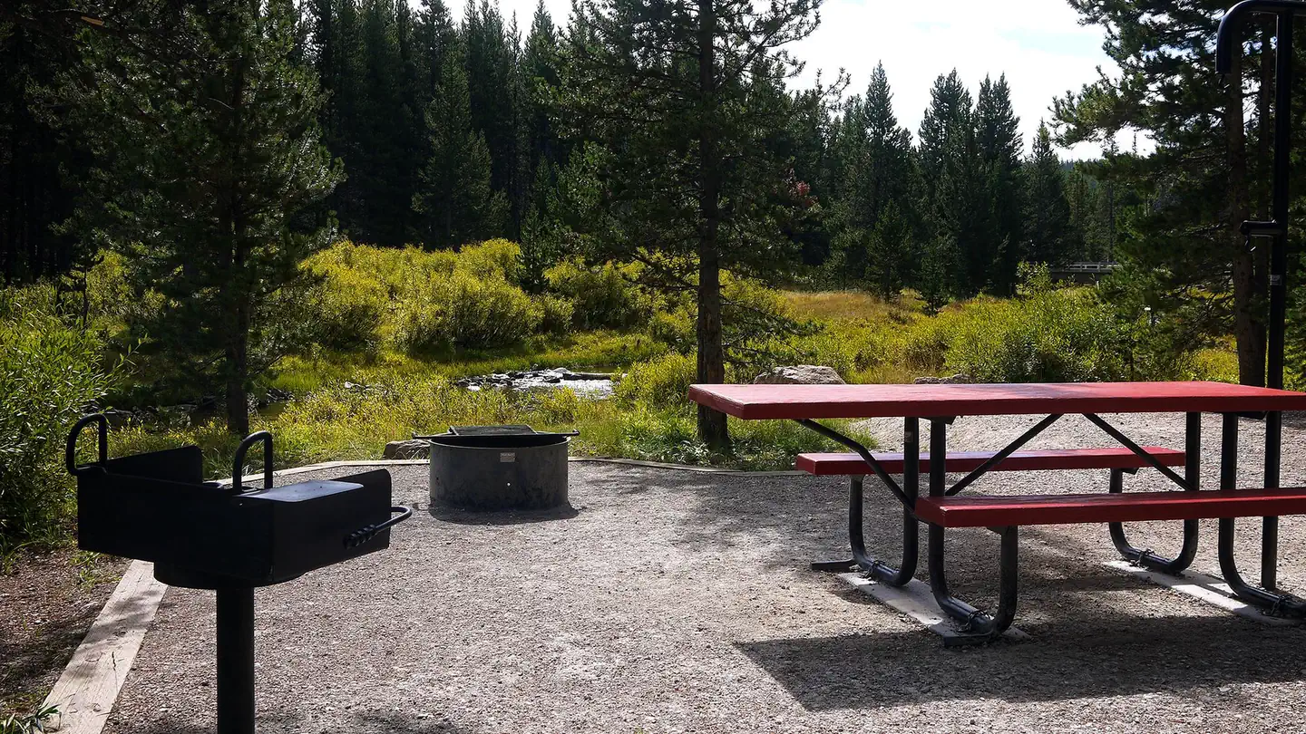
The campground offers one large group site that can accommodate up to 150 people for overnight camping or day-use picnicking. A shelter covers several picnic and serving tables, and a campfire ring and grill are on-site. Accessible vault toilets, drinking water and trash collection are provided. The nearest dump station is 20 miles away at Burgess Junction.
Individual sites vary. Confirm on Recreation.gov or with the managing office.
Season & status
| Status | Closed for the season. Forest Service sites close for the season; check the official page for the reopening date. |
| Season | Memorial Day - Labor Day |
| Forest | Bighorn National Forest |
| Booking | Group site can be reserved by calling Toll Free 1-877-444-6777 (International 518-885-3639 or TDD 877-833-6777) or online. |
| Fees | $20 per night. Additional vehicle $9. Limit 2 vehicles per site and 8 people per site. Group Fees: $90 for 1-35, $110 for 36-60, $130 for 61-120, $160 over 120 (150 people maximum) 1 site reservable. |
| Rules | 14 day stay limit |
Weather by month
Getting there
Located 34 miles east of Greybull, Wyoming on U.S. Highway 14. Turn off onto Paintrock Lake Road (Forest Road 17). Ranger Creek Campground is 3.5 miles from the turnoff, 2 miles beyond Shell Creek Campground.
| Nearest town | Shell, Wyoming |
| Coordinates | 44.5458° N, 107.4992° W · Directions ↗ |
Good to know
- The administering organization is Rustic Freedom/Gallatin Canyon Campgrounds; e-mail: [email protected]
Charges and cancellations
This cancellation processing fee is retained by the reservation service contractor along with the non-refundable reservation fee. All requests for the return of the non-refundable reservation fee and the cancellation processing fee will be declined by the campground concessionaire as they did not receive these fees (these are the fees retained by the reservation contractor, a different entity).
Fire nearby
- WildfirePk
20 mi from the campground · 1,645 acres · 85% contained
Distance is to the reported incident point, not the fire edge. Call the managing office before you drive.
Supplies & services
| Outdoor gear | Sportsman's Warehouse ↗ | 31.3 mi |
| Dump station | Leigh Creek RV Dump Station ↗ | 32.8 mi |
Locations © OpenStreetMap contributors. Call ahead; hours change seasonally.
Explore
Video
Ranger Creek Recreation Area - Campground Walkthrough
Worth a stop
The Shell Falls Visitor Center, at the overlook of Shell Falls, is about 8 miles west. Burgess Junction Visitor Center is 20 miles north. Both centers offer interpretive trails, scenic views and educational displays about natural features like flora and fauna, and area history. Elk View Inn and other nearby lodges provide guided horseback riding and fishing adventures, off-road vehicle rentals and fishing supplies, as well as dining options, showers and general stores. The Red Gulch Dinosaur Tracksite, near the town of Shell, is the largest of its kind in the state and one of only a few in the world from the Middle Jurassic Period. The tracks found here are approximately 167 million years old.
- 9.9 miConey Creek Trailhead ↗Trailhead
- 10.7 miTwin Lakes Picnic Ground ↗Day use
- 10.9 miEdelman Trailhead ↗Trailhead
Trails nearby
- 0.1 miShell Bench ↗10.6 mi trail · hiking, horse, bike
- 0.5 miAdelaide ↗5.6 mi trail · hiking, horse, bike, motorcycle and 1 more
- 1.8 miMail Creek ↗4.9 mi trail · hiking, horse, bike, motorcycle and 1 more
- 3.7 miGranite Creek1.1 mi trail · hiking, horse, bike, motorcycle and 2 more
Trailheads within three miles
- under 0.1 miAdelaide TH ↗Bighorn National Forest
Trail and trailhead records are the Forest Service's. Distances are straight-line to the nearer trail end. Trail conditions are not tracked here.
Public land it sits in
This campground sits inside Bighorn National Forest.
- inBighorn National Forest ↗National Forest · Forest Service · 1,112,948 acres
- 7.7 miCloud Peak Wilderness ↗Wilderness · Forest Service · 191,914 acres
Each unit is published as a centre point and an acreage rather than a boundary, so this section stands it in for a circle of the same area. Whether a campground is inside, and how far it is from one it is outside, are both approximate.
Other campgrounds nearby

On the National Register nearby
- Shell Community HallBuilding · Shell · 13.8 mi
- Eje Bridge over Shell CreekStructure · Shell · 14.9 mi
Natural features
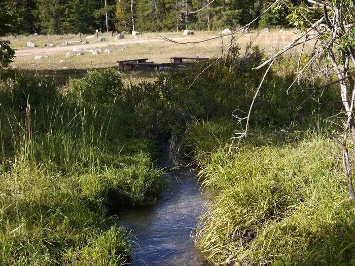
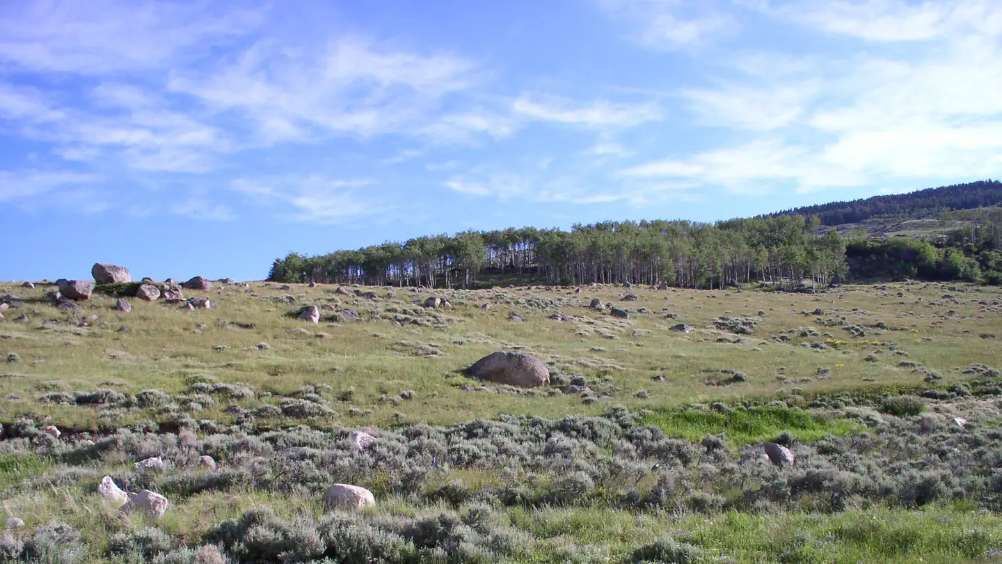
The campground is situated on the banks of Ranger Creek in the Bighorn Mountains, where craggy granite peaks rise over 13,000 feet above sea level. The area is forested with a mix of pine and aspen trees. An abundance of wildlife lives in the area.
Recreation
Scenic off-road driving is available on Battle Creek Road to Medicine Lodge Lake, Ranger Creek Road to Shell Reservoir, Hunt Mountain Road and the Burgess Overlook Jeep trail. Diverse hiking opportunities vary from loop trails to treks along creeks and over mountain peaks including access to the Cloud Peak Wilderness. The Adelaide Trail, for hiking and horseback riding is nearby, providing access to Shell Creek and the Shell Creek Trail. Many creeks, lakes and ponds dot the region, offering some of the best trout fly-fishing in the state.
Guidebooks for Wyoming
We earn a small commission if you buy through these links. It does not change what we list.
Titles come from Open Library's catalog, matched by subject heading or by title.
Reference
Questions people ask
Do I need a reservation at Ranger Creek Recreation Area?
Sites at Ranger Creek Recreation Area are reservable on Recreation.gov. Group site can be reserved by calling Toll Free 1-877-444-6777 (International 518-885-3639 or TDD 877-833-6777) or online. Any walk-up sites are listed on the booking page.
Source: Recreation.gov
How much does it cost to camp at Ranger Creek Recreation Area?
Group reservation prices depend on number of people in a group; extra fees will be charged for exceeding the number of people stated in the reservation and will be collected at the campground.
Source: Recreation.gov
What time is check-in at Ranger Creek Recreation Area?
Check-in 02:00 PM, checkout 02:00 PM.
Source: Recreation.gov
Is Ranger Creek Recreation Area open right now?
Closed for the season as of Oct 16, 2026. Season Memorial Day - Labor Day.
Source: Forest Service status
How many sites does Ranger Creek Recreation Area have?
12 sites, including 11 standard sites without power and 1 group standard area nonelectric.
Source: Recreation.gov
Will my RV fit at Ranger Creek Recreation Area?
The longest site here provides 75 feet of vehicle capacity. Most sites are shorter. The sidebar tool checks a trailer or motorhome length against every site.
Source: Will my RV fit
Are there showers or a dump station at Ranger Creek Recreation Area?
The nearest dump station is 20 miles away at Burgess Junction.
Source: Recreation.gov
Are pets allowed at Ranger Creek Recreation Area?
Yes, pets are allowed at Ranger Creek Recreation Area. Leash rules apply.
Source: Recreation.gov
Can I have a campfire at Ranger Creek Recreation Area?
Fires are allowed in the provided rings under normal conditions. As of 2026-10-16, there is 1 active fire within 50 miles, so check current restrictions before you light one. 14 day stay limit
Source: Fire nearby
Are there accessible sites at Ranger Creek Recreation Area?
Sites 010 and 011 are listed accessible on Recreation.gov. What that covers (a paved pad, an accessible table, a nearby accessible restroom) is on each site's booking page.
Source: Recreation.gov
What is there to do at Ranger Creek Recreation Area?
Scenic off-road driving is available on Battle Creek Road to Medicine Lodge Lake, Ranger Creek Road to Shell Reservoir, Hunt Mountain Road and the Burgess Overlook Jeep trail. The Recreation section on this page has the rest.
Source: Recreation
What is the nearest town to Ranger Creek Recreation Area?
Shell, Wyoming. The Shell Falls Visitor Center, at the overlook of Shell Falls, is about 8 miles west.
Source: Getting there