Ya-Gub-Weh-Tuh Campground
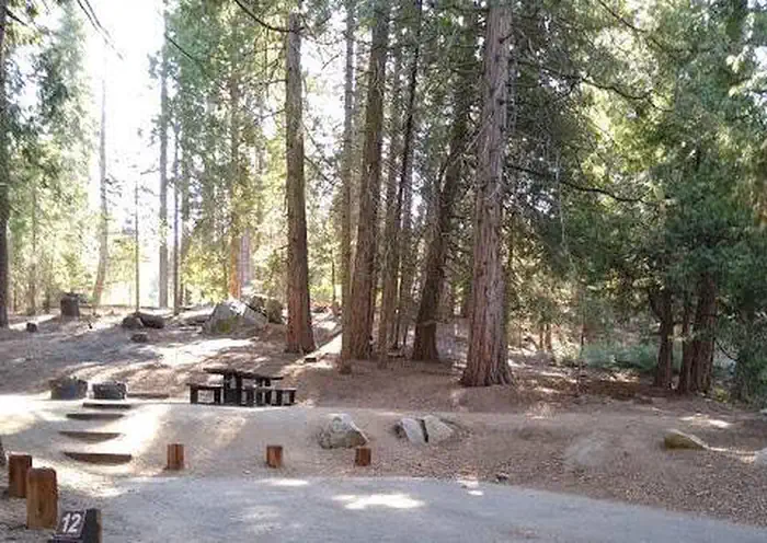
Gorgeous views of the Table Mountains surround this campsite and trailhead. Camping is available on a first come-first serve basis, reservations are not accepted for this campground of six campsites with picnic tables, fire pits, and vault toilet (a maximum of 8 people per site; double sites are also available). Campsites are accessible and reached via a primitive hardened path, located close to the paved parking area.
More like this: first-come in California

Amenities & rules
| Fees | $10-15 per night |
| Stay limit | 14 day camping limit. Day use 6am to sunset |
Individual sites vary. Confirm on Recreation.gov or with the managing office.
Weather by month
Getting there
The San Joaquin River Gorge is located approximately five (5) miles northwest of the town of Auberry. The visitor center is located at 40060 Smalley Road, Auberry, California. Google Maps accurately locates the visitor center at it's actual location. From Fresno, take CA-168 north. One mile after the town of Prather, turn left onto Auberry Road.
| Nearest town | Auberry, California |
| Coordinates | 37.0831° N, 119.5543° W · Directions ↗ |
Good to know
- Drinking water and garbage receptacles are available at this campground (electricity is not).
Fire nearby
- WildfireDome
34 mi from the campground · 6,788 acres · 95% contained
- PrescribedGrant Grove Rx Spring
38 mi from the campground · 15 acres
- PrescribedGrant Grove Fall Rx
40 mi from the campground
- WildfireLand
43 mi from the campground · 20 acres
Distance is to the reported incident point, not the fire edge. Call the managing office before you drive.
Supplies & services
| Outdoor gear | Shaver Lake Sports ↗ | 13 mi |
| Dump station | Dump station ↗ | 13.6 mi |
| RV sales & service | RV sales & service ↗ | 58.9 mi |
Locations © OpenStreetMap contributors. Call ahead; hours change seasonally.
No site-by-site records or photos in the Recreation.gov record. What is here comes from the agency's own listing. The rest lives there.
Checked nightly. Modules appear as soon as the record fills in.
Explore
Worth a stop
- under 0.1 mi
- 13.6 miDorabelle Picnic Site ↗Day use
Trails nearby
- 4.9 miRiver Bend0.5 mi trail · hiking, horse, bike
Trail and trailhead records are the Forest Service's. Distances are straight-line to the nearer trail end. Trail conditions are not tracked here.
Public land it sits in
This campground sits inside Sierra National Forest.
- inSierra National Forest ↗National Forest · Forest Service · 1,418,790 acres
Each unit is published as a centre point and an acreage rather than a boundary, so this section stands it in for a circle of the same area. Whether a campground is inside, and how far it is from one it is outside, are both approximate.
Other campgrounds nearby

Guidebooks for California
We earn a small commission if you buy through these links. It does not change what we list.

Titles come from Open Library's catalog, matched by subject heading or by title.
Reference
Questions people ask
Do I need a reservation at Ya-Gub-Weh-Tuh Campground?
No. Ya-Gub-Weh-Tuh Campground is first-come, first-served. Sites are taken on arrival and paid at the fee station.
Source: San Joaquin River Gorge
How much does it cost to camp at Ya-Gub-Weh-Tuh Campground?
$10-15 per night
Source: San Joaquin River Gorge
How long can I stay at Ya-Gub-Weh-Tuh Campground?
14 day camping limit. Day use 6am to sunset
Source: San Joaquin River Gorge
What is the nearest town to Ya-Gub-Weh-Tuh Campground?
Auberry, California.
Source: Getting there
What if Ya-Gub-Weh-Tuh Campground is full?
The nearest public campgrounds are Aholul Group Campground (0.1 mi, first-come), Equestrian Campground (0.2 mi, first-come), and Dorabelle Campground (13.5 mi).
Source: Campgrounds nearby