King's Bottom Campground
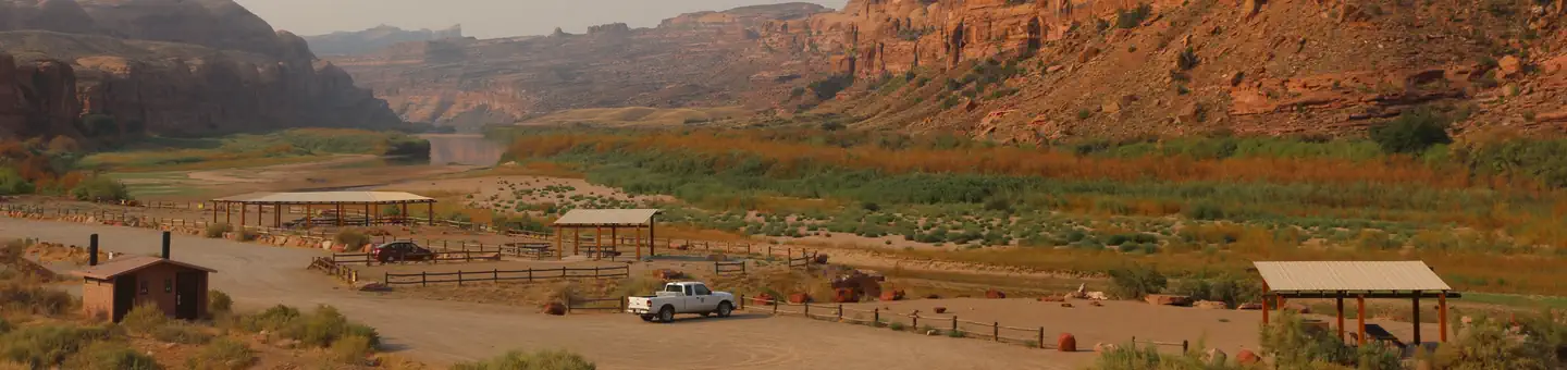
Campsites are located along the banks of the Colorado River, nestled between massive canyon walls. Individual sites are available on a first-come, first-served basis. The campground accommodates tents and small RVs only. Eleven of the sites are walk-in only tent sites. This location is popular due to its proximity to Moab and area hiking, biking and 4WD/UTV roads. Individual Sites: 21 (limited to 10 people & two vehicles per site) Water: No Toilets: Yes Hook-ups: No
More like this: first-come in Utah

Site map
15 campsite locations mapped by OpenStreetMap contributors. The site numbers are theirs and may not match the posts at the campground. Map data © OpenStreetMap contributors, ODbL.
Amenities & rules
| Stay limit | 14 nights in a 30 consecutive day period |
Individual sites vary. Confirm on Recreation.gov or with the managing office.
Weather by month
Getting there
From the center of Moab (Center St. & Main St.), head south to Kane Creek Road (between the Burger King and McDonald's). Turn right (west) on Kane Creek Road. At the stop sign, continue straight and drive 2 miles. The campground will be on your right, just past the Moab Rim Trailhead.
| Nearest town | Moab, Utah |
| Coordinates | 38.5565° N, 109.5850° W · Directions ↗ |
Supplies & services
| Outdoor gear | Gearheads Outdoor Store ↗ | 2 mi |
| Dump station | Dump station ↗ | 2.2 mi |
Locations © OpenStreetMap contributors. Call ahead; hours change seasonally.
Explore
Worth a stop
- 0.2 miMoab Rim Trailhead ↗Trailhead
- 0.2 miStairmaster Trailhead ↗Trailhead
- 3.6 miMoab Day Use Sites ↗Day use
- 4.2 miCanyonlands Backcountry Office ↗Visitor center
- 4.2 mi
- 8.6 miTake Out Boat Ramp ↗Boat launch
Show all 8Hide
- 10.4 miSandy Beach River Access ↗Swimming
- 13.4 miRocky Rapid Boat Ramp ↗Boat launch
Other campgrounds nearby

On the National Register nearby
- Moab CabinBuilding · Moab · 2.3 mi
- John Henry Shafer HouseBuilding · Moab · 2.3 mi
- Moab LDS ChurchBuilding · Moab · 2.4 mi
Guidebooks for Utah
We earn a small commission if you buy through these links. It does not change what we list.


Titles come from Open Library's catalog, matched by subject heading or by title.
Reference
Questions people ask
Do I need a reservation at King's Bottom Campground?
No. King's Bottom Campground is first-come, first-served. Sites are taken on arrival and paid at the fee station.
Source: BLM Website
How long can I stay at King's Bottom Campground?
14 nights in a 30 consecutive day period
Source: BLM Website
What is the nearest town to King's Bottom Campground?
Moab, Utah.
Source: Getting there
What if King's Bottom Campground is full?
The nearest public campgrounds are Jaycee Park Campground (1.3 mi, first-come), William's Bottom Campground (1.7 mi, first-come), and Gold Bar Group Sites (2.9 mi).
Source: Campgrounds nearby