S-Tree Campground
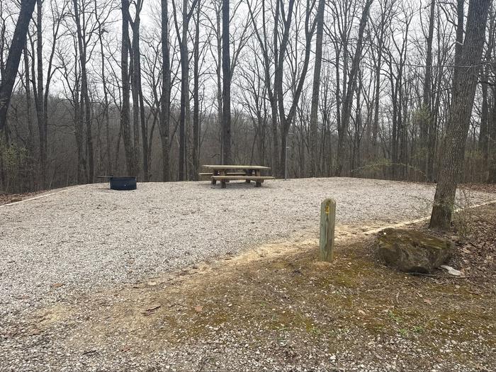
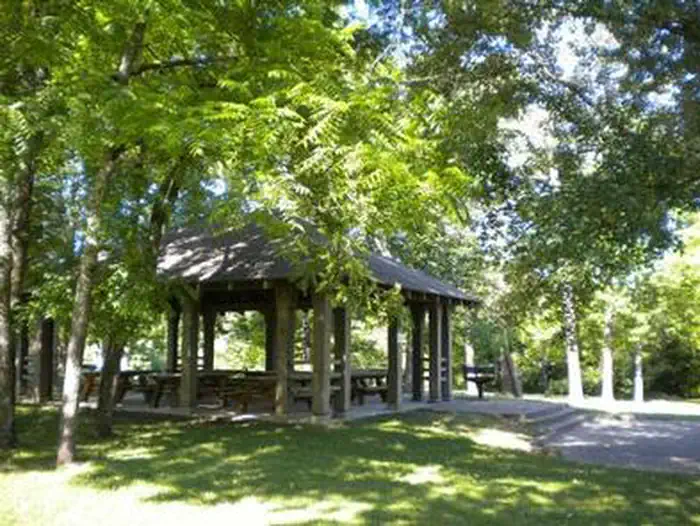
S-Tree Campground sits on a ridge above Horse Lick Creek near McKee in Jackson County, KY. Each of the 20 first-come, first-served campsites has a picnic table, tent pad, fire ring and lantern pole. The campground's small first come, first serve picnic area features a historic shelter that was constructed in the 1930s by the Civilian Conservation Corps. The campground is popular with off-highway vehicle (OHV) enthusiasts due to its proximity to Renfro Loop OHV Trail #302.
More like this: reservable in Kentucky · tent only in Kentucky · pets allowed in Kentucky · accessible sites in Kentucky
Check availability on Recreation.gov ↗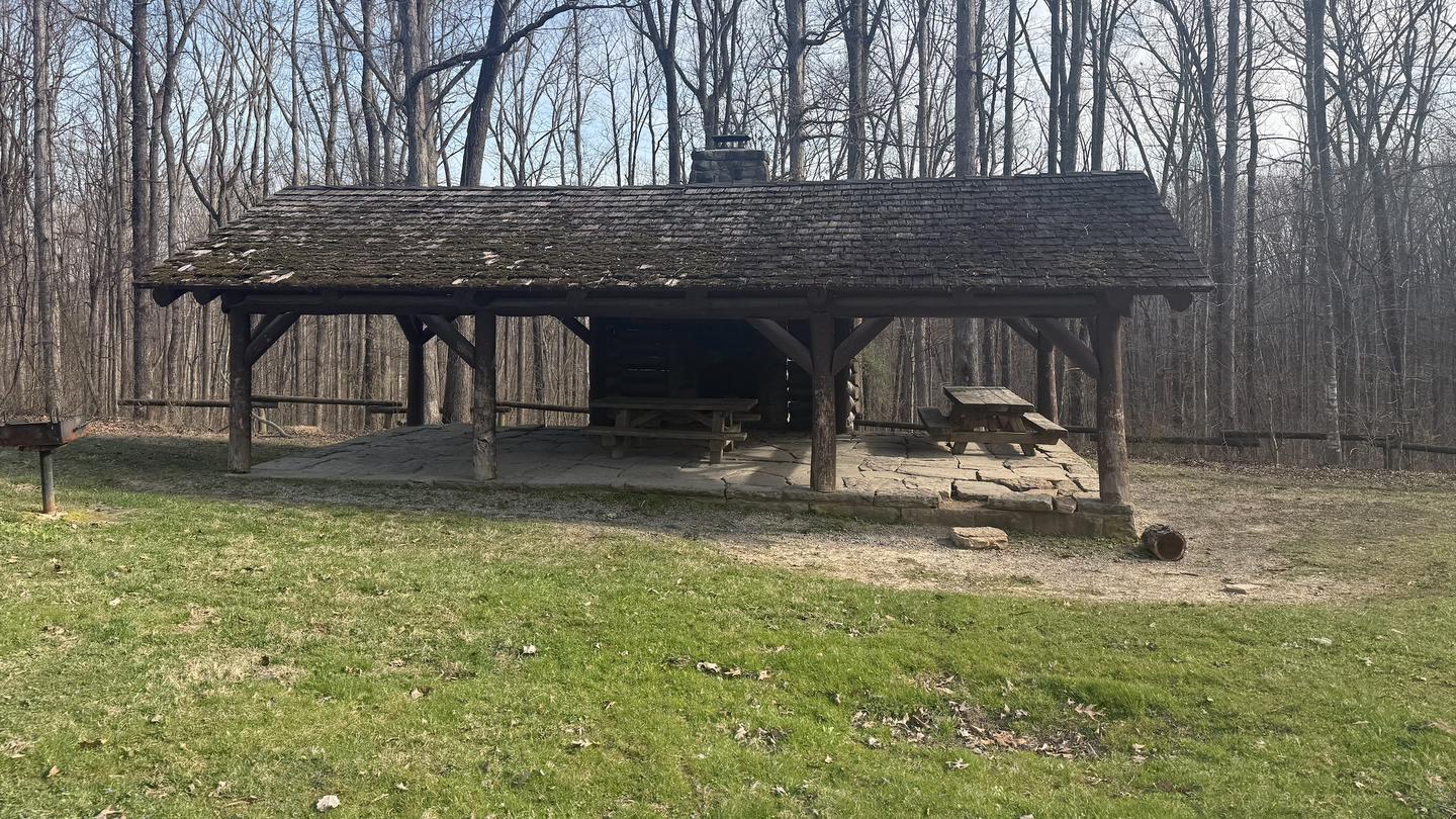
Site mix
| Standard, no hookups | 20 |
Site guide
20 sites in 2 loops. Tap a filter to narrow the list; the map follows.
| Site | Loop | Fits, ft | Surface | Shade | Water / sewer | People / vehicles | Fires | Accessible |
|---|---|---|---|---|---|---|---|---|
| 01 | A | 12 | Gravel | Partial | No / No | 16 / – | Yes | Yes |
| 02 | A | 12 | Gravel | Partial | No / No | 8 / – | Yes | Yes |
| 03 | A | 12 | Gravel | Partial | No / No | 8 / – | Yes | Yes |
| 04 | A | 12 | Gravel | Partial | No / No | 8 / – | Yes | Yes |
| 05 | A | 12 | Gravel | Partial | No / No | 8 / – | Yes | Yes |
| 06 | A | 12 | Gravel | Partial | No / No | 16 / – | Yes | Yes |
| 07 | A | 12 | Gravel | Partial | No / No | 8 / – | Yes | Yes |
| 08 | A | 12 | Gravel | Partial | No / No | 8 / – | Yes | Yes |
| 09 | A | 12 | Gravel | Partial | No / No | 8 / – | Yes | Yes |
| 10 | A | 12 | Gravel | Partial | No / No | 16 / – | Yes | Yes |
Per-site records as published by the managing agency on Recreation.gov. Blank cells mean the agency listed nothing for that site.
Amenities & rules
| Equipment | Tents |
| Pets | Allowed |
| Campfires | Allowed, subject to restrictions |
| Fees | Payment must be made with in 30 minutes of occupying the Campsite. Pay using scan and pay via Rec.gov app or by using the fee tube on site. Make sure to post proof of payment on site post. |
| Accessibility | Sites 01, 02, 03, 04 and 16 more are listed accessible |
Individual sites vary. Confirm on Recreation.gov or with the managing office.
Season & status
| Status | Open |
| Season | Half of the campground is open all year; one loop closed seasonally |
| Forest | Daniel Boone National Forest |
Weather by month
Getting there
From Berea: travel east on KY 21E (Chestnut/Big Hill Road) for approximately 5 miles until it ends at US 421. Turn right (south) on US 421. Take US 421 west for approximately 18 miles to McKee KY, then turn right (south) on KY 89 for 3 miles, make a slight right (west) on Forest Service Road 43 (S-Tree Road).
| Nearest town | London, Kentucky |
| Coordinates | 37.3868° N, 84.0717° W · Directions ↗ |
Fire nearby
- PrescribedSte-Wildlife Openings Rx
49 mi from the campground · 8 acres
Distance is to the reported incident point, not the fire edge. Call the managing office before you drive.
Supplies & services
| Outdoor gear | Get Outside KY | GOKY ↗ | 17.5 mi |
| Dump station | Dump station ↗ | 34.8 mi |
| RV sales & service | Bluegrass RV ↗ | 52 mi |
Locations © OpenStreetMap contributors. Call ahead; hours change seasonally.
Explore
Video
Camping in Kentucky | S-Tree Campground | Awesome Camp Daniel Boone National Forest
Trails nearby
- 0.1 miRenfro Loop4.3 mi trail
- 0.3 miRenfro Connector0.6 mi trail
Trail and trailhead records are the Forest Service's. Distances are straight-line to the nearer trail end. Trail conditions are not tracked here.
Public land it sits in
This campground sits inside Daniel Boone National Forest.
- inDaniel Boone National Forest ↗National Forest · Forest Service · 2,043,073 acres
Each unit is published as a centre point and an acreage rather than a boundary, so this section stands it in for a circle of the same area. Whether a campground is inside, and how far it is from one it is outside, are both approximate.
Other campgrounds nearby



Historic landmarks nearby
.jpg/960px-Berea_College%2C_Lincoln_Hall%2C_Berea_College%2C_Berea_(Madison_County%2C_Kentucky).jpg)
Recreation
Day users please, park at the trail head. Hiking Biking OHV Bouldering
Nearby
Mill Creek MGMT area Sheltowee TH
Guidebooks for Daniel Boone National Forest and Kentucky
We earn a small commission if you buy through these links. It does not change what we list.
Titles come from Open Library's catalog, matched by subject heading or by title.
Reference
Questions people ask
Do I need a reservation at S-Tree Campground?
Sites at S-Tree Campground are reservable on Recreation.gov. Any walk-up sites are listed on the booking page.
Source: Recreation.gov
How much does it cost to camp at S-Tree Campground?
Payment must be made with in 30 minutes of occupying the Campsite. Pay using scan and pay via Rec.gov app or by using the fee tube on site. Make sure to post proof of payment on site post.
Source: Recreation.gov
Is S-Tree Campground open right now?
Open as of Oct 16, 2026. Season Half of the campground is open all year; one loop closed seasonally.
Source: Forest Service status
How many sites does S-Tree Campground have?
20 sites, including 20 standard sites without power.
Source: Recreation.gov
Can I bring an RV to S-Tree Campground?
S-Tree Campground is listed for tents only.
Source: Recreation.gov
Are pets allowed at S-Tree Campground?
Yes, pets are allowed at S-Tree Campground. Leash rules apply.
Source: Recreation.gov
Can I have a campfire at S-Tree Campground?
Fires are allowed in the provided rings under normal conditions. As of 2026-10-16, there is 1 active fire within 50 miles, so check current restrictions before you light one.
Source: Fire nearby
Are there accessible sites at S-Tree Campground?
Sites 01, 02, 03, and 04 are listed accessible on Recreation.gov, 20 sites in all. What that covers (a paved pad, an accessible table, a nearby accessible restroom) is on each site's booking page.
Source: Recreation.gov
What is there to do at S-Tree Campground?
Day users please, park at the trail head. The Recreation section on this page has the rest.
Source: Recreation
What is the nearest town to S-Tree Campground?
London, Kentucky. Mill Creek MGMT area Sheltowee TH
Source: Getting there
What if S-Tree Campground is full?
The nearest public campgrounds are Turkey Foot Campground (10.1 mi, first-come), Bee Rock Campground (28.3 mi, first-come), and White Oak Boat-In Campground (28.9 mi, first-come).
Source: Campgrounds nearby