Kings Bottom Group Site
The Kings Bottom Group Site is located within Kings Bottom Campground along the Colorado River on the paved portion of Kane Creek Road. The rest of the individual sites at Kings Bottom are first-come first-served, and during the busy season this is a highly sought location for its proximity to town, Canyonlands and Arches National Parks, popular 4x4 routes, climbing walls, mountain bike trails, and all the other outdoor activities that draw visitors to Moab. Kane Creek Road is a busy place during the day and the associated noise from motorists passing by on their way to various activities tends to die down by the end of the day, when you're enjoying the evening light in Moab's "Portal".
Some sites take reservations on Recreation.gov. Others are first-come, first-served.
More like this: first-come in Utah · reservable in Utah · pets allowed in Utah · group sites in Utah
Check availability on Recreation.gov ↗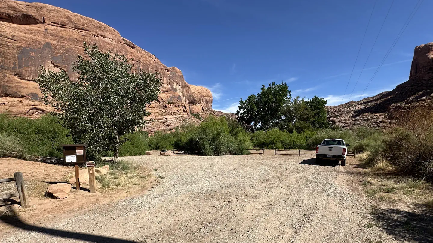
Site mix
| Group sites | 1 |
Site guide
Will my RV fit
The longest site here provides 25 feet of vehicle capacity. Most sites are shorter.
1 site. Tap a filter to narrow the list; the map follows.
| Site | Entry | Fits, ft | Water / sewer | Waterfront | People / vehicles | Fires |
|---|---|---|---|---|---|---|
| Kings Bottom Group Site | Back-in | 25 | No / No | Riverfront | 15 / 8 | Yes |
Per-site records as published by the managing agency on Recreation.gov. Blank cells mean the agency listed nothing for that site.
Amenities & rules
| Hookups | None |
| Equipment | RVs & trailers, Tents |
| Pets | Allowed |
| Campfires | Allowed, subject to restrictions |
| Fees | Group Size (max 15 people): $75 |
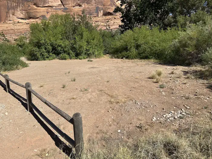
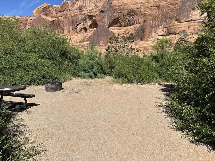
The group site has a fire ring with two picnic tables and access to the vault toilet shared by the rest of Kings Bottom Campground. There is no water, dump station, or electric hook-up.
Individual sites vary. Confirm on Recreation.gov or with the managing office.
Weather by month
Getting there
From hwy 191 in Moab, take Kane Creek Boulevard, which turns into Kane Creek Road for 3 miles. The campground is on your left.
| Nearest town | Moab, Utah |
| Area | Recreation.gov lists no exact point for this campground. The recreation area is at 38.56° N, 109.55° W. Call the office before you drive. |
Charges and cancellations
- Please contact the BLM Moab Field Office for assistance with changes and cancellations at 435-259-2100.
- Changes
- You can make changes to a reservation through your online Recreation.gov user account any time prior to the arrival/first date of the reservation.
- There is a $10 change fee If you wish to change to dates entirely outside of the original reservation dates.
- There is no change fee if you wish to extend or shorten the original reservation as long as the first day of your reservation stays the same.
- You cannot make changes to your reservation after the arrival/first day through your Recreation.gov account. However, the BLM Moab Field Office may be able to assist you, 435-259-2100.
- For reservations with dates at the end of the available booking window (a.k.a. sliding window), you will not be able to make changes or cancellations until the site has been available to the general public for four days.
- Cancellations
- Please cancel your reservation if you do not plan to use it. This opens highly sought campsites for others to reserve.
- You can cancel your reservation online through your Recreation.gov user account or through the call center (call center incurs an additional fee). A $10 service fee will be withheld from any refund for a cancellation.
- Late Cancellations
- A late cancellation occurs less the 14 days before the arrival/first date of the reservation (a.k.a. cut-off window).
- A $10.00 cancellation fee AND forfeit the first night's fees if cancelled less than 14 days before the arrival date (not to exceed the total paid for the original reservation).
- There are no refunds, modifications, cancellations, or other fee changes allowed with Scan & Pay payments.
- Early Departures
- If you spend at least one night and then leave prior to the scheduled departure check-out date, please contact the BLM Moab Field Office (435-259-2100) to open the remaining nights for others to use. You will not be able to cancel these nights through your Recreation.gov account.
- If customers request an early departure after the facility check-out time, the customer will not receive a refund for that night.
- No-Shows
- A No Show occurs if you do not arrive at your campsite or cancel your reservation by check-out time (Noon) on the day after the scheduled arrival date.
- Campgrounds are inconsistently staffed by volunteers and there is no guarantee that your site will be available on the second day.
Explore
Natural features
Situated in the famous Moab "Portal", two high sandstone cliffs between which the Colorado River passes, the King's Bottom Campground is right in the middle of the most striking scenery visible from town. The group site is surrounded by low shrubs and some cottonwood trees where birds nest, and is next to a quiet stretch of the Colorado River.
Recreation
The Kings Bottom Campground and Group Site is within walking distance to the Stairmaster trail, Moab Rim 4x4 trail, and Moonflower Canyon where you can visit rock imagery, use the reservable picnic area, and hike the trail up the canyon. Further down Kane Creek Road you'll find Pritchett Canyon, the Amasa Back Trailhead, Hunter Canyon, and the Hunter Rim trail. The opportunities for recreation are endless with mountain biking, hiking, challenging 4x4 trails, rock climbing, and canyoneering. The Spring and Fall are the busiest time of year in this area, and are the best time to stay at Kings Bottom Campground and Group Site. The campground is open year-round, however the group site becomes first-come first-served in the Winter.
Nearby
Kane Creek, Moab Rim, Moonflower Canyon, Pritchett Canyon, Hunter Canyon, Hurrah Pass provide access to world class recreation.
Guidebooks for Utah
We earn a small commission if you buy through these links. It does not change what we list.


Titles come from Open Library's catalog, matched by subject heading or by title.
Reference
Questions people ask
Do I need a reservation at Kings Bottom Group Site?
For some sites. Some sites take reservations on Recreation.gov. Others are first-come, first-served.
Source: Recreation.gov
How much does it cost to camp at Kings Bottom Group Site?
Group Size (max 15 people): $75
Source: Recreation.gov
What does it cost to cancel a reservation at Kings Bottom Group Site?
You can cancel your reservation online through your Recreation.gov user account or through the call center (call center incurs an additional fee). A $10 service fee will be withheld from any refund for a cancellation.
Source: Charges and cancellations
How many sites does Kings Bottom Group Site have?
1 site, including 1 group site.
Source: Recreation.gov
Can I bring an RV to Kings Bottom Group Site?
Kings Bottom Group Site is listed for tents only.
Source: Recreation.gov
Are there showers or a dump station at Kings Bottom Group Site?
There is no water, dump station, or electric hook-up.
Source: Recreation.gov
Are pets allowed at Kings Bottom Group Site?
Yes, pets are allowed at Kings Bottom Group Site. Leash rules apply.
Source: Recreation.gov
Can I have a campfire at Kings Bottom Group Site?
Fires are allowed in the provided rings under normal conditions.
Source: Recreation.gov
What is there to do at Kings Bottom Group Site?
The Kings Bottom Campground and Group Site is within walking distance to the Stairmaster trail, Moab Rim 4x4 trail, and Moonflower Canyon where you can visit rock imagery, use the reservable picnic area, and hike the trail up the canyon. The Recreation section on this page has the rest.
Source: Recreation
What is the nearest town to Kings Bottom Group Site?
Moab, Utah. Kane Creek, Moab Rim, Moonflower Canyon, Pritchett Canyon, Hunter Canyon, Hurrah Pass provide access to world class recreation.
Source: Getting there