South Creek
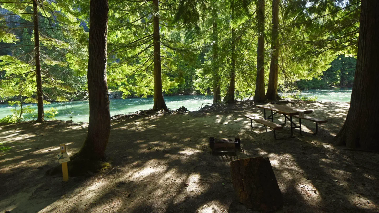
This campground is located near the confluence of South Creek and the Twisp River and gives access to several trailheads for day hikes. Enjoy bicycling and scenic drives. This campground gives access to the Twisp River Trail 440 and also gives access to the South Creek Trail 401 and nearby Scatter Creek Trail 427, which both go into the Lake Chelan-Sawtooth Wilderness
Sites are first-come, first-served. Recreation.gov lists this campground for paying on site, and you may be able to pay with the Scan and Pay feature of its app.
More like this: first-come in Washington · tent only in Washington

Amenities & rules
| Equipment | Tents |
| Fees | $10/Night for single unit plus $5 per additional vehicle. |
Individual sites vary. Confirm on Recreation.gov or with the managing office.
Season & status
| Season | May |
| Forest | Okanogan-Wenatchee National Forest |
| Fees | $10/Night for single unit plus $5 per additional vehicle. |
| Rules | Maximum stay limit is 14 days |
Weather by month
Getting there
From Twisp, drive west on paved Twisp River Road (County Road 9114) for 12 miles, then the county road becomes paved Forest Service Road 44. Continue straight on Forest Service Road 44, travel 5 miles, road turns into gravel and becomes Forest Service Road 4440.
| Coordinates | 48.4385° N, 120.5298° W · Directions ↗ |
Fire nearby
- WildfireSisi
15 mi from the campground · 4,615 acres · 34% contained
- WildfireLittle Giant
33 mi from the campground · 172,912 acres · 95% contained
- WildfirePtarmigan
35 mi from the campground · 25,566 acres · 90% contained
- WildfireLuna
41 mi from the campground · 8,553 acres · 42% contained
Distance is to the reported incident point, not the fire edge. Call the managing office before you drive.
Supplies & services
| Outdoor gear | Goat's Beard Mountain Supplies ↗ | 12.1 mi |
| Dump station | Dump station ↗ | 17.7 mi |
| RV sales & service | RV sales & service ↗ | 47.2 mi |
Locations © OpenStreetMap contributors. Call ahead; hours change seasonally.
Explore
Worth a stop
- 12.4 miChickadee Trailhead ↗Trailhead
Trails nearby
- 0.1 miSouth Creek ↗7.3 mi trail
- 0.1 miTwisp River Upper West4.2 mi trail
- 0.5 miScatter Creek ↗8.1 mi trail
- 1.8 miLouis Lake2.8 mi trail
- 1.9 miTwisp River ↗17.5 mi trail
- 2.2 miTwisp River Upper East ↗6.6 mi trail
Trailheads within three miles
- 0.5 miScatter Creek - Methow Valley RD Trailhead ↗Okanogan-Wenatchee National Forest · Season June
- 2.2 miGilbert Trailhead ↗Okanogan-Wenatchee National Forest · Season July
- 2.6 miSlate Creek Trailhead ↗Okanogan-Wenatchee National Forest · Season June
- 2.9 miReynolds Creek Trailhead ↗Okanogan-Wenatchee National Forest · Season June
Trail and trailhead records are the Forest Service's. Distances are straight-line to the nearer trail end. Trail conditions are not tracked here.
Public land it sits in
This campground sits inside Lake Chelan-Sawtooth Wilderness, which overlaps Okanogan-Wenatchee National Forest.
- inLake Chelan-Sawtooth Wilderness ↗Wilderness · Forest Service · 152,980 acres
- inOkanogan-Wenatchee National Forest ↗National Forest · Forest Service · 3,858,129 acres
- 11.1 miGlacier Peak Wilderness ↗Wilderness · Forest Service · 566,161 acres
Each unit is published as a centre point and an acreage rather than a boundary, so this section stands it in for a circle of the same area. Whether a campground is inside, and how far it is from one it is outside, are both approximate.
Other campgrounds nearby
On the National Register nearby
- Sulphide–Frisco CabinSite · Stehekin · 8.6 mi
- Stehekin SchoolBuilding · Stehekin · 10.2 mi
- George Miller HouseBuilding · Stehekin · 10.4 mi
Guidebooks for Washington
We earn a small commission if you buy through these links. It does not change what we list.
Titles come from Open Library's catalog, matched by subject heading or by title.
Reference
Questions people ask
Do I need a reservation at South Creek?
No. South Creek is first-come, first-served. Sites are taken on arrival and paid at the fee station.
Source: Forest Service
How much does it cost to camp at South Creek?
$10/Night for single unit plus $5 per additional vehicle.
Source: Forest Service
Can I bring an RV to South Creek?
South Creek is listed for tents only.
Source: Forest Service
What if South Creek is full?
The nearest public campgrounds are Twisp River Horse Camp (0.2 mi, first-come), Mystery (3.7 mi, first-come), and War Creek (7.8 mi, first-come).
Source: Campgrounds nearby