Alum Ford Campground
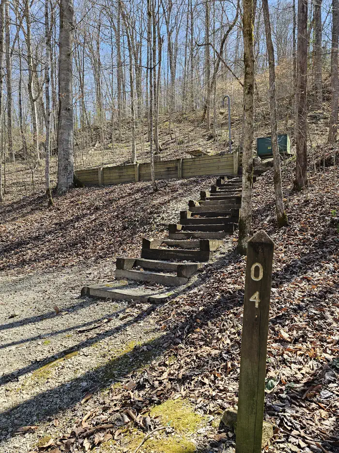
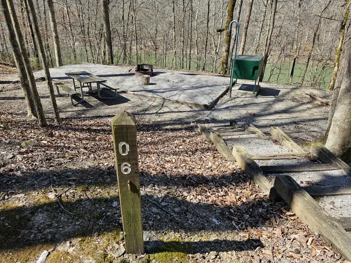
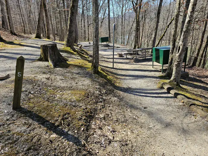
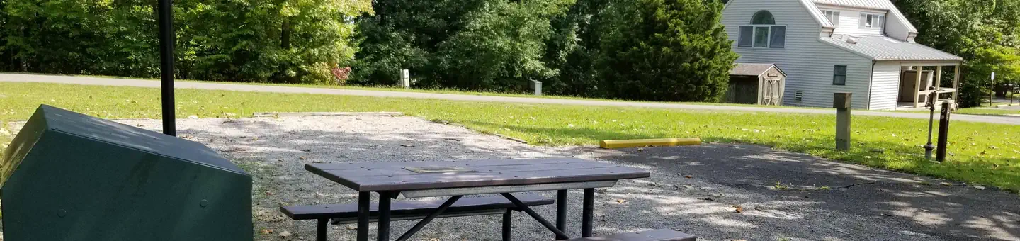
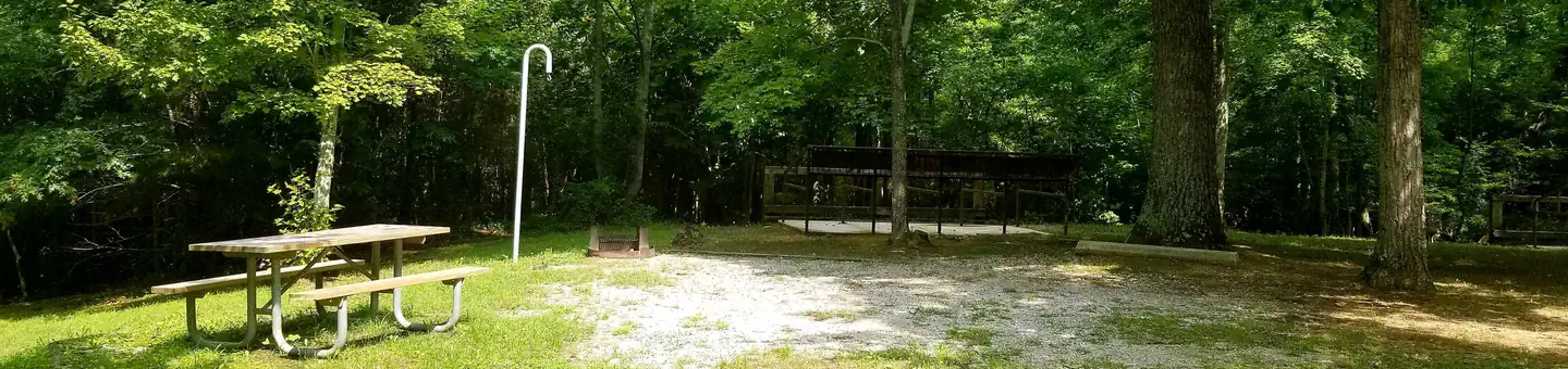
Alum Ford Campground is located in the Kentucky portion of Big South Fork seven miles west of Whitley City, Kentucky at the end of Highway 700. The campground consists of six campsites each with picnic table and fire ring.
More like this: reservable in Kentucky · tent only in Kentucky · pets allowed in Kentucky
Check availability on Recreation.gov ↗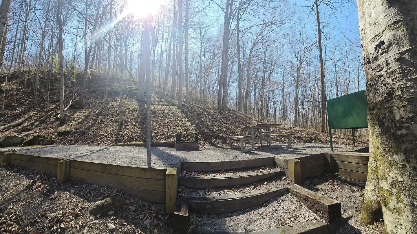
Site mix
| Standard, no hookups | 6 |
Site guide
6 sites. Tap a filter to narrow the list; the map follows.
| Site | Entry | Fits, ft | Surface | Shade | Water / sewer | Waterfront | People / vehicles | Fires | Accessible | Rating |
|---|---|---|---|---|---|---|---|---|---|---|
| Campsite 1 | Back-in | Gravel | Partial | No / – | Riverfront | 6 / – | Yes | Standard | ||
| Campsite 2 | Back-in | 21 | Gravel | Partial | No / – | Riverfront | 6 / – | Yes | Standard | |
| Campsite 3 | Back-in | 20 | Gravel | Partial | No / – | Riverfront | 6 / – | Yes | Standard | |
| Campsite 4 | Back-in | 23 | Gravel | Partial | No / – | Riverfront | 6 / – | Yes | Standard | |
| Campsite 5 | Back-in | 22 | Gravel | Partial | No / – | Riverfront | 6 / – | Yes | Yes | Standard |
| Campsite 6 | Back-in | 45 | Gravel | Partial | No / – | Riverfront | 6 / – | Yes | Standard |
Per-site records as published by the managing agency on Recreation.gov. Blank cells mean the agency listed nothing for that site. Check-in 12:00 PM, checkout 12:00 PM.
Amenities & rules
| Equipment | Tents |
| Pets | Allowed |
| Campfires | Allowed, subject to restrictions |
| Accessibility | Site Campsite 5 is listed accessible |
Alum Ford Campground has six sites with tent pads, picnic tables, fire rings with grills, bear-proof garbage cans, and food storage lockers. A vault toilet facility is also available.
Individual sites vary. Confirm on Recreation.gov or with the managing office.
Weather by month
Getting there
| Nearest town | Whitley City, Kentucky |
| Coordinates | 36.7652° N, 84.5472° W · Directions ↗ |
Fire nearby
- PrescribedSte-Wildlife Openings Rx
10 mi from the campground · 8 acres
Distance is to the reported incident point, not the fire edge. Call the managing office before you drive.
Supplies & services
| Outdoor gear | Sheltowee Trace Outfitters ↗ | 16.7 mi |
| Dump station | Dump station ↗ | 20.2 mi |
| RV sales & service | Weekend RV Center ↗ | 53.9 mi |
Locations © OpenStreetMap contributors. Call ahead; hours change seasonally.
Explore
Video
Alum Ford Campground & Yahoo Falls
Worth a stop
The Big South Fork Scenic Railway Depot is located about 9 miles away in the town of Stearns, which offers train rides and other educational opportunities for campers. Just a few miles from Stearns is Blue Heron Mine, also known as Mine 18, a historic abandoned mining town that has been rebuilt as an outdoor museum. Visitors can hear audio presentations from actual people who lived in the community in the 1950s. Additional attractions include the Daniel Boone National Forest and Cumberland Falls State Resort Park, offering additional recreation opportunities.
- 9.1 miKeno Shooting Range ↗OHV / range
Trails nearby
- 1.9 miAlum1.8 mi trail
- 1.9 miYahoo Arch1.4 mi trail
- 2 miMarkers Arch0.4 mi trail
- 2.1 miYellow Cliff2.1 mi trail
- 2.8 miStraight Creek OHV Trail A0.8 mi trail
- 3 miLick Creek3.2 mi trail
Trail and trailhead records are the Forest Service's. Distances are straight-line to the nearer trail end. Trail conditions are not tracked here.
Public land it sits in
Beaver Creek Wilderness begins about 9.6 miles away, and it is the closest of these.
- 9.6 miBeaver Creek Wilderness ↗Wilderness · Forest Service · 4,816 acres
Each unit is published as a centre point and an acreage rather than a boundary, so this section stands it in for a circle of the same area. Whether a campground is inside, and how far it is from one it is outside, are both approximate.
Other campgrounds nearby


On the National Register nearby
- Stearns Administrative and Commercial DistrictHistoric district · Stearns · 6 mi
- Wartburg Presbyterian ChurchBuilding · Wartburg · 11.4 mi
Natural features
This small campground sits above the Alum Ford Boat Ramp which provides access to the Big South Fork River.
Recreation
The campground is located adjacent to the Alum Ford Boat Launch, providing access for motorized and non-motorized watercraft to this remote section of the Big South Fork River where it becomes Lake Cumberland. The Sheltowee Trace National Recreational Trail also passes through the campground. The Sheltowee Trace is a 260-mile back country trail through Daniel Boone National Forest, Big South Fork NRRA, and Natural Bridge, Cumberland Falls, & Pickett State Parks in Kentucky and Tennessee.
Guidebooks for Kentucky
We earn a small commission if you buy through these links. It does not change what we list.
Titles come from Open Library's catalog, matched by subject heading or by title.
Reference
Questions people ask
Do I need a reservation at Alum Ford Campground?
Sites at Alum Ford Campground are reservable on Recreation.gov. Any walk-up sites are listed on the booking page.
Source: Recreation.gov
What time is check-in at Alum Ford Campground?
Check-in 12:00 PM, checkout 12:00 PM.
Source: Recreation.gov
How many sites does Alum Ford Campground have?
6 sites, including 6 standard sites without power.
Source: Recreation.gov
Can I bring an RV to Alum Ford Campground?
Alum Ford Campground is listed for tents only.
Source: Recreation.gov
Are pets allowed at Alum Ford Campground?
Yes, pets are allowed at Alum Ford Campground. Leash rules apply.
Source: Recreation.gov
Can I have a campfire at Alum Ford Campground?
Fires are allowed in the provided rings under normal conditions. As of 2026-10-16, there is 1 active fire within 50 miles, so check current restrictions before you light one.
Source: Fire nearby
Are there accessible sites at Alum Ford Campground?
Site Campsite 5 is listed accessible on Recreation.gov. What that covers (a paved pad, an accessible table, a nearby accessible restroom) is on each site's booking page.
Source: Recreation.gov
What is there to do at Alum Ford Campground?
The campground is located adjacent to the Alum Ford Boat Launch, providing access for motorized and non-motorized watercraft to this remote section of the Big South Fork River where it becomes Lake Cumberland. The Recreation section on this page has the rest.
Source: Recreation
What is the nearest town to Alum Ford Campground?
Whitley City, Kentucky. The Big South Fork Scenic Railway Depot is located about 9 miles away in the town of Stearns, which offers train rides and other educational opportunities for campers.
Source: Getting there
What if Alum Ford Campground is full?
The nearest public campgrounds are Barren Fork Horse Camp (4.4 mi, partly first-come), Blue Heron Campground (6.2 mi), and Bear Creek Campground - Ky (8.7 mi).
Source: Campgrounds nearby
Which national park is Alum Ford Campground in?
Alum Ford Campground is a Big South Fork National River & Recreation Area campground. Entrance fees, alerts, and hours are on Park Atlas.