Pocket Campground
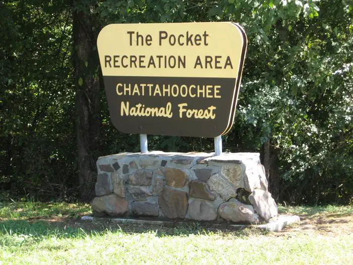
The Pocket Recreation Area is located within the Chattahoochee-Oconee National Forest in the ridges and valleys of northwest Georgia. The campground sits in a low lying geographical area between Horn and Mill mountains. This low lying area was formed by limestone dissolving, leaving the ridges above and valleys below. These ridges are rich in iron ore "pockets" giving this area its name. Deer and turkeys thrive in the surrounding forest. Spring wildflowers and autumn colors abound, showcasing the beauty of the region. Nearby trails and overlooks allow visitors to enjoy the National Forest from different perspectives. The Pocket area is rich in cultural and historical history.
More like this: reservable in Georgia · pets allowed in Georgia
Check availability on Recreation.gov ↗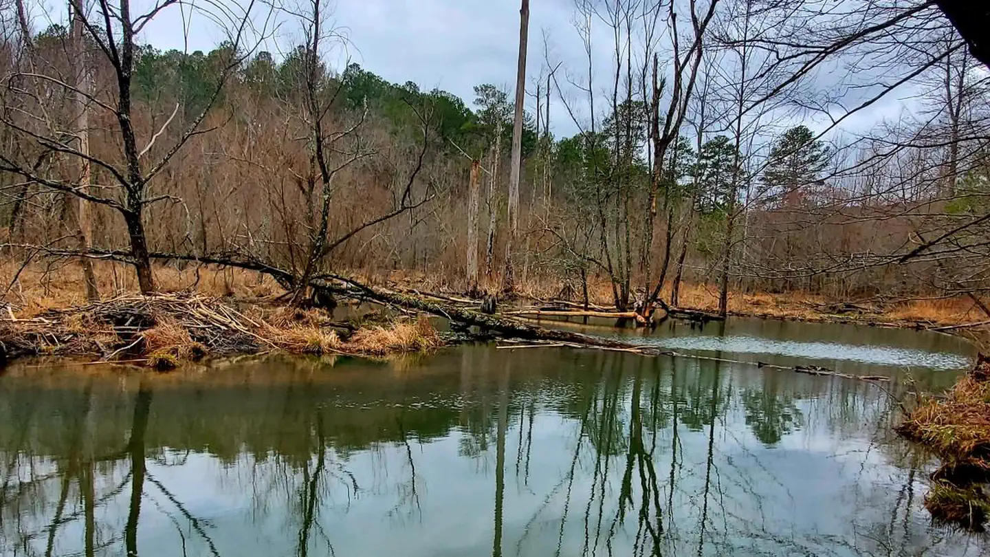
Site mix
| Standard, no hookups | 26 |
Site guide
Will my RV fit
The longest site here provides 28 feet of vehicle capacity. Most sites are shorter.
26 sites. Tap a filter to narrow the list; the map follows.
| Site | Entry | Fits, ft | Surface | Shade | People / vehicles | Fires | Accessible |
|---|---|---|---|---|---|---|---|
| 1 | Back-in | 25 | Paved | Partial | 5 / 2 | Yes | |
| 2 | Back-in | 28 | Paved | Partial | 5 / 2 | Yes | |
| 3 | Back-in | 28 | Paved | Partial | 5 / 2 | Yes | |
| 4 | Back-in | 28 | Paved | Partial | 5 / 2 | Yes | |
| 5 | Back-in | 28 | Paved | Partial | 5 / 2 | Yes | |
| 6 | Back-in | 28 | Paved | Partial | 5 / 2 | Yes | |
| 7 | Back-in | 28 | Paved | Partial | 5 / 2 | Yes | |
| 8 | Back-in | 28 | Paved | Partial | 5 / 2 | Yes | |
| 9 | Back-in | 18 | Paved | Partial | 5 / 2 | Yes | |
| 10 | Back-in | 15 | Paved | Partial | 5 / 2 | Yes |
Per-site records as published by the managing agency on Recreation.gov. Blank cells mean the agency listed nothing for that site. Check-in 03:00 PM, checkout 02:00 PM.
Amenities & rules
| Hookups | None |
| Equipment | RVs & trailers, Tents |
| Pets | Allowed |
| Campfires | Allowed, subject to restrictions |
| Accessibility | Site 21 is listed accessible |
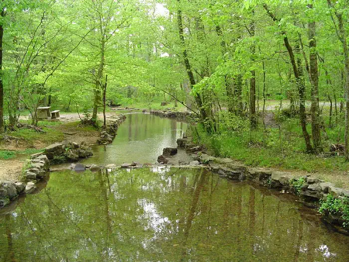
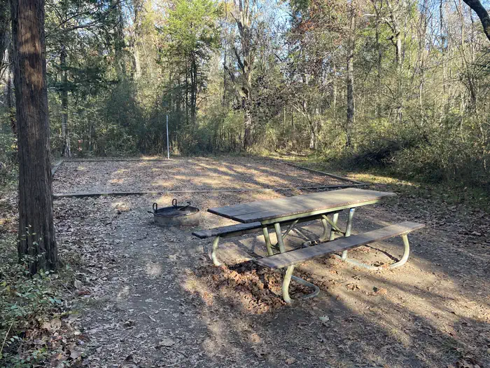
The Pocket Campground is a 26 site campground with one main loop. The campsites are located in a forested setting. A creek flows through the adjacent Day Use/Picnic Area. Each campsite has a paved parking spur, a gravel tent pad, picnic table, lantern post, and a fire ring with a grill. There is a restroom with flush toilets centrally located (no showers). Water hydrants are located throughout the campground. There is no electricity at this campground. There is no dump station at this campground. Cell phone service is very limited. A host site is located at the entrance to the campground. This site is a host residence, not a store or office. Campsites vary in size, accommodating various types of camping opportunities from tents up to 28 foot travel trailers. The roads leading to the Pocket Campground are paved and easy to travel.
Individual sites vary. Confirm on Recreation.gov or with the managing office.
Season & status
| Status | Open |
| Season | April to October 31 |
| Forest | Chattahoochee-Oconee National Forest |
| Booking | The Pocket campground has transitioned to reservation only. Same day reservations are accepted. |
| Fees | $15/site/night |
| Rules | Campsites are for 1 family or 5 adults. Site must be occupied first night of stay. Maximum two vehicles per campsite. 14-day limit. Dogs must be leashed at all times. Alcohol is prohibited in the entire Pocket Recreation Area. RV maximum length 28 feet. |
Weather by month
Getting there
From I-75, take exit 320 (LaFayette/Resaca) west on Georgia Highway 136 for approximately 14 miles. Turn left onto Pocket Road for approximately 7 miles. The recreation area will be on the left.
| Coordinates | 34.5836° N, 85.0854° W · Directions ↗ |
Good to know
- Chestnut Mountain Shooting Range (Fee Area, see Recreation.gov page Chestnut Mountain Shooting Range ): A U.S.
Fire nearby
- PrescribedRx - West Viniard Alexander
24 mi from the campground · 175 acres
Distance is to the reported incident point, not the fire edge. Call the managing office before you drive.
Supplies & services
| Dump station | Dump station ↗ | 18.9 mi |
| RV sales & service | Dunlap Family RV of Chattanooga ↗ | 22.5 mi |
| Outdoor gear | Battlefield Outdoors ↗ | 27 mi |
Locations © OpenStreetMap contributors. Call ahead; hours change seasonally.
Explore
Video
The Pocket Campground walkthrough, Chattahoochee National Forest.
Worth a stop
Johns Creek Trout Fishing Area: A great place to go trout fishing managed by the U.S. Forest Service and ga dnr with the help of Trout Unlimited. Leaving the campground, turn left onto Pocket Road. After 1/4 mile stay right at the Y. After 1 mile look for legal pull-offs for fishing access. (Georgia DNR fishing regulations apply). Johns Mountain Overlook: A U.S. Forest Service overlook where visitors can view the Armuchee Valley and distant Taylor's Ridge. Leaving the campground, turn right onto Pocket Road. After 3 miles turn left at the Johns Mountain Overlook entrance sign (Forest Service Road 208). Follow FSR 208 for 2 miles to the overlook. Keown Falls Picnic Area and Trailhead: A beautiful place to picnic with a loop hike to Keown Falls. Best seen after rain. Leaving the campground, turn right onto Pocket Road. After 2 miles turn left at the Keown Falls Trailhead entrance sign (Forest Service Road 702). Follow FSR 702 for half a mile. The Keown Falls trail is a 3 mile loop trail. The falls are about 1 mile when following the trail counter clockwise.
- 0.2 mi
- 2.1 mi
- 2.6 miDry Creek Equestrian Trailhead ↗Trailhead
- 3.4 miChestnut Mountain Shooting Range ↗OHV / range
- 14.4 miHouston Valley Ohv Area ↗OHV / range
Trails nearby
- 0.3 miPocket2.6 mi trail · hiking
- 0.3 miPocket Trail Connector0.4 mi trail · hiking
- 0.6 miPocket Trail Spurunder 0.1 mi trail · hiking
- 1.8 miWheat Trail4.3 mi trail · hiking, horse, bike
- 2 miKeown Falls1.5 mi trail · hiking
- 2.1 miEast Armuchee Trail ↗5.5 mi trail · hiking, horse, bike
Trailheads within three miles
- 2.1 miKeown Falls Picnic Area and Trailhead ↗Chattahoochee-Oconee National Forest
- 2.6 miDry Creek Equestrian Trailhead ↗Chattahoochee-Oconee National Forest · Season Open year-round
Trail and trailhead records are the Forest Service's. Distances are straight-line to the nearer trail end. Trail conditions are not tracked here.
Other campgrounds nearby



Historic landmarks nearby

Natural features
Surrounded by the horseshoe ridges formed by Horn and Mill Mountains, the Pocket Campground is located in a geographical region known as the Ridge and Valley Province of Northwest Georgia, part of the Southern Appalachian Mountains. This region consists of long narrow ridges, sweeping valleys, creeks, streams, ponds, and waterfalls. A small creek, locally known as Spring Branch (a tributary to nearby Johns Creek) meanders through the recreation area, providing a cool relief in the summer months. An informational interpretive loop trail and the Pocket Loop Trail leads visitors through a mixed pine/oak forest, past a small wildlife pond, and near wildlife food plots. This variety of natural features provides habitat for deer, turkeys, a multitude of song birds, and aquatic life, such as amphibians and beavers. The Johns Mountain Overlook and the Keown Falls Picnic Area are found nearby. These two beautiful recreation sites showcase the natural features of the surrounding region.
Recreation
The Pocket Campground is a quiet campground which not only serves as a place to rest and relax by the campfire, but serves as a base camp for activities located within other parts of the National Forest. Adjacent to the campground is the Pocket Picnic Area, complete with tables, grills, a reservable picnic shelter, and a vault toilet. The trail heads for the Pocket Loop Trail and Pocket Interpretive Trail are located in the picnic area. A Civilian Conservation Corps spring box is located in the creek, releasing cold water from deep below the surface. This is a great place to wade and cool off during long summer days. Hiking the 1.5 mile Pocket Interpretive Trail contains signs to provide an educational walk through multiple types of habitat where an array of wildlife and plant species can be found. The 2.5 mile Pocket Loop Trail provides a similar, but longer experience, sharing some of the same tread with the interpretive trail. Trout fishing in Johns Creek (less than a mile away) is a great place to wet a line and fill one's creel. Georgia DNR fishing regulations apply.
Guidebooks for Georgia
We earn a small commission if you buy through these links. It does not change what we list.
Titles come from Open Library's catalog, matched by subject heading or by title.
Reference
Questions people ask
Do I need a reservation at Pocket Campground?
Sites at Pocket Campground are reservable on Recreation.gov. The Pocket campground has transitioned to reservation only. Any walk-up sites are listed on the booking page.
Source: Recreation.gov
How much does it cost to camp at Pocket Campground?
$15/site/night
Source: Recreation.gov
What time is check-in at Pocket Campground?
Check-in 03:00 PM, checkout 02:00 PM.
Source: Recreation.gov
Is Pocket Campground open right now?
Open as of Oct 16, 2026. Season April to October 31.
Source: Forest Service status
How many sites does Pocket Campground have?
26 sites, including 26 standard sites without power.
Source: Recreation.gov
Can I bring an RV to Pocket Campground?
Pocket Campground is listed for tents only.
Source: Recreation.gov
Are there showers or a dump station at Pocket Campground?
There is a restroom with flush toilets centrally located (no showers).
Source: Recreation.gov
Are pets allowed at Pocket Campground?
Yes, pets are allowed at Pocket Campground. Leash rules apply.
Source: Recreation.gov
Can I have a campfire at Pocket Campground?
Fires are allowed in the provided rings under normal conditions. As of 2026-10-16, there is 1 active fire within 50 miles, so check current restrictions before you light one. Campsites are for 1 family or 5 adults.
Source: Fire nearby
Are there accessible sites at Pocket Campground?
Site 21 is listed accessible on Recreation.gov. What that covers (a paved pad, an accessible table, a nearby accessible restroom) is on each site's booking page.
Source: Recreation.gov
What is there to do at Pocket Campground?
The Pocket Campground is a quiet campground which not only serves as a place to rest and relax by the campfire, but serves as a base camp for activities located within other parts of the National Forest. The Recreation section on this page has the rest.
Source: Recreation
What if Pocket Campground is full?
The nearest public campgrounds are Woodring Campground (25.3 mi), Woodring Branch Primitive Campground (25.6 mi), and Chickamauga Battlefield Group Campground (25.9 mi).
Source: Campgrounds nearby