Obsidian
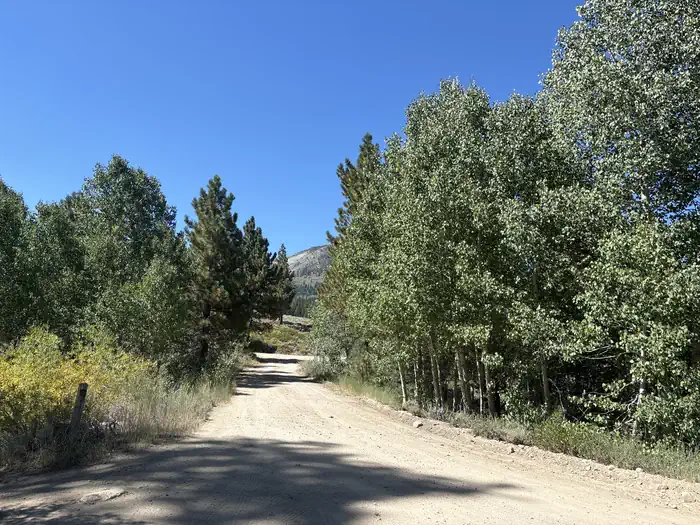
Obsidian campground offers opportunity to get away from crowds amidst shade of aspens and pines. Campground is close to Molybdenite Creek and Little Walker River. The river is stocked with trout. Area trailheads offer several interesting hikes. The trail from Molybdenite Creek trailhead splits, with one branch heading south into the Hoover Wilderness, and one looping north along Wheeler Creek to connect with the trail along the Little Walker River. This can be hiked as a loop from Burt Canyon trailhead (just west of campground). The Emma Lake trailhead leads to a short but steep hike to Emma Lake on the shores of Mount Emma.
More like this: reservable in California · pets allowed in California
Check availability on Recreation.gov ↗


Site mix
| Standard, no hookups | 11 |
Amenities & rules
| Pets | Allowed |
| Campfires | Allowed, subject to restrictions |
This campground is best suited for small vehicles and tent camping. Campsites have picnic tables and campfire rings. The campground has vault toilets for public use. There is no garbage service so please pack in/pack out any trash. There is no potable water available.
Individual sites vary. Confirm on Recreation.gov or with the managing office.
Season & status
| Season | Late May to Mid-October |
| Forest | Humboldt-Toiyabe National Forest |
| Booking | No reservations needed, first come, first serve. |
| Fees | Per Day: $18 Single/$6 Extra Vehicles |
| Rules | California camp fire permit required ( https://www.fs.usda.gov/detail/htnf/passes-permits/?cid=fseprd673196 ). Dog must be on a leash at campground. |
Weather by month
Getting there
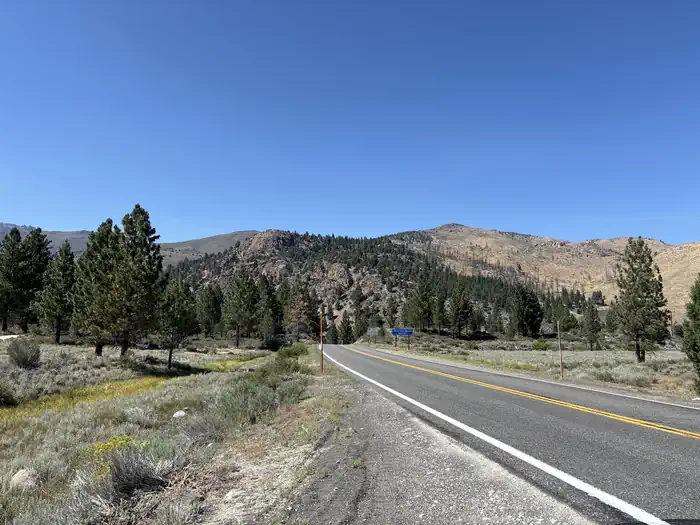
1. From Highway 395 south in Bridgeport, drive approximately 16 miles to Little Walker Road. 2. Turn left on Little Walker Road (Forest Service Road # 066). Go approximately three miles on that unpaved road to campground sign.
| Coordinates | 38.2999° N, 119.4492° W · Directions ↗ |
Supplies & services
| Dump station | Dump Station ↗ | 29.9 mi |
| Outdoor gear | Bear Valley Adventure Company ↗ | 34 mi |
Locations © OpenStreetMap contributors. Call ahead; hours change seasonally.
Explore
Video
Lets go Explore - Obsidian Campground - Mono Mills & Lake - Virginia Lakes! - 4Runner
Worth a stop
- 5 mi
- 6 miLeavitt Meadows Trailhead ↗Trailhead
- 10.3 miSonora Pass Th ↗Trailhead
- 10.5 mi
Trails nearby
- 0.1 miWheeler Creek ↗4.5 mi trail · hiking, horse, bike
- 0.2 miMolybdenite Creek ↗6.8 mi trail · hiking, horse, bike
- 1.3 miEmma Lake1.3 mi trail · hiking, horse, bike, 4WD
- 1.5 miLong Valley Creek Route ↗5.7 mi trail · hiking, horse, bike
- 1.7 miMolybdenite Cutoff1.9 mi trail · hiking, horse, bike
- 2.9 miBurt Canyon ↗11.1 mi trail · hiking, horse, bike
Trail and trailhead records are the Forest Service's. Distances are straight-line to the nearer trail end. Trail conditions are not tracked here.
Public land it sits in
Hoover Wilderness begins about 3.1 miles away, and it is the closest of these.
- 3.1 miHoover Wilderness ↗Wilderness · Forest Service · 128,044 acres
- 8.9 miStanislaus National Forest ↗National Forest · Forest Service · 1,090,354 acres
- 10.7 miCarson-Iceberg Wilderness ↗Wilderness · Forest Service · 158,147 acres
Each unit is published as a centre point and an acreage rather than a boundary, so this section stands it in for a circle of the same area. Whether a campground is inside, and how far it is from one it is outside, are both approximate.
Other campgrounds nearby

Historic landmarks nearby

Natural features
The Obsidian campground is at an elevation of 7800 feet.
Recreation
The Obsidian campground is popular with hikers, fishermen, and campers looking for a quiet rustic campground.
Guidebooks for California
We earn a small commission if you buy through these links. It does not change what we list.

Titles come from Open Library's catalog, matched by subject heading or by title.
Reference
Questions people ask
Do I need a reservation at Obsidian?
Sites at Obsidian are reservable on Recreation.gov. No reservations needed, first come, first serve. Any walk-up sites are listed on the booking page.
Source: Recreation.gov
How much does it cost to camp at Obsidian?
Per Day: $18 Single/$6 Extra Vehicles
Source: Recreation.gov
What time is check-in at Obsidian?
Check-in 02:00 PM, checkout 12:00 PM.
Source: Recreation.gov
How many sites does Obsidian have?
11 sites, including 11 standard sites without power.
Source: Recreation.gov
Are pets allowed at Obsidian?
Yes, pets are allowed at Obsidian. Leash rules apply.
Source: Recreation.gov
Can I have a campfire at Obsidian?
Fires are allowed in the provided rings under normal conditions. California camp fire permit required ( https://www.fs.usda.gov/detail/htnf/passes-permits/?cid=fseprd673196 ).
Source: Recreation.gov
What if Obsidian is full?
The nearest public campgrounds are Sonora Bridge (5 mi), Leavitt Meadows (6.3 mi), and Chris Flat (6.5 mi).
Source: Campgrounds nearby