Patterson Guard Station
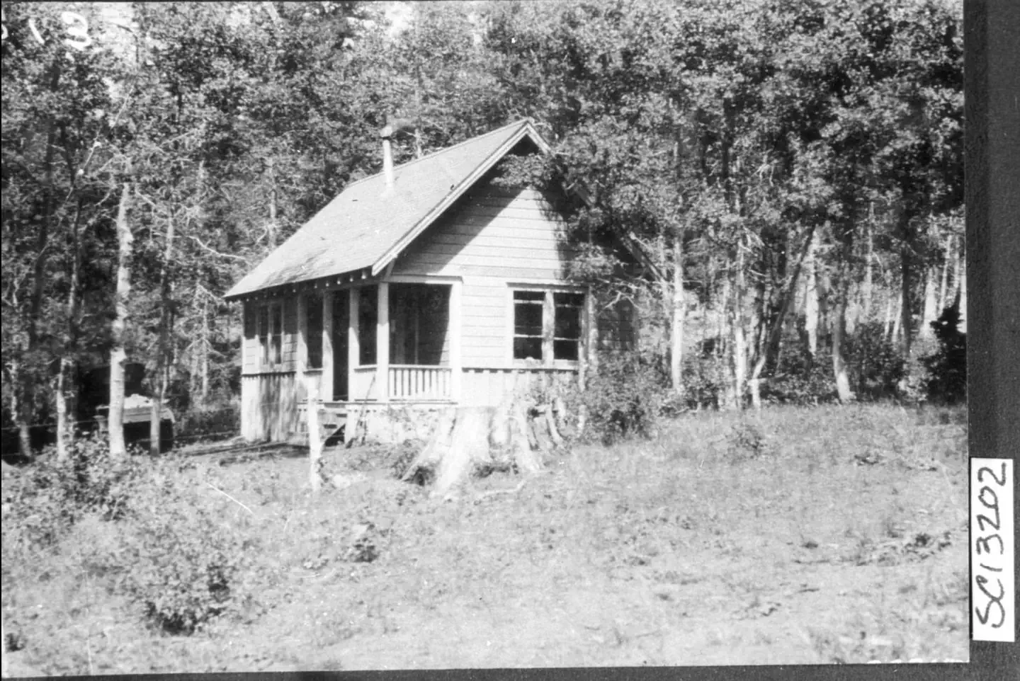
*Altitude is 7,080 feet above sea level* Set on the edge of a meadow surrounded by Aspen, Fir and Pine trees, Patterson Guard Station has stood since 1921. It served the Modoc National Forest as a fully staffed fire office and guard station until 1981. Just a few footsteps from the Summit Trail and one-quarter mile from the wilderness boundary, Patterson Guard Station can be your basecamp for trips into the South Warner Wilderness or the perfect place to disconnect and relax. The cabin only has one set of bunkbeds (two mattresses). There is a large turn-around parking area directly adjacent to the cabin which can accommodate camper trailers, smaller RVs and gooseneck horse trailers.
Check availability on Recreation.gov ↗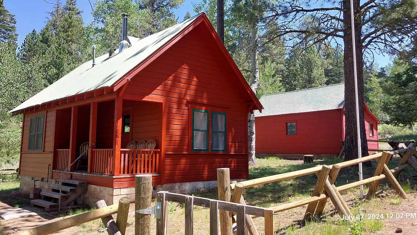


Site mix
| Cabins | 1 |
Site guide
1 site. Tap a filter to narrow the list; the map follows.
| Site | Shade | Water / sewer | People / vehicles | Fires | Rating |
|---|---|---|---|---|---|
| Patterson Guard Station | Partial | No / – | 8 / – | Yes | Standard |
Per-site records as published by the managing agency on Recreation.gov. Blank cells mean the agency listed nothing for that site. Check-in 02:00 PM, checkout 11:00 AM.
Amenities & rules
| Pets | Allowed |
| Campfires | Allowed, subject to restrictions |
- Patterson Guard Station was restored in 2022 thanks to funding from the Bipartisan Infrastructure Law. The guard station is currently equiped with one bunk bed (two matresses). There will also be two chairs that each convert to a single bed. Pots and pans will be provided. Pets are allowed. The guard station features a new refrigerator and oven/range fueled by propane (provided). New floors and a
- THINGS YOU MUST BRING WITH YOU:
- DRINKING WATER AND WATER FOR WASHING
- BATTERY POWERED LANTERNS AND LIGHTS FOR INDOOR USE
- BUG SPRAY AND FIRST AID KITS
- BEDDING (SLEEPING BAGS, BLANKETS, SHEETS, PILLOWS)
- Check-in is 2pm and check-out is 11am. Maximum occupancy is listed at eight (8) but when it comes to sleeping arrangments, the guard station will only accomdate four (4) persons.
Individual sites vary. Confirm on Recreation.gov or with the managing office.
Season & status
| Status | Open |
| Season | Facilities open as weather permits; usually mid-May to late October |
| Forest | Modoc National Forest |
| Booking | All sites are first come, first served. |
| Fees | $15/single campsite per day with a maximum of 2 vehicles. |
| Rules | Dogs shall remain on leash within developed recreation sites and campgrounds. Please clean up after your dog. Camping limit 14 days. |
Weather by month
Getting there
From Alturas, California, travel South on U.S. Highway 395 for 18 miles to the town of Likely and Turn left (East) onto County Rd 64. Continue for 9 miles toward Jess Valley and stay right at the fork toward Blue Lake (Blue Lake Road), this road is not maintained for winter travel.
| Nearest town | Alturas, California |
| Coordinates | 41.1978° N, 120.1887° W · Directions ↗ |
Supplies & services
| RV sales & service | Reliable RV ↗ | 59.5 mi |
Locations © OpenStreetMap contributors. Call ahead; hours change seasonally.
Explore
Trails nearby
- under 0.1 miSummit Trail ↗22.7 mi trail · hiking, horse
- 0.2 miConnector Trail0.7 mi trail · hiking, horse, bike
- 0.5 miEast Creek Trail ↗5.6 mi trail · hiking, horse
- 3.5 miBearcamp Trail1.8 mi trail · hiking, horse
- 4.6 miSouth Emerson Trail3.4 mi trail · hiking, horse
- 4.6 miNorth Emerson Trail4.4 mi trail · hiking, horse
Trailheads within three miles
- 0.5 miEast Creek Trailhead ↗Modoc National Forest
Trail and trailhead records are the Forest Service's. Distances are straight-line to the nearer trail end. Trail conditions are not tracked here.
Public land it sits in
South Warner Wilderness begins about 2.9 miles away, and it is the closest of these.
- 2.9 miSouth Warner Wilderness ↗Wilderness · Forest Service · 70,206 acres
- 12.7 miModoc National Forest ↗National Forest · Forest Service · 2,023,026 acres
Each unit is published as a centre point and an acreage rather than a boundary, so this section stands it in for a circle of the same area. Whether a campground is inside, and how far it is from one it is outside, are both approximate.
Other campgrounds nearby



On the National Register nearby
- Jess Valley SchoolhouseBuilding · Likely · 8 mi
Natural features
The Warner Mountains form a prominent Northwestern boundary of the basin and range geologic province that envelops the entire state of Nevada. This range was once a sedimentary basin between volcanoes of the ancestral Cascade Range until the Warners went through their own phases of active volcanism between ~28 million years ago until as recently as 2 to 3 million years ago. Dramatic uplift on the eastern side of this range provides breathtaking views, best seen from Surprise Valley, east of the Warners. South-facing slopes in the Warner Mountains are often dry and host Lodgepole and Ponderosa Pine, Juniper trees and Sagebrush. North facing slopes are wetter and host Fir trees. Aspen trees are found along streams and boggy areas beside Corn Lillies that can grow up to 5 feet tall before drying up by mid-summer.
Recreation
Hiking & Horseback Riding The nearby trails within the South Warner Wilderness offer wild landscapes and solitude for hikers and horseback riders. The Wilderness Act of 1964 prohibits the use of motorized and/or mechanized equipment within the Wilderness area (limited exceptions are provided by the Americans with Disabilities Act). South Warner WIlderness maps are advised and always available at the Modoc National Forest Supervisor's Office in Alturas, Calif. Maps may also be available at the Likely General Store in Likely, Calif. Off-Highway Vehicles Many of the roads near Patterson Guard Station, outside of the wilderness area, are open to Off-Highway Vehicles. Motor Vehicle Use Maps are available online and at the Modoc National Forest Supervisor's Office in Alturas, Calif. Boating Blue Lake, 9 miles west, features a boat ramp and dock for motorized and non-motorized watercraft. Help keep this lake clean by following the California Invasive Species Prevention Program Please respect the 10 mph speed limit on the lake. If speed-boating is your thing, consider launching your boat at West Valley Reservoir instead.
Nearby
- Blue Lake, 9 miles West, offers a boat ramp and dock with a kayak launcher, fishing platform, day use area with grills and picnic tables and a developed campground with 40+ developed campsites at $15/night.
- Cedarville, California, is a historic western town offering restuarants, a grocery store, and shopping oppourtunities. 31 miles North along County Road 1.
Guidebooks for California
We earn a small commission if you buy through these links. It does not change what we list.

Titles come from Open Library's catalog, matched by subject heading or by title.
Reference
Questions people ask
Do I need a reservation at Patterson Guard Station?
Sites at Patterson Guard Station are reservable on Recreation.gov. All sites are first come, first served. Any walk-up sites are listed on the booking page.
Source: Recreation.gov
How much does it cost to camp at Patterson Guard Station?
$15/single campsite per day with a maximum of 2 vehicles.
Source: Recreation.gov
What time is check-in at Patterson Guard Station?
Check-in 02:00 PM, checkout 11:00 AM.
Source: Recreation.gov
Is Patterson Guard Station open right now?
Open as of Oct 16, 2026. Season Facilities open as weather permits; usually mid-May to late October.
Source: Forest Service status
How many sites does Patterson Guard Station have?
1 site, including 1 cabin.
Source: Recreation.gov
Are pets allowed at Patterson Guard Station?
Yes, pets are allowed at Patterson Guard Station. Leash rules apply.
Source: Recreation.gov
Can I have a campfire at Patterson Guard Station?
Fires are allowed in the provided rings under normal conditions. Dogs shall remain on leash within developed recreation sites and campgrounds.
Source: Recreation.gov
What is there to do at Patterson Guard Station?
Hiking & Horseback Riding The nearby trails within the South Warner Wilderness offer wild landscapes and solitude for hikers and horseback riders. The Recreation section on this page has the rest.
Source: Recreation
What is the nearest town to Patterson Guard Station?
Alturas, California. Blue Lake, 9 miles West, offers a boat ramp and dock with a kayak launcher, fishing platform, day use area with grills and picnic tables and a developed campground with 40+ developed campsites at $15/night.
Source: Getting there
What if Patterson Guard Station is full?
The nearest public campgrounds are East Creek Campground (0.5 mi, first-come), Emerson Campground (5.3 mi, first-come), and Blue Lake Campground Group Site (6.1 mi, partly first-come).
Source: Campgrounds nearby