Peavine Campground
Just northwest of the Los Angeles metro area, Peavine provides a scenic and relaxing destination for camping, hiking, picnicking and wildlife viewing. Within walking distance of Jackson Lake for easy access to fishing, canoeing, and swimming. Visitors enjoy exploring the Angeles Crest Scenic Byway, which offers incredible views of oak thickets, high desert landscapes, chaparral and pine forests.
More like this: reservable in California · pets allowed in California
Check availability on Recreation.gov ↗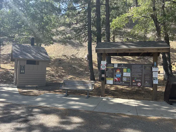
Site mix
| Tent-only | 4 |
Site guide
4 sites. Tap a filter to narrow the list; the map follows.
| Site | Shade | People / vehicles | Fires |
|---|---|---|---|
| 1 | Partial | 8 / 2 | Yes |
| 2 | Partial | 8 / 2 | Yes |
| 3 | Partial | 8 / 2 | Yes |
| 4 | Partial | 8 / 2 | Yes |
Per-site records as published by the managing agency on Recreation.gov. Blank cells mean the agency listed nothing for that site. Check-in 02:00 PM, checkout 11:00 AM.
Amenities & rules
| Pets | Allowed |
| Campfires | Allowed, subject to restrictions |
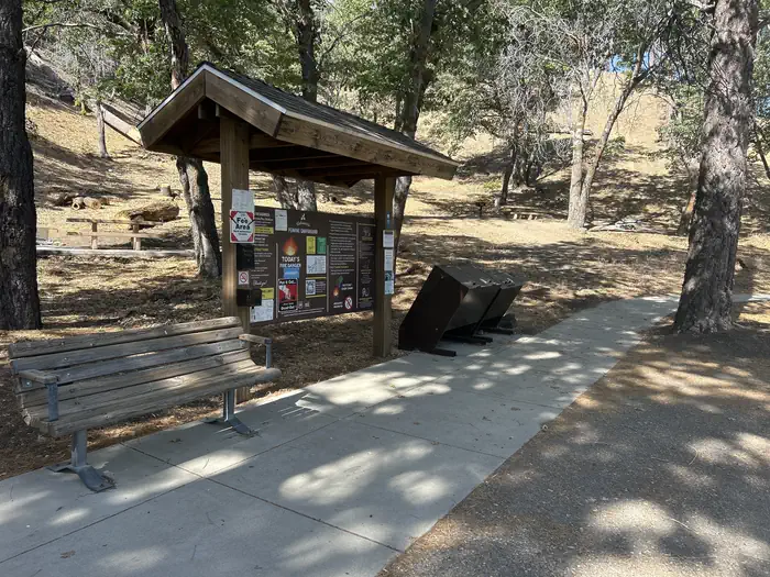
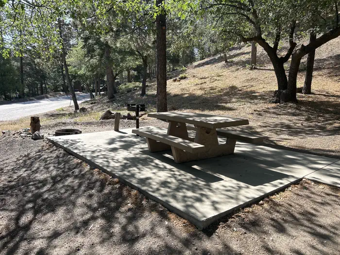
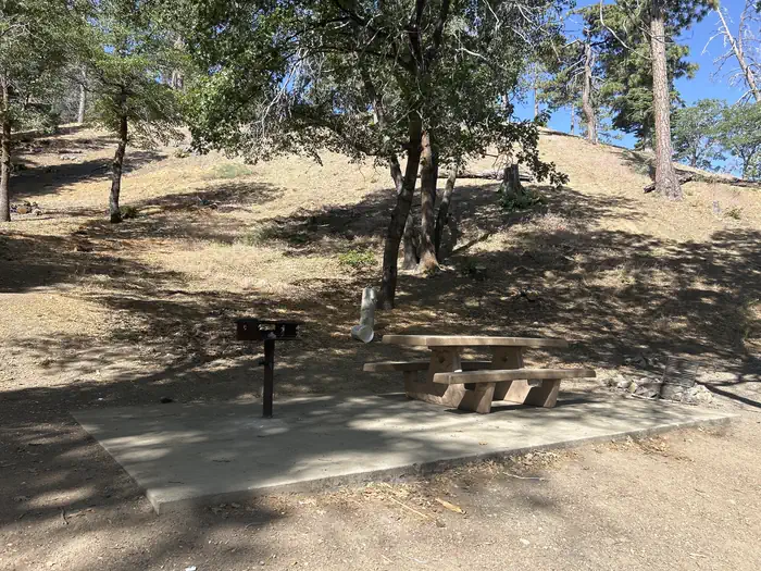
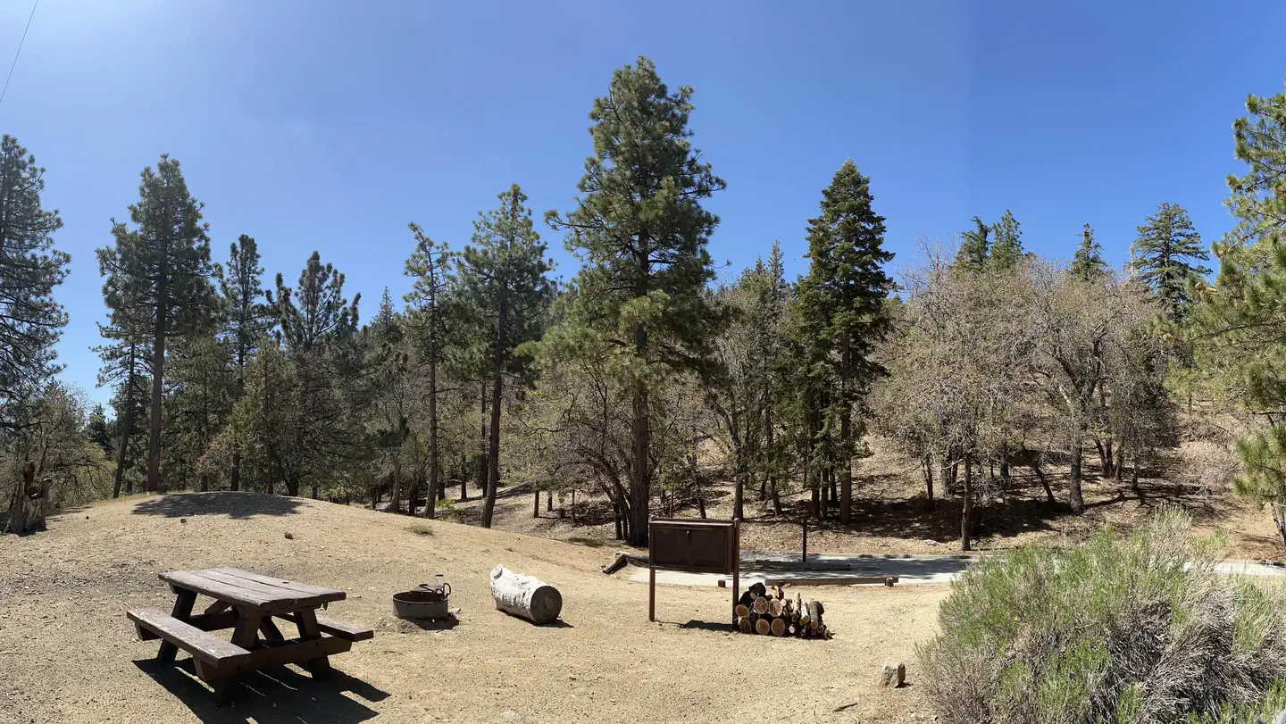
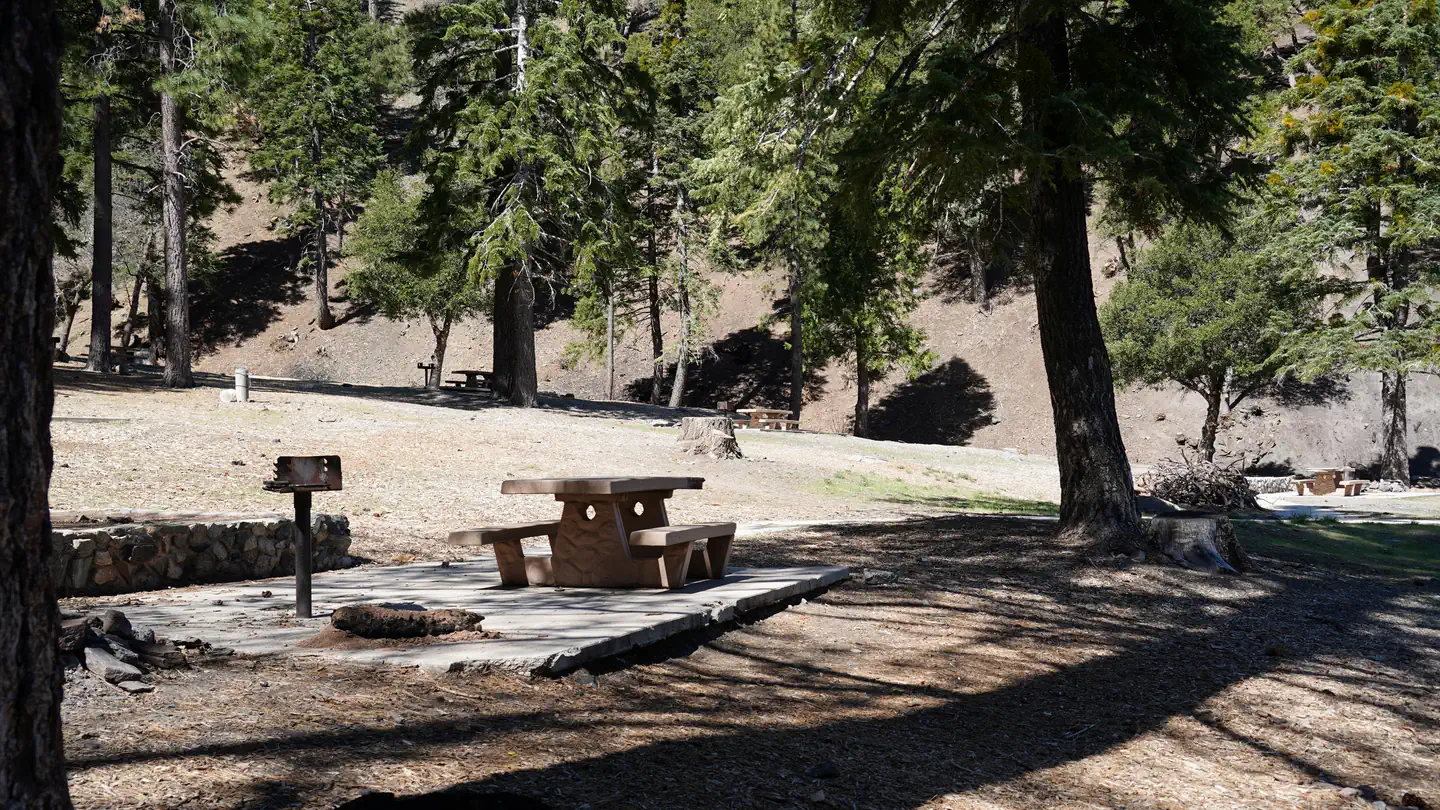
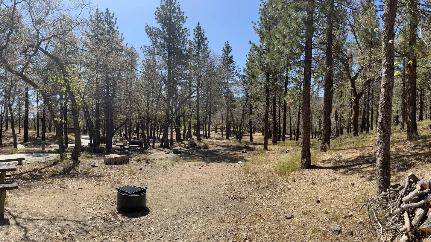
Tent campsites can accommodate eight campers. Remote parking for one vehicle is provided in a shared parking lot right next to the sites. Grills, picnic tables, pit toilets, and drinking water are provided. Firewood can be purchased from the host at nearby Mountain Oak Campground.
Individual sites vary. Confirm on Recreation.gov or with the managing office.
Season & status
| Status | Open |
| Forest | Angeles National Forest |
| Booking | Make reservations at www.recreation.gov or 1-877-444-6777. For more information, contact the concessionaire at Mountain High Resort at (760) 316-7828. |
| Fees | This site is operated by Mountain High Resort. A Big Pines Pass from Mountain High Resort is required when parking here. The Adventure Pass and any of the Interagency Passes are not honored here. Camping fee can be paid with the campground host at Mt. Oak Campground. |
| Rules | See current fire restrictions. |
Weather by month
Getting there
| Nearest town | Wrightwood, California |
| Coordinates | 34.3896° N, 117.7187° W · Directions ↗ |
Good to know
- Powerboating is not permitted on Jackson Lake, so the setting is peaceful and quiet for swimming, canoeing and fishing.
Supplies & services
| RV sales & service | Major RV Sales ↗ | 20.5 mi |
| Outdoor gear | REI ↗ | 22 mi |
| Dump station | Dump station ↗ | 22.1 mi |
Locations © OpenStreetMap contributors. Call ahead; hours change seasonally.
Explore
Worth a stop
The Angeles Crest Highway, part of California State Route 2, is a scenic byway that meanders through oak thickets, chaparral, high desert landscapes and pine tree forests. The ski resort town of Wrightwood is very close by. Restaurants and a disc golf course can be found at the North Resort. Take a hike on the Blue Ridge Trail or the Pacific Crest Trail. The Pacific Crest Trail is an impressive path that starts in Mexico and zigzags its way through Angeles and continues north across California, Oregon and Washington. Visit the Mountain High Downhill Bike Park.
- 0.2 miMescal Picnic Site ↗Day use
- 0.5 miJackson Lake Picnic Site ↗Day use
- 1.3 miInspiration Point Trailhead ↗Trailhead
- 7.7 miWindy Gap Trailhead ↗Trailhead
- 12.3 miLytle Creek Firing Line - Shooting Range ↗OHV / range
- 13.2 mi
Show all 7Hide
- 13.3 miWest Fork Fishing Access Fishing Site ↗Fishing site
Trails nearby
- 0.5 miJackson Lake Interpretive0.6 mi trail · hiking, horse, bike
- 0.7 miJackson Lake2.1 mi trail · hiking, horse, bike
- 1.1 miJackson Flat Interpretive0.4 mi trail · hiking, horse, bike
- 1.2 miLightning Ridge Nature Trail0.4 mi trail · hiking, horse, bike
- 1.2 miJackson Flat Geological0.5 mi trail · hiking, horse, bike
- 1.3 miPCT Grassy Hollow ↗4.5 mi trail · hiking, horse, bike · national_scenic_or_historic
Trailheads within three miles
- 1.3 miInspiration Point Trailhead ↗Angeles National Forest
- 2.2 miMt. Baden Powell via Vincent's Gap ↗Angeles National Forest
Trail and trailhead records are the Forest Service's. Distances are straight-line to the nearer trail end. Trail conditions are not tracked here.
Public land it sits in
Sheep Mountain Wilderness begins about 1.3 miles away, and it is the closest of these.
- 1.3 miSheep Mountain Wilderness ↗Wilderness · Forest Service · 43,182 acres
- 6.7 miAngeles National Forest ↗National Forest · Forest Service · 706,719 acres
- 6.9 miPleasant View Ridge Wilderness ↗Wilderness · Forest Service · 26,839 acres
Each unit is published as a centre point and an acreage rather than a boundary, so this section stands it in for a circle of the same area. Whether a campground is inside, and how far it is from one it is outside, are both approximate.
Other campgrounds nearby

Natural features
Peavine Campground sits at an elevation of 6,100 feet in Angeles National Forest. Campsites are shaded with scattered oak trees and Jeffrey pines. Daytime temperatures in the summer are usually in the low 80s and evenings are cool. The Angeles National Forest spans nearly 695,000 acres over most of the San Gabriel Mountain Range in southern California. Vegetation ranges from chaparral and oak at lower elevations to pine forests at higher altitudes. Elevations range from 1,200 to 10,000 feet. The endangered California condor inhabits the forest. The Least Bells vireo and the Southwestern Willow flycatcher are two migratory birds that visitors enjoy spotting in the area. Other local inhabitants include the Arroyo toad, mountain yellow-legged frog, the mountain lion and the two-striped garter snake.
Recreation
Wildlife viewing is a popular activity, as visitors may see bobcats, mountain lions, bears and Nelson bighorn sheep. The lake is stocked with trout and bluegill.
Guidebooks for California
We earn a small commission if you buy through these links. It does not change what we list.

Titles come from Open Library's catalog, matched by subject heading or by title.
Reference
Questions people ask
Do I need a reservation at Peavine Campground?
Sites at Peavine Campground are reservable on Recreation.gov. Make reservations at www.recreation.gov or 1-877-444-6777. Any walk-up sites are listed on the booking page.
Source: Recreation.gov
How much does it cost to camp at Peavine Campground?
This site is operated by Mountain High Resort. A Big Pines Pass from Mountain High Resort is required when parking here. The Adventure Pass and any of the Interagency Passes are not honored here.
Source: Recreation.gov
What time is check-in at Peavine Campground?
Check-in 02:00 PM, checkout 11:00 AM.
Source: Recreation.gov
Is Peavine Campground open right now?
Open as of Oct 16, 2026.
Source: Forest Service status
How many sites does Peavine Campground have?
4 sites, including 4 tent-only sites.
Source: Recreation.gov
Are pets allowed at Peavine Campground?
Yes, pets are allowed at Peavine Campground. Leash rules apply.
Source: Recreation.gov
Can I have a campfire at Peavine Campground?
Fires are allowed in the provided rings under normal conditions. See current fire restrictions.
Source: Recreation.gov
What is there to do at Peavine Campground?
Wildlife viewing is a popular activity, as visitors may see bobcats, mountain lions, bears and Nelson bighorn sheep. The Recreation section on this page has the rest.
Source: Recreation
What is the nearest town to Peavine Campground?
Wrightwood, California. The Angeles Crest Highway, part of California State Route 2, is a scenic byway that meanders through oak thickets, chaparral, high desert landscapes and pine tree forests.
Source: Getting there
What if Peavine Campground is full?
The nearest public campgrounds are Lake Campground (0.3 mi), Appletree Campground (0.4 mi), and Mountain Oak (0.7 mi).
Source: Campgrounds nearby