Pulver Mountain Group Site
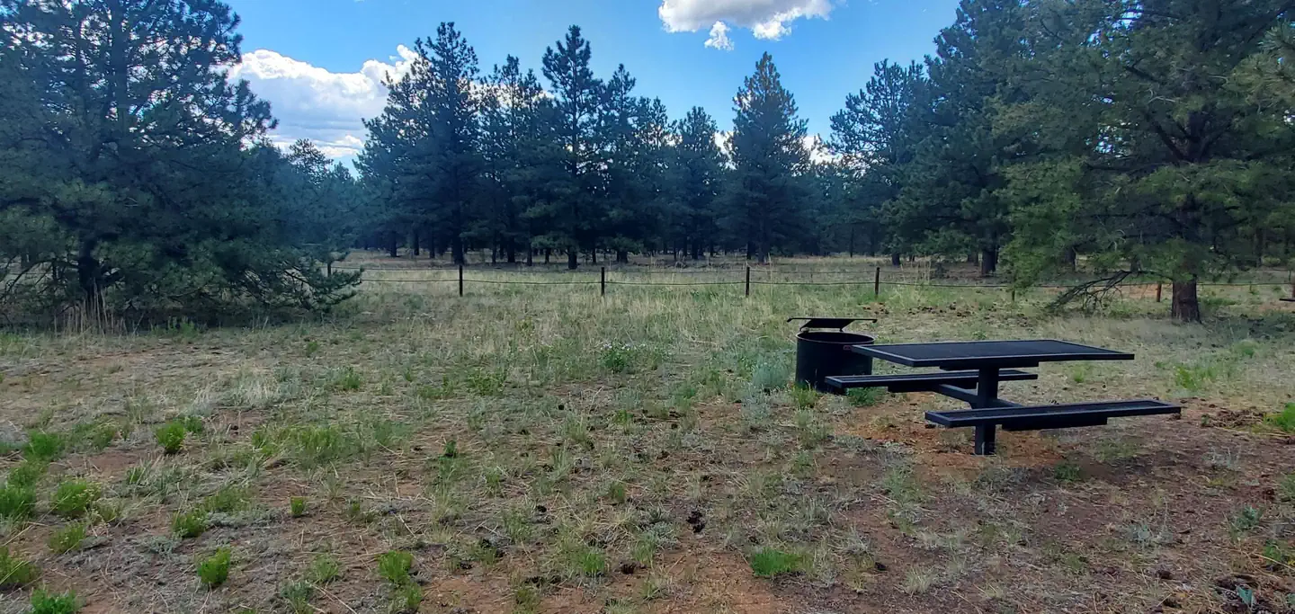
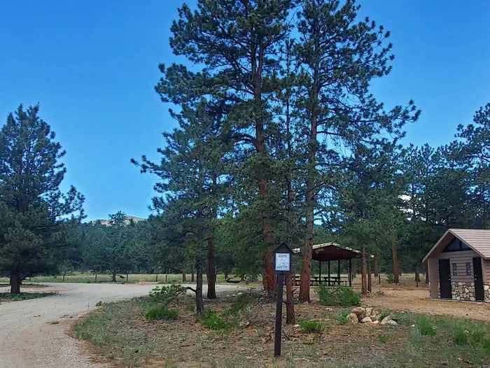
Pulver group site offers a private area with large pavilion with several tables and a large communal campfire pit. For your convenience, a double-stall vaulted restroom is provided. Within the group site are 6 individual campsites for your guest, each having their own table and campfire ring. Firewood is provided by roaming host who can be located nearby at Round Mountain campground. Access to the west field is by foot only and for your use of additional tents, recreation, or main even activities.
More like this: reservable in Colorado · pets allowed in Colorado · group sites in Colorado
Check availability on Recreation.gov ↗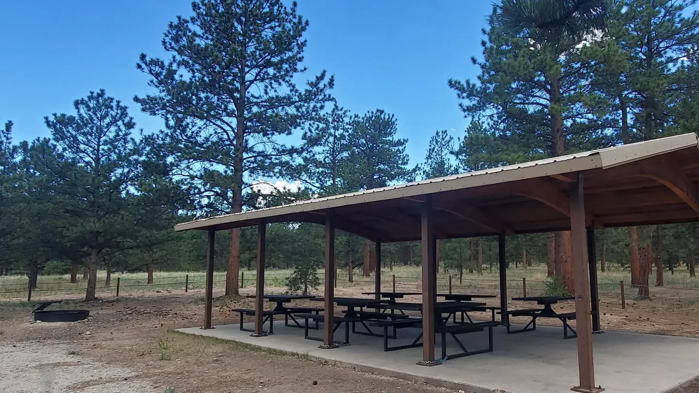

Site mix
| Group sites | 1 |
Site guide
1 site. Tap a filter to narrow the list; the map follows.
| Site | Surface | Shade | Water / sewer | People / vehicles | Fires | Accessible | Rating |
|---|---|---|---|---|---|---|---|
| Pulver Mountain Group Site | Gravel | Partial | No / – | 75 / 15 | Yes | Yes | Standard |
Per-site records as published by the managing agency on Recreation.gov. Blank cells mean the agency listed nothing for that site. Check-in 2:00 PM, checkout 12:00 PM.
Amenities & rules
| Hookups | None |
| Equipment | RVs & trailers, Tents |
| Pets | Allowed |
| Campfires | Allowed, subject to restrictions |
| Accessibility | Site Pulver Mountain Group Site is listed accessible |
1 pavilion, 1 large group-campfire ring, Double-stall vaulted restroom, 6 moveable tables in pavilion, 6 stationary tables at individual campsites, 6 campfire rings, Private activity field, Firewood available via roaming hosts and management.
Individual sites vary. Confirm on Recreation.gov or with the managing office.
Weather by month
Getting there
FROM THE EAST. - South of 24, about 5 miles west of Lake George (2 miles west of the turnoff to Round Mountain campground). - Between mile marker 257 & 258. - Turn left onto Forest Service Road 861 (indescript dirt road, signage will be placed soon.). - Follow about 1/4-mile, gate will be on right. FROM THE WEST.
| Nearest town | Lake George, Colorado |
| Coordinates | 39.0263° N, 105.4716° W · Directions ↗ |
Fire nearby
- PrescribedO'Brien 2 Broadcast Rx
5 mi from the campground · 267 acres
- PrescribedRainbow Gulch Rx
26 mi from the campground · 912 acres
- PrescribedHarris Park Broadcast Rx
34 mi from the campground · 390 acres
Distance is to the reported incident point, not the fire edge. Call the managing office before you drive.
Supplies & services
| Dump station | Dump station ↗ | 6.5 mi |
| Outdoor gear | South Platte Fly Shop ↗ | 22.9 mi |
| RV sales & service | Berkenkotter Motors ↗ | 40.4 mi |
Locations © OpenStreetMap contributors. Call ahead; hours change seasonally.
Explore
Worth a stop
National forest areas: - Eleven Mile Canyon - Badger Flats - Wilkerson Pass - Manitou Lakes - Rampart Range - Deckers - Pikes Peak - Norht Catamount Reservoir - Clear Creek Reservoir - national monument: - Florissant Fossil Beds state park areas: - Eleven Mile reservoir - Spinney Mountain Reservoir - Mueller State Park - Taryall Reservoir - Antero Reservoir, nearby towns: - Lake George - Woodland Park - Cripple Creek - Fairplay
- 7.2 miEleven Mile Picnic Area ↗Day use
- 7.2 mi
Trails nearby
- 3 miPuma Point0.7 mi trail · hiking, horse, bike
Trail and trailhead records are the Forest Service's. Distances are straight-line to the nearer trail end. Trail conditions are not tracked here.
Public land it sits in
Lost Creek Wilderness begins about 10.2 miles away, and it is the closest of these.
- 10.2 miLost Creek Wilderness ↗Wilderness · Forest Service · 114,864 acres
Each unit is published as a centre point and an acreage rather than a boundary, so this section stands it in for a circle of the same area. Whether a campground is inside, and how far it is from one it is outside, are both approximate.
Other campgrounds nearby


On the National Register nearby
- South Platte River BridgeStructure · Lake George · 6.4 mi
- Tarryall SchoolBuilding · Tarryall · 6.5 mi
- Florissant SchoolBuilding · Florissant · 10.9 mi
Natural features
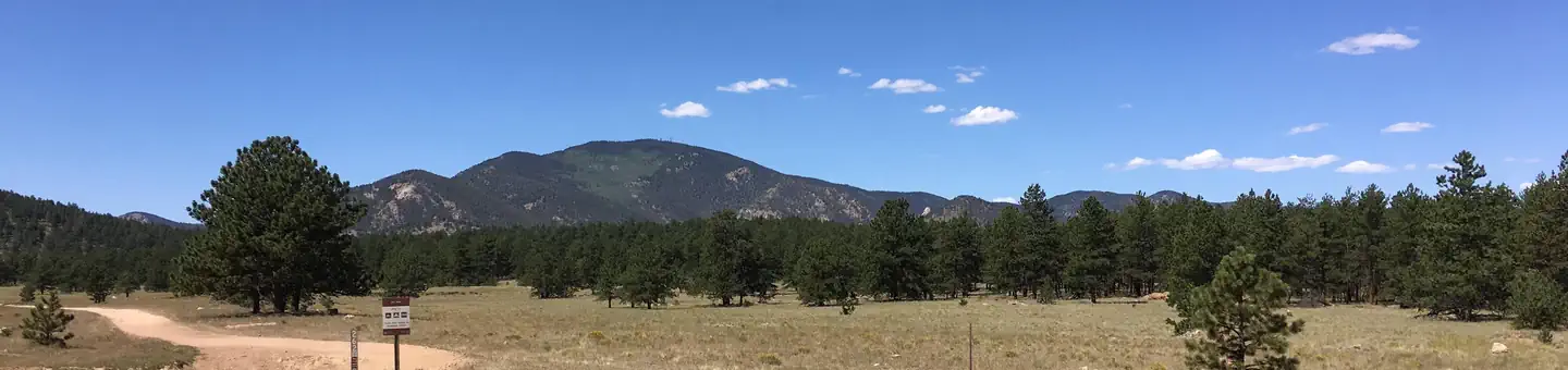
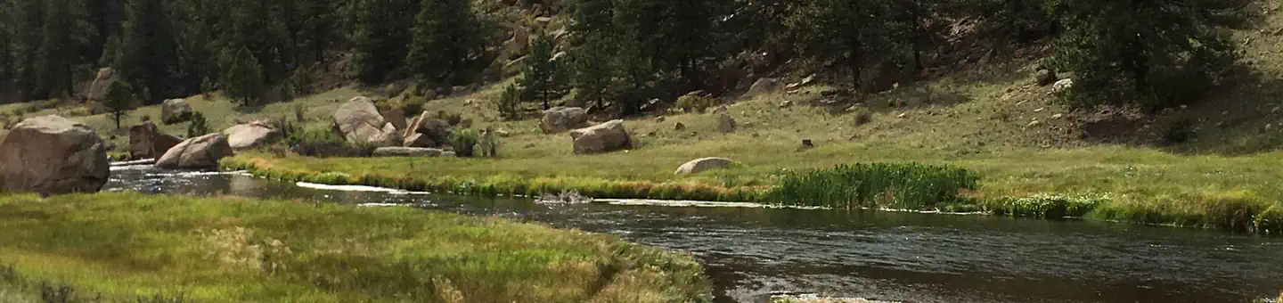
This fairly flat terrain is covered with natural grasses and speckled with pines providing plenty of shade. If solar and sunbathing is in your itinerary, a generous amount of sun is easily acquired as well.
Recreation
- Being in the National Forest, nearby is Eleven Mile Canyon. The canyon is part of the historical Midland Railroad. You can drive along the railbed, following the South Platte River for nine miles to the base of the dam of Eleven Mile Reservoir, while enjoying the beautiful scenery of the river and granite canyon. The open area of Eleven Mile Reservoir is state park whereas the canyon (National
- Jefferson Lake is about 45 minutes north with spectacular wildlife, hiking, and hand launched boating. The depth of the lake is unknown and flows towards the basin of Pulver Group Site, into Tarryall Reservoir. The state park of Tarryall reservoir is visiting often for fishing by boat and shoreline.
- Offroading is located just outside the gate to Pulver group site to the south. To the north, Badger Flats area offers a large area to explore and admire the beauty of sub-alpine terrain. This area shows remnents of early settlers and active ranching. (OHV must be trailered to/from).
Guidebooks for Colorado
We earn a small commission if you buy through these links. It does not change what we list.



Titles come from Open Library's catalog, matched by subject heading or by title.
Reference
Questions people ask
Do I need a reservation at Pulver Mountain Group Site?
Sites at Pulver Mountain Group Site are reservable on Recreation.gov. Any walk-up sites are listed on the booking page.
Source: Recreation.gov
What time is check-in at Pulver Mountain Group Site?
Check-in 2:00 PM, checkout 12:00 PM.
Source: Recreation.gov
How many sites does Pulver Mountain Group Site have?
1 site, including 1 group site.
Source: Recreation.gov
Can I bring an RV to Pulver Mountain Group Site?
Pulver Mountain Group Site is listed for tents only.
Source: Recreation.gov
Are pets allowed at Pulver Mountain Group Site?
Yes, pets are allowed at Pulver Mountain Group Site. Leash rules apply.
Source: Recreation.gov
Can I have a campfire at Pulver Mountain Group Site?
Fires are allowed in the provided rings under normal conditions. As of 2026-10-16, there are 3 active fires within 50 miles, so check current restrictions before you light one.
Source: Fire nearby
Are there accessible sites at Pulver Mountain Group Site?
Site Pulver Mountain Group Site is listed accessible on Recreation.gov. What that covers (a paved pad, an accessible table, a nearby accessible restroom) is on each site's booking page.
Source: Recreation.gov
Is there cell service at Pulver Mountain Group Site?
FCC coverage maps show Verizon 4G LTE and T-Mobile 5G at the campground point. Terrain changes that from one site to the next.
Source: FCC Broadband Map
What is there to do at Pulver Mountain Group Site?
Being in the National Forest, nearby is Eleven Mile Canyon. The canyon is part of the historical Midland Railroad. You can drive along the railbed, following the South Platte River for nine miles to the base of the dam of Eleven Mile Reservoir, while enjoying the beautiful scenery of the river and g
Source: Recreation
What is the nearest town to Pulver Mountain Group Site?
Lake George, Colorado. National forest areas: - Eleven Mile Canyon - Badger Flats - Wilkerson Pass - Manitou Lakes - Rampart Range - Deckers - Pikes Peak - Norht Catamount Reservoir - Clear Creek Reservoir - national monument: - Florissant Fossil Beds state park areas: - Eleven Mile reservoir - Spin
Source: Getting there
What if Pulver Mountain Group Site is full?
The nearest public campgrounds are Round Mountain (2.2 mi), Happy Meadows Campground (5.9 mi), and Riverside (5.9 mi).
Source: Campgrounds nearby