Brandywine Campground
Not suitable for large RVs. Dump station is available. Sites are limited to one RV or two tents, no more than two vehicles, and no more than eight persons per site. When recreating on Forest Service Lands, follow the safety and outdoor ethics recommendations. Water is available when temperatures are above freezing but is winterized when temperatures are low enough to freeze and damage the water system
Sites are first-come, first-served. Recreation.gov lists this campground for paying on site, and you may be able to pay with the Scan and Pay feature of its app.
More like this: first-come in West Virginia
Amenities & rules
| Fees | Day Use: $8 per vehicle per day (Up to 8 Passengers) $2 per person per day (buses and vans). Peak Season. Single Site: $20 per night. Non-Peak Season (water not available). Single Site: $10 per night |
Individual sites vary. Confirm on Recreation.gov or with the managing office.
Season & status
| Status | Closed for the season. Forest Service sites close for the season; check the official page for the reopening date. |
| Season | mid-May to mid-December |
| Forest | George Washington & Jefferson National Forest |
| Fees | Day use is $8 per vehicle for up to 8 passengers and $2 per person for vans and buses carrying more than 8 passengers and walk-ins. $20 per campsite per night during the primary (summer) recreation season and $10 per campsite per night during the winter season when water is not available. |
| Rules | Not suitable for large RVs. Dump station is available. Sites are limited to one RV or two tents, no more than two vehicles, and no more than eight persons per site. |
George Washington & Jefferson National Forest recreation page ↗
Weather by month
Getting there
| Nearest town | Brandywine, West Virginia |
| Coordinates | 38.5953° N, 79.1997° W · Directions ↗ |
Supplies & services
| Outdoor gear | Pendelton County Outdoors ↗ | 8 mi |
| Dump station | Dump station ↗ | 16.1 mi |
Locations © OpenStreetMap contributors. Call ahead; hours change seasonally.
Explore
Video
Brandywine Lake Campground
Trails nearby
- 0.1 miSaw Mill3.7 mi trail · hiking, horse, bike
- 0.2 miHigh Knob2.8 mi trail · hiking, horse, bike
- 0.3 miBrandywine Fishing Access0.1 mi trail · hiking, horse, bike
- 0.4 miBrandywine Loop0.4 mi trail · hiking, horse, bike
- 2.3 miRoad Run1.3 mi trail · hiking, horse, bike
- 4.1 miMiller Run1.5 mi trail · hiking, horse, bike
Trail and trailhead records are the Forest Service's. Distances are straight-line to the nearer trail end. Trail conditions are not tracked here.
Public land it sits in
Monongahela National Forest begins about 8.4 miles away, and it is the closest of these.
- 8.4 miMonongahela National Forest ↗National Forest · Forest Service · 1,703,725 acres
Each unit is published as a centre point and an acreage rather than a boundary, so this section stands it in for a circle of the same area. Whether a campground is inside, and how far it is from one it is outside, are both approximate.
Other campgrounds nearby


On the National Register nearby
- Old Probst ChurchBuilding · Brandywine · 3.1 mi
- Priest MillBuilding · Franklin · 7.7 mi
- McCoy HouseBuilding · Franklin · 7.8 mi
Recreation
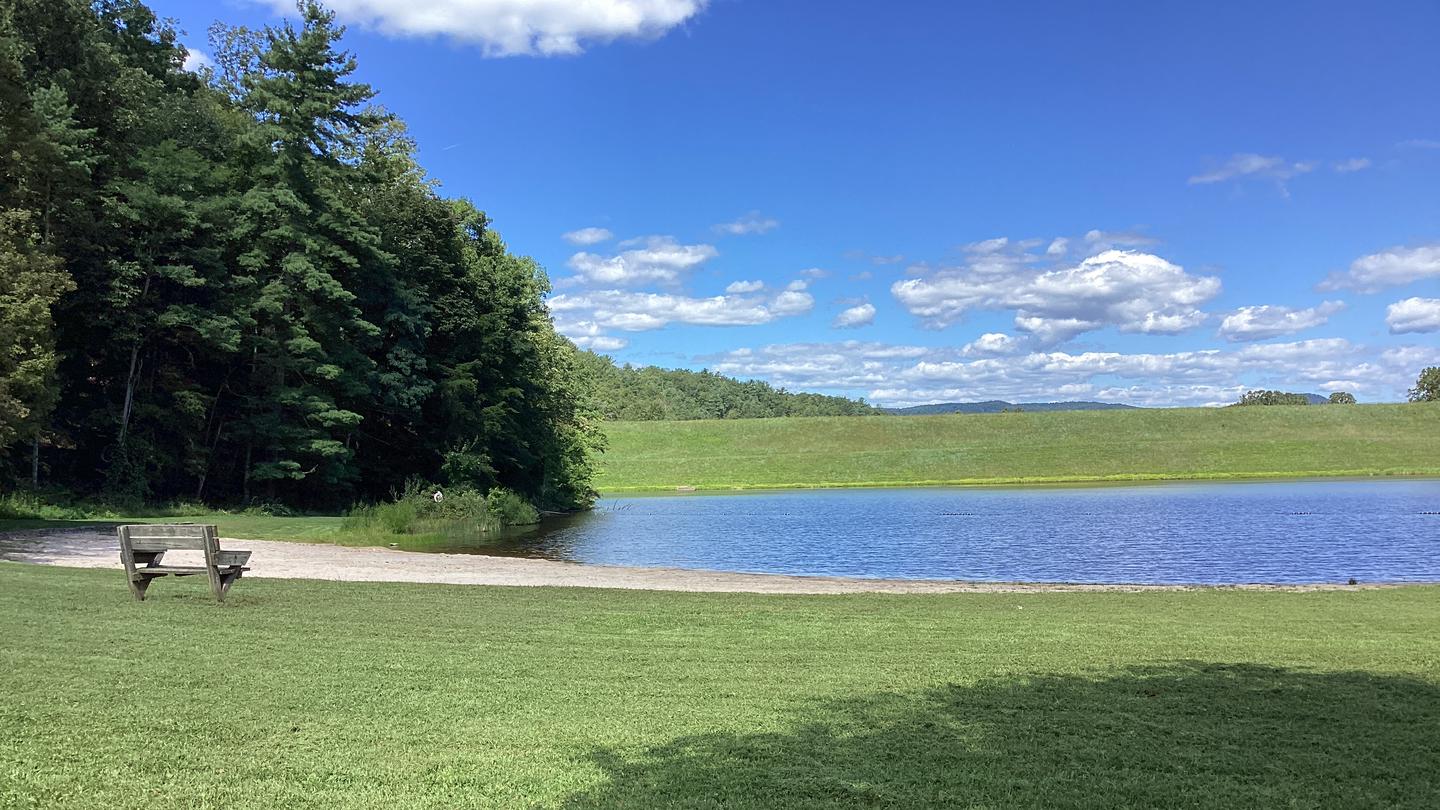
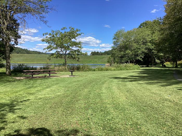
This wooded recreation area affords access to multiple hiking and mountain biking trails, a swimming beach, and a campground with an onsite host. Dump station is available. Sites are limited to one RV or two tents, no more than two vehicles, and no more than eight persons per site. Bath houses have hot showers and flush toilets, drinking water available. Each campsite has a tent pad, picnic table, lantern post and grill.
Nearby
- High Knob Tower on Shenandoah Mountain near North River was built using native stone in 1939–1940 by Civilian Conservation Corps (CCC Camp #2) crews and World War I veterans.
- History and Location
- Location: Sits on the border of Virginia and West Virginia along Shenandoah Mountain in the George Washington and Jefferson National Forests.
- Design: It is a unique historic stone fire tower featuring a catwalk and an interior room.
- Elevation: Stands at an elevation of 4,223 feet
Guidebooks for West Virginia
We earn a small commission if you buy through these links. It does not change what we list.
Titles come from Open Library's catalog, matched by subject heading or by title.
Reference
Questions people ask
Do I need a reservation at Brandywine Campground?
No. Brandywine Campground is first-come, first-served. Sites are taken on arrival and paid at the fee station.
Source: Forest Service
How much does it cost to camp at Brandywine Campground?
Day Use: $8 per vehicle per day (Up to 8 Passengers) $2 per person per day (buses and vans). Peak Season. Single Site: $20 per night.
Source: Forest Service
Is Brandywine Campground open right now?
Closed for the season as of Oct 16, 2026. Season mid-May to mid-December.
Source: Forest Service status
How many sites does Brandywine Campground have?
35 sites.
Source: Forest Service
What is there to do at Brandywine Campground?
This wooded recreation area affords access to multiple hiking and mountain biking trails, a swimming beach, and a campground with an onsite host. The Recreation section on this page has the rest.
Source: Recreation
What is the nearest town to Brandywine Campground?
Brandywine, West Virginia. High Knob Tower on Shenandoah Mountain near North River was built using native stone in 1939–1940 by Civilian Conservation Corps (CCC Camp #2) crews and World War I veterans.
Source: Getting there
What if Brandywine Campground is full?
The nearest public campgrounds are Hone Quarry Campground (9.8 mi, first-come), Todd Lake Campground (15.9 mi, first-come), and North River Campground (17.7 mi, first-come).
Source: Campgrounds nearby