Applewhite Campground
Located three miles north of the Lytle Creek Ranger Station, the campground provides an easy get-away. Trees surround the campsites and Lytle Creek flows across the street at Applewhite Picnic Area. Please use caution crossing the road. This site is accessible. There is a $5 charge for an additional vehicle which must be paid on site.
More like this: reservable in California · pets allowed in California
Check availability on Recreation.gov ↗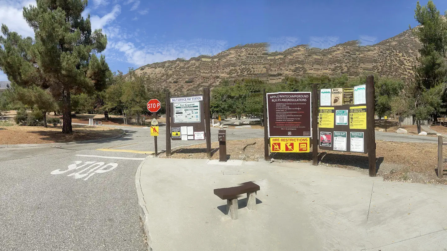
Site mix
| Standard, no hookups | 42 |
| Host/management | 2 |
Site guide
36 sites in 2 loops. Tap a filter to narrow the list; the map follows.
| Site | Loop | Entry | Fits, ft | Surface | Water / sewer | People / vehicles | Fires | Rating |
|---|---|---|---|---|---|---|---|---|
| 15 | Applewhite Lower Loop | 20 | Paved | No / – | 8 / 1 | Yes | Standard | |
| 16 | Applewhite Lower Loop | Back-in | 30 | Paved | No / – | 8 / 1 | Yes | Standard |
| 17 | Applewhite Lower Loop | Back-in | 25 | Paved | No / – | 8 / 1 | Yes | Standard |
| 18 | Applewhite Lower Loop | Back-in | 25 | Paved | No / – | 8 / 1 | Yes | Standard |
| 19 | Applewhite Lower Loop | Back-in | 45 | Paved | No / – | 8 / 1 | Yes | Standard |
| 20 | Applewhite Lower Loop | Back-in | 30 | Paved | No / – | 8 / 1 | Yes | Standard |
| 21 | Applewhite Lower Loop | Back-in | 40 | Paved | No / – | 8 / 1 | Yes | Standard |
| 22 | Applewhite Lower Loop | Back-in | 50 | Paved | No / – | 8 / 1 | Yes | Standard |
| 23 | Applewhite Lower Loop | Back-in | 30 | Paved | No / – | 8 / 1 | Yes | Standard |
| 24 | Applewhite Lower Loop | Back-in | 25 | Paved | No / – | 8 / 1 | Yes | Standard |
Per-site records as published by the managing agency on Recreation.gov. Blank cells mean the agency listed nothing for that site. Check-in 2:00 PM, checkout 12:00 PM.
Amenities & rules
| Hookups | None |
| Max vehicle length | 15 ft |
| Equipment | RVs & trailers, Tents |
| Pets | Allowed |
| Campfires | Allowed, subject to restrictions |
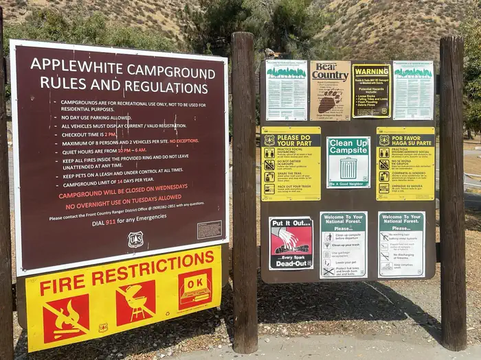
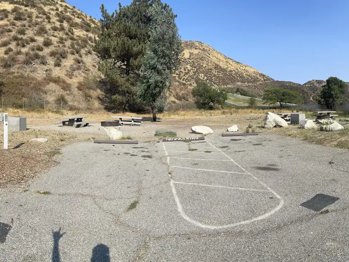
The campground offers dozens of single-family campsites, available mostly for tent camping. Some sites can accommodate RV/camper camping without water or electric hookups. The parking aprons are paved, but can be quite narrow. Each site is equipped with a table and campfire ring with grill. Accessible flush toilets and water spigots are provided. Check-in time is 2:00 PM. Check-out time is 12:00 PM. There is a Maximum of eight (8) people and two (2) vehicles allowed per campsite. Quiet hours are from 10:00 PM - 6:00 AM.
Individual sites vary. Confirm on Recreation.gov or with the managing office.
Season & status
| Status | Open |
| Forest | San Bernardino National Forest |
| Booking | Reservations for available sites are available by using the widget above. |
| Fees | $15.00 for a Single Site, $20.00 or a Double site, limited to 8 people and 1 vehicle. Two vehicles total allowed; second vehicle is $5.00/night. There is no overflow parking available. The fee is payable at a self-serve station at the entrance to the campground, cash or check only. |
| Rules | Quiet hours are 10:00 pm - 6:00 am. Pets allowed on leash only; must clean up after your pet. Dump stations and electric/water hookups are not provided. Do not drain your wastewater onto the ground. All vehicles must park on the pavement within your site, and drive at 5 MPH speed limit (please watch for children). Operation of green or red sticker vehicles are not permitted. |
Weather by month
Getting there
Continue 3 miles past the Lytle Creek Ranger Station. Campground is on the right with Upper Loop campsites on the left and Lower Loop Campsites on the right.
| Coordinates | 34.2599° N, 117.4933° W · Directions ↗ |
Supplies & services
| Dump station | Dump station ↗ | 8.2 mi |
| Outdoor gear | Bull Outdoor Products ↗ | 10 mi |
| RV sales & service | Major RV Sales ↗ | 13.8 mi |
Locations © OpenStreetMap contributors. Call ahead; hours change seasonally.
Explore
Video
Camping at Applewhite Campground and Exploring the Area, Lytle Creek, CA.
Worth a stop
- 1.8 miLost Lake Day Use Area ↗Day use
- 3.4 miLytle Creek Firing Line - Shooting Range ↗OHV / range
- 3.5 miCleghorn Ridge Ohv Road 2N47 ↗OHV / range
- 8.2 miIcehouse Trailhead ↗Trailhead
- 8.9 mi
- 14.6 miInspiration Point Trailhead ↗Trailhead
Trails nearby
- 1.9 miChaparral Neighborhood ↗0.8 mi trail
- 2.6 miPCT Section 4 ↗4.5 mi trail · national_scenic_or_historic
- 2.6 miPCT Section 5 ↗5.4 mi trail · national_scenic_or_historic
- 2.7 miMiddlefork Non Wilderness ↗1.4 mi trail
- 3.1 miPCT Section 3 ↗4.3 mi trail · national_scenic_or_historic
- 3.1 miStonehouse - Stonehouse Cut-Of ↗0.8 mi trail
Trail and trailhead records are the Forest Service's. Distances are straight-line to the nearer trail end. Trail conditions are not tracked here.
Public land it sits in
Cucamonga Wilderness begins about 3.6 miles away, and it is the closest of these.
- 3.6 miCucamonga Wilderness ↗Wilderness · Forest Service · 13,007 acres
- 8.7 miSheep Mountain Wilderness ↗Wilderness · Forest Service · 43,182 acres
- 14.2 miSan Bernardino National Forest ↗National Forest · Forest Service · 805,483 acres
Each unit is published as a centre point and an acreage rather than a boundary, so this section stands it in for a circle of the same area. Whether a campground is inside, and how far it is from one it is outside, are both approximate.
Other campgrounds nearby


On the National Register nearby
- Pacific Electric Etiwanda DepotBuilding · Rancho Cucamonga · 9.4 mi
- Sam and Alfreda Maloof CompoundBuilding · Alta Loma · 9.8 mi
- Bono's Restaurant and DeliBuilding · Fontana · 10.7 mi
Natural features
Across the road from the campground is Lytle Creek, which offers a cooling place to relax and recreate.
Recreation
Ample opportunities for short, day hikes in the Lytle Creek area as well as OHV opportunities in the nearby Cajon Pass area. Flowing waters of Lytle Creek nearby offer a relaxing place to enjoy the cool waters.
Guidebooks for California
We earn a small commission if you buy through these links. It does not change what we list.

Titles come from Open Library's catalog, matched by subject heading or by title.
Reference
Questions people ask
Do I need a reservation at Applewhite Campground?
Sites at Applewhite Campground are reservable on Recreation.gov. Reservations for available sites are available by using the widget above. Any walk-up sites are listed on the booking page.
Source: Recreation.gov
How much does it cost to camp at Applewhite Campground?
$15.00 for a Single Site, $20.00 or a Double site, limited to 8 people and 1 vehicle. Two vehicles total allowed; second vehicle is $5.00/night. There is no overflow parking available.
Source: Recreation.gov
What time is check-in at Applewhite Campground?
Check-in 2:00 PM, checkout 12:00 PM.
Source: Recreation.gov
Is Applewhite Campground open right now?
Open as of Oct 16, 2026.
Source: Forest Service status
How many sites does Applewhite Campground have?
44 sites, including 42 standard sites without power.
Source: Recreation.gov
Will my RV fit at Applewhite Campground?
The longest site here provides 15 feet of vehicle capacity. Most sites are shorter. The sidebar tool checks a trailer or motorhome length against every site.
Source: Will my RV fit
Are there showers or a dump station at Applewhite Campground?
Accessible flush toilets and water spigots are provided.
Source: Recreation.gov
Are pets allowed at Applewhite Campground?
Yes, pets are allowed at Applewhite Campground. Leash rules apply.
Source: Recreation.gov
Can I have a campfire at Applewhite Campground?
Fires are allowed in the provided rings under normal conditions. Quiet hours are 10:00 pm - 6:00 am.
Source: Recreation.gov
What is there to do at Applewhite Campground?
Ample opportunities for short, day hikes in the Lytle Creek area as well as OHV opportunities in the nearby Cajon Pass area. The Recreation section on this page has the rest.
Source: Recreation
What if Applewhite Campground is full?
The nearest public campgrounds are Manker Flat Campground (7.9 mi, first-come), Guffy Campground (10.8 mi, first-come), and Lupine Campground (11.1 mi, first-come).
Source: Campgrounds nearby